A Topographical Dictionary of England. Originally published by S Lewis, London, 1848.
This free content was digitised by double rekeying. All rights reserved.
'Wilton - Wimpole', in A Topographical Dictionary of England, ed. Samuel Lewis (London, 1848), British History Online https://www.british-history.ac.uk/topographical-dict/england/pp584-592 [accessed 30 April 2025].
'Wilton - Wimpole', in A Topographical Dictionary of England. Edited by Samuel Lewis (London, 1848), British History Online, accessed April 30, 2025, https://www.british-history.ac.uk/topographical-dict/england/pp584-592.
"Wilton - Wimpole". A Topographical Dictionary of England. Ed. Samuel Lewis (London, 1848), British History Online. Web. 30 April 2025. https://www.british-history.ac.uk/topographical-dict/england/pp584-592.
In this section
Wilton
WILTON, a hamlet, in the parish of Hale, union of Whitehaven, Allerdale ward above Derwent, W. division of Cumberland; containing 72 inhabitants.
Wilton (St. James)
WILTON (St. James), a parish, in the union of Thetford, hundred of Grimshoe, W. division of Norfolk, 4 miles (W.) from Brandon-Ferry. The parish is bounded on the south by the Lesser Ouse, which separates it from the county of Suffolk; it comprises by measurement 2600 acres. The living is a discharged vicarage, united to the rectory of Hockwold, and valued in the king's books at £6. 7. 6. The church is in the decorated and later styles, and consists of a nave and chancel, separated by a handsome carved screen; it has a massive embattled tower, surmounted by an octangular spire of freestone. There is a place of worship for Wesleyans. Near the church is an ancient cross.
Wilton, or Welton
WILTON, or Welton, a tything, in the parish of Midsummer-Norton, union of Clutton, hundred of Chewton, E. division of Somerset, 8½ miles (S. W.) from Bath; containing 1480 inhabitants.
Wilton (St. George)
WILTON (St. George), a parish, in the union of Taunton, hundred of Taunton and Taunton-Dean, W. division of Somerset; containing, with the hamlets of Galmington and Shurford, 799 inhabitants. The living is a perpetual curacy, in the patronage of the Rev. Dr. Cottle, with a net income of £104: the tithes have been commuted for £225. 8., and there are nearly 6 acres of impropriate glebe. The church, which has been enlarged, was originally a chapel to the vicarage of St. Mary Magdalene, in Taunton, to which town Wilton forms an extensive suburb. The house of correction, capable of containing 175 prisoners, is situated here. In the parish was anciently an hospital, built by one of the bishops of Winchester.
Wilton (St. Mary)
WILTON (St. Mary), a borough and parish, the head of a union, and formerly a market-town, locally in the hundred of Branch and Dole, Salisbury and Amesbury, and S. divisions of Wilts, 3 miles (W. by N.) from Salisbury, and 85 (W. S. W.) from London; containing, with the tything of Bulbridge, and part of the hamlet of Ditchampton, 1698 inhabitants. This town, which derives its name from the river Wily, is of great antiquity, and is supposed by Baxter to have been the Caer-Guilo, or capital of the British prince, Caroilius, and subsequently a seat of the West Saxon kings. It was a place of importance for several centuries preceding the Norman Conquest, possessing an eminent religious establishment, and giving name to the county; the town had also a mint. Wilton is stated by Camden and other writers to have been originally called Ellandune, and to have been the scene of a sanguinary battle fought between Egbert, king of the West Saxons, and Beorwolf, the Mercian king, in which the latter was defeated; but later writers have controverted this opinion, and the engagement is now thought to have occurred at a place named Ellendune, in another part of the county. A battle occurred here in 871, between King Alfred and the Danes, when the latter, though ultimately successful, were obliged to sue for peace.
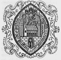
Corporation Seal.
The celebrated monastery was commenced in the year 800, by Wulstan, Earl of Wiltshire, who, having defeated Ethelmund, the Mercian king, established a chantry or oratory here; repaired the old church of St. Mary at Wilton, which had been destroyed by the Danes; and placed in it a college of secular priests. About thirty years after Earl Wulstan's death, his widow Alburga, sister to King Egbert, induced that monarch to convert the oratory into a priory of thirteen sisters, of which she became the first prioress: hence Egbert has been commonly reputed its founder. Immediately on granting peace to the Danes, King Alfred, at the solicitation of his queen, Ealswitha, built a nunnery on the site of the palace, and transferred to it the thirteen sisters of the priory, adding to them an abbess and twelve nuns; his successors were great benefactors to the establishment, particularly Edgar, who enlarged its buildings and augmented its revenue. Edgar's natural daughter, Editha, was abbess, and, after her death, being canonized, became its patron saint. Editha, daughter of Earl Godwin, and queen of Edward the Confessor, who was educated in the nunnery, rebuilt it in a magnificent manner with stone, it having been originally constructed of wood; and Matilda, queen of Henry I., was also brought up in it, under her aunt, the abbess Christina. Early in the tenth century, Wilton became the seat of the diocese of Wiltshire, and continued so during the lives of eleven successive bishops, the last of whom, Hermannus, having been also appointed to the see of Sherborne, united the two bishoprics, and removed to Old Sarum. In the year 1143, King Stephen took possession of the town, intending to convert the nunnery into a place of defence; but being surprised by Robert, Earl of Gloucester, with the troops of the Empress Matilda, who set fire to the town on all sides, the king was obliged to flee, leaving behind his troops and baggage. The monastic institution continued of importance until the Dissolution, when it was granted to Sir William Herbert, afterwards Earl of Pembroke, its revenue being at that time estimated at upwards of £600. A house of Black friars, and two hospitals dedicated to St. Mary Magdalene and St. John, also existed here at the period of the Dissolution. Wilton was visited by Queen Elizabeth in Sept. 1579, and it became the residence of the court, for a short time, in October, 1603.
The town, consisting principally of two streets which cross at nearly right angles, is situated in a broad and fertile valley, near the confluence of the rivers Nadder and Wily. It is partially paved, and well supplied with water. The manufacture of carpets, for which Wilton has been so much celebrated, was introduced by a former earl of Pembroke, who brought over workmen from France for that purpose, this being the first place in England where the manufacture was commenced; and the making of carpets at Axminster having been recently discontinued, the splendid articles called after that town are now produced at Wilton. Fancy cloth waistcoatings also formed, at one time, a considerable branch of trade. Fairs are held on May 4th and Sept. 12th; the former is for cattle and sheep, and the latter constitutes one of the largest sheep-fairs in the west of England, the number sold often exceeding 100,000. Wilton is a borough by prescription, and its ancient rights and franchises have been confirmed by charters of various monarchs, from the time of Henry I. It is governed by a mayor, recorder, high steward, five aldermen, and an unlimited number of burgesses, with a townclerk, two serjeants-at-mace, and four constables. On Oct. 13th, a manorial court leet is held at the town-hall, an ancient brick building, which was repaired and improved a few years since, by the corporation. The mayor and recorder are justices of the peace, with exclusive jurisdiction. The borough first sent members to parliament in the 23rd of Edward I., and continued to do so without interruption, till the passing of the act 2nd of William IV., cap. 45, since which it has returned only one, elected by the £10 householders of an enlarged district comprising an area of 32,150 acres: the mayor is returning officer.
The living is a rectory, with that of Bulbridge and the vicarage of Ditchampton united, valued in the king's books at £12. 16. 3.; net income, £450; patron, the Earl of Pembroke. The incumbent's tithes in Wilton, exclusive of Nether Hampton, have been commuted for £300, and the glebe consists of 22 acres. The present church is a handsome structure in the modern Norman style of architecture, consisting of a nave, aisles, and chancel, with a square tower 120 feet in height; the central entrance forms an open recessed porch, within a rich archway, and the interior is remarkable for its chasteness and beauty. The whole was completed in 1845, at the expense of the Hon. Sidney Herbert. At Nether Hampton, in the parish, is a chapel of ease; and the Independents and Methodists have each a place of worship in the town. The free school, situated in Northstreet, was founded in 1714, under the will of Walter Dyer, who in the year 1706 had bequeathed £600 for the purpose. Part of this sum was expended in the erection of premises, to which additions have been made at different times by the trustees; and the residue, with a legacy of £1000 Bank stock, producing by accumulation £2090, from Richard Uphill in 1716, was laid out in an estate at East Knoyle. The rental amounts to £120 per annum, and the school is also entitled to the interest of £1000, part of a sum of £4200 three per cent, consols, bequeathed in 1775, by Robert Sumption, for various purposes. Of the remainder of Mr. Sumption's bequest, the interest of £1000 is given in marriage-portions to young women, and that of £2000 appropriated to the benefit of five men and as many women. In 1816, Thomas Mease gave to the high steward and corporation, on the death of his wife, £4000 Navy five per cents., to be applied to charitable uses. The union of Wilton comprises 22 parishes or places, and contains a population of 10,327.
The hospital of St. John, supposed to have been founded by Hubert, bishop of Salisbury in 1189, and archbishop of Canterbury in 1193, is endowed for a master, or prior, who is a clergyman, nominated by the Dean of Salisbury, and two poor men and two women, chosen by the prior. The tenements are falling into decay, and the pensioners are lodged in an adjoining cottage; but the chapel has been repaired and enlarged, at the expense of the prior, and divine service is now performed every Sunday evening and every alternate Friday evening, by a chaplain appointed by the prior, who receives a stipend of £44. On the site of the celebrated nunnery, Sir William Herbert, to whom it was granted, commenced the erection of that princely pile now the residence of his descendants, the earls of Pembroke, designed by Holbein and Inigo Jones, and containing a collection of paintings, statues, and various antiquities, not excelled by any in the kingdom. In this mansion the distinguished Sir Philip Sidney, whose sister Mary was the celebrated Countess of Pembroke, composed his heroic romance of Arcadia.
Wilton
WILTON, a tything, in the parish of Great Bedwin, union of Hungerford, hundred of Kinwardstone, Marlborough and Ramsbury, and S. divisions of Wilts; containing 284 inhabitants.
Wilton (St. Cuthbert)
WILTON (St. Cuthbert), a parochial chapelry, in the union of Guisborough, E. division of the liberty of Langbaurgh, N. riding of York, 3½ miles (N. N. W.) from Guisborough; containing 361 inhabitants. This chapelry is situated on the road from Stockton to Redcar, and bounded on the north by the river Tees. It comprises 3401 acres, of which 200 are woodland, and nearly two-thirds of the remainder arable. The soil is in part a strong clay; in the southern portion it is a lighter mould, and the surface is here more elevated and picturesque, with marine views of great extent: there are some thriving plantations, and about 250 acres of moorland. Good freestone is quarried for building purposes. Here was formerly a monastery; and at the west end of the village is Wilton Castle, recently built upon the site of the ancient baronial castle of the Bulmers, who possessed it for many generations, till Sir John Bulmer, Knt., was attainted of high treason, when his estates were confiscated. The living is a perpetual curacy; net income, £117; patron, Sir J. H. Lowther, Bart.: the tithes were commuted for land in 1800. The church is an ancient structure, with a square tower. There is a place of worship for Independents at Lazenby; and a parochial school is supported by subscription, aided by a gift of £20 per annum from the Lowther family. On the higher hills near the castle is a fine waterfall, and there are numerous tumuli on Wilton moor.
Wilton
WILTON, a chapelry, in the parish of Ellerburn, Pickering lythe and union, N. riding of York, 3¾ miles (E. by S.) from Pickering; containing 216 inhabitants. The township comprises about 2060 acres of land, chiefly the property of Lord Hotham, who is lord of the manor. The village is on the road from Allerston to Thornton, equidistant from each place, and in its vicinity are the ruins of an ancient Hall, formerly a seat of the Cholmley family. There are a small chapel of ease, a place of worship for Wesleyans, and a school built in 1836.
Wilton, Bishop (St. Edith)
WILTON, BISHOP (St. Edith), a parish, in the union of Pocklington, Wilton-Beacon division of the wapentake of Harthill, E. riding of York; containing, with the township of Bolton, and that of Youlthorpe with Gowthorpe, 792 inhabitants, of whom 592 are in the township of Bishop-Wilton with Belthorpe, 4 miles (N.) from Pocklington. This place derives its affix from the residence here of Archbishop Neville: at the time of the Domesday survey, it had a church and a priest, and the manor was held by the see of York. The parish is situated on the road between York and Bridlington. In the township are 4214a. 1r. 3p., of which 3010 acres are arable, 1003 pasture, and 200 woodland; the soil is clay, mixed with gravel: the scenery around is very beautiful, and the village appears as if embosomed in an amphitheatre. Here is a small ironfoundry. The living is a discharged vicarage, valued in the king's books at £7. 3. 6½.; net income, £148; patron and impropriator, Sir Tatton Sykes, Bart.: the tithes for the township were commuted for land and a money payment in 1769. The church is an ancient structure of various styles, with a tower and spire; on one of the windows are painted the arms of the Nevilles. There are places of worship for Methodists; and a parochial school. Of the palace built in the reign of Edward IV. by Archbishop Neville, no vestiges now exist; but the moat which encompassed it still remains. On the Wolds are some tumuli.
Wiltshire
WILTSHIRE, an inland county, bounded on the north and north-west by Gloucestershire, on the west by Somerset, on the south-west and south by Dorset, on the south-east and east by Hampshire, and on the north-east by Berks. It extends from 50° 55' to 50° 42' (N. Lat.), and from 1° 30' to 2° 22' (W. Lon.), and comprises an area of 882,560 statute acres, or about 1379 square miles. There are 50,879 inhabited houses, 2138 uninhabited, and 253 in progress of erection; and the population amounts to 258,733, of whom 128,240 are males, and 130,493 females.
A large portion of the county was occupied, in the time of Caesar, by the Belgæ; the Hedui inhabited the north-western parts of it, and the Carvilii another district. The Cangi are also supposed, either at this period or soon after, to have possessed some territory within its northern limits. On the second invasion of the Romans, during the reign of Claudius, in the year 44, the Belgæ were found to have subdued nearly the whole, possessing territory as far north as the rude barrier of the Wansdyke, beyond which the Cangi are, by some writers, thought to have preserved their dominion. Under the Roman government, Wiltshire was comprised in the division called Britannia Prima. After the withdrawal of the Roman forces, Cerdic, founder of the kingdom of the West Saxons, who had been engaged in an arduous warfare, for upwards of 20 years, with the Romanized Britons near the place of his landing, on the coast of Hampshire, at last penetrated into this territory, in the year 520: he was defeated, however, in a great battle, by the British hero Arthur, and the Saxons did not return hither for upwards of 30 years. In 554, Cenric, son of Cerdic, and his successor in the sovereignty of Wessex, advanced with his army towards Sorbiodunum, or Old Sarum, and defeated a British army opposed to his progress near that place, of which he immediately after took possession. Four years subsequently another decisive battle was fought, at "Beranbyrig," or Barbury Castle, near Marlborough, in which the Britons were again routed; and Wiltshire shortly became incorporated in the kingdom of Wessex.
It derives its name from Wilton, which, for a long period anterior to the Norman Conquest, and for a considerable time after that event, was its principal town. Wiltshire was, till lately, wholly in the diocese of Salisbury, province of Canterbury; but by the act 6th and 7th of William IV., cap. 77, the deaneries of Cricklade and Malmesbury have been annexed to the diocese of Gloucester and Bristol. The Salisbury portion forms the two archdeaconries of Sarum and Wilts, the former comprising the deaneries of Amesbury, Chalk, Salisbury, Wilton, and Wily, and the latter those of Avebury, Potterne, and Marlborough. The Gloucester and Bristol portion is in the archdeaconry of Bristol, and comprises the deaneries of Cricklade and Malmesbury. The total number of parishes is 295. For purposes of civil government it is divided into the hundreds of Alderbury, Amesbury, Bradford, Branch and Dole, Calne, Cawden and Cadworth, Chalk, Chippenham, Damerham (North and South), Downton, Dunworth, Elstub and Everley, Frustfield, Heytesbury, Kingsbridge, Kinwardstone, Malmesbury, Melksham, Mere, Potterne and Cannings, Ramsbury, Selkley, Swanborough, Underditch, Warminster, Westbury, Whorwelsdown, and Highworth, Cricklade, and Staple. It contains the city of Salisbury; the borough and market towns of Calne, Chippenham, Cricklade, Devizes, Malmesbury, Marlborough, and Westbury; the borough of Wilton; and the market-towns of Amesbury, Great Bradford, Hindon, Market-Lavington, Melksham, Mere, Swindon, Trowbridge, Warminster, and Wootton-Bassett. By the act 2nd of William IV., cap. 45, the county was divided into the Northern and Southern divisions, each being empowered to send two members to parliament. Two citizens are returned for Salisbury; two representatives for each of the boroughs of Chippenham, Cricklade, Devizes, and Marlborough; and one each for Calne, Malmesbury, Westbury, and Wilton. The county is included in the Western circuit: the Lent assizes are held at Salisbury, and the summer assizes at Devizes; the quarter-sessions are held at Devizes in the winter, at Salisbury in the spring, at Warminster in the summer, and at Marlborough in the autumn. The county gaol is at Fisherton-Anger, the house of correction at Devizes, and the bridewells at Devizes and Marlborough.
The form of the county is nearly an ellipse, the transverse diameter of which bears north and south. It is common to consider it as separated into North and South, by a line passing through it from east to west, at or near Devizes; but the natural division is into Southeast Wilts and North-west Wilts, by an irregular line extending from the confines of Berkshire, near Bishopston, south-westward, to those of Somerset, near MaidenBradley. South-east Wilts, containing nearly 500,000 acres, comprehends, and is almost entirely occupied by, the whole of the Wiltshire Downs, with their intersecting valleys, forming the western division of the ranges of chalk hills which occupy so great a portion of Hampshire, and a smaller extent of Berks. At a distance, this portion of the county presents the appearance of a large elevated plain; but on a nearer approach its surface is found to be broken by numerous and frequently extensive valleys, and to possess an almost constant series of gentle eminences, but no where a mountainous elevation. The declivities on one side of some of the ridges are very abrupt, while on the other they sink gently, in irregular gradation, sometimes into a perfect flat. The two grand divisions of the chalk hills are into Marlborough Downs, being those to the north of the Kennet and Avon canal, and Salisbury Downs or Plain, consisting of nearly all the county southward of that line. These great districts are separated by the vale of Pewsey, and the only difference in their general appearance is, that the eminences of the former are more abrupt and elevated than those of the latter. The most extensive level prevails around Stonehenge, where the scenery is peculiarly tame. On Marlborough Downs are scattered many of the singular masses of stone called "Grey Wethers," and, when broken, "Sarsden-stones," or, by contraction, "Sarsons." The principal valleys display scenes of rich meadow and arable lands, adorned with seats, villages, and occasionally woods, and are traversed by streams of excellent water, of which those descending from Salisbury Plain take a direction towards Wilton and Salisbury. The North-western division of the county presents a remarkably different appearance, being a rich tract of vale land, extending from the base of the Downs to the northern and western confines of the county, and generally so flat that few deviations from the ordinary level are perceptible; approaching the Cotswold hills of Gloucestersh ire, however, the surface becomes gradually more elevated. This low plain is so well wooded, that, when viewed from any of the surrounding hills, it appears like a vast plantation. The most remarkable eminences in the county, and some of those which command the finest prospects, are, Beacon Hill, near Amesbury, rising to the height of 600 feet above the level of the sea; Bidcombe Hill, near Maiden-Bradley; Codford Hill; the high grounds near Standlinch House; Old Sarum Hill, 339 feet high; and Westbury Down, 775 feet high.
The courses of crops are very various. In the southeastern district the red wheat is most commonly produced. Barley is a favourite crop in the chalk district, but hardly in any other part: a few peas and beans are grown in the north-west of the county: rye is often sown as spring food for sheep, but is seldom suffered to stand for a corn crop. Turnips are extensively cultivated on the chalky and stone-brash soils. Rape, or cole-seed, is grown to a great extent on the Downs; as also are vetches in this and in the north-western district. Potatoes are much cultivated, particularly on the rich sands adjoining the chalk. The grass lands in the north-eastern district are of the richest quality; they are partly occupied by dairies, and partly in the fattening of cattle. The cheese, which is the only produce of the numerous dairies, excepting the poor kind of butter made from the whey, is well known and much esteemed under the name of "North Wiltshire." Bordering on the streams of the Downs are narrow tracts of meadow land, under an excellent system of irrigation, which became general about the commencement of the last century: the quantity is estimated at about 20,000 acres. With the grass lands of Wiltshire may be classed its spacious downs, which are uninclosed, and subject to common rights; and though a portion of them is always under tillage, yet by far the most extensive tracts are covered with a fine native sward, affording food to no less than 500,000 sheep and lambs during the summer and autumn.
Wiltshire was anciently well wooded, but its present woodlands are of comparatively small extent. Different parts near its border are occupied by valuable woods, generally in a thriving condition, but much injured by cattle, to which they are common. The only forest still remaining in a well-wooded state, is that of Savernake, the property of the Marquess of Ailesbury, which is about 16 miles in circumference, and situated to the south-east of Marlborough. Cranborne Chace occupied a long narrow tract on the extreme southern verge of the county, and contained six lodges, with walks appropriated to each, the whole under the care of a ranger deputed by Lord Rivers, as lord of the chace; it was lately disfranchised, his lordship receiving an annual payment from the owners of the woods in it, and the lands adjoining. Vernditch Chace, belonging to the Earl of Pembroke, adjoins the latter on the east, and is now nearly all under, cultivation. Grovely Forest, generally called Grovely Woods, also belongs to Lord Pembroke, and forms a long narrow tract of the high ground between the valleys of the Nadder and the Wily. The ancient forest of Penchett, or Ponsett, near Salisbury, is now better known as Clarendon Park and Woods, the property of Sir F. H. Bathurst. The wastes are comparatively trifling, and consist chiefly of small marshy commons, most of them in the north-western part of the county, where are also a few small heaths.
The mineral productions are of little importance. The chalk, forming the substratum of nearly all the extensive south-eastern district, is, in some places, extremely hard, though more frequently of a soft marly texture; the finest kind is found at Sidbury Hill, which furnishes a supply to several of the western counties. Sandstone is obtained in the low grounds both of North and South Wilts. The "corn-grate" kind is frequently found in masses so thin as to be employed in the roofing of houses; it is also used for building and paving. A more regular stratified sandstone occurs under the sandy surface at Swindon, and is in much request for paving, for cisterns, and for tombstones. The inferior limestone found between Highworth and Clack, is used only for making and repairing roads. On the western side of the county, bordering on Somersetshire, are numerous and extensive quarries of a fine kind of freestone; those at Box, near Bath, are among the most celebrated in the vicinity of that city, and produce a great variety of fossil shells and other marine exuviæ. Near Wootton-Bassett, in the blue clay, and near Grittleton, in the freestone strata, other singular fossil remains are found. The freestone-quarries at Chilmark, Tisbury, and that neighbourhood, are extensive, and the stone is of a very superior quality.
The manufactures are of considerable extent and importance, particularly that of woollen goods. At Salisbury great quantities of flannel were made till within the last forty years, and also fancy woollens; but the manufacture gradually declined, and a very small quantity of flannel and linsey is now made. This city has a manufacture of cutlery and steel goods, of great excellence. Wilton has a manufacture of carpets, and of kerseymere and linsey; while Bradford, Trowbridge, Westbury, and all the adjacent towns and villages, from Chippenham to Heytesbury inclusive, carry on extensive woollen manufactures, chiefly of superfine broad-cloth, kerseymere, and fancy cloths. At Mere and in its vicinity is a manufacture of linen, chiefly dowlas and bed-ticking; at Aldbourn is one of cotton goods, chiefly fustians and thicksets. The manufacture of silk has been introduced at Devizes; and the parishes of Stourton and Maiden-Bradley, and others in their vicinity, participate to a small extent in the neighbouring linen manufacture of Dorsetshire, and the silk manufacture of Bruton, in Somersetshire. Ale of a superior quality is brewed in some parts of the county, and a considerable quantity of it is sold in London, under the names of "Wiltshire" and "Kennet" ale. The commerce consists chiefly in the exportation of the agricultural and manufacturing produce. Of the former there is a considerable surplus, principally wheat, barley, fat-cattle, calves, sheep, hogs, and cheese, part of which is taken to the London market, and the rest to Bath, Bristol, and the eastern parts of Somerset. Wiltshire, also, besides supplying its own woollen manufactures with the raw material, sends a quantity to other counties. The principal imports are the ordinary articles of merchandise, coal, and cows for the supply of the dairy districts.
The rivers and streams are very numerous, and all of them rise either within the county, or near its borders; the principal are the Isis, or Thames, the Lower Avon, the Kennet, and the Salisbury (or Wiltshire and Hampshire) Avon, not one of which is navigable within its limits. The Kennet and Avon canal crosses the centre of the county from west to east, and connects the navigation of the Lower Avon with that of the Kennet and the Thames. The act of parliament for its formation was obtained in 1794; and several other acts for the alteration of the course originally designed, and for raising additional funds, were afterwards passed. The line was not completed and opened until the end of the year 1809. The Wilts and Berks canal, branching from the Kennet and Avon line at Semington, about two miles west of Devizes, passes northward by Melksham, to the vicinities of Chippenham and Calne, to each of which towns it has a short branch: the act for its formation was passed in 1795, but the work experienced many delays. The North Wilts canal, executed under an act obtained in 1813, begins in the Wilts and Berks canal near Swindon, and terminates in the Thames and Severn canal at Weymoor Bridge, in the parish of Latton, being eight miles and three furlongs in length. The Thames and Severn canal crosses the northern extremity of the county, passing the northern bank of the Isis, and near the town of Cricklade. The Great Western railway enters the county a little to the east of Stratton St. Margaret's, and running on the north of Swindon, by Wootton-Bassett, Chippenham, and Corsham, quits it a little beyond the last-named town. At Swindon, the Cheltenham and Great Western Union railway joins the line, entering the county at Kemble, near the head of the river Thames. A part of the Romsey and Salisbury branch of the London and Southampton railway, is also within the bounds of Wiltshire.
The county contained the Roman stations of Sorbiodunum, at Old Sarum; Verlucio, in the vicinity of Heddington; and Cunetio, a little to the east of Marlborough. This people had also several other permanent settlements in Wiltshire, particularly at Easton-Grey, Wanborough, near Heytesbury, and Littlecot. The principal Roman road that traversed it was a continuation of the Julia Strata, which, entering from Bath, proceeded north-eastward, by Medley and Spye Park, to the station of Verlucio, and thence by Colston and across the river Kennet to Cunetio, beyond which it stretched across the eastern confines of the county. The Fosse-way branched from the Julia Strata at Bath-Ford, and passed by Banner Down, Easton Grey, and across the turnpike-road between Tetbury and Malmesbury, to Cirencester, in Gloucestershire. Another great road entered from Cirencester, and passed south-eastward by Cricklade to Wanborough, at which place it separated into two branches, one proceeding by Baydon, towards Speen, in Berkshire, and the other by Ogbourne, Mildenhall, Manton, and Chute Park, towards Winchester. Sorbiodunum was connected with other stations by three roads, one of which ran by Bemerton, Stratford St. Anthony, and Woodyates-Inn, towards Dorchester; another by Ford, Winterslow, Buckholt Farm, and Bossington, towards Winchester; and the third by Porton and Idmiston, towards Silchester, in the north of Hampshire. The Ridge-way, extending north-eastward from Avebury into the adjoining county of Berks, is also mentioned by Whitaker as a Roman road.
Wiltshire presents remarkably numerous traces (chiefly in its south-eastern districts) of the nations which successively occupied it during the earlier periods of history. Of these, the stupendous monument of Stonehenge, two miles westward of Amesbury, and that of Avebury, about five miles to the west of Marlborough, are entitled to primary notice. The vast earthwork of the Wansdyke is conjectured by some to have been the northern boundary of the Belgæ, and to have intersected the whole county, from the north of Somerset to the north of Hampshire. In the greater part of its course it can be distinctly traced only in detached spots, yet, throughout the range of hills to the south and west of Marlborough, it is still tolerably entire, and in one place is conspicuous, in a bold and connected line, for ten or twelve miles. The sepulchral mounds called barrows, or tumuli, are abundant, more particularly around Stonehenge and Avebury: the most remarkable is Silbury Hill, near Avebury. There is a cromlech at Clatford-Bottom, near the village of Clatford, and another at Littleton-Drew. The Roman roads may yet be distinctly traced in several places; and the Ridge-way is clearly visible on the high chalk ridge extending north-eastward from Avebury into Berkshire.
The encampments, which are very numerous, vary in the period of their formation, in their size, shape, and mode of construction, and in the peculiarities of their situations. Some of them are undoubtedly the work of British tribes and of the Belgæ, and others of successive invaders, the Romans, the Saxons, and the Danes. The largest and most noted are, the vast fortifications of Old Sarum, inclosing an area of nearly thirty acres, the foundations of the walls of which are still visible; Chidbury Camp, north-west of Tidworth, including seventeen acres; and Vespasian's Camp, as it is commonly called, to the west of Amesbury, inclosing an area of thirty-nine acres. There are many others nearly equal in extent, and scarcely less interesting to the antiquary, evidently formed for purposes of military defence; and a variety of earthworks are spread over Salisbury Plain and Marlborough Downs, the uses of which are unknown; some of them are considered the sites of British villages, others as denoting places consecrated to religion. Many less vestiges of antiquity, such as tessellated pavements, coins, urns, &c, of the Romans, and fragments of sculpture, daggers, shields, gold and silver ornaments, and a great variety of other articles of British, Saxon, Danish, or Norman manufacture, have been discovered at different periods.
The number of religious houses, including colleges and hospitals, was about fifty-seven: there are remains of the abbeys of Kingswood, Laycock, and Malmesbury; of the priory of Bradenstoke; and of the nunnery of Kington St. Michael. Extensive remains yet exist of the ancient castles of Castle-Combe, Devizes, Farley, Ludgershall, Malmesbury, Marlborough, and Wardour. Amongst the numerous seats of the nobility and gentry, the most splendid are, Bowood, the residence of the Marquess of Lansdowne, lord-lieutenant of the county; Charlton House, that of the Earl of Suffolk; Stowerhead, of Sir H. R. Hoare, Bart.; Longleat, of the Marquess of Bath; Tottenham Park, of the Marquess of Ailesbury; Wardour Castle, of Lord Arundel; Wilton House, of the Earl of Pembroke; Longford Castle, of the Earl of Radnor; and Corsham House, of Lord Methuen. There are, a chalybeate spring at Chippenham, a chalybeate and saline aperient spring near Melksham, and mineral springs of different other qualities at Heywood, Holt, and Middle-Hill Spa near Box. Wiltshire gives the inferior title of Earl to the Marquess of Winchester.
Wily (St. Mary)
WILY (St. Mary), a parish, in the union of Wilton, hundred of Branch and Dole, Hindon and S. divisions of Wilts, 6 miles (S. E. by E.) from Heytesbury; containing 508 inhabitants. It lies on the great western road, and comprises 2277a. 1r. 20p., of which 1165 acres are arable, and 1100 meadow and pasture; the soil is a black loam, with a substratum of chalk. The village is pleasantly situated, and contains the well-known Deptford inn. A large sheep-fair is held on the 4th of October. The living is a rectory, valued in the king's books at £21. 14. 2., and in the gift of the Earl of Pembroke: the tithes have been commuted for £535, and the glebe contains 10½ acres. The church was lately repaired and beautified, and re-opened for divine service in November 1844: the cost was £1100. Elizabeth Mervyn, in 1581, bequeathed 7½ bushels of wheat and 100 ells of linen and cloth, to be provided by the possessor of her estates, on Good-Friday, and distributed among the poor of Wily, Steeple-Langford, Upton, Padworth, and Tisbury. Christopher Willoughby, in 1678, gave £200 for the poor of Wily and Marlborough. About a mile from the village is a large British encampment called BadburyRings, or Wily Carnp, which occupies a point of down projecting from the principal ridge, and incloses an area of more than seventeen acres. Two miles from Deptford inn is Yarnbrough Castle, a Roman encampment.
Wimbish (All Saints)
WIMBISH (All Saints), a parish, in the union of Saffron-Walden, hundred of Uttlesford, N. division of Essex, 4¼ miles (E. S. E.) from Saffron-Walden; containing 983 inhabitants. This parish, including the merged parish of Thunderley, is about sixteen miles in circumference: the scenery is enriched with trees of stately growth. The living is a vicarage, with that of Thunderley united in 1425, valued in the king's books at £8; patron, J. Greensall, Esq. The rectory is a sinecure, valued at £12; patron and incumbent, the Rev. J. Dolignon. The tithes of the rector have been commuted for £560; those of an impropriator for £195; and of the vicar for £275: there are 162 acres of appropriate glebe, and 7 of vicarial. The church is an ancient stone structure, with a tower of brick replacing the original one, which fell down.
Wimbledon (St. Mary)
WIMBLEDON (St. Mary), a parish, in the union of Kingston, W. division of the hundred of Brixton, E. division of Surrey, 7 miles (S. W.) from London; containing 2630 inhabitants. The name of this place, anciently written Wymbandune, Wymbaldon, and Wymbledon, is supposed to have been derived from one of its early proprietors. The principal feature in the parish is Wimbledon Park, which comprises 922 acres, including a sheet of water covering about forty acres; it is one of the finest parks in the county, and has some very stately trees, especially ever-green oaks and cedars, one of the latter of which measures nineteen feet in circumference at two feet from the ground. In the pleasuregrounds is a curious sarcophagus; also several blocks of marble taken from the French during the war, which were presented to the late Earl Spencer, then first lord of the admiralty, and are said to have been brought from Pompeii for Buonaparte. Wimbledon common is surrounded by seats of the nobility and gentry, and exhibits at the south-west angle a circular encampment with a single ditch, including a surface of seven acres; the trench is very deep, and perfect. This encampment is said to mark the site of a battle fought in 568, between Ceawlin, King of the West Saxons, and Ethelbert, King of Kent, in which the latter was defeated, and his two generals, Oslac and Cnebban, slain. At the northeast angle of the common is the village, consisting of one street containing many respectable houses; and in detached situations are numerous pleasant villas. A little north of the encampment is a well, the water of which has never been known to freeze. The London and South-Western railway passes through the parish, and about half a mile from the church has a station. The mills of the English Copper Company are in the parish; also some works for printing calico. A pleasurefair is held on the first Monday after Lady-day, and the two following days.
The living is a perpetual curacy; net income, £170; patrons, the Dean and Chapter of Worcester, as appropriators of the rectory, which is valued in the king's books at £35. 2. 11. The church, a neat structure in the Grecian style, situated about a quarter of a mile north of the village, was erected in 1787, on the site of an edifice which had fallen into decay. On the south side is the Cecil chapel, an ancient building, in which are portions of mail armour and several monuments, one an altar-tomb of black marble to the memory of Sir Edward Cecil. In the east window are some remains of painted glass representing the arms of the families of Leeds, Salisbury, Dorset, &c.; and in the churchyard are several handsome mausoleums and monuments, including one to the memory of G. S. Newton, R. A., a painter of considerable merit. There is a place of worship for Independents. Five almshouses erected in 1839 by subscription, are endowed with the interest of £1000, the profits of a fancy-fair held in the grounds of Wimbledon House, belonging to Mrs. Marryat. It is said that Catherine Parr, after the death of Henry VIII., occupied a house in the village, now a large school; and the celebrated Lord Burleigh is thought to have resided here, and planted the magnificent avenue of elms on the common. Judge Park lived many years in the parish, and the inhabitants have erected a monument in the church to his memory. On digging in the grounds of Belvidere House, in 1838, to make space for an artificial piece of water, two fine figures of white marble, as large as life, were discovered several feet below the surface, one representing Summer, and the other Winter.
Wimblington
WIMBLINGTON, a hamlet, in the parish of Doddington, union and hundred of North Witchford, Isle of Ely, county of Cambridge, 4 miles (S.) from March; containing 1099 inhabitants. It comprises 7590 acres, of which only 26 are common or waste. The village is well inhabited, and situated on the road from the villages of Chatteris and Doddington to the town of March; it is nearly in the centre of the poor-law union. The tithes have been commuted for £2068. There is a place of worship for Wesleyans; also a school, erected in 1817, and endowed with lands of which the rental is £144.
Wimboldsley
WIMBOLDSLEY, a township, in the parish of Middlewich, union and hundred of Northwich, S. division of the county of Chester, 2¼ miles (S. W.) from Middlewich; containing 106 inhabitants. The township comprises 907 acres, the soil of which is clay. The Grand Junction railway passes through. Lea Hall here, was for a considerable period the residence of the celebrated physician, Dr. Fothergill, who died in 1780.
Wimborne (All Saints, or Allhallows)
WIMBORNE (All Saints, or Allhallows), a parish, in the union of Wimborne and Cranborne, hundred of Cranborne, Wimborne division of Dorset, ½ a mile (N.) from Wimborne St. Giles; containing 175 inhabitants. The living is a rectory, united in 1732 to that of Wimborne St. Giles, and valued in the king's books at £9. 4. 4½. The church, which appears to have been originally the mother church to St. Giles, was pulled down in 1733.
Wimborne (St. Giles)
WIMBORNE (St. Giles), a parish, in the union of Wimborne and Cranborne, hundred of Wimborne St. Giles, Wimborne division of Dorset, 5 miles (S.) from Woodyates; containing 475 inhabitants. It comprises 3970a. 8p., of which 1704 acres are arable, 1033 meadow and pasture, 362 woodland, 705 down and common, and 57 in homesteads and gardens; the soil is light, resting on chalk. The living is a rectory, with that of Wimborne All Saints united, valued in the king's books at £12. 13. 4., and in the gift of the Earl of Shaftesbury: the tithes have been commuted for £527. 8., and the glebe comprises 107½ acres. The church, rebuilt in 1732, on the union of the livings, is a neat structure in the Grecian style, with a tower crowned by an open balustrade, and surmounted at the angles with ornamental urns; it is near the seat of the Earl of Shaftesbury, and is the burial-place of the family. There are almshouses for eleven people, founded in 1624 by Sir Anthony Ashley, Bart., and endowed with a large farm.
Wimborne-Minster (St. Cuthberga)
WIMBORNE-MINSTER (St. Cuthberga), a markettown and parish, and the head of the union of Wimborne and Cranborne, in the hundred of Badbury, Wimborne division of Dorset, 26 miles (E. N. E.) from Dorchester, and 101 (S. W. by W.) from London; containing, with the tythings of Holt and Leigh, and the manor of Kingston-Lacy, 4326 inhabitants. This place, which is of remote antiquity, was in the time of the Romans of considerable importance as a station to their camp at Badbury, and by them was denominated Vindogladia, or Ventageladia, terms descriptive of its situation near to, or between, two rivers. The Saxon appellation of Vinburnan, whence the present name is obviously deduced, is of similar import; and the epithet of Minster, from the ancient monastery, is added as a terra of distinction. Some writers suppose this to have been the scene of the battle between Kearl, Earl of Devon, and the Danes, in 851, in which the latter were defeated; but Bishop Gibson says the battle happened at Wenbury, in Devonshire, with which he endeavours to identify Wicganbeorche, the place where it is stated in the Saxon Chronicle to have occurred. About the commencement of the tenth century, in the beginning of his reign, Edward the Elder, being opposed by Ethelwald, son of his uncle Ethelbert, who aspired to the crown, encamped at Badbury with a considerable army, and advanced upon Wimborne, Ethelwald's headquarters, which he captured after an ineffectual resistance from the latter. Wimborne nunnery was founded previously to 705, and dedicated to the Virgin Mary, by St. Cuthberga, daughter of Cenred, and sister of Ina, both kings of the West Saxons; it was destroyed by the Danes about the year 900, and subsequently converted into a house for secular canons, whose revenue, at the Dissolution, was valued at £131. 14. The foundress became an inmate of the nunnery, where she died; and was buried in the church, of which she was made the tutelar saint.
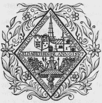
Corporation Seal.
The town is situated in a fertile vale, near the confluence of the rivers Stour and Allen, on the main road from London to Poole; the streets are irregular, and the houses in general of mean appearance. At the eastern extremity, the Allen divides into two branches, over which are two bridges. Leland thus describes Wimborne: "the town is yet meatly good, and reasonably well inhabited; it hath bene a very large thing, and was in price in the tyme of the West Saxon kinges. Ther be in and about it diverse chappelles, that in tymes paste were, as I have learnid, paroche chirchis of the very town of Wimburne." And in another place he says: "the soile about Wimburn-Minstre self is very good for corn, grasse, and woodde." The townhall, which stood near the square, long since fell into decay: it occupied the site of St. Peter's chapel, sometimes styled the King's free chapel, which, having been neglected soon after the Reformation, was, with the cemetery, containing about one acre of ground, vested in the corporation, and their successors in fee, for the erection of a town-hall, the residue of the profits to be applied towards the maintenance of the choristers in the church. A railway from Southampton, by Wimborne, to Dorchester, was completed in 1847. The market is on Friday; and fairs take place on the Friday before Good-Friday, and on September 14th, each for two days, for horses and cattle. The powers of the county debt-court of Wimborne, established in 1847, extend over the registration-district of Wimborne and Cranborne, and part of that of Poole. Constables are appointed at the manorial court held at Michaelmas.
On the establishment of the Secular canons, when the nunnery was destroyed by the Danes, the church became collegiate, and a royal free chapel, exempt, by letters of Edward II. in the eleventh year of his reign, from all ordinary jurisdiction, imposition, &c. In Leland's time the society consisted of a dean, four prebendaries, five cantuarists, three vicars, and four secondaries. On the dissolution of the college, its possession lapsed to the crown; and Elizabeth, in the fifth year of her reign, reestablishing the school, appointed twelve of the inhabitants governors, whom she incorporated, with a common seal, and to whom she granted the tithes of the parish, and other endowments of the college and school. In the reign of Charles I., the governors having surrendered these possessions, the king re-granted them in full, on condition of their providing the necessary officers for the service of the church and school, with all ecclesiastical jurisdiction within the parish, and power to appoint the official and registrar of the peculiar court. Three incumbents are elected by the governors, to serve the church in rotation weekly; they also appoint three clerks, an organist, three singing-men, and six singingboys.
The church, commonly called the Minster, is a large cruciform structure, with a quadrangular tower, rising from the intersection, and another at the west end, the former in the Norman style, the latter in the later English; the east window is in the early English style. A tempest destroyed the spire about 1600, and it has not been replaced. The chancel and choir are approached from the nave by a flight of steps, and are supported by pillars: in the choir are sixteen stalls, with canopies of carved oak. Very extensive repairs and restorations have been effected during the last few years, which have greatly increased the splendour of this interesting edifice. Five stained-glass windows have been put up in the choir; the three at the east end were presented by Mr. Baukes, the one on the north side of the altar by the Earl of Devon, and the opposite one, on the south, by the Duke of Beaufort. St. Cuthberga is supposed to have been entombed in the wall of the chancel: here also was King Ethelred's tomb, of which the brass plate fixed in the floor is all that remains. On the south side of the choir is an altar-tomb, with the effigies of the Duke and Duchess of Somerset, parents of Margaret, Countess of Richmond, mother of Henry VII.; and on the opposite side is a similar tomb, but without figures, to the memory of Gertrude, Marchioness of Exeter, mother of the unfortunate Edward Courtenay, last earl of Devonshire. In the south aisle is a monument, with an armed recumbent figure, to Sir Edmund Uvedale, Knt., dated 1606. At Holt is a chapel; and there are places of worship in the town for Baptists, Independents, and Wesleyans; also a Roman Catholic chapel at Stapehill.
The free grammar school, originally established by Margaret, Countess of Richmond, in 1497, was refounded by Queen Elizabeth. St. Margaret's hospital, of ancient and obscure foundation, consists of seven good tenements for five men and two women; and in a chapel attached, divine service is occasionally performed. A second hospital, called Courtenay's, situated at the east end of the town, was built pursuant to the will of Gertrude, Marchioness of Exeter, bearing date 1557; there are six almspeople. At Pamphill, in the parish, are a school and almshouse, founded pursuant to the will of Roger Gillingham, dated July 2nd, 1695; the schoolmaster receives £20, and each of the almspeople £5, per annum. The poor-law union of Wimborne and Cranborne comprises 24 parishes or places, and contains a population of 15,949. This is supposed to be the birthplace of Matthew Prior, the poet, who was educated at the grammar school. The Duke of Monmouth, after his escape from the battle of Sedgemoor, is stated to have been arrested in a small inclosure called Shagsheath, near the town; but this is doubted by some, who are of opinion that his capture was effected near Ringwood. Badbury Camp, a circular intrenchment, surrounded by three ramparts, inclosing an area of eighteen acres, is in the vicinity: Roman coins, urns, and a sword, were dug up in 1665.
Wimbotsham (St. Mary)
WIMBOTSHAM (St. Mary), a parish, in the union of Downham, hundred of Clackclose, W. division of Norfolk, 1¼ mile (N. by E.) from Downham; containing 582 inhabitants. It comprises 2020 acres, of which 1393 are arable, 472 pasture and meadow, and 58 woodland. The village is situated on the road to Lynn, and the river Ouse flows up to one extremity of the parish. The living is a discharged rectory, annexed to the vicarage of Stow-Bardolph, and valued in the king's books at £5. 6. 8.: the tithes of Wimbotsham have been commuted for £378. 11., and the glebe comprises 9 acres. The church is chiefly in the Norman style, with later additions; the chancel is separated from the nave by a handsome Norman arch, and the north and south entrances have enriched arches of the same character. The poor receive one-third of £60, the rent of 100 acres allotted under the act for draining Downham.
Wimeswould (St. Mary)
WIMESWOULD (St. Mary), a parish, in the union of Loughborough, hundred of East Goscote, N. division of the county of Leicester, 5¼ miles (N. E. by E.) from Loughborough; containing 1270 inhabitants. The parish comprises nearly 3500 acres, of which the soil is generally clay, in some parts sand and gravel; the surface is gently undulated. There are quarries of blue lias of an inferior kind, and gravel of excellent quality is raised for the roads. The village is pleasantly situated, and watered by a brook; the population is partly employed in the manufacture of cotton stockings and elastic worsted hose, and many of the children in working patterns on net-edgings. A market and a fair, granted by Edward III., have long been discontinued. The living is a discharged vicarage, valued in the king's books at £9; net income, £191; patrons and impropriators, the Master and Fellows of Trinity College, Cambridge. The tithes were commuted for land in 1757; the glebe comprises 78 acres, with a small house. The church is a handsome structure in the decorated and later English styles, with a square embattled tower, formerly surmounted by a lofty crocketed spire, which was destroyed by lightning. There are places of worship for Baptists, Primitive Methodists, and Wesleyans.
Wimpole (St. Andrew)
WIMPOLE (St. Andrew), a parish, in the union of Caxton and Arrington, hundred of Wetherley, county of Cambridge, 6 miles (S. E. by S.) from Caxton; containing 464 inhabitants. This place, which is on the road from Royston to Huntingdon, is remarkable as the residence of the Earl of Hardwicke, whose magnificent seat of Wimpole Hall, splendidly embellished, and surrounded by a beautiful demesne, was visited by Her Majesty and Prince Albert in October 1843. The living is a rectory, valued in the king's books at £18, and in the gift of the Earl: the tithes have been commuted for £567, and the glebe comprises one acre. The church, which has been enlarged by fitting up a private chapel with seats, contains various monuments to the Yorke family, including one to the memory of Lord Chancellor Hardwicke, who was interred here.