A Topographical Dictionary of England. Originally published by S Lewis, London, 1848.
This free content was digitised by double rekeying. All rights reserved.
'Corfe-Castle - Corstone', in A Topographical Dictionary of England, ed. Samuel Lewis (London, 1848), British History Online https://www.british-history.ac.uk/topographical-dict/england/pp685-693 [accessed 30 April 2025].
'Corfe-Castle - Corstone', in A Topographical Dictionary of England. Edited by Samuel Lewis (London, 1848), British History Online, accessed April 30, 2025, https://www.british-history.ac.uk/topographical-dict/england/pp685-693.
"Corfe-Castle - Corstone". A Topographical Dictionary of England. Ed. Samuel Lewis (London, 1848), British History Online. Web. 30 April 2025. https://www.british-history.ac.uk/topographical-dict/england/pp685-693.
In this section
Corfe-Castle (St. Edward the Martyr)
CORFE-CASTLE (St. Edward the Martyr), an incorporated town and parish, in the union of Wareham and Purbeck, possessing separate jurisdiction, locally in the hundred of Corfe-Castle, Wareham division of Dorset, 23 miles (E. S. E.) from Dorchester, and 120 (S. W.) from London; containing 1946 inhabitants. This place, which in the Saxon Chronicle is termed Corve and Corvesgeate, appears to have derived its importance from a formidable Castle erected by Edgar prior to the year 980, at the gate of which Edward the Martyr, when calling to visit his step-mother Elfrida, was by her order treacherously murdered. In the reign of Stephen the castle was taken by Baldwin de Rivers, Earl of Devonshire, who held it against the king: it was frequently the residence of King John, who here kept the regalia, and by whose orders twenty-two prisoners, some of them among the principal nobility of Poitiers, were starved to death in its dungeons; and Edward II., after his deposition in 1327, was removed from Kenilworth to this fortress, where he was detained for a short time prior to his tragical death at Berkeley Castle. During the parliamentary war, Lord Chief Justice Bankes, who then resided in the castle, being with the king at York, Sir Walter Earl and Sir Thomas Trenchard assaulted the place, thinking to obtain easy possession of it for the parliament; but it was heroically defended by Lady Bankes and her daughters, with the assistance only of their domestics, until, on the approach of Charles to Blandford, Captain Lawrence was sent to her assistance, when, having raised a small guard of her tenantry, she sustained a siege for six weeks, and, with the loss of two men only, preserved the castle for the king. In 1645, the castle was again besieged by the parliamentarian forces, under Fairfax, when, by the treachery of Lieutenant-Colonel Pitman, an officer of the garrison, who deserted from the king's service, it was taken and demolished. The remains of this stupendous edifice are extensive and interesting, and plainly indicate its former prodigious strength; they occupy the summit of a lofty and steep eminence to the north of the town, with which they are connected by a bridge of four narrow circular arches, crossing a deep ravine, and leading to the principal entrance between two massive circular towers. The walls, which inclose a spacious area divided into four wards, were defended by numerous circular towers at convenient distances, of which several have declined from the perpendicular line, owing to the attempts made to undermine them at the siege, and of which, as well as of the walls, vast fragments have fallen into the vale. At the western angle are the remains of the keep, a massive octagonal tower, and in the inner ward those of the king's and queen's towers, between which is part of the chapel, with two pointed windows; the east end of the king's tower, which is separated from the main building, is overgrown with ivy, and forms a picturesque feature in these extensive ruins, which, from their elevated situation, are conspicuously grand and majestic.
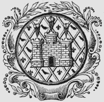
Seal and Arms.
The town stands on an eminence, nearly in the centre of the Isle of Purbeck, and consists principally of two streets diverging from the market-place, in the centre of which is an ancient stone cross; the houses are in general built of stone, obtained from the neighbouring quarries, and are approached by a flight of steps; the inhabitants are well supplied with water. The bridge connecting the castle with the town is called St. Edward's bridge, and is said to be the spot where Edward, fainting from the loss of blood, fell from his horse and expired. At the entrance from the London road is an ancient stone bridge over the small river Corfe, by which the town is bounded on the east. The population is chiefly employed in the quarries and claypits for which the isle is celebrated; and from the principal of these, called Norden, about a mile from the town, a railway has been constructed, to facilitate the communication with Poole harbour, where the clay is shipped for the Staffordshire and other potteries. A few of the female inhabitants are engaged in the knitting of stockings. The market, which was held on Thursday, has been for some time discontinued; the fairs are on May 12th and October 29th. The lord of the manor of Corfe was anciently hereditary lord-lieutenant of the Isle of Purbeck, and had the power of appointing all officers, and determining all actions or suits by his bailiff or deputy; he was also admiral of the isle, and exercised the authority of lord high admiral, in which capacity he was entitled to all wrecks, except in cases where there was a special grant to the contrary. These privileges ceased on the passing of the Militia act, in 1757, Mr. Bankes, then lord of the manor, having omitted to enforce his claims. Though a borough by prescription, the town was not incorporated till the 18th of Queen Elizabeth, who invested it with the same powers as were enjoyed by the cinque-ports. Under the existing charter of Charles II., the corporation consists of a mayor, who is elected at the court leet of the lord of the manor, held at Michaelmas, and eight barons, who have previously served the office of mayor; the mayor and the late mayor are justices of the peace. The elective franchise was granted in the 14th of Elizabeth, from which time the borough returned two members to parliament, till it was disfranchised in the 2nd of William IV.
The parish comprises 7193 acres, of which 1479 are common or waste. The living is a rectory, valued in the king's books at £40. 14. 7.; net income, £685; patron, William Bankes, Esq. The church is a spacious and ancient structure, partly Norman, and partly in the early English style, with a lofty embattled tower, crowned by pinnacles, and ornamented with niches in which are some sculptured decorations of singular design; it contains a few old monuments and several altar-tombs of Purbeck marble. The parish is in the centre of a district of considerable extent, in which the earliest of the Sunday schools were established, under the auspices of William Morton Pitt, Esq., of Kingston House. Several schools are supported by subscription; and there are almshouses in East-street for six aged persons, with an endowment in land. In making a road near the town, in 1768, two stone coffins, formed of flat stones placed edgeways, and containing a skeleton, were found; in 1753, an urn containing burnt bones was discovered, with the mouth downwards, near St. Edward's bridge. About two miles to the east of the town is an eminence called Nine-Barrow Down, where are sixteen barrows of various dimensions, chiefly circular, nine of which are in a straight line; eight or ten of them are surrounded by a narrow trench. The eminence commands a beautiful view of the bay of Swanwich, the British Channel, and the Isle of Wight.
Corfe-Mullen
CORFE-MULLEN, a chapelry, in the parish of Sturminster-Marshall, union of Wimborne and Cranborne, hundred of Cogdean, Wimborne division of Dorset, 3 miles (S. W. by W.) from WimborneMinster; containing 758 inhabitants, and comprising 3086 acres, of which 148 are common or waste. The chapel is dedicated to St. Nicholas, and has been enlarged by the addition of 140 free sittings. There is an annuity of £27 for the support of a school, to which Richard Lockyer in 1706 bequeathed £17.
Corfton
CORFTON, a chapelry, in the parish of Diddlebury, union of Ludlow, hundred of Munslow, S. division of Salop, 8½ miles (N.) from Ludlow; containing 232 inhabitants.
Corhampton
CORHAMPTON, a parish, in the union of Droxford, hundred of Meon-Stoke, Droxford and N. divisions of the county of Southampton, 15 miles (S. W. by S.) from Alton; containing 181 inhabitants. The parish is situated on the London and Gosport road, and comprises by computation 2500 acres; the scenery is pleasingly varied, and combines several interesting features. Preshaw, the seat of Walter Long, Esq., is a noble mansion of various styles, situated in an extensive park commanding several fine views of the surrounding country. The living is a perpetual curacy or donative; net income, £39; patron and impropriator, Wadham Wyndham, Esq. The church is an ancient edifice, apparently of early Norman construction.
Corley
CORLEY, a parish, in the union of Meriden, Atherstone division of the hundred of Hemlingford, N. division of the county of Warwick, 4 miles (N. N. W.) from Coventry; containing 288 inhabitants. This place, called in the Norman survey Cornelie, is supposed by Dugdale to have derived its name from the British "Coryn," signifying the top of anything, in reference to its situation on one of the highest elevations in England. The parish comprises 1373 acres, of which 53 are common or waste; the surface is hilly, and the soil, though somewhat sandy, is in general good and productive. Corley is intersected from south-east to northwest by the road between Coventry and Tamworth. The living is a vicarage, endowed with the rectorial tithes; net income, £400; patron, A. F. Gregory, Esq.
Cornard, Great (St. Andrew)
CORNARD, GREAT (St. Andrew), a parish, in the union of Sudbury, hundred of Babergh, W. division of Suffolk, 1¼ mile (S. E.) from Sudbury; containing 938 inhabitants. It is bounded on the west by the river Stour, which is here navigable. The living is a discharged vicarage, valued in the king's books at £9, and in the gift of Miss Mallows. The great tithes have been commuted for £420, and the vicarial for £167; the glebe contains nearly 10 acres, with a glebe-house.
Cornard, Little (All Saints)
CORNARD, LITTLE (All Saints), a parish, in the union of Sudbury, hundred of Babergh, W. division of Suffolk, 3 miles (S. E.) from Sudbury; containing 396 inhabitants. It is bounded on the south-west by the navigable river Stour, and comprises about 1400 acres. The living is a rectory, valued in the king's books at £8. 2. 8½., and in the patronage of Mrs. Green: the tithes have been commuted for £492, and there is a glebe of 50 acres.
Cornbrough
CORNBROUGH, a township, in the parish of Sheriff-Hutton, union of Malton, wapentake of Bulmer, N. riding of York, 11 miles (N. by E.) from York; containing 63 inhabitants. The township comprises 920 acres by measurement, divided between arable and pasture.
Cornelly (St. Cornelius)
CORNELLY (St. Cornelius), a parish, in the union of Truro, W. division of the hundred of Powder and of the county of Cornwall, ¾ of a mile (W. by S.) from Tregoney; containing 119 inhabitants, and comprising about 1047 acres. The living is a perpetual curacy; net income, £47; patron, the Vicar of Probus; impropriators, the principal inhabitants: the glebe contains 12 acres. It was anciently annexed to Probus, from which it was separated in 1532, the incumbent paying 6s. 8d. annually to the vicar of that parish, as an acknowledgment. The Bishop of Exeter receives a tithe rent-charge of £134, and the incumbent one of £15.
Corney (St. John the Baptist)
CORNEY (St. John the Baptist), a parish, in the union of Bootle, Allerdale ward above Derwent, W. division of Cumberland, 4 miles (S. E. by S.) from Ravenglass; containing 273 inhabitants. This parish is situated on the coast of the Irish Sea, and comprises about 3000 acres, of which 1000 are common or waste; it is bounded on the east by a lofty range of fells stretching on the south to the mountain of Black Comb. The surface is boldly varied, and the scenery in many parts strikingly picturesque; the higher grounds command diversified prospects, and from Corney Hall is an exceedingly fine view of the sea and numerous interesting objects. On the lands of the Hall are several veins of iron-ore of very rich quality, but of limited depth, which were wrought to some extent about 80 years since. The living is a discharged rectory, valued in the king's books at £9. 17. 1.; net income, £140; patron, the Earl of Lonsdale. To the north of the village are some extensive ruins, of which the history is unknown, and in the neighbourhood are numerous Druidical remains. Mr. Troughton, an eminent philosophical instrument maker, was a native of the parish.
Cornforth
CORNFORTH, a township, in the parish of Bishop's-Middleham, union of Sedgefield, N. E. division of Stockton ward, S. division of the county of Durham, 6¼ miles (S. S. E.) from Durham; containing 700 inhabitants. It comprises about 1570 acres. Coal is obtained, which is shipped on the Tees; and a vast quantity of limestone is quarried from a hill, at the bottom of which the village lies, in a low and warm situation: the houses are disposed in the form of a square, with a green of several acres in the centre. The impropriate tithes have been commuted for £108. 6. 6., and the vicarial for £28. 10. Dr. Hutchinson, a learned writer, was born here. An extensive burial-ground was discovered a few years since, in a field on the summit of the high ground on the south of the village: the graves are made in all directions, and at no great depth, in the magnesian limestone; in one was found the umbo of a shield, and in another the head of a spear.
Cornhill
CORNHILL, a parish, in the union of Berwickupon-Tweed, in Norhamshire, N. division of Northumberland, 1½ mile (E. by S.) from Coldstream; containing 823 inhabitants. It comprises about 4430 acres, of which the soil is productive and chiefly arable, and the scenery of a romantic character. The village, which is pretty and salubrious, is separated from Scotland by the Tweed only; Coldstream is the first town over the border, and the river is crossed by a noble stone bridge. There is a good hotel for the sporting gentlemen who resort here to hunt in great numbers during the winter months. A fair is held on December 6th. The living is a perpetual curacy, in the patronage of the Dean and Chapter of Durham, who are the appropriators. The church, dedicated to St. Helen, was rebuilt in 1751, when a stone coffin, containing fragments of a human skeleton, and two urns of coarse earthenware, were found; it was again partly rebuilt in 1840, at a cost of about £500, and is principally in the early English style, with a campanile bell-tower. The castle here was demolished by the Scots in 1385, and again in 1549, when a considerable booty fell into their possession; the remains are built up in a modern mansion. To the southeast is an encampment of unusual construction; and a quarter of a mile westward is another large collection of earth-works, the most remarkable north of the Wall for variety and extent. In a wood is St. Helen's well, the water of which is serviceable in scorbutic and gravel complaints; but it is not much used.
Cornsay
CORNSAY, a township, in the parish and union of Lanchester, N. W. division of Darlington ward, S. division of the county of Durham, 6¼ miles (N. E.) from Wolsingham; containing 201 inhabitants, and comprising 2141 acres, of which 200 are common or waste. The impropriate tithes have been commuted for £119. 10. In 1811, Wm. Russell, Esq., of Brancepeth Castle, gave an endowment of £20 per annum for a schoolmaster, and built and endowed almshouses for six men and six widows.
Cornwall
CORNWALL, a maritime county, bounded on the north by the Bristol Channel, on the west by the Atlantic Ocean, on the south by the English Channel, and on the east by Devonshire. It extends from 49° 57' 30" to 50° 55' 30" (N. Lat.) and from 4° 10' to 5° 44' (W. Lon.), and contains 1327 square miles, or 849,280 statute acres: within its limits are 65,574 inhabited houses, 4962 uninhabited, and 926 in the course of erection; and the population amounts to 341,279, of whom 164,757 are males, and 176,522 females. The part of Britain including this county and a portion of Devonshire, from its shape was called by its ancient British inhabitants Kernou, or, as it is written by the Welsh, Kerniw, signifying "the horn," which word was Latinized to Carnubia or Cornubia; and when the Saxons gave the name of Weales to the Britons, they distinguished those who had retired into Kernou, or Cornubia, by that of Cornweales, and their country was thus called Cornuwall, or Cornwall, that is, "Cornish Wales." At the time of the Roman Conquest, the northern part was inhabited by the Cimbri, the eastern by the Danmonii, and the remaining portion by the Carnabii, of whom the Danmonii had subdued the two other tribes, and taken possession of their territories; but on the completion of the Roman Conquest, the whole became included in the great province of Britannia Prima. During the aggressions of the Saxons, various acts of hostility occurred between them and the Cornish Britons, and the latter were obliged to invoke the assistance of the Danes, who arrived on this coast in 806. King Egbert, nevertheless, overran the whole territory; and the Britons were at length finally reduced by Athelstan, prior to which time they had occupied a great part of Devonshire, and inhabited Exeter in common with the Saxons.
Cornwall is within the diocese of Exeter, and province of Canterbury; and forms, with three parishes in Devonshire, an archdeaconry, comprising the deaneries of East, Kerrier, Penwith, Powder, Pyder, Trigg-Major, Trigg-Minor, and West, and containing 203 parishes: the Scilly Islands are also in the archdeaconry of Cornwall. The office of rural dean, which in most parts of the kingdom has become nearly nominal, is here an efficient office; the rural deans are appointed annually, perform regular visitations to every church within their deaneries, and report the state of each at the archdeacon's visitations. For civil purposes the county is divided into the hundreds of East, Kerrier, Lesnewth, Penwith, Powder, Pyder, Stratton, Trigg, and West. It contains the borough and market towns of Bodmin, Falmouth, Helston, Launceston, Liskeard, Penryn, St. Ives, and Truro; the following market-towns, also ancient boroughs, but deprived of their privilege of sending representatives to parliament by the act of the 2nd of William IV., cap. 45, viz., Bossiney, Callington, Camelford, East Looe, Fowey, Lostwithiel, St. Mawes, Saltash, and Tregoney; four decayed boroughs having no markets, deprived in like manner, viz., Newport, St. Germans, St. Michael, and West Looe; and twelve market-towns which are not boroughs, viz., Camborne, Grampound, Marazion, Padstow, Penzance, Polperro, Redruth, St. Agnes, St. Austell, St. Columb, Stratton, and Wadebridge. Of the above towns, twelve are sea-ports, viz., Falmouth, Fowey, Looe, Marazion, Padstow, Penryn, Penzance, Polperro, St. Agnes, St. Ives, Truro, and Wadebridge; besides which, there are the smaller ports of Boscastle, Bude, Charlestown, Gweek, Hayle, Helford, Mevagissey, New Quay, Porth, Port-Isaac, Portleven, Portreath or Basset's Cove, and Trevannance. By the act above named the county was divided into two portions, called the Eastern and the Western divisions, each sending two representatives to parliament: the boroughs Bodmin and Truro continue to return two members each, as also does Penryn, in conjunction with Falmouth, which, prior to the passing of the act, enjoyed no share in the representation: Helston, Launceston, Liskeard, and St. Ives, each now return only one. Cornwall is included in the Western circuit: the spring and summer assizes, and the quarter-sessions, are held at Bodmin, where stand the county gaol and house of correction; and the Easter quarter-sessions at Truro.
Cornwall is a royal duchy, settled by act of parliament on the eldest son of the sovereign; and its immediate government is vested in the duke, who has his chancellor, attorney-general, solicitor-general, and other officers, and his court of exchequer, with the appointment of sheriffs, &c. The important concerns of the tin-mines are under a separate jurisdiction, the tin-miners being, by ancient privilege confirmed by Edward III., exempt from all other civil jurisdiction than that of the Stannary Courts, except in cases affecting land, life, or limb. At the head of this jurisdiction is the lord-warden of the stannaries, under whom is the vice-warden, whose court, held generally once a month, is a court of equity for all matters relating to the tin-mines and trade, from which no writ of error lies to the courts at Westminster, though there is an appeal to the lord-warden, and from him to the duke and his council. Issues are frequently directed by the vice-warden to be tried in the stannary courts, which are held at the end of every three weeks (except in the stannary of Foymore, in which there is scarcely any business for the court), before the steward of each stannary and a jury, for determining on all civil actions arising within the stannaries, which have reference to the tin-mines; the decision of each of these courts is subject to an appeal to the vice-warden, and from him to the superior authorities. Henry VII., on confirming their ancient privileges, decreed that no new laws affecting the miners should be enacted by the duke and his council, without the consent of twenty-four persons, called stannators, six being chosen out of each of the four stannaries, or mining districts, of Foymore, Blackmore, Tywarnhaile, and Penwith and Kerrier. The stannators for Foymore are chosen by the corporation of Lostwithiel, those for Blackmore by the corporation of Launceston, those for Tywarnhaile by the corporation of Truro, and those for Penwith and Kerrier by the corporation of Helston; on assembling they elect a speaker, and their meeting is called a stannary parliament. The parliaments have been convened occasionally by the lord-warden, as the circumstances of the times have required new laws, or the revision of the old; the last met at Truro, in 1752, and continued by adjournments until Sept. 11th, 1753. The stannary prison is at Lostwithiel, where the ancient records of the stannaries were kept previously to the parliamentary war, when they were burnt.
Nearly the whole of the county is remarkable for the inequality of its surface. A large portion consists of uncultivated moors, abounding with tors composed of immense masses of granite, and extending from near Blisland, on the west, to near Northill on the east, and from near Davidstow, on the north, to the vicinity of St. Neot's on the south, about twelve miles in length and ten in breadth. The high grounds, through which the great roads chiefly pass, present a dreary aspect, especially in the mining district, where the surface has in many places been greatly disfigured by the streamworks of successive ages; but in several parts there is a pleasing diversity of hill and dale, and some of the valleys are richly varied and beautifully picturesque. The most agreeable scenery is found near the southern coast, and along the course of the Tamar; Falmouth bay and Mount's bay are considered equal in beauty to any recesses on the English coast. So salubrious is the climate, that Cornwall has long been celebrated for the longevity of its inhabitants; and the southern coast, especially towards the Land's End, is, on account of the superior mildness of the air, much resorted to by invalids in the winter season. The prevailing soils are, the black gravelly, the shelfy or slaty, and various loams, differing in colour, texture, and degree of fertility. The labours of the farmer are entirely engaged in tillage, to the exclusion of the dairy, one-third of the cultivated lands being constantly under arable crops. The corn crops usually cultivated are wheat, barley, and oats, including the naked oat, called in Cornwall pillis or pilez, a word signifying "bald." The green and root crops consists principally of turnips, ruta baga, potatoes, in some places the flat-pole or drum-head cabbage, and yellow clover, trefoil, and rye-grass, the last here called eaver. The dry, light, friable and porous soils of Cornwall, and its moist and mild climate, are particularly favourable to the growth of potatoes, which have here been cultivated to a great extent longer than in any other parts of the kingdom; in the vicinity of Penzance the land produces two crops in the year, and an acre has been known to yield 300 bushels of the early kidneypotatoes at the first crop, and 600 bushels of applepotatoes at the second: a large quantity is sent to London, Plymouth, and Portsmouth. The natural meadows are comparatively of small extent, and lie scattered throughout the county; the only pasture lands consist of the wastes, and of the fields of artificial grasses. Many of the valleys are well wooded, particularly in the south-eastern part of the county, and in the vicinity of Lostwithiel and Bodmin; and there are extensive plantations at Tregothnan, Clowance, Tehidy, Port Eliot, Carclew, Trelowarren, Boconnock, Heligan, &c.: the principal landowners having of late years directed their attention to planting, chiefly in elevated situations, the face of the country, in the course of twenty or thirty years, will present extensive woodland scenery. Nearly a fourth part of the surface, from 150,000 to 200,000 acres, consists of uninclosed moors, downs, and crofts, as the waste lands are here generally called.
Cornwall has been celebrated for the produce of its mines from a remote period of antiquity. Strabo, Herodotus, and other ancient writers relate that the Phœnicians, and after them the Greeks and the Romans, traded for tin to Cornwall and the Scilly Islands, under the name of the islands Cassiterides, from a very early period; and Diodorus Siculus, who wrote in the reign of Augustus, gives a particular account of the manner in which the tin-ore was dug and prepared by the Britons. At what time the coinage of the tin procured here was established is uncertain, but it was practised so early as the reign of King John. In that of Edward I. it was first ordered, for better securing the payment of the duty to the earl, that all tin should be brought to certain places appointed for that purpose, to be weighed and stamped, or, as it is usually termed, coined; and that no tin should be sold until the stamp had been affixed. The term coinage, by which this process has always been designated, appears to have been derived from cutting off a coign, or corner of each block, to ascertain its purity. The average annual quantity raised from these mines in the years 1799, 1800, and 1801, was 16,820 blocks, each weighing about 3¼ cwt.; in 1811, the quantity produced was only 14,698 blocks, but in 1824, it had increased to 28,310, and in 1831 it was 25,155, the average of the eight years from 1824 to 1831 inclusive being 26,647 blocks. The mineral rights of tin in the duchy manors were sold, about 35 years ago, for a term of years. The tin-ore has always been smelted in the county, at first in blast-furnaces, the buildings for which were called "blowing-houses;" but reverberatory furnaces being introduced early in the last century, the ore has since been smelted in them with pit-coal from South Wales, the produce being called "common tin." The blowing-houses are now used for smelting the diluvial or stream tin, in which charcoal alone is employed; and the produce is called "grain tin," being of purer quality, and bearing a higher price than the common kind. The Copper mines were not extensively worked until the close of the 17th century, since which the quantity of ore raised has been gradually increasing: in 1824, 110,000 tons of ore were obtained, producing 8417 tons of copper, of the value of £743,253; in 1826, 128,459 of ore, producing 10,450 of copper, of the value of £755,358; in the year ending June, 1831, 146,502 of ore, producing 12,218 of copper, of the value of £817,740; and in 1837, 140,753 of ore, producing 10,823 of copper, of the value of £908,613. The produce of the Lead mines is inconsiderable, and the only mine from which silver is extracted is in the parish of Calstock. The various mines employ a fourth of the entire population, and the wages paid from the copper-mines alone, exceed half a million annually; the steam-engines employed at the mines annually consume 80,000 tons of coal.
Much use is made of the various kinds of stone found in the county; and the Cornish slate is a considerable article of commerce. Of this, the principal quarries are those on the southern coast, those between Liskeard and the Tamar, those in the parishes of Padstow and Tintagel, and the celebrated quarry of Delabole, or Dennybal, in the parish of St. Teath, the produce of which is held in the highest esteem, and is shipped in large quantities from Port Isaac, about five miles distant, both coastwise and to the continent: the quartz crystals found in this quarry are of great brilliancy. There is a large quantity of stone suitable for building in various parts of the county; it is principally taken from the porphyry dykes, or elvan courses, which traverse both the granite and slate strata; the granite, or moor-stone, which abounds on the surface of the moors, has of late years been exported for the erection of bridges and other public buildings. Steatite, or soap rock, of a fine soft texture, is found imbedded in the serpentine, near the Lizard, and is the most curious of all the earthy substances found in Cornwall; it is of various colours, but the pure white is most esteemed for the porcelain manufacture, for the use of which much of it is exported. An abundance of felspar-clay, resulting from the decomposition of granite, is obtained in the parishes of Roche, St. Stephen, and St. Denis; and is likewise shipped, chiefly at the neighbouring ports of Charlestown and Pentuan, for the manufacture of china and fine earthenware. A yellow sandy clay, which, from its resisting intense heat, is called fire-clay, found near Lelant, is sent to Wales, for laying the bottoms of copper furnaces. In the parish of St. Keverne is a yellow clay used to make moulds for casting metals; and near Liskeard is found a clay of a slaty nature, but of a soapy texture, which has fertilizing properties. Among the Cornish ornamental stones may be enumerated its serpentine or porphyry, its marbles, talc, stalactites, and the asbestos and small gems: its fossils are of great variety, many of them beautiful in colour, and some clear and transparent, from which they have obtained the name of Cornish diamonds.
The abundance of Fish on the coast constitutes an important source of trade. The most esteemed species for the table, such as the turbot, dory, piper, sole, red mullet, whiting, &c., are plentiful; but the most important of the fisheries are those of mackerel, herrings, and pilchards, particularly of the last, which are peculiar to this coast, the opposite coast of Britanny, and the south of Ireland. After supplying the inhabitants with their winter stock, the great mass of pilchards are salted, the oil is then pressed out of them, and they are packed in hogsheads for exportation, principally to the ports of Italy. The chief stations of the pilchard-fisheries are Fowey, Looe, Mevagissey, St. Mawes, the coves of the Lizard, and in Mount's bay, on the south coast; and St. Ives and New Quay, on the north coast. About 21,000 hogsheads are annually produced; 2000 tons of mackerel are also taken. Oysters are found in great abundance in the creeks of the Hel, and exported to the Medway, where they are laid down to fatten for the London market.
There are few branches of Manufacture, except such as relate to the smelting and preparation of the metals. The manufacture of carpets is carried on at Truro, and coarse woollen-cloths are made at Truro and PerranArworthal; there are iron-foundries at Perran-Wharf and Hale, and manufactories for gunpowder at Kennall Vale, in the parish of St. Stythians, and at Cosawes, in that of St. Gluvias. With regard to the state of the Harbours, the mouths of nearly all the tide rivers on the north coast have been almost choked with sand cast up by the surge, or drifted in by the north-westerly winds. The principal rivers are, the Tamar, which forms, from the sea up to its source (excepting only for the space of about three miles) the boundary between this county and Devonshire, and is navigable as high as New Quay, about 24 miles above Plymouth; the Lynher or Lyner, which becomes navigable at Noddetor or Notter Bridge, and spreads into the Lynher creek, four miles below which it falls into the Tamar; the Tide, or Tidi, which becomes navigable two miles above St. Germans creek, which forms a junction with the Lynher creek; the East Looe river, which is navigable up to Sand-place; the Duloe, a tributary of the East Looe, and navigable up to Trelawnwear; the Fawy, which becomes navigable, at high water, at Lostwithiel, three miles below which it joins the Leryn creek, and forms a wide and deep haven, falling into the sea below Fowey; the Fal, which about a mile below Tregoney spreads into a wide channel, and soon afterwards opens into the broad expanse of Falmouth harbour, through which it empties itself into the sea, being navigable in all its creeks; the Hel, which at high water becomes navigable at Gweek, and, being joined in the latter part of its course, by several small creeks, forms Helford haven, within a mile below which it falls into the sea, through an estuary about a mile broad; the Heyl, which at St. Erth spreads into the estuary of Hayle, the latter about two miles further opening into St. Ives' bay; the Alan or Camel, which is navigable up to Polbrock; and the Seaton.
A canal was constructed from Bude harbour to Thornbury, in the county of Devon, by a company formed in 1819. It has divers branches: from Red Post a branch, nineteen miles in length, extends down the western bank of the Tamar to Druxton Bridge, about three miles north of Launceston; and from Burmsdon there is a branch, nearly a mile and a half in length, up the west bank of the Tamar to Moreton Mill, where it receives a feeder from a reservoir on Langford Moor. In 1825, an act was obtained for the construction of the Liskeard and Looe canal, which commences at Tarras Pill, and terminates at Moorswater, being five miles and seven furlongs in length, and having twentyfive locks: there is a branch, about a mile in length, to Sand-place. In 1824, an act was obtained for making a railway from Redruth to Point Quay, in the parish of St. Feock, with several branches; also for restoring, improving, and maintaining the navigation of Restrongett-creek. The Redruth and Chacewater railway, commencing at the town of Redruth, proceeds in an eastern direction to Nangiles, where it is joined by a branch from the mines near Scorrier Hall. The Hayle railway, chiefly for the conveyance of minerals from that place to Redruth, with a branch to Portreath, joins the Redruth and Chacewater railway; it has been bought by the West Cornwall Railway Company, and will form part of their line from Truro to Penzance. The Bodmin and Wadebridge railway, for the conveyance of minerals and passengers, was opened in 1834: the line is 12 miles in length.
Cornwall abounds with rude monuments of its aboriginal inhabitants, much resembling those found in Ireland, Wales, and North Britain, consisting of large unwrought stones placed erect, either singly or in circles, or with others laid across, and of tumuli of stones or earth: the numerous circles of erect stones are generally termed Dawns-mên, "the stone dance." There are also two circular inclosures of stone, or earth, one at St. Just near the Land's End, and the other at Peranzabuloe, within which are rows of seats, having formed amphitheatres, originally designed for the exhibition of various sports, and where, in later times, the Cornish plays were acted: these are called "rounds," or plan an quare, "the place of sport." Tumuli are to be seen in all parts of the county. Another kind of rude stone monument, most probably sepulchral, occurs in many places, viz., the cromlech, which consists of a large flat stone laid horizontally upon several others fixed upright in the ground, and which is provincially called the "quoit," or the "giant's quoit." Celts have been found here more abundantly than in any other part of the kingdom. Several artificial caves, or subterranean passages have been discovered, consisting of long galleries extending in various directions, formed of upright stones with others laid across. In 1749, a great number of gold coins, believed to be British, was found in the middle of the ridge of Carnbrê Hill. In several parts of the county may be seen rude stones of granite, with inscriptions, supposed to be ancient British, and some of them coeval with the time of the Romans. The Roman antiquities consist mostly of coins, which of late years have been discovered in abundance in the western part of the county; and of spear-heads, swords, and other weapons of mixed metal, which have frequently been found in the ancient mines and stream-works. The situation of any of the Roman stations has not been ascertained. Ancient roads, or fragments of them, are visible in various parts of the county: one of these, believed to be British, traverses the hills, with barrows at intervals along its line, from the Land's End towards Stratton and the north of Cornwall, passing near the great British station of Carnbrê. Two Roman roads enter the county from Devonshire, one of which was a continuation of the great road from Dorchester and Exeter; the other appears to have led from Torrington and the northern part of Devonshire towards Stratton. Camps and earthworks are particularly numerous, the greater part of them being nearly round or oval. In many places along the coast a single vallum runs across from the edge of one cliff to that of another, with a ditch on the land side. There are considerable remains of a vallum called the "Giant's Hedge," which appears to have been originally about seven miles and a half in length, extending in an irregular line from the river Looe, a little above the town of West Looe, to Leryn.
Before the Reformation, there were about twenty religious establishments, including two alien houses, and one commandery of the Knights Hospitallers; there were also eleven colleges and seven hospitals: but the monastic remains are few, and, excepting those of St. Germans Priory, not remarkable. Small chapels, or oratories, erected over wells or springs to which extraordinary properties have been attributed, abound in most parts of the county, the greater part of them however in ruins; and throughout the whole of it are ancient stone crosses, not only in the churchyards, but on the moors, and in other solitary situations. There are also, particularly in the narrowest parts of the county, from St. Michael's Mount to the Land's End, remains of several rude circular buildings on the summits of hills, of very remote antiquity, and still denominated Castles; together with several cliff castles, formed by stone walls running across necks of land from one cliff to another on the sea-coast. Of more regular fortresses the principal remains are those at Launceston, Carnbrê, Tintagel, Trematon, and Restormel, all of high antiquity, and the first believed to be of British origin. The most perfect specimen of ancient domestic architecture is Cothele House, built in the reign of Henry VII. Many others of the houses of the landed proprietors are also fine old family mansions, of very antique structure, though some of them have been altered, enlarged, and modernised. Notwithstanding the abundance and variety of the mineral strata, there are few springs possessing mineral properties. The Cornish men were formerly much addicted to sports and pastimes, especially to the miracle play, wrestling, and hurling; the practice of wrestling still prevails. Cornwall, as before noticed, gives the title of Duke to the eldest son of the sovereign.
Cornwell
CORNWELL, a parish, in the union of ChippingNorton, hundred of Chadlington, county of Oxford, 4 miles (W.) from Chipping-Norton; containing 97 inhabitants. The living is a discharged rectory, valued in the king's books at £7. 4. 2., and in the patronage of the Crown; net income, £140.
Cornwood (St. Michael)
CORNWOOD (St. Michael), a parish, in the union of Plympton St. Mary, hundred of Ermington, Ermington and Plympton, and S. divisions of Devon; containing, with the village or post-town of Ivy-Bridge, 1080 inhabitants. The parish comprises 10,680 acres, of which 7459 are moor, common, and waste; it is intersected by the river Yealm, and bounded on the northeast by the Erm. About 5000 acres of moor are, for nine months in the year, appropriated to the pasture of large quantities of cattle and sheep. Granite is found in abundance, and extensively quarried for building. Cattlefairs are held on the first Monday in May, and the fourth Monday in September. The living is a vicarage, valued in the king's books at £33. 4. 7.; net income, £405; patron, the Bishop of Exeter; impropriator, Sir J. L. Rogers. The glebe comprises about 80 acres. The church is in the ancient English style, and has three stone stalls and a piscina. There is a chapel for the district of Ivy-Bridge, at the extremity of the parish: the living is in the gift of Sir J. L. Rogers. A school on the national plan is aided by an endowment of £10 per annum by the Rev. Duke Yonge, the late vicar, who also bequeathed £20 per annum for affording medical assistance to the poorer inhabitants. The Rook charity, comprising upwards of 27 acres, produces a rent of £44, which is distributed among the poor. The aunt of Sir Walter Raleigh resided at Fardd, in the parish.
Cornworthy (St. Peter)
CORNWORTHY (St. Peter), a parish, in the union of Totnes, hundred of Coleridge, Stanborough and Coleridge, and S. divisions of Devon, 4¼ miles (S. E. by S.) from Totnes; containing 554 inhabitants. The parish is situated on the navigable river Dart, and separated from Ashprington by the river Harborne, which falls into the Dart. It comprises by estimation 1600 acres: the soil is fertile in some parts, in others poor; there are some good pastures, and productive orchards. About fifty persons are employed in the paper manufacture. Here are quarries of limestone, which is raised for building purposes, but chiefly for burning into lime, and for the roads. The living is a discharged vicarage, valued in the king's books at £10; net income, £210; patron, the Rev. Charles Barter; impropriators, Edward Holdelet, J. Peete, and H. Tucker, Esqrs. The church is a neat structure in the later English style, and contains a monument to Sir Thomas Harrison. A school, now conducted on the national plan, was founded in 1609, by Elizabeth Harris, and endowed by her with land producing about £25 per annum. Sir John Peters bequeathed a small sum from the great tithes, to be distributed to poor people; and there are some cottages erected on land given for that purpose by Sir Peter Edgecumbe. A priory for seven nuns of the order of St. Augustine, said to have been founded by the family of Edgecumbe, and valued at the Dissolution at £63 per annum, formerly stood here: two of the arched gateways still remain.
Corpusty (St. Peter)
CORPUSTY (St. Peter), a parish, in the union of Aylsham, hundred of South Erpingham, E. division of Norfolk, 6 miles (W. N. W.) from Aylsham; containing 449 inhabitants. The parish is on the road from Norwich to Holt, and comprises 1018 acres, whereof 49 are common or waste: the village is situated on the south side of a branch of the river Bure, on which is a flour-mill. The living is a discharged vicarage, valued in the king's books at £4. 12. 8½.; net income, £62; patron, the Bishop of Norwich; impropriator, J. R. Ives, Esq., whose tithes have been commuted for £256. The church, which stands on an eminence commanding very fine views, is chiefly in the decorated style, and consists of a nave and chancel, with a square embattled tower; the nave is separated from the chancel by the remains of a carved screen, and there is a handsome sculptured font. The Wesleyans and Primitive Methodists have each a place of worship.
Corridge
CORRIDGE, a township, in the parish of Hartburn, union of Morpeth, W. division of Morpeth ward, N. division of Northumberland, 11 miles (W. by S.) from Morpeth; containing 22 inhabitants. The families of Aynsley, Robson, and Carr have held lands here. The township is divided into two farms, East and West, and comprises 329a. 1r. 19p., of which 67 acres are arable, 262 pasture, and the remainder woodland; the river Wansbeck passes on the north. A rent-charge of £24 is paid to the vicar of Hartburn.
Corringham (St. Mary)
CORRINGHAM (St. Mary), a parish, in the union of Orsett, hundred of Barstable, S. division of Essex, 3 miles (E.) from Horndon-on-the-Hill; containing 255 inhabitants. The parish is situated between Tilbury Fort and Canvey Island, and bounded on the south by the river Thames: at the time of the Norman survey it belonged to the Bishop of London. The living is a rectory, valued in the king's books at £22. 13. 4.; patron and incumbent, the Rev. J. H. Stephenson, whose tithes have been commuted for £830, and whose glebe contains 29 acres. The church, situated on the Green, is an ancient building, with a low tower surmounted by a shingled spire.
Corringham (St. Lawrence)
CORRINGHAM (St. Lawrence), a parish, in the union of Gainsborough, wapentake of Corringham, parts of Lindsey, county of Lincoln, 4 miles (E. by N.) from Gainsborough, on the road to Louth; comprising the hamlets of Aisby, Dunstall, and Yawthorpe, the township of Little Corringham, and the chapelry of Somerby; and containing 564 inhabitants, of whom 189 are in Little Corringham. This parish is in the Norman survey called Coringeham; it gives name to the wapentake, and is the head of a deanery, the original establishment of which, though not exactly known, must have been prior to the year 1100. The hamlet of Great Corringham comprises 1889 acres; that of Little Corringham 987: including respectively 595 and 275 acres of common or waste. The village is seated between two branches of the small river Eau. The living is a vicarage, valued in the king's books at £12, and in the patronage of the Bishop of Lincoln: the great tithes have been commuted for £532. 12. 11., and those of the vicar for £170. 18. The church, which belonged to the Knights Templars, is an ancient stone structure in the Norman style, with later additions, and has a tower; the south doorway has a richly ornamented Norman arch, and there are several similar arches within the church, which evidently consisted originally only of a nave and chancel. Here are two places of worship for Wesleyans.
Corscombe (St. Michael)
CORSCOMBE (St. Michael), a parish, in the union and hundred of Beaminster, Bridport division of Dorset, 3½ miles (N. E.) from Beaminster; containing 810 inhabitants. The parish comprises by computation 5000 acres; the soil is various, in some parts chalky, in some clayey, and in others a rich black mould. The village is situated on the north side of a hill, and commands extensive views over the county of Somerset to the Bristol Channel, and the mountains of Wales. The Court-house, belonging to the lord of the manor, and now occupied as a farmhouse, is nearly encompassed by a moat, over which was a drawbridge. The living is a rectory, valued in the king's books at £21. 3. 4., and in the gift of W. Maskell, Esq.: the tithes have been commuted for £573, and the glebe comprises 61 acres. The church is a neat edifice, erected about 1675.
Corse (St. Margaret)
CORSE (St. Margaret), a parish, in the union of Newent, Lower division of the hundred of Westminster, E. division of the county of Gloucester, 6 miles (N. N. W.) from Gloucester; containing 482 inhabitants. This parish, which comprises by measurement 1901 acres of land, is beautifully situated on the road from Gloucester to Ledbury, and has been improved by the inclosure of upwards of 1300 acres, that anciently abounded with wood, and were called "Corse Lawn." Stone is quarried for the building of cottages and the repair of roads. The living is a discharged vicarage, endowed with the rectorial tithes, valued in the king's books at £6. 2. 9., and in the patronage of the Crown; net income, £443. The glebe consists of 5½ acres, with a glebe-house. The Wesleyans have a place of worship; and a sum of about £20 per annum, derived from land, is applied to charitable purposes.
Corsenside
CORSENSIDE, a parish, in the union of Bellingham, N. E. division of Tindale ward, S. division of Northumberland, 17 miles (N. by W.) from Hexham; containing 1108 inhabitants. This parish, anciently Crossan-set (the place of the crosses), lies on the Watlingstreet, and comprises by measurement 7840 acres, of which about 2500 are arable, 5000 pasture, and 340 wood. On the east and west sides the land is bleak, moorish, and sterile, but along the banks of the Rede the soil is light, dry, and gravelly, producing good crops of grass and corn; the surface is in general rugged in the extreme, and the scenery uninteresting, except during the summer, when, in the vicinity of Woodburn, it becomes highly picturesque. There are several quarries of excellent limestone and freestone; seams of coal in different places; and an extensive mine of iron-ore of superior quality. An iron-foundry employs between 200 and 300 hands. The parish contains the beautiful hamlet of West Woodburn, and that of East Woodburn, the latter chiefly remarkable for having been the residence of the distinguished family of De Lisle. The living is a discharged vicarage, endowed with the rectorial tithes, in 1736, by the Aynsley family, and in the patronage of Messrs. Tweddell: the tithes have been commuted for £184, and the glebe consists of 84 acres, with a good glebe-house. The church is a small ancient edifice; one of the Umfrevilles gave the advowson and impropriation of it to the convent of Hallystone, which, about 1240, held "Cressenset" in pure alms, of Gilbert de Umfreville. A large quantity of iron-ore, supposed to have been dug up by the Romans, who had iron-works here, was found on the surface near the parish borders; tumuli are frequently met with near the river, and many vases have been discovered.—See Chesterhope and Risingham.
Corsham Regis (St. Bartholomew)
CORSHAM REGIS (St. Bartholomew), a parish, and formerly a market-town, in the union and hundred of Chippenham, Chippenham and Calne, and N. divisions of Wilts, 4 miles (S. W. by W.) from Chippenham; containing 3842 inhabitants. This place is of very considerable antiquity: it is recorded in the Saxon Chronicles that, in 1015, "King Ethelred lay sick at Cosham, and Alderman Edric collected an army there." According to the Norman survey it was held by Tosti, Earl of Northumberland, and at the Conquest became part of the royal possessions; and from the Malmesbury Chronicle, preserved in Leland's Collectanea, it appears that, in 1358, the king and queen spent all the summer at this place and at Marlborough. It comprises the royal manor and the manor of the rectory: the former was granted in the reign of Henry III., by Richard, Earl of Cornwall, to the tenants as farmers in fee, on condition of their paying the annual sum of 110 marks; and the original charter, which is deposited with the court rolls, is in excellent preservation. The bailiffs of this manor are chosen by the tenants from among themselves; they are invested with the powers of sheriff and coroner within the parish, and the tenants of the rectory manor owe suit and service to their court leet.
The town principally consists of one long street, the houses of which, built chiefly of freestone, have a very neat appearance: its situation is dry and healthy, and the free access which the inhabitants have to Corsham Park renders it desirable as a place of residence. Corsham House, the seat of Lord Methuen, lord of the manor, who was raised to the peerage by the title of Baron Methuen, of Corsham, July 13th, 1838, was built on the site of the ancient palace, in 1582, and was considerably enlarged by the late Mr. Methuen, in order to receive the extensive gallery of pictures which had been collected by Sir Paul Methuen. The manufacture of woollen-cloths was formerly carried on, and in the last century had obtained some degree of celebrity, but it has since that period altogether disappeared. The market has been discontinued; but fairs for cattle are held on March 7th and September 4th. A new markethouse, which is also a court-house, was built with a view of reviving the market, in 1784, in the centre of the town. The Great Western railway runs in the vicinity. The parish comprises 6498a. 3r. 14p., of which more than 2200 acres are arable, nearly 3800 pasture, and 228 woodland: the peasantry are partly occupied in raising stone from the numerous quarries in this parish and that of Box.
The living is a discharged vicarage, valued in the king's books at £10. 16.; patron, Lord Methuen; impropriators, the landowners. The vicarial tithes have been commuted for £299. 10.; the vicar enjoys some peculiar privileges, and possesses an official seal. The church is an ancient structure, with a tower rising from four massive piers and arches in the centre, between the nave and the chancel, and formerly surmounted by a lofty spire, which, being deemed insecure, was taken down in 1812. The aisles are separated from the nave by low Norman pillars and small arches: in the north aisle is a small chapel, divided from it by a stone screen of handsome design; and on the north-western side is the ecclesiastical or consistory court of the incumbent. There are places of worship for Baptists and Independents. At the south-east entrance to the town is a free school, with an almshouse for six aged poor, built and endowed by Lady Margaret Hungerford, in 1668, and both under the superintendence of a master, who occupies a lodge adjoining the schoolroom. The first master, appointed by Lady Hungerford, was the Rev. Edward Wells, vicar of the parish, and father of the learned author of Sacred Geography; and Mr. Hasted, the historian of the county of Kent, who died here in 1812, held the same appointment. Some valuable lands are vested in trustees for repairing the church, sustaining the poor in the parish-dwelling, and for the repair of the bridges. Richard Kirby, of Islington, in 1672 bequeathed his interest in an estate near Dublin, to be distributed among eight poor persons; and Lady James' charity, producing £57. 8. per annum from the three per cents., of which the parish receives two-thirds, is appropriated to the distribution of blankets and coats.
Bishop Tanner states that here was an alien priory, and that William the Conqueror gave the church of this place to the abbey of St. Stephen, at Caen, in Normandy, the monks of which held it until, as parcel of the late possessions of that foreign house, it was assigned by Henry VI. to King's College, Cambridge; but he is at a loss to reconcile this fact with the gift of the church and other possessions by Henry II. to the Benedictine monks of Marmonstier, in Tourrain, who had a cell here. During the wars with France, this priory was in the custody of the Bishop and Chapter of Exeter. It was given, in the 1st of Edward IV., towards the endowment of the monastery at Sion, and as parcel thereof was granted by James I. to Philip Moore; the revenue was £22. 13. 4. There was also a nunnery, which occupied the present site of the Methuen Arms inn.
Corsley (St. Margaret)
CORSLEY (St. Margaret), a parish, in the union and hundred of Warminster, Warminster and S. divisions of Wilts, 3¼ miles (W. N. W.) from Warminster; and containing 1621 inhabitants. The parish comprises by measurement 2580 acres. Stone for building and road-making is quarried; and the weaving of cloth employs about thirty persons. Fairs are held on WhitTuesday and the first Monday in August, for cheese, pigs, and toys. The ancient manor-house, in which it is said Sir Walter Raleigh passed much of his time in concealment, is now occupied as a farmhouse. The living is a discharged rectory, valued in the king's books at £11. 0. 10.; net income, £215, arising chiefly from 98 acres of land allotted under an act for inclosing the parish, in 1780; patron and impropriator, the Marquess of Bath. The present handsome church was erected on the site of a former structure, at an expense of £3500, and was opened for divine service on the 22nd of October, 1833. On the summit of Clea Hill are remains of a strong intrenchment, to which the Danes are said to have fled from Edindon, where they had been attacked by Alfred; numerous fossils are found imbedded in the chalk of which the hill consists.
Corston (All Saints)
CORSTON (All Saints), a parish, in the union of Keynsham, hundred of Wellow, E. division of Somerset, 3¾ miles (W.) from Bath; containing 604 inhabitants. The river Avon bounds the parish on the northeast, and the Great Western railway intersects it; the area is 1145 acres. Cornua ammonis and various petrified shells abound in the quarries. The living is a discharged vicarage, valued in the king's books at £6. 3. 9.; net income, £150; patron, the Bishop of Bath and Wells; impropriators, the family of Langton.
Corstone
CORSTONE, a chapelry, in the parish, union, and hundred of Malmesbury, Malmesbury and Kingswood, and N. divisions of Wilts, 2½ miles (S. by W.) from Malmesbury; containing 273 inhabitants. The chapel, dedicated to All Saints, exhibits some portions of early English architecture.