A Topographical Dictionary of Scotland. Originally published by S Lewis, London, 1846.
This free content was digitised by double rekeying. All rights reserved.
Samuel Lewis, 'Criech - Cullicudden', in A Topographical Dictionary of Scotland(London, 1846), British History Online https://www.british-history.ac.uk/topographical-dict/scotland/pp233-246 [accessed 30 April 2025].
Samuel Lewis, 'Criech - Cullicudden', in A Topographical Dictionary of Scotland(London, 1846), British History Online, accessed April 30, 2025, https://www.british-history.ac.uk/topographical-dict/scotland/pp233-246.
Samuel Lewis. "Criech - Cullicudden". A Topographical Dictionary of Scotland. (London, 1846), British History Online. Web. 30 April 2025. https://www.british-history.ac.uk/topographical-dict/scotland/pp233-246.
In this section
Criech
CRIECH, a parish, in the county of Sutherland, 11½ miles (W. N. W.) from Tain; containing, with the village of Bonar, 2582 inhabitants. This place is famed for a contest which happened in the eleventh or twelfth century, between the Scots and the Danes, at Druimleah, near Bonar-Bridge, whence the invaders, after being completely routed, retired to their ships at Portnacoulter, at present called the Meikle Ferry. It is an extensive parish, in length about forty miles, and six miles in average breadth, and contains about 150,000 acres. The general appearance of the surface is hilly, approximating in many parts to the character of a mountainous district, and a small proportion only of its area is under cultivation, the rest being covered with natural wood and heath. At Ledmore is a fine oak-wood of about 150 acres; and in several other parts there is a considerable quantity of natural wood, as well as of plantations. A large extent of ground on the estates of Skibo and Pulrossie was planted with fir and larch about forty years ago, to which about 1500 acres have been added by the present proprietor, with an intermixture of oak and other forest trees. Other plantations have been made within the last few years, and the extent of the whole of them throughout the parish is now calculated at 2500 acres. The rivers are, the Shin, the Oykell, a considerable stream, and the Cassley, the two last of which join at the southern extremity, and form the Frith of Dornoch; they all contain salmon, which are regularly taken, and sturgeons are also sometimes seen in the Shin. There are likewise several lakes, the most considerable of which are Migdol, Gour, and Elst, all abounding with small good-flavoured trout.
The prevailing soil is the gravelly peaty kind usual in mountainous districts. At Pulrossie, Flode, Rosehall, and some other places near the Frith, there is an admixture of clay, and the hills in the vicinity of Rosehall form a fine natural pasture, and are covered with sheep. The largest corn-farm produces about £300 per annum, and the others, amounting to about six in number, return severally from £50 to £200: the only sheep-farms are at Auchinduich and Inverchasly, and the breed on each is the Cheviot. Great improvements have been made within these few years, particularly on the two estates just named, consisting chiefly in the reclaiming of waste lands, draining, and irrigation. The rateable annual value of the parish is £4811. There are two quarries of whinstone, but both very hard to work; and at Rosehall is a vein, about five inches wide, of fine-grained, solid, bluish-grey manganese, perfect and free from iron, but which, though valuable for its quality, is of too inconsiderable extent to repay the expense of working. A village and a cotton manufactory were established at Spinningdale by Mr. Dempster, of Dunnichen, in the latter part of the last century; but, the factory being destroyed by fire in 1809, the village has since fallen to decay. The neighbouring village of Bonar has, however, increased in extent and importance, especially since the erection of the great iron bridge in 1812, and vessels now trade to it, of from thirty to sixty tons' burthen, importing meal, coal, and lime, and exporting fir-props, wool, oak-bark, corn, and salmon. Newton is also a shipping-place for articles of the same kind. The ecclesiastical affairs are subject to the presbytery of Dornoch and synod of Sutherland and Caithness; patrons, the Crown and the Duke of Sutherland. The minister's stipend is £209, with a manse, and a glebe valued at £5 per annum. The church, a plain structure, built in 1790, is in good condition, and accommodates 500 persons with sittings. A place of worship has been erected in connexion with the Free Church. There is also a parochial school, for which a new school-house has been built; the master has a salary of £30, with some small fees. The relics of antiquity comprise numerous tumuli, a vitrified fort on the summit of the Doune or Hill of Criech, and an obelisk near the church, eight feet long and four broad, erected, according to tradition, in memory of a Danish chief who fell near the spot. There are also various chalybeate springs in the parish.
Crieff
CRIEFF, a parish, in the county of Perth; containing 4333 inhabitants, of whom 3584 are in the town of Crieff, 17 miles (W. by S.) from Perth, and 56 (N. W.) from Edinburgh. This place, of which the name, of Gaelic origin, is derived from its situation on the side of a hill, appears, from various old documents, to have been, at a very remote period, the spot where the ancient thane of the district usually held his court in the open air, and dispensed justice to the inhabitants. It was from an early date regarded as the chief town of Strathearn, and was the seat of an earldom until the heiress of Malise, the last earl, marrying the English Earl de Warren, was led into rebellion against Robert I., in 1320. It continued, however, to be the capital of that district, and was the seat of the jurisdictions of the king's steward of Strathearn, which office became hereditary in the family of Drummond, with whom it remained till the abolition of hereditary jurisdictions in 1748. About half a mile to the east of the town, is a spot till of late surrounded with a low wall of earth and stone, now hardly to be traced. Here the courts were held; and a little to the west of the town, is a rising ground where criminals were executed, and which still retains the appellation of Gallow Hill. The town was occupied by the army of Montrose during some of the disturbances of the civil war, but was at other times the head-quarters of the insurgent forces. It was burnt by the Highlanders in 1715, and in the rebellion of 1745 was saved from destruction only by the interposition of the Duke of Perth. During all these conflicts the inhabitants maintained a firm and stedfast loyalty to their legitimate sovereign. On the 10th of September, 1842, the town was visited by Her Majesty, in the course of her tour in Scotland; she was rapturously received by the inhabitants of the place, by whom a triumphal arch had been erected at the entrance of the town, and through this the Queen passed to Drummond Castle, in the vicinity.
The town is beautifully situated on the sloping acclivity of an eminence near the base of the Grampian hills, commanding an extensive and richly-varied prospect of the country towards the south, which is in a state of high cultivation, and thickly studded with the residences of the gentry. It consists of one principal or high street, in the centre of which is St. James's-square, a handsome range of building, and of several other well-built streets, one of which leads to a bridge over the river Earn, affording a communication with the parish of Muthill. The inhabitants are amply supplied with excellent water from springs in the immediate vicinity, from which it is conveyed into a reservoir in the centre of St. James's-square, where a handsome building of stone has been erected, which, surrounded with some lime-trees of great beauty, forms an interesting and picturesque ornament in the town. Nearly in the centre of the high street is the ancient cross, of rude workmanship, consisting of a block of stone raised on a plinth of hewn stone. It is about six feet three inches high, about two feet in breadth, and little more than six inches in thickness; the front is embellished with a cross, carved in relief, and there are traces of a legend, of which the characters are so greatly obliterated by time, as to be altogether illegible. A subscription library has been established, and is well supported; the number of volumes at present is above 1000, and it is supposed that the number will soon be greatly extended. A circulating library is also kept; and two reading-rooms are supported by subscription. Assemblies are held in the ball-room of the chief inn, and also in the large rooms of St. Michael's Lodge, and the Weavers' Hall.
The principal trade carried on is the weaving of cotton, for the manufacturers of Glasgow, in which nearly 500 persons are employed at their own homes, in producing checks and handkerchiefs. The quantity of yarn annually sent to this place from Glasgow is valued at £15,000; the average value of the goods when manufactured is about £20,000. About 400 looms are engaged regularly at this work, which forms the staple manufacture of the town. The manufacture of woollen-stuffs is also carried on to a moderate extent, in a factory lately erected on the banks of the river Turret, and affords employment to about forty persons. The articles are, blankets, plaiding, shawls, and various coloured stuffs; and all the processes are performed with machinery propelled by water, of which the river affords an abundant supply. Several other persons are occupied in the manufacture of linen-cloth, chiefly for home consumption, and a considerable number of females in tambour work, and in working figured-muslins. There are three tanneries, employing a considerable number of hands, and producing a very large quantity of leather; likewise two distilleries, which produce about 73,000 gallons of whisky annually, and pay duties to the excise of more than £7000. Five malting establishments are also conducted, yielding in the aggregate nearly 7000 quarters of malt, and paying a duty of £5420 per annum. An oil-mill has been established, which is in constant operation; and there are corn, flour, and barley mills, all belonging to one proprietor, who disposes of the produce at the Glasgow and Dundee markets. The trade is principally with Glasgow, but certain portions of it are carried on with Edinburgh, Perth, Stirling, Dundee, and several towns in England. Great facility of communication with the neighbouring towns is afforded by good roads which pass through the parish, and of which the Tay-bridge road, traversing Glenalmond, is one of the best in the country. Mail and stage coaches pass daily through the town. The market is on Thursday, and is well attended by the farmers, and abundantly supplied with provisions of all kinds for the supply of the inhabitants. From its central situation, the town has been made the seat of numerous fairs previously held in the neighbouring parishes; and nine fairs, for which a commodious situation has been provided by Lady Willoughby de Eresby, are now regularly held. They are on the first Thursday in January, the third in February, the second in March, the first in April, the first and last in June, the second in July, the third in August, and the Thursday preceding the October Falkirk tryst.
The government of the town, which is a burgh of barony, is vested in three baron-bailies and a committee, appointed by the three proprietors of the lands on which the town is built, of whom Lady Willoughby de Eresby is the chief. The common funds, amounting to about £100 per annum, are appropriated by the committee in watching and lighting the streets, and supplying the inhabitants with water. A court is held four times in the year by the sheriff of the county for the recovery of small debts and the determination of minor offences; but there is neither a regular magistracy nor police, and the whole management is vested in the committee of the inhabitants of the town. The Masons' Hall, or St. Michael's Lodge, was built in 1816, at an expense of £2000, under the direction of a committee, for the transaction of the society's business; it is a handsome edifice, containing a good assembly-room, and the requisite offices. The Weavers' Hall, a neat building also containing an assembly-room, was erected by that company in 1786. The old Tolbooth was built in 1665, for the accommodation of the officers of the stewards' court after the proceedings ceased to be conducted in the open air. It contained a prison in the lower part, in which offenders were temporarily confined; a court-room where the smalldebt and other courts were held; and above, a room for the use of the public library. The building has been demolished by the County Prison Board, and a larger edifice is in progress of erection on its site.
The parish is separated into two divisions by the intervening lands of the parish of Monzie. The Highland division comprises the larger portion of the district of Glenalmond, through which the river Almond has its course, and abounds with every variety of mountain scenery, in its wildest and most romantic features. The Lowland division, which may properly be regarded as the parish, is about four miles in length, and three in breadth, and comprises 3800 acres; it is bounded on the north-west by the river Shaggy, on the east by the Pow, on the south by the Earn, and on the west by the Turret. The surface is generally level, being broken only by the Knock of Crieff and the hill called Callum's, the former of which has an elevation of 400 feet above the sea. These eminences, which are both richly wooded, add greatly to the diversity and to the beauty of the scenery. The Earn, which issues from the lake of that name, forms the boundary of the parish for nearly three miles, and at Crieff receives the waters of the Turret. It is crossed by a good stone bridge of four arches, one of which, in 1715, was broken down by the Highlanders to arrest the pursuit of the royalist forces, and has been replaced by one that does not harmonize with the others. The rivers generally abound with trout, and the Earn with salmon, eels, perch, and pike, which are taken in great numbers, and are of superior quality.
The soil in the north, west, and south, is light and sandy, intermixed with gravel; nearer the town, a rich loam; and in the east and south-east portions, a stiff reddish clay. Of the 3800 acres in the parish, all, with the exception of about 600 in plantations, are under cultivation; the system of agriculture is in a highly improved state, and draining has been extensively practised in the most efficient manner. The crops are, oats, barley, potatoes, and turnips, of which great quantities are grown, of excellent quality; wheat is also raised, but to a very limited extent, the soil not being so well adapted for it. Considerable quantities of cattle are reared here, for the supply of the south country markets, and for home consumption; about 1500 are annually fed by the various distillers in the neighbourhood, and particular attention is paid to the improvement of the breed. The black-cattle are the Highland or Teeswater, with a cross of the Dunlop. Few sheep are pastured, except for the use of the parish. The woods, occupying little more than ten acres, consist of oak (of which there are three kinds, the common, the scarlet, and the Turkey), ash, elm, beech, sycamore, chesnut, plane, walnut, and poplar; and the plantations, to which considerable attention is paid, are chiefly larch, spruce, Scotch, and silver firs. There are not many trees remarkable for their growth: at Inchbrakie, however, is an ancient yew of extraordinary size, in which the Marquess of Montrose is said to have concealed himself. The substrata of the hills are mostly mica and clay slate, with quartz, hornblende-slate, and some portions of granite. The lower lands are partly sandstone of a reddish hue, alternated in some places with trap dikes of limited extent, and partly greenstone, which is wrought for the roads. Quarries of freestone are worked in several parts, the stone possessing great durability, and being susceptible of a high polish; but the veins have not yet been wrought to a sufficient depth to produce the best specimens. The rateable annual value of the parish is £7600.
The ecclesiastical affairs are under the superintendence of the presbytery of Auchterarder and synod of Perth and Stirling; patron, Lady Willoughby de Eresby. The stipend of the incumbent is £182. 14., with a manse, built in 1701, and a glebe valued at £10 per annum. The church, built in 1786, and thoroughly repaired in 1827, affords accommodation for 966 persons; and an additional church was erected in 1837, at an expense of £1533, and until lately had a quoad sacra parish annexed to it, containing 2177 inhabitants, and called West Church. There are places of worship for members of the Free Church, United Secession, and Relief Church, Original Seceders, and Roman Catholics. The parochial school affords a useful education; the master has a salary of £34, with a house and garden. There are numerous friendly societies, of which the Masons', instituted by the Duke of Perth in 1737, and the Weavers', in 1770, are the chief. On the taking down of the old parish church, which was a very ancient building, about forty gold coins of the reign of Robert I. were found in a niche in one of the walls; on the obverse was a head of the king, with the legend Robertus Rex Scotorum, and on the reverse, a figure of St. Andrew with his cross. There are some traces of the Roman road, which is supposed to have connected the camp at Strageath with that at Dalginross, passing through the lands at Broich; and in forming the present road through Burrel-street, a Roman pavement was discovered, in tolerable preservation, and at a considerable depth below the surface. Near the spot where the stewards of Strathearn were accustomed to hold their courts, is a large upright stone, of which the history is not clearly ascertained. From the well-known fact that many Druidical remains existed in the neighbourhood, it is, however, supposed to have been one belonging to a circle, of which the others may have been removed at various times, and applied to agricultural uses. This spot was the scene of a sanguinary conflict, in 1413, between Graeme, Earl of Strathearn, and Drummond of Concraig, steward of that district, in which the former was slain. It was also chosen by Sir John Cope for his head-quarters, in the rebellion of 1745; and there is still a fine spring called "Cope's well," near which an old sword was lately found. Some slight remains exist of the ancient house of Inchbrakie, the strongly-fortified residence of Patrick Graeme, colonel of the Posse Comitatus of the county of Perth, and cousin of the celebrated Marquess of Montrose, in whose cause he took a decisive part. He is said to have defeated the Duke of Argyll, and to have taken Aberdeen, in retaliation for which, his house at Inchbrakie was burnt by Cromwell. Mallet, the poet, and Dow, the historian of Hindostan, are said to have received their early education in the school of this parish; and Dr. William Wright, a physician and natural philosopher of eminence, and Dr. Thomas Thomson, the distinguished professor of chemistry in the university of Glasgow, were natives of the place. Sir David Baird, Bart., passed the later years of his life at Ferntower, in the parish; and the sword of Tippoo Saib, presented to the general after the storming of Seringapatam, is still preserved there. A marble tablet on the wall of the parish church records his decease, and the deep sympathy which it excited in the minds of the people of Crieff, by whom his memory is held in veneration.
Crimond
CRIMOND, a parish, in the district of Deer, county of Aberdeen, 9 miles (N. N. W.) from Peterhead; containing 767 inhabitants. This place once contained a castle belonging to the celebrated Cumyn, Earl of Buchan, which stood on a small hill called Castlehill, and was suffered to fall into ruins after his fatal defeat at the battle of Inverury by Robert Bruce. Near this castle, the remains of which are covered over with sand blown from the sea-shore, are the walls of a chapel in good preservation, supposed to have been the private family chapel; and in the immediate vicinity formerly stood the ancient town of Rattray, which, in the sixteenth century, possessed all the privileges of a royal burgh, except that of sending members to parliament. The Earl of Errol was superior of the burgage lands, of which, though originally extensive, there is now only one feu remaining. The parish is situated in that part of the county called Buchan, and on the coast of the German Ocean, about midway between Peterhead and Fraserburgh; it comprises nearly 6000 acres, of which 4093 are arable, 707 pasture, 100 plantations, and the remainder moor, moss, bent, and waste. The coast measures two miles, and consists of flat beach and sand-hills, except at the famous promontory of Rattray head, where it runs into a ridge of low rocks, stretching into the sea, in an easterly direction, to the distance of between one and two miles. There were formerly numerous shipwrecks; but these accidents have become far less frequent, chiefly in consequence of a lighthouse having been erected at Kinnaird's head to the north, and another at Boddom, near Peterhead, on the south. The surface along the shore rises to the height of nearly 200 feet, but slopes towards the interior, which is only slightly elevated above the sea. Afterwards, however, the land rises to the south and south-west boundaries, uniting with the higher grounds of Lonmay and St. Fergus.
The loch of Strathbeg, situated partly in Crimond, but chiefly in Lonmay, parish, covers between 600 and 700 acres; the water is now fresh, but it formerly communicated with the sea, and was entered by vessels of small burthen till the year 1720, when a strong east wind blew the sand into the channel, and effectually choked up the entrance. The banks towards the sea present nothing but a succession of sand-hillocks covered with bent, and the other side is lined with bogs and marshes. The loch, however, has many attractions to the botanist and the sportsman, from the variety of the productions growing near its banks, or on the margin of its tributary burns; its numerous wild-fowl, comprehending most species usual in the country; and its supply of different sorts of fish. The upper part of the parish contains the loch of Logie, which covers about twenty acres, and is surrounded by low tracts of moss, of a dreary and barren appearance. The prevailing soil is a light loam, incumbent on clay; that near the shore is sandy, and other parts contain a great extent of moss. The land produces good crops of all kinds of grain, potatoes, turnips, and hay; the system of farming is of a superior kind, and considerable improvements have been effected by draining, although much yet remains to be done in this respect. On account of the facilities of communication between Aberdeen and London, much attention has been recently given to the rearing and fattening of cattle for the market; and among other kinds, a cross between the Teeswater and Buchan is in general preferred. But few sheep are kept; and cows for the dairy, now numbering between 250 and 300, have been less regarded since the increase in the sale of cattle. The rateable annual value of the parish is £3424.
The rocks comprise whinstone, which is abundant, and a darkish blue granite of very good quality; red granite is also found, but chiefly in a decomposed state, and limestone was formerly worked near Bilbo. There is an ancient seat called Haddo, and an elegant modern mansion has been built on the estate of Rattray. The population of the parish is mostly agricultural; but some are engaged in fishing, and besides the perch, trout, eels, and flounders taken in Loch Strathbeg and its burns, the neighbouring seas afford herrings, mackerel, skate, haddock, and other fish, especially the famous cod known as the Rattray-head cod. The turnpike-road from Peterhead to Fraserburgh runs through the parish. Fairs are held in February, September, and October, for horses, cattle, and sheep; and home-made shoes, and cotton-pieces for gowns, were formerly sold. The parish is in the presbytery of Deer and synod of Aberdeen, and in the patronage of the Earl of Fife; the minister's stipend is between £200 and £300, with a manse, and a glebe valued at £6 per annum. The church is an elegant structure, built in 1812, and surmounted by a lofty spire, containing a good clock and bell. The parochial school affords instruction in the usual branches; the master has a salary of £35, with a house erected in 1816, and £17 fees, in addition to which he receives a portion of the Dick bequest, and the interest of £400 left by the Rev. Mr. Johnston, a former minister of the parish. There is also a parochial library, containing about 400 volumes. Arthur Johnstone, a Latin poet of the sixteenth century, is said to have been born in the parish; and Mr. Farquhar, of Fonthill, who amassed an immense fortune in India, and was generally known by the name of "rich Farquhar," was also a native.
Crinamail
CRINAMAIL, an isle, in the parish of Barra, county of Inverness. It is one of the Hebrides, situated in the roads of Ottervore, and is of very small extent, and uninhabited.
Crocketford
CROCKETFORD, a village, partly in the parish of Kirkpatrick-Durham, and partly in that of Urr, stewartry of Kirkcudbright; containing, in the Kirkpatrick-Durham portion 117, and in the Urr portion 122, inhabitants. A road branches off from the village to New Galloway and the Glenkens. There is a small school.
Crofthead
CROFTHEAD, a village, in the parish of Neilston, Upper ward of the county of Renfrew, ¾ of a mile (W. S. W.) from Neilston; containing 297 inhabitants. This place, which is situated a little east of the road from Irvine to Barrhead, owes its origin to the introduction of the cotton manufacture. In 1792, an extensive spinning and weaving mill was built, around which the village has arisen. In addition to the cottages of the work-people employed in the factory, and in the printing and bleaching establishments connected with the cotton trade, there are some neat houses inhabited by persons occupied in superintending and conducting these extensive works.
Croich
CROICH, or Croick, lately a quoad sacra parish, forming part of the parish of Kincardine, county of Ross and Cromarty, 9 miles (W.) from Kincardine; containing 316 inhabitants. This place, of which the name signifies a nook or corner, is situated on the Carron water, and is the head of a remote pastoral district of the civil parish. It was formed into a parish in 1827, and placed under the controul of the presbytery of Tain and synod of Ross: the church was erected in the same year. The stipend of the minister is £120, with a manse, and a glebe of the annual value of £10; the patronage is in the Crown. There is a small school.
Crolin
CROLIN, an island, in the parish of Applecross, county of Ross and Cromarty; containing 40 inhabitants. It is situated near the entrance into Loch Carron, on the western coast, and is the most southerly of a small group, and about a mile in length and of nearly equal breadth. There is some good pasturage.
Cromarty
CROMARTY, a burgh of barony, sea-port, and parish, in the county of Ross and Cromarty, 175 miles (N. by W.) from Edinburgh; containing 2662 inhabitants, of whom 1938 are in the burgh. This place, of which the Gaelic name, Crom Ba, signifying the crooked bay, is derived from the winding shore of the Frith of Cromarty, appears to have attained to some importance at an early period, though few details of its ancient history are recorded. It is identified in some degree with the usurper Macbeth, to whom it gave his earliest title of Thane of Cromarty. It also seems to have been the scene of various disastrous battles, in commemoration of which are numerous tumuli in different parts of the parish, raised over the bodies of the slain. The hill behind the town is distinguished by tradition as the site of one of the victories gained by William Wallace over the English, during the disputed succession to the Scottish throne in the reign of Edward I. of England; and the opinion is confirmed by some artificial hillocks still discernible among the trees which crown that eminence. The district appears to have been originally inhabited by the Lowland Scots. Prior to the reign of Robert II., the town, which carried on a considerable trade in the exportation of wool and salmon to Flanders and France, was erected into a royal burgh, and united with that of Inverness.
The inhabitants were constantly subject to the predatory incursions of the Highlanders of the surrounding district; and in the reign of James IV., a combination of the Highland clans assaulted the town, and carried off nearly the whole of the property, even to the household furniture, for the restitution of which a decree was enacted by the lords of the council. Nearly the whole of the lands in the old county of Cromarty belonged to Sir John Urquhart, who was hereditary sheriff; and on his petition, the town was disfranchised as a royal burgh, and erected into a burgh of barony under his own jurisdiction. The prosperity of the place was subject to great fluctuation prior to the Reformation; but at that time it began to revive, and in the reign of Anne it had regained much of its previous importance, and had five vessels engaged in the herring-fishery. At the period of the union it experienced considerable depression, and in 1730 had so far declined that scarcely a single shopkeeper was to be found in the town. In 1765, however, the lands of Cromarty were purchased by George Ross, Esq., who, at his own cost, added greatly to the revival and prosperity of the town by the construction of a pier, the introduction of an extensive manufacture of hempen-cloth, the erection of a public brewery, and the establishment of a lucrative trade in pork for the English market. Among other beneficent measures, was the erection and endowment of a Gaelic chapel for the accommodation of Highland inhabitants.
The town is pleasantly situated in the eastern part of the parish, upon a low promontory between the Moray Frith on the east, and the Frith of Cromarty on the west. It consists of several streets of irregularlybuilt houses, which, notwithstanding the antique appearance of the more ancient, have an air of cheerful neatness. The herring-fishery, which was formerly carried on to a great extent, and, within the last twelve years, produced annually not less than 20,000 barrels that were shipped from the port, has recently been almost discontinued. The manufacture of hempen-cloth introduced by Mr. Ross is, however, still carried on in an extensive factory, in which about 150 persons are employed, in addition to nearly half that number in its collateral branches; the brewery noticed above is a ruin. The principal trade of the port is the exportation of pork for the supply of the English market, of which the average quantity annually shipped is valued at from £15,000 to £20,000; and the importation of coal from Sunderland, and other produce from different parts of the coast. The harbour has a commodious pier, and is accessible to vessels of 400 tons, which can come up to the quay; and should the population and the trade of the district require it, this might be made one of the best harbours on the coast.
The entrance into the bay of Cromarty, from the North Sea, is between two lofty and precipitous promontories called the North and South Souters, of which the former is in the county of Ross, and the latter in that of Cromarty. The passage is about a mile and a half in width, and the bay is about seven miles in length, five miles in breadth, and from nine to twelve fathoms in depth, and affords secure shelter to vessels in the severest gales. Towards the south-west, it contracts into a frith of about two miles in breadth, across which is a good ferry to Invergordon, where no accident has occurred within the memory of man. The market, which was on Friday, and amply supplied with provisions, has long been discontinued; and of the several fairs that were formerly held here only one remains, on the third Tuesday in November. (O. S.) The government of the burgh, since the late act for municipal reform, has been vested in a provost, two bailies, and seven councillors; but they have no funds. The burgh is associated with those of Dingwall, Dornoch, Kirkwall, Tain, and Wick, in returning a member to the imperial parliament; the number of qualified voters is about fifty. The town-hall, a neat substantial building, was erected by Mr. Ross, and contains, in the upper story, a spacious hall surmounted by a dome, and on the ground-floor a prison. The internal intercourse is impeded by the numerous inlets from the sea with which the parish is indented; but a road has been formed to Inverness, which passes through Chanonry, Rosemarkie, and Avoch, and the regular sailing packets from London, Leith, and Inverness touch at the port, and afford great facilities.
The parish extends from five to seven miles in length, and from two to three in breadth, comprising about 7100 acres, of which 2047 are arable, 1850 woodland and plantations, and the remainder meadow, pasture, and waste. The surface is strikingly diversified. Towards the Moray Frith it is precipitous and abrupt, attaining, at a small distance from the shore, an elevation of 470 feet above the sea. On the north and west, it declines gently towards the Frith of Cromarty for some distance, and then subsides, more abruptly, into a continuous extent of table-land overhanging the beach. In the eastern portion of the parish is the hill of Cromarty, having an elevation of 300 feet, and richly crowned with wood; and about two miles to the east of the town, is a natural arch in the cliff, affording a passage to a peninsulated rock rising to the height of 100 feet from the beach. The small burn of Ethie, which forms the extreme southern boundary of the parish, flows for nearly two miles through a deep ravine in a bed of sandstone, of which the banks rise precipitously to an elevation of 250 feet. In its course it forms numerous cascades of romantic character, and in one part flowing between banks crowned with flowers and foliage of every hue, falls from a height of thirty feet into a dark mossy basin, shaded with plantations of hazel, birch, and hawthorn, intermixed with ivy and wild honeysuckle.
The soil of the arable land is of a clayey quality, and in other parts are large tracts of moor and moss. The system of agriculture is in an improving state; the chief crops are, wheat, which was first raised about forty years since, and the various other kinds of grain. The substrata are mostly sandstone of various formation, and granitic gneiss, of which the rocks are mainly composed. Cromarty House, a handsome modern mansion, beautifully situated in a richly-planted demesne, and Udale, are the principal residences. The Ecclesiastical affairs are under the superintendence of the presbytery of Chanonry and synod of Ross. The minister's stipend is £251. 12., with an allowance in money in lieu of a manse, and the glebe is valued at £15 per annum; patron, the Crown. The church is a plain structure in very bad repair. The Gaelic chapel erected in 1783, by Mr. Ross, for the accommodation of the Highlanders employed in his factory, has an endowment of £150 per annum from government, for the support of its minister. To this chapel, containing 580 sittings, of which 300 are free, the Gaelic people now come indiscriminately from all parts of the parish. There is also a place of worship for members of the Free Church. The parochial school is well conducted; the master has a salary of £40, with a sum for house and garden, and the fees average £10. The poor have bequests producing £75 per annum. There are some very slight remains of ancient chapels, of which the most perfect are those of St. Regulus; and among the ruins of the chapels of St. Duthac and St. Bennet, are two springs of excellent water. Of the distinguished persons connected with the place, may be named, Sir Thomas Urquhart, celebrated as the author of Genealogy and Universal Language, and the late Dr. James Robertson, librarian of the university of Edinburgh, and professor of the Oriental languages, who were both natives. The town formerly gave the title of earl to the Mackenzie family, but George, the third earl, was attainted for his participation in the rebellion of 1745, and the title became extinct.
Cromarty
CROMARTY, County of.—See Ross and Cromarty.
Crombie-Point
CROMBIE-POINT, a village, in the parish of Torryburn, district of Dunfermline, county of Fife, 3 miles (E.) from Torryburn; containing 54 inhabitants. This village, which is situated on the north shore of the Frith of Forth, was formerly a place of considerable trade. It was, indeed, the principal depôt for the transit of the manufactures of Dunfermline, which were shipped hence to Borrowstounness, at that time the chief port on the Frith. The harbour, which is dry at low water, is inclosed by a pier of stone, now in great want of repair. A very considerable portion of the coal found in the neighbourhood, and of agricultural produce, is still shipped from this place; and the Newhaven and Stirling steamers still land, and take in, passengers and goods at the pier.
Cromdale
CROMDALE, a parish, partly in the county of Elgin, but chiefly in that of Inverness, 18 miles (S. W.) from Rothes; containing, with the village of Grantown, 3561 inhabitants. It is supposed to have derived its name from the Gaelic words crom, signifying crooked or curved, and dail, a plain or meadow, a portion of land being made semicircular, by the winding of the river Spey. This district, consisting of the three ancient parishes of Cromdale, Inverallan, and Advie, has from an early period been possessed by the Grant family, who were very powerful in Scotland in the thirteenth century, and the first of whom mentioned in old records was Gregory de Grant, sheriff-principal of Inverness, Ross, Sutherland, and Caithness, in the reign of Alexander II. Among the many sanguinary conflicts of the neighbourhood, a battle fought on the haughs of Cromdale, on the 1st May, 1690, is the most celebrated. It took place between General Buchan, with a large party from different clans, on the side of the Stuarts, and Sir Thomas Livingstone, who commanded the royalists; and the Highlanders, after fighting bravely, were routed with considerable slaughter. The castle of Lochindorb, situated in the parish, on an island in a loch of the same name, afforded a retreat for the lady of the Earl of Athol, when the latter had been killed in an engagement with the Earl of March, in 1335, at Kilblair: Sir Alexander Gordon shortly laid siege to the fort, but was obliged to withdraw in the following year.
The parish is very irregular in its outline, and is about twenty-seven miles in length, and ten miles at its greatest breadth, comprising, according to a survey made in 1810, 54,744 acres, of which 5306 are arable, 3283 underwood, 396 lake, and the remainder hill, moor, and moss. The lands are separated into two distinct portions by the Spey. Those on the northern side are much varied by slopes, stretching down to the river, and covered with thick forests of pine, oak, and larch; on the south the most prominent feature is Cromdale hill, a lofty mountain ridge, about seven miles long, covered with heath, extending to the east and west, and separating this parish from that of Kirkmichael. Most of the high grounds abound with grouse and different kinds of game, and with brown and white hares; and ptarmigan have been shot in some places: the Spey is well stocked with salmon. The soil is in general favourable; but the vicissitudes of the climate, the site of the parish being 600 feet above the level of the sea, often expose promising crops to ruin from cold and frost. Agriculture is, however, on a very respectable footing, the rotation of crops, and other approved usages of modern farming being followed; and lime is prepared on almost every allotment of land, however small. The sheep are mostly the black-faced, with a few Cheviots; and the black-cattle, which are very superior, are of the West Highland breed. The rateable annual value of the parish is £5849. Primitive limestone of excellent quality is abundant, and is extensively wrought by nearly all the tenants, not only for manure, but for the purposes of building; granite of a superior kind is also found, with many rocks of the primitive formation.
The parish is famous for its large and flourishing plantations, which are said to exceed those of any other parish in this part of the country. About 5000 acres are covered with larch, fir, and various other trees, half of which have been planted within the last thirty years; and many trees among the older plantations are of great bulk and value, especially in the vicinity of Castle-Grant, whence some have been taken to Garmouth for shipmasts. The natural wood, also, comprises a considerable extent of oak, birch, and alder; and in the churchyard is a very old and magnificent beech, the branches of which are capable of overshadowing more than 1000 persons. The mansion of Castle-Grant is situated on an eminence on the northern side of the Spey, about two miles from the river, and is encompassed with forests of ancient and noble trees. This splendid edifice, the seat of the Grant family from remote ages, but now the property of the Earl of Seafield, the sole proprietor of the parish, was built in the fourteenth century, but has since been frequently altered and improved, especially within the last few years. It consists of a quadrangular pile of several stories, with lower wings; and the apartments, which are spacious, and handsomely furnished, contain many valuable paintings by the ancient masters, and one by Hamilton, of very superior merit, representing the Death of Patroclus. In the front hall are between thirty and forty portraits of different members of the Grant family; and there is also an extensive armoury. The parish is in the presbytery of Abernethy and synod of Moray, and in the patronage of the Earl of Seafield; the minister's stipend is £249, with a manse, and two glebes, the one at Cromdale, and the other at Advie, valued at £22 per annum. The church, situated on the southern bank of the Spey, was built in 1809, and will accommodate 900 persons. There are four parochial schools affording the usual instruction; the masters receive each £12. 16. per annum, with fees, and the master of the school at Advie also shares the Dick bequest. The chief relics of antiquity are, the ruin of the castle of Lochindorb, already mentioned, and that of Muckerach Castle, built by Patrick Grant, about 1598. Sir James M'Grigor, Bart., the head of the medical department of the army, was born here in 1771.—See Grantown.
Cromwell-Park
CROMWELL-PARK, a village, in the parish of Redgorton, county of Perth; containing 124 inhabitants. It is situated on the Almond river, and is the seat of extensive cotton-works and a bleachfield, which employ the greater part of the population. The Almond turns several spinning-mills near this place, and has some fine waterfalls at short distances from the village.
Cronay
CRONAY, an isle, in the parish of Assynt, county of Sutherland. This is a small flat islet, with a shallow shore, lying in Oldernay bay, on the western coast of the county, and a short distance westward of Oldernay island.
Crook
CROOK, a hamlet, in the parish of Alves, county of Elgin; containing 73 inhabitants.
Crook Of Devon
CROOK OF DEVON, a village, in the parish of Fossoway and Tulliebole, county of Kinross, 5 miles (W. N. W.) from Kinross; containing 61 inhabitants. It is situated in the western part of the parish, and at an angle of the Crook water, which here turns suddenly. The vicinity is very romantic: the Devil's mill is about a mile and a half, the Rumbling Brig two miles, and the Cauldron Linn three miles, below the village.
Cross and Burness
CROSS and BURNESS, a parish, in the island of Sanda, county of Orkney; containing 983 inhabitants, of whom 515 are in Cross, and 468 in Burness. These two ancient parishes, now united, include about onehalf of the island in which they are situated, the former occupying the south-west, and the latter the north-west, portion, together about nine and a half miles in length, and from half a mile to three miles in breadth. They are bounded on the north by the Frith of North Ronaldshay, which is about seven miles broad, and on the west by the Atlantic Ocean. Cross comprises about 4600 acres, of which one-fourth is moorland, and nearly an equal quantity sandy downs. Its surface is diversified with hills, rising in some parts to an elevation of more than 300 feet above the sea. One of these, called the Brae of Fea, terminates on the west in an abrupt precipice, washed by the sea, and fretted by the action of the waves into numerous fantastic caverns; it slopes gradually on the east to the margin of Ben-Loch, the declivity being richly covered with pasture, and enlivened with a pleasing variety of field flowers. The district of Burness, anciently St. Colmes, comprises about 2500 acres, of which a considerable portion is under profitable cultivation. Its surface is nearly an uninterrupted level, and, being almost surrounded by the sea, is abundantly supplied with weed for manure, and also for the manufacture of kelp. The lands of the district are generally fertile, and in good cultivation, and the scenery is enlivened with fields of luxuriant pasture, except near the junction with the district of Cross, where there is an extensive tract of barren moor. It is bounded on the west by the Atlantic, from the violent surges of which it is sheltered by the Holms of Ire; and on the east by the bay of Otterswick, formerly Odinswick, by which it is separated from the parish of Lady-Kirk. There are several lakes of considerable extent and depth, and one fresh-water lake, which, together with those in the district of Cross, are frequented by a great variety of aquatic fowl.
The substrata of the parish, in common with those of the whole island, are principally of the old red sandstone formation, with sandstone flag and a little limestone. In Burness is an isolated mass of gneiss, about fourteen tons in weight, resting upon the surface, and to which there is no rock of similar formation nearer than Stromness, about thirty miles distant. On the west shore of Cross is a singular rock of breccia, consisting of rounded nodules of sandstone, with a few specimens of quartz and calcareous nodules intermixed. The bays of Stove and Otterswick abound with shell-fish of various kinds, particularly cockles and the razor-fish; and the large accumulation of shells reduced to powder, and heaped on the beach by the action of the waves, has tended much, by intermixing with the soil, to improve its fertility. The system of Agriculture is inferior to that of many of the other islands of Orkney, from the neglect it suffered during the almost general attention of the inhabitants to the more profitable pursuit of manufacturing kelp, vast quantities of sea-weed being thrown upon the shores. It has, however, been considerably improved under the auspices of Mr. Laing, of Papdale, and Mr. Traill, of Westove. The soil is well adapted for turnips, of which large quantities are raised; and the abundant use of weed as manure has greatly benefitted the lands, which now produce excellent oats and bear, potatoes, grass, and various green crops. The cattle are of the common breed, to the improvement of which much attention is paid. The native breeds of sheep are similar to those of Shetland and the Hebrides; some merinos, introduced by Mr. Laing, have been crossed with those of the Cheviot breed, and subsequently with those of the Orkneys.
The manufacture of kelp was formerly very extensive, about 480 tons being produced annually, of a very superior quality, and readily obtaining a market at £9 per ton; but this source of profit has been almost annihilated. As a substitute, considerable attention has been paid to the improvement of the fisheries off the coast, which are now conducted with activity and success. The lobster-fishery affords employment to fourteen boats, and fifteen sloops and boats are engaged in the herring and cod fisheries; the average quantity of cod cured and dried here may be stated at fourteen tons annually. Otters are frequently seen in the caverns of the rocks on the western coast, and large shoals of what are called bottle-nosed whales are occasionally embayed here. These fish, which vary from five to twenty-five feet in length, and in numbers from fifty to five hundred, are on their appearance surrounded by the boats, and driven into the shallow water on the sandy shore, where they are easily taken. The Ecclesiastical affairs are under the superintendence of the presbytery of the North Isles and synod of Orkney. The minister's stipend, including an allowance for communion elements, is £210, with a manse situated in Cross, and a glebe in each of the districts, together valued at £19 per annum; patron, the Earl of Zetland. The churches are both old and inconvenient structures; that of Cross contains 248, and the church of Burness 262, sittings. Divine service is performed at each on alternate Sundays. There is a place of worship for members of the Free Church. The parochial school is well attended; the master has a salary of £46. 14., with a house and garden, and the fees average £10. Several of those ancient buildings called Picts' houses are scattered along the shores; and in Cross was formerly a small but handsome structure of stone, erected by James Fea, of Claistron, about the beginning of the last century, as a family chapel and burying-place. This was taken down when the property was in the possession of Malcolm Laing, the celebrated historian of Scotland.
Cross
CROSS, or Ness, lately a quoad sacra parish, with the island of Rona-Lewis, in the parish of Barvas, county of Ross and Cromarty, 27 miles (N. W.) from Stornoway; containing 1810 inhabitants. The district is about ten miles in length, and seven in breadth, and surrounded on all sides by the Atlantic, except on the south, where it is bounded by Barvas and Stornoway. It forms the most northerly part of the island of Lewis; its shores are bold and wild. In many parts it is hilly, abounds in lakes, and its large moors are deep and wet: the population is employed a good deal in cod and ling fishing. The ecclesiastical affairs are under the presbytery of Lewis and synod of Glenelg: the church, situated about two miles from the Butt of Lewis, was erected, in 1829, by the Parliamentary Commissioners, and is a good and substantial, but plain edifice. The stipend of the minister is £120, with a manse, and a glebe of the annual value of £3; patron, the Crown. There is a school under the General Assembly's Education Committee, and two Gaelic schools are supported; in the latter Gaelic alone is taught, and in the other combined with the ordinary branches of instruction. Here are ruins of a place of worship, supposed to have been a chapel before the Reformation.
Cross
CROSS, an isle, in the parish of Dunrossness, county of Shetland. It lies a short distance west of the mainland of the parish, at the entrance of Quendal bay, and is one of the smallest of the Shetland isles.
Cross-Arthurlee
CROSS-ARTHURLEE, Renfrew.—See Arthurlee, Cross.
Crossford
CROSSFORD, a village, in the parish and district of Dunfermline, county of Fife, 2 miles (S. W. by W.) from Dunfermline; containing 443 inhabitants. This village, which is situated on the road from Kincardine to Alloa, is built on the lands of Pitferrane, the property of Sir Charles Halket, Bart. It is small, and chiefly inhabited by persons employed in agriculture, and in the several works in the neighbourhood.
Crossford
CROSSFORD, a village, in the parish of Lesmahago, Upper ward of the county of Lanark, 5 miles (N. W. by W.) from Lanark; containing 431 inhabitants. It is in the northern part of the parish, and on the high road from Lanark to Hamilton. The river Clyde, which bounds the parish on the east, passes close to the village.
Crossgates
CROSSGATES, a hamlet, in the parish of Cults, district of Cupar, county of Fife; containing 20 inhabitants.
Crossgates
CROSSGATES, a village, chiefly in the parish of Dunfermline, but partly in that of Dalgety, district of Dunfermline, county of Fife, 3 miles (E. by S.) from Dunfermline; containing 646 inhabitants. This village is situated at the junction of the parishes of Dunfermline, Inverkeithing, and Dalgety, and takes its name from the intersection of the roads from Edinburgh to Perth and from Dunfermline to Kirkcaldy, which cross each other here. It is well built, containing several neat houses, and a good inn, where an agricultural association of the neighbouring gentry hold their meetings for the annual distribution of prizes. A post-office has been established under that of Inverkeithing; and fairs are held on the last Tuesday in April, the fourth Wednesday in May, the third Tuesday in July, the second Thursday in September, and the Friday before Hallowtide. There is a place of worship for members of the United Associate Synod.
Crosshill
CROSSHILL, a village, in the parish of Kirkmichael, district of Carrick, county of Ayr, 2¾ miles (S. E.) from Maybole; containing 1163 inhabitants. This village, which is pleasantly situated on the river Girvan, has arisen within the last fifty years, and is partly built on lands let for that purpose by the proprietor of the barony of Dalhoan. The inhabitants, of whom a large majority are settlers from Ireland, are chiefly employed in the cotton manufacture established by the wholesale houses of Glasgow, who have agents residing on the spot. A considerable number of the female population, both here and throughout the parish, are employed in working and flowering muslins for the Glasgow and Paisley manufacturers, and their work is much admired for its elegance. A chapel of ease has been erected; it is a neat and substantial edifice, adapted for a congregation of more than 450, and is so arranged as to admit of future enlargement by the addition of galleries when requisite. A spacious schoolroom was erected in the village by a former proprietor, for the instruction of the children of this part of the parish, and in addition to the use of the schoolroom, the master till recently received £3. 10. from the heritors. This school has lately been taken into connexion with the schools of the General Assembly.
Crosshill
CROSSHILL, lately a quoad sacra parish, in the parish of Old Monkland, Middle ward of the county of Lanark, 4½ miles (E. by S.) from Glasgow; containing, with the villages of Baillieston, Barachnie, Craigend, West Merrystone, and Swinton, 2591 inhabitants. This district is, for the most part, beautifully situated, the land rising considerably above the vale of the Clyde, and commanding, on the south, an interesting view of all the hills and heights from the western shore to the ridge of Tinto on the east, and on the north from BenLomond all along the Campsie and Kilsyth hills. It is about eighteen square miles in extent, the whole under cultivation, with the exception of a few acres of plantation. The soil is chiefly sandy, but towards the north of a stiff clayey nature, and the farms have been latterly very much improved by tile-draining: the average rent is now about £2. 5. per acre. The freestone and coal formations prevail, and there are seven coal-mines, of which six are at present in operation. The road between Glasgow and Edinburgh, and the Monkland canal, pass through the parish, the latter affording great facilities for the conveyance of coal to Glasgow, and of manure and other heavy articles to the farmers along the whole of its line, on which are also boats for passengers. Among the chief mansions are Mount Vernon, Blairtummock, Easterhouse, Baillieston House, and Garrowhill, the last the residence for some time of a former Duchess of Atholl. The ecclesiastical affairs are under the presbytery of Hamilton and synod of Glasgow and Ayr: the church was erected in 1833, by subscriptions from the neighbouring heritors, aided by £50 from the university of Glasgow, and is a neat plain edifice, with a belfry, and contains 494 sittings, of which twenty-six are free. The stipend of the minister is £70, raised by seat-rents; patrons, the Subscribers and Pew-holders. The United Secession had a place of worship here for several years, but it has been converted into dwelling-houses. There are schools connected with some of the coal-works; and of two other schools, one is aided by the heritors of Old Monkland and the congregation of Crosshill, and the master of the other has a free house, school-house, and garden.
Crosshill
CROSSHILL, a village, in the parish of Cathcart, Upper ward of the county of Renfrew, 2 miles (S.) from Glasgow; containing 63 inhabitants. It lies in the northern part of the parish, and on the eastern confines of the county: the road from Glasgow to Cathcart runs a short distance westward of the village. There is a valuable quarry of freestone, which is extensively wrought for the erection of buildings in Glasgow.
Crosshouse
CROSSHOUSE, a village, in the parish of Kilmaurs, district of Cunninghame, county of Ayr, 2½ miles (W. by N.) from Kilmarnock; containing 255 inhabitants. This place is situated on the western side of the Carmel water, and on the roads between Irvine and Kilmarnock, and Dundonald and Kilmaurs, which here form a junction. In the village is a small school, of which the master is allowed £6 per annum and a dwelling by the heritors.
Crosslee
CROSSLEE, a village, in the parish of Houston, Upper ward of the county of Renefrew, ½ a mile (S. by E.) from Houston; containing 711 inhabitants. This village is in the southernmost extremity of the parish, and on the banks of the Gryfe water, which is here very devious in its course. It is a seat of the cotton manufacture, and there is an extensive mill, which employs a great part of the population. In the vicinity is Crosslee House. A school has been established for the use of the work-people and their children.
Crossmichael
CROSSMICHAEL, a parish, in the stewartry of Kirkcudbright; containing, with the village of Clarebrand, 1321 inhabitants, of whom 222 are in the village of Crossmichael, 3½ miles (N.) from Castle-Douglas. This place, which is of remote antiquity, derives its name, in old documents Corse-Michael, from the dedication of its church, which was granted to the abbey of Sweetheart, in the year 1275, by Dervorgille, wife of Allan, Lord of Galloway, and mother of John Baliol, King of Scotland. The parish is situated nearly in the centre of the stewartry, and is bounded on the east by the river Urr, and on the west by the Dee. It is about four miles and a half in length, and nearly three and a half in breadth, comprising 9700 acres, which, with the exception of a few acres of woodland and plantations, and a small proportion of pasture, are all arable.
The Surface is beautifully diversified. The lands along the banks of the Dee form part of an extensive valley in rich cultivation; but, both from the Dee on the west, and the Urr on the east, the ground rises gradually, towards the centre, into a ridge of which the acclivities are marked with gentle undulations, all arable. Towards the north-east, are several hills affording only pasture for sheep and cattle, and of which some have been planted with larch, adding greatly to the beauty of the scenery. There are three lakes in the parish, of which Loch Roan, situated in the highest district, is about fifty acres in extent, and of very considerable depth; there are two outlets from it. Loch Encrogo, in which are two small islands, where sea-gulls formerly built their nests, is smaller than Loch Roan; and if the water were not necessary for driving a corn-mill, it might easily be drained. Loch Smaddy is still smaller in extent. All these lakes abound with trout, perch, pike, and eels.
The soil is partly a fertile loam alternated with gravel and sand, producing favourable crops of grain of all kinds, with potatoes and turnips; and the pastures are luxuriantly rich. The system of agriculture is improved, and some of the lands have been drained, though much still remains to be done in that respect. The cattle are generally of the Galloway breed; the cows upon the dairy-farms are the Ayrshire: large numbers of sheep are fed. The rateable annual value of the parish is £8827. The plantations, which are well managed, and in a thriving condition, are chiefly larch. The substrata are mostly greywacke and slate. The seats are, Greenlaw, Mollance, Danevale, Hillowton, Cullgruff, and Ernespie. The village of Crossmichael has a branch post-office under that of Castle-Douglas; and facility of communication is afforded by good roads, of which those from Kirkcudbright to Ayr, and from Dumfries to Portpatrick, pass through the parish. There is a bridge over the Dee at Glenlochar; also a ferry, nearly opposite the manse.
The ecclesiastical affairs are under the superintendence of the presbytery of Kirkcudbright and synod of Galloway. The minister's stipend is £269. 15., with a manse, and a glebe valued at £28 per annum; patron, Mrs. Gauld. The church, situated in the western portion of the parish, is a plain structure erected in 1751; it has been frequently repaired, and contains 650 sittings. There is a place of worship for members of the Relief Synod. Two parochial schools are supported; the master of one has a salary of £31, with a house and garden, and the fees average £30. The other school was built, and endowed with £11 per annum, by William Gordon, Esq., in addition to which the master has a salary of £20, with a house and garden, but no fees. There is also a parochial library. The parish formerly contained numerous tumuli, in which were found human bones of large size; and there are still several remains of ancient forts. Roman urns and weapons have been discovered by the plough; also, the head of a war-horse in bronze, and other Roman relies. On a steep crag overhanging Loch Roan, are some remains of a hill fortress still called the Kirk of Loch Roan.
Crossmill
CROSSMILL, a village, in the Abbey parish of the town of Paisley, Upper ward of the county of Renfrew; forming part of the late quoad sacra parish of Levern, and containing 265 inhabitants.
Crossmyloof
CROSSMYLOOF, a village, in the parish of Cathcart, Upper ward of the county of Renfrew, 2½ miles (S. S. W.) from Glasgow; containing 587 inhabitants. It is situated on the road from Glasgow to Pollockshaws, and a short distance north-eastward of the latter town; the Whitecart water passes in the vicinity, on the south. There is a small dissenters' school.
Crovie
CROVIE, a village, in the parish of Gamrie, county of Banff, 6 miles (W. by N.) from Aberdour; containing 164 inhabitants. This is a small fishing-station, situated on the coast of the Moray Frith, about a mile to the east of the village of Gardenstown, and is supposed to have been founded in the early part of the last century. Nine boats belonging to it are engaged in fishing for haddock, whiting, and other small fish, which produce as much as £1215 per annum; and a revenue of nearly £400 per annum is obtained from cod and ling.
Croy and Dalcross
CROY and DALCROSS, a parish, partly in the county of Nairn, but chiefly in that of Inverness, 7 miles (S. W.) from Nairn; containing 1684 inhabitants. The etymology of the name of Croy is altogether uncertain: the word Dalcross is derived from a Gaelic term signifying "the dale at the end of the ravine," and this description is strikingly applicable to the locality. The date of the union of the two ancient parishes cannot now be ascertained; but upon the authority of charters still extant, the event appears to have taken place some time between the middle and the close of the 15th century. In the year 1128, Dalcross, which anciently formed part of the lordship of Lovat, was annexed to the priory of Urquhart, founded in 1125 by David I., and the vicar of Dalcross, by order of the prior, also officiated in the private chapel of Kilravock. A large part of the moor of Culloden is situated in the parish: here was fought, on the 16th April, 1746, the celebrated battle which decided the fate of the Stuarts. The parish, the outline of which is of the most irregular description, is about twenty-one miles in length, and three and a half miles in average breadth, and comprises 44,800 acres. The surface partly consists of a long continuous vale, watered by the river Nairn, and the lands of which are in some places wooded, and in others rich and well cultivated; and an extensive tract of upland moor reaches from the river to the north and north-western boundaries, and is here and there interspersed with cultivated portions, but is in general bleak and barren, and of wild appearance.
The soil on the southern bank of the river is light and gravelly, but, if well farmed, fertile; in the eastern part of the parish, it comprises all the varieties of sand, lime, fine vegetable mould, and cold and wet, and sometimes ferruginous, earth. In the centre of the district, it is a very fine mould; and between this and the western portion called Leys, is the moor, covering about 1700 acres, the soil of which exhibits sand, lime, and clay, with various admixtures. The Leys district is chiefly a siliceous or gravelly earth incumbent on red sandstone. The general husbandry is improved, but the old system is still partly followed, to the exclusion of many modern improvements. Some of the larger proprietors have set an example to the tenants, in the erection of inclosures, and the reclaiming of large tracts of waste ground, which have been sheltered with belts of plantations, and are so well cultivated as to produce fine crops of wheat, oats, and barley. The rateable annual value of the parish is £3917. The rocks comprise granite, gneiss, and the old red sandstone: several quarries of the last are in operation. Some of the trees of the plantations are of great age and stature, and 400 acres have been lately set apart for larch, oak, and other wood, in addition to the extensive plantations already existing. The castle of Kilravock, situated upon a bold rugged rock, and the residence of the Roses since the year 1460, is the property of Hugh Rose, Esq., the chief, and the twenty-fourth in lineal descent. Dalcross Castle, built by Lord Lovat in 1621, stands in the midst of imposing scenery, and commands extensive views of the most interesting character: Leys Castle, recently built, is a strikingly beautiful edifice, and also commands views embracing every description of picturesque scenery. The mansion of Holm is an elegant modern structure, situated on the banks of the Nairn; and that of Cantray, also a modern edifice, is nearly encompassed on the south by the same river. A market is held for the sale of cattle and sheep, on the Saturday immediately following the great Beauly market. The parish is in the presbytery of Nairn and synod of Moray, and in the patronage of Earl Cawdor and Mr. Rose, who present alternately; the minister's stipend is £239, with a manse, and a glebe valued at £11 per annum. The remains of Dalcross church have almost disappeared: the present parish church, containing sittings for 527 persons, was built in 1767, and repaired in 1829. The parochial school affords instruction in the usual branches; the master has the maximum salary, with a house, and about £20 fees. The parish contains several Druidical circles; and to the west of the church is a large grey stone called Clach na Seanaish, or the listening stone, at which, in ancient times, secret communications were made relating to the movements and designs of hostile clans.
Cruden
CRUDEN, or Invercruden, a parish, in the district of Ellon, county of Aberdeen, 7 miles (S. S. W.) from Peterhead; containing, with the villages of Finnyfold or Whinnie-Fauld, Bullers-Buchan, and the Ward, 2349 inhabitants. This place was the scene of a memorable battle fought in the year 1005, upon a plain near the bay of Ardendraught, between Malcolm II. and the Danes under Canute, in which the latter, who had a castle in the neighbourhood, were totally defeated. The parish is situated on the shore of the German Ocean, and is eleven miles in length, and varies in breadth from four to seven miles, comprising mostly cultivated land. The sea forms the southern boundary, and the coast is marked by bold and lofty rocks of red granite, from the east end to Slains Castle, close to which is the Ward, a small fishing village affording occasionally a landing place for coal and lime. Beyond this, to Sand End, a distance of about two miles, stretches a fine sandy beach called the Bay of Cruden, from the south extremity of which runs a ridge of sunken rocks named the Scares of Cruden; and from this place the shore is exceedingly abrupt and majestic all along the south, the rocks consisting of black basalts. The climate is bleak; and when the wind is high the grandeur of the ocean is so striking that Dr. Johnson, who visited this spot in his celebrated tour, declared that Slains Castle was the place from which he should wish to behold a storm. Husbandry is on a respectable footing, great improvements having been made, especially in draining; and the farmers, who have in general commodious houses, live comfortably. The rateable annual value of the parish is £8792. Quarries of red granite were in operation some time since, and supplied a material for several of the London bridges; but they have all been closed. Very little wood is to be seen, and this is chiefly in the vicinity of Slains Castle, a remarkably strong edifice, built on the margin of the sea, and the residence for generations of the earls of Erroll. A carding and spinning mill was lately erected on the estate of Aquaharney, and is on a somewhat extensive scale: the thread manufactories formerly employing so many hands have become totally extinct. The parish, which has a post-office, is situated on the public road between Aberdeen and Peterhead, and to the latter place and Newburgh the produce is sent for sale, except that part of the cattle disposed of at various other markets. A small cattle-fair is held in April, and another in May; and some business is done in the sale of fish, a salmon-fishery being in operation near Ward, and there being stations at the other villages for the fish common to the coast. The parish is in the presbytery of Ellon and synod of Aberdeen, and in the patronage of the Earl of Erroll; the minister's stipend is £204, with a manse, and a glebe of six acres of arable land and pasturage ground. The church was built in 1776, and lately enlarged. A place of worship has been recently erected in connexion with the Free Church, and there is also an episcopal chapel. The parochial school affords instruction in the usual branches; the master has a salary of £26, with £18 fees, and also participates in the Dick bequest. A parochial library was established a few years since.
Cuffabout
CUFFABOUT, a hamlet, in the parish of Carriden, county of Linlithgow; containing 16 inhabitants. This is a very small place, situated on the shore of the Frith of Forth, a short distance east-south-east of Bridgeness, and close to the parochial church.
Culbokie
CULBOKIE, a village, in the parish of Urquhart and Wester Logie, county of Ross and Cromarty; containing 107 inhabitants. It is situated a short distance eastward from the shore of the Frith of Cromarty, and about two miles and a half east-north-east from Dingwall. Four fairs are holden in the course of the year.
Culcaboch
CULCABOCH, a village, in the parish and county of Inverness, 1 mile (S. E.) from Inverness; containing 279 inhabitants. This village, which is pleasantly situated to the west of the Castle Hill, is inhabited chiefly by persons employed in agriculture, and by a few wrights and masons.
Cullen
CULLEN, a burgh, seaport, and parish, in the county of Banff, 5 miles (W. by N.) from Portsoy, and 170 (N. by E.) from Edinburgh; containing 1564 inhabitants, of whom 712 are in the town of Cullen, 711 in the sea-town of Cullen, and 141 in the rural district. This place, the origin of the name of which is altogether uncertain, was originally called Inverculan, being bounded on the north and west by the water of Cullen, which falls into the sea on the western side of the parish; and in ancient times it formed part of the parish of Fordyce. Its early history is for the most part involved in obscurity; but there appears to be no reason to doubt the truth of the tradition, that a severe conflict took place here between the Danes and the Scots under Indulfus, in the year 960. The king was killed by an arrow at the head of his troops; but the enemy were completely routed, and this battle is supposed to have been among the last fought with the Danes before their expulsion from the kingdom in the beginning of the eleventh century. It is known by the name of "the battle of the Baads," on account of the field of action, which was the moor of Rannachie, being called the Baads of Cullen; tumuli abound in every direction, and the decayed bones and fragments of arms contained in them are concluded to be the deposits of the remains of the defeated army. The lands have, from a remote period, been the property of the ancestors of the Earl of Seafield, the present proprietor, who traces his descent from Gilchrist Ogilvie, created Earl of Angus by King Malcolm Canmore. A bede-house was erected, most probably by one of this family, and endowed for the support of eight decayed farmers and eight farmers widows; but the hospital system was abolished about sixty years since, and the funds are now applied by the Earl of Seafield, who has the management, to the distribution of meal to poor families belonging to his estates in the parishes of Cullen, Rathven, Deskford, and Fordyce. The church of Cullen, originally dedicated to St. Mary, was founded by Robert I., whose queen, Elizabeth, is supposed to have been buried in it, and who appointed a chaplain, with an endowment, to offer up prayers for her soul. It had a provost, six prebendaries, and two singing boys, whose offices were founded in 1543, by one of the Ogilvies, aided by several eminent persons of both the clergy and laity: the foundation was endowed with considerable property and many privileges, and was subsequently confirmed by William, Bishop of Aberdeen, and John, Archbishop of St. Andrew's. The town was much exposed in turbulent times to the violence of party commotions. It was repeatedly plundered by the Marquess of Montrose, and on one occasion, in May, 1645, he sent troops to the place, who first plundered it of every thing valuable, and then burnt it to the ground.
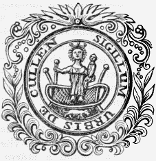
Burgh Seal.
The town is situated on the coast of the Moray Frith, and consists of two parts, entirely separated, called respectively the New-town, and the Sea or Fish town. The former of these received its distinguishing appellation from its recent erection in place of the old town, which was meanly built, and entirely demolished about the year 1822, to make room for the improvements of Cullen House. It stands nearer to the sea than the old town, being close to the eastern extremity of the Seatown, and is on a much higher site. There are many good houses, regularly and tastefully disposed; and it has altogether a neat and interesting appearance, and forms a striking contrast to the miscellaneous collection of fishermen's tenements below, constituting the Seatown. All the buildings contemplated in the plan are not yet completed; but the favourable situation of the place for fishing and agricultural occupations, and the agreeable character of the surrounding district, afford every promise of future advancement. Its contiguity to the beautiful bay of Cullen, and the picturesque grounds of Cullen House, with the traffic of the post-road from Banff to Fochabers, which runs through it, invest the immediate locality with a lively and pleasing appearance, while the highly diversified scenery around, comprising hill and dale, wood and water, with well cultivated fields, and the precipitous and majestic rocks along the shore, unite to render the environs attractive. Some of the eminences command fine views of the sea, enlivened with trading vessels and fishingboats, with the lofty headland of Scarnose at the western extremity of the bay, and the Castle hill, the site of an old fortification, overhanging the Sea-town; and over the Frith, in the distance, are seen the sable mountains of Sutherland and Caithness. The Bin hill, bordering upon the parish, and rising 1076 feet above the sea, and which is planted with trees of various kinds, is also a prominent object in the surrounding scenery, and affords an excellent landmark to mariners. The town contains numerous good shops, and has every convenience calculated to render it a desirable place of residence: many of the houses are lighted with gas, supplied by a company established in 1841, with a capital of £1000. Among the public buildings the most conspicuous is the hotel, erected in 1822, at a cost of £3000, by the Earl of Seafield. It is situated in the public square, and has attached to it an elegant ballroom, forty-three feet long and twenty-three broad; a spacious room in which the sheriff and justice-of-peace courts are held; and the council-room of the burgh, an elegant circular apartment, twenty-three feet in diameter and sixteen feet high.
The inhabitants were formerly much engaged in manufactures. In 1748, the Earl of Findlater and Seafield introduced the manufacture of linen, and subsequently sixty-five looms were constantly at work, some of them for weaving damask, besides seven stocking-looms. In addition to this, a great number of webs were given out to be woven by country people in their own houses; but these sources of employment have now all ceased, and the inhabitants are almost exclusively occupied in agriculture and fishing. There are about thirty boats belonging to the place which are engaged in fishing for cod, skate, ling, and haddocks: the herring-fishery, on account of some recent failures in the quantity of fish, has been given up, and the men and their boats are hired every season by the curers at Wick, Macduff, Fraserburgh, and Peterhead. The average annual value of the several fisheries carried on in the bay is £7543, including £750 for the salmon-fishery. About twenty persons are employed in boat-building, and complete above forty boats each year; and recently, five vessels, varying in burthen from 40 to 110 tons, have been built here in three years. The harbour, which is small but convenient, was constructed by the Earl of Seafield in 1817, and enlarged in 1834 by an additional quay, the cost of the whole work having amounted to more than £10,000; the water at neap tides is eight feet and a half deep, and twelve feet at spring tides. There are four vessels belonging to the port of from 40 to 100 tons each, the aggregate burthen being 270 tons. Coal, salt, staves, and barley for distillation, constitute the chief imports; and the exports are, herrings, dried-fish, timber, oats, and potatoes. A distillery was erected in 1824, and considerably enlarged in 1828; it produces annually upwards of 25,000 gallons of proof spirits, and on the water of Cullen are a lint-mill, a saw-mill, and a meal-mill. Steam-boats plying between Inverness and Leith visit the bay. A weekly market is held for the sale of grain during the spring months; and there are fairs, principally for the hiring of servants, on the third Friday in May, the second Friday in November, and the 7th of January. Cullen is a royal burgh of considerable antiquity, as appears from a charter of James I., dated 1455, ratifying one of Robert I., by which the usual liberties and privileges had been granted. It was at one time a constabulary, of which the Earl of Findlater was hereditary constable, by virtue of an ancient right; but the council now consists of a provost, three bailies, a dean of guild, treasurer, and thirteen others, the jurisdiction extending over a district of about three miles from east to west, and two from north to south. The parliamentary boundaries are much less extensive than those of the royalty: the burgh is united with Elgin, Banff, Inverury, Peterhead, and Kintore, in sending a member, and of the constituency of the whole thirty-eight belong to Cullen. A sheriff small-debt court, for sums not exceeding £8. 6. 8., is held on the second Thursday in February, June, and October; and a justice-of-peace court on the first Tuesday in every month, for sums not exceeding £5. A lock-up house containing three apartments is used for the punishment of delinquents, and for the custody of persons to be afterwards sent to the county gaol.
The parish is about a mile and a half in length, from north to south, and one mile in breadth, and comprises 684 acres, of which 34 are occupied as the site of the town, 425 are arable, 110 park grounds belonging to Cullen House, and the remainder waste pasturage and moor, along the sea-shore. The land in general is of superior quality, and consists of a rich loam, incumbent on clay or gravel, and yielding crops of wheat, barley, oats, potatoes, and turnips; the soil on the higher grounds is thin, resting on gravel, but tolerably productive, and most of the land owes its abundant returns, in a great measure, to the profusion of fishrefuse applied as manure. About 200 acres of land are let to the inhabitants of the town, in small allotments, each being sufficient for the support of a cow. The towns-people usually keep the Banffshire cows; the cattle on the farms are mostly a cross between the Banffshire and Teeswater: the sheep are chiefly of the Cheviot kind. The rateable annual value of the parish is £2243. Cullen House, situated at a small distance from the town, is an ancient structure with many splendid apartments, elegantly furnished, and is embosomed in plantations covering about thirty acres, and comprising all the trees, both useful and ornamental, found in the country. At the base of the rock on which the mansion stands, flows the water of Cullen, here crossed by a stone bridge of one arch; and the numerous winding walks and drives also contribute to the beautifully picturesque appearance of the pleasure-grounds. The parish is in the presbytery of Fordyce and synod of Aberdeen, and in the patronage of the Earl of Seafield. The minister's stipend is £156, of which about a fourth is received from the exchequer, with a manse, and a glebe valued at £27 per annum. The church, accommodating 800 persons, is a cruciform structure of great antiquity, but still in very good condition. It is situated in the centre of the old burial-ground, nearly encompassed by the lands of Cullen House; and the interior contains many elegant monuments to members of the Findlater and Seafield family who were buried here. A portion of the parish of Rathven has long been attached to Cullen quod sacra, and a church was erected in that district in 1839, chiefly by the assistance of the Earl of Seafield. A place of worship has been erected in connexion with the Free Church. The parochial or grammar school affords instruction in the usual branches; the master has a salary of £36, with a house and garden, between £10 and £15 fees, and a share in the Dick bequest. A parochial library was established in 1830.
Cullicudden
CULLICUDDEN, Ross and Cromarty.—See Kirkmichael and Cullicudden.