Survey of London: Volumes 43 and 44, Poplar, Blackwall and Isle of Dogs. Originally published by London County Council, London, 1994.
This free content was digitised by double rekeying. All rights reserved.
, 'Plate 61: East India Docks', in Survey of London: Volumes 43 and 44, Poplar, Blackwall and Isle of Dogs, (London, 1994) pp. 61. British History Online https://www.british-history.ac.uk/survey-london/vols43-4/plate-61 [accessed 20 May 2024].
. "Plate 61: East India Docks", in Survey of London: Volumes 43 and 44, Poplar, Blackwall and Isle of Dogs, (London, 1994) 61. British History Online, accessed May 20, 2024, https://www.british-history.ac.uk/survey-london/vols43-4/plate-61.
. "Plate 61: East India Docks", Survey of London: Volumes 43 and 44, Poplar, Blackwall and Isle of Dogs, (London, 1994). 61. British History Online. Web. 20 May 2024, https://www.british-history.ac.uk/survey-london/vols43-4/plate-61.
In this section
East India Docks (pp. 575–92)
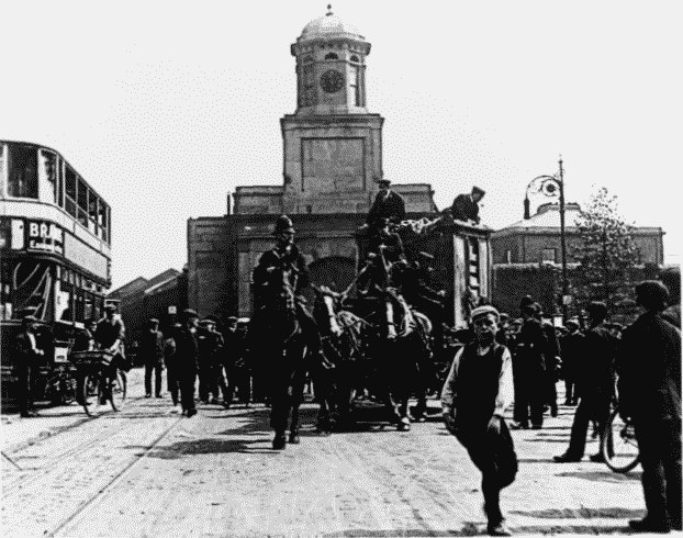
a. Valuable goods being escorted from the docks along East India Dock Road in c1919 (p. 579).
East India Docks
Main Gateway in the background (p. 592). Demolished
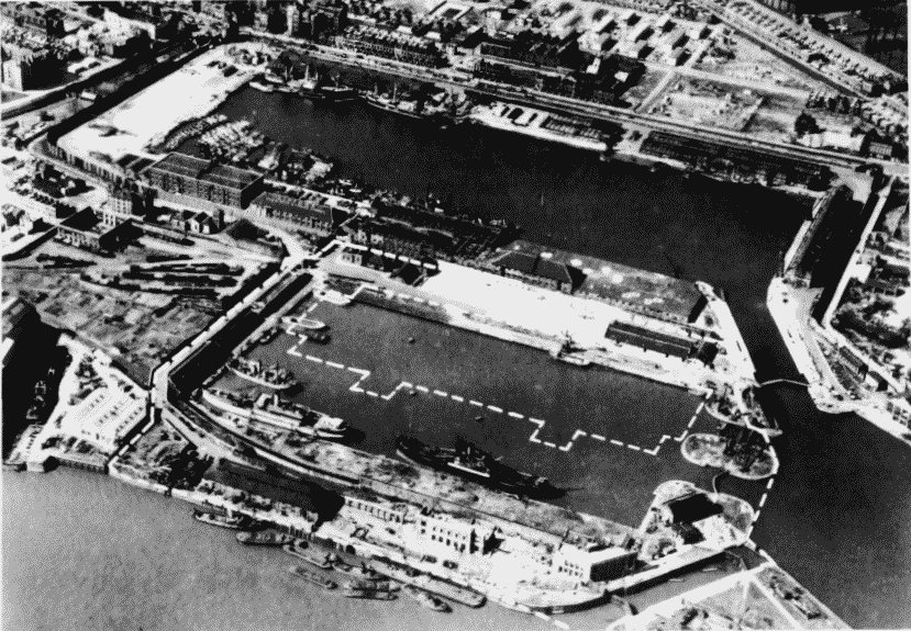
b. Aerial view looking north-west in April 1947.
East India Docks
Aerial view looking north-west in April 1947.
Brunswick Wharf in the foreground (pp. 593–8). The broken white lines show the intended site of Brunswick Wharf Power Station (pp. 598–600)