Ancient and Historical Monuments in the County of Gloucester Iron Age and Romano-British Monuments in the Gloucestershire Cotswolds. Originally published by Her Majesty's Stationery Office, London, 1976.
This free content was digitised by double rekeying. All rights reserved.
'North Nibley', in Ancient and Historical Monuments in the County of Gloucester Iron Age and Romano-British Monuments in the Gloucestershire Cotswolds(London, 1976), British History Online https://www.british-history.ac.uk/rchme/ancient-glos/p86 [accessed 1 May 2025].
'North Nibley', in Ancient and Historical Monuments in the County of Gloucester Iron Age and Romano-British Monuments in the Gloucestershire Cotswolds(London, 1976), British History Online, accessed May 1, 2025, https://www.british-history.ac.uk/rchme/ancient-glos/p86.
"North Nibley". Ancient and Historical Monuments in the County of Gloucester Iron Age and Romano-British Monuments in the Gloucestershire Cotswolds. (London, 1976), British History Online. Web. 1 May 2025. https://www.british-history.ac.uk/rchme/ancient-glos/p86.
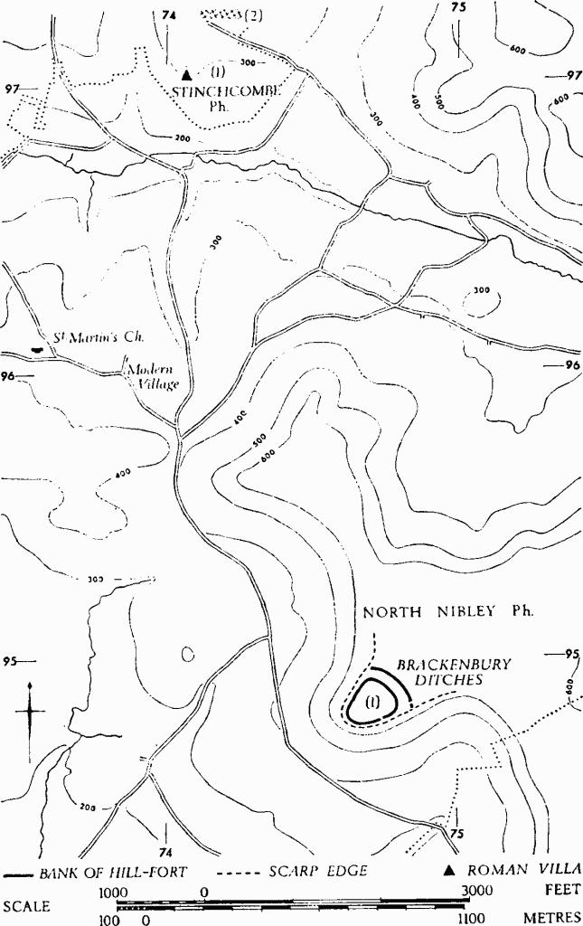
NORTH NIBLEY
(21 miles W.S.W. of Cirencester)
(1) Brackenbury (fn. 1) Ditches Hill-fort (ST 747949), partly bivallate, unexcavated, encloses 4 acres on a spur of the Cotswold escarpment, ¾ mile S.E. of the village.
The outer rampart, 25 ft. wide and 5 ft. high, with external ditch 20 ft. wide and 4 ft. deep, crosses the spur from N.W. to S.E., its ends resting on the scarp edges. The entrance from the plateau is through a gap 20 ft. wide near the S. end.
The inner defences surround the tip of the spur. The N.E. side is defined by a rampart, 50 ft. wide and 10 ft. high, separated by a berm 8 ft. wide from an external ditch, 45 ft. wide and 8 ft. deep, with a slight counter-scarp bank. On the N.W. and S.E. sides the rampart, reduced in size, sits on the edges of the spur; it is 20 ft. above the ditch which, still with a counter-scarp bank, drops from the N. corner to follow a ledge as far as the entrance in the middle of the S.E. side. This entrance, a 10 ft. gap between staggered bank ends, is approached from the vale by a hollow-way; access from the plateau is by way of the entrance through the outer rampart.
Monuments in North Nibley and Stinchcombe.
Lloyd Baker (1821), 166, No. 13. Playne (1876), 217, No. 37. Witts (1883), 6, No. 13 (Blackenbury Camp: 19th-century name). TBGAS, 74 (1957), 150–6 (Becketsbury: 17th-18th-century name).