Ancient and Historical Monuments in the County of Gloucester Iron Age and Romano-British Monuments in the Gloucestershire Cotswolds. Originally published by Her Majesty's Stationery Office, London, 1976.
This free content was digitised by double rekeying. All rights reserved.
'Down Ampney', in Ancient and Historical Monuments in the County of Gloucester Iron Age and Romano-British Monuments in the Gloucestershire Cotswolds(London, 1976), British History Online https://www.british-history.ac.uk/rchme/ancient-glos/pp44-45 [accessed 30 April 2025].
'Down Ampney', in Ancient and Historical Monuments in the County of Gloucester Iron Age and Romano-British Monuments in the Gloucestershire Cotswolds(London, 1976), British History Online, accessed April 30, 2025, https://www.british-history.ac.uk/rchme/ancient-glos/pp44-45.
"Down Ampney". Ancient and Historical Monuments in the County of Gloucester Iron Age and Romano-British Monuments in the Gloucestershire Cotswolds. (London, 1976), British History Online. Web. 30 April 2025. https://www.british-history.ac.uk/rchme/ancient-glos/pp44-45.
DOWN AMPNEY
(5 miles S.E. of Cirencester)
(1) Enclosures and Linear Ditches (SU 102960), undated, show as crop-marks E. of Bean Hay Copse, 3/8 mile S.S.E. of All Saints' Church and about 270 ft. above O.D. A sub-circular enclosure 300 ft. in diameter, defined by an interrupted ditch, is intersected by a straight ditch, possibly the S.E. side of a rectilinear enclosure with an entrance on the east. A small irregular oval enclosure in the E. corner of the rectilinear enclosure has a gap in the S. side (plan below).
N.M.R., OAP SU 1095/6/327–8.
(2) Settlement and Road (SU 108959), undated, showing as crop-marks within the S. boundary of the airfield, N.W. of Gully Leaze Copse, lie about 260 ft. above O.D. The settlement covers about 4 acres and is indicated by traces of twelve or more sub-rectangular and D-shaped enclosures partly surrounded by a ditch (plan below). Adjacent on the N.E. are three or four rectangular plots, each 50 ft. wide and some 300 ft. long. The road, upon which the settlement abuts in the S.E., is defined by two pairs of side-ditches, each 40 ft. apart and of slightly differing widths, suggesting reconstruction.
N.M.R., OAP SU 1096/1/325–6; 1095/7–8; 1095/10 (infrared).
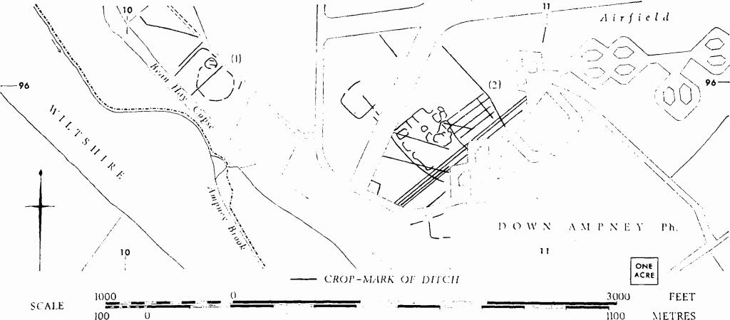
Down Ampney. (1) Enclosures and Linear Ditches. (2) Settlement and Road.
(3) Rectangular Enclosures (SU 10809665), undated, show as crop-marks within the W. boundary of the airfield, E. of Poplar Wood. An enclosure about 200 ft. long and 170 ft. wide with two gaps in the N. side is intersected almost at right angles by ditches apparently belonging to another enclosure.
N.M.R., OAP SU 1096/3/305–7.
(4) Rectilinear Enclosure (SU 124965), undated, seen with other ditches as crop-marks, 400 yds. W. of Wetstone Bridge, lies on flat ground at about 250 ft. above O.D. The E. side lies partly beneath the modern road; the N. side is not traceable. There are gaps in the E. and W. sides.
C.U.A.P., OAP BW 7.
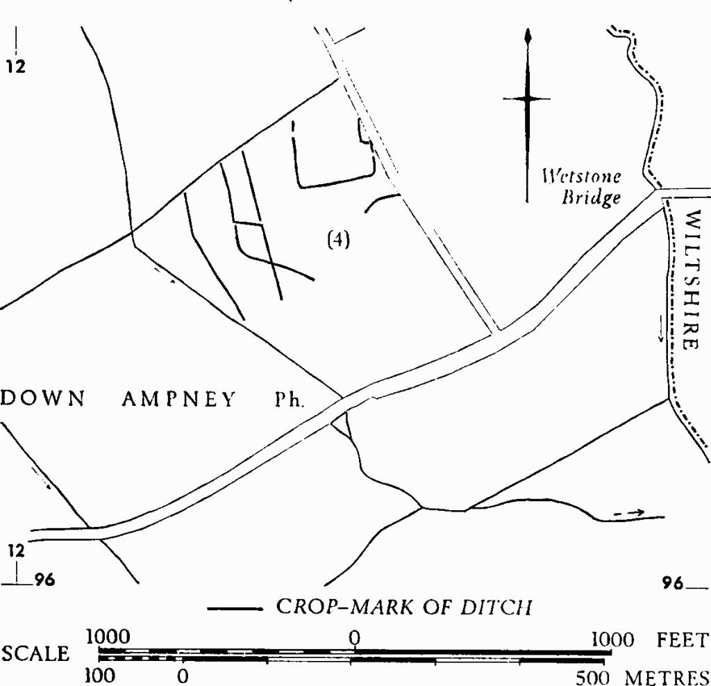
Down Ampney. (4) Enclosure.