An Inventory of the Historical Monuments in the County of Northamptonshire, Volume 4, Archaeological Sites in South-West Northamptonshire. Originally published by Her Majesty's Stationery Office, London, 1982.
This free content was digitised by double rekeying. All rights reserved.
'Sectional Preface', in An Inventory of the Historical Monuments in the County of Northamptonshire, Volume 4, Archaeological Sites in South-West Northamptonshire(London, 1982), British History Online https://www.british-history.ac.uk/rchme/northants/vol4/xxiii-li [accessed 30 April 2025].
'Sectional Preface', in An Inventory of the Historical Monuments in the County of Northamptonshire, Volume 4, Archaeological Sites in South-West Northamptonshire(London, 1982), British History Online, accessed April 30, 2025, https://www.british-history.ac.uk/rchme/northants/vol4/xxiii-li.
"Sectional Preface". An Inventory of the Historical Monuments in the County of Northamptonshire, Volume 4, Archaeological Sites in South-West Northamptonshire. (London, 1982), British History Online. Web. 30 April 2025. https://www.british-history.ac.uk/rchme/northants/vol4/xxiii-li.
In this section
SECTIONAL PREFACE
Topography and Geology
The part of Northamptonshire described in this volume covers an area of some 750 square kilometres in the S.W. of the county. Topographically the region is a plateau dipping very gently eastwards and composed largely of rocks of the Jurassic Series. The down-cutting of the four major river systems, the Cherwell in the N., the Great Ouse in the S., the Nene in the N. and the Tove in the E. and centre, has produced a rolling landscape of open valleys and flat-topped ridges. Only in the extreme S.W. does the Oolite Limestone form large areas of level ground and even here erosion has produced a number of deep valleys. Most of the higher land, except in the extreme W. of the area, is covered by Boulder Clay and other glacially-derived deposits, and the solid geology is only exposed in the valleys. In the W., and to a lesser extent in the N., clays, limestones and sands form the greater part of the surface geology.
Apart from the higher limestone plateau, the region is well timbered, with numerous small woods and copses; larger tracts of woodland in the S. and S.E. are survivals of the medieval forests of Whittlewood and Salcey. There are ample water supplies throughout most of the area and building stone of varying quality has been available from the limestone strata. Today the greater part of the land is arable except for the old woodlands.
Rural settlement is evenly distributed over the area and the only towns are Towcester and Brackley, both relatively small. The former has Roman origins but the latter is a planned medieval town created sometime before 1173. No major extractive industries continue at present, though in the recent past extensive ironstone-mining has occurred between Gayton and Blisworth in the N.E. and at King's Sutton in the S.W.
Prehistoric and Roman Settlement (Figs. 1–13)
Compared with the other parts of the county, the area covered by this Inventory is poor in prehistoric and Roman remains and relatively few standing monuments of these periods have survived. The lack of material is largely due to insufficient archaeological research, just as the density of known sites in the E. and N.E. of the county is more a reflection of the amount of archaeological work there than of any outstanding importance in prehistoric and Roman times. This explanation is supported by the exceptional amount of material found at Marston St. Lawrence, Thenford and in parts of the adjoining parishes of Farthinghoe and Greatworth, almost all of which has been discovered during intensive fieldwork by D. J. Barrett over the last twenty years. With such detailed work, the relationship between the distribution of the archaeological material and the existing land-use becomes apparent and this is of considerable significance in assessing the validity of distribution patterns elsewhere (Fig. 85). There can be little doubt that the same quantity of material could be found throughout this part of Northamptonshire if the same level of field examination were carried out.
Few crop and soil-marks have been recorded in this area, partly as a result of concentration of archaeological air reconnaissance in the centre and N.E. of the county, though this imbalance is now being rectified. Many sites doubtless await discovery, especially on the limestone tableland in the S.W. of this area. There is reason to believe that almost every part of this section of the county was settled and cultivated throughout most of the later prehistoric times and in the Roman period, and few conclusions can be drawn from the distribution maps at present available.
Prehistoric Remains
As in earlier Inventories, it is difficult to establish a chronology for the prehistoric period. Few sites have produced pottery, except for a small number of Iron Age settlements, and though numerous flint-working areas have been found it is still not possible to date them. Similarly, the majority of the cropmark sites cannot be dated without excavation. Some of them may indeed be of post-Roman origin. The cropmarks inevitably occur on the lighter soils, but prehistoric settlements which have been discovered by fieldwork, notably in Marston St. Lawrence and Thenford, indicate that the heavier clay soils were also occupied. Especially important is the survival, until recent destruction, of earthworks, of Iron Age settlements within Whittlewood Forest (Whittlebury (1–3)). One Iron Age enclosed settlement does survive in Salcey Forest (Hartwell (1)). These sites show that areas regarded as marginal or waste in medieval or later times were occupied at least in late prehistoric times. No excavations have been carried out on prehistoric sites except at the Iron Age hill fort at Rainsborough (Newbottle (1)).
Palaeolithic and Mesolithic Periods
Only two Palaeolithic axes have been found in the area, one at Marston St. Lawrence and the other at Towcester. Two Mesolithic sites are recorded at Marston St. Lawrence (1) and (2) and three at Thenford (1), (2) and (6), and isolated tools attributable to the period have been noted at Newbottle and Paulerspury. The lack of Mesolithic material must be due in large part to the difficulty of recognition. A more careful examination of the numerous flint-working sites would almost certainly reveal the presence of flints of Mesolithic type, as has been shown in south-east England (CBA Research Report, 21 (1978), 75), and many other sites must be as yet undiscovered.
Neolithic Period
A number of stone or flint axes has been found in the area but their distribution appears to be random. Many of the stone axes are of Group VI. The marked concentration around Marston St. Lawrence is again only the result of the intensive fieldwork there. No Neolithic site has been excavated though there are said to be settlements at King's Sutton (5), Marston St. Lawrence (1) and Helmdon (1). Many of the known flint-working sites seem to be of late Neolithic or early Bronze Age date although more work is needed on these. Some of them, notably at Thenford (1), Middleton Cheney (2) and Marston St. Lawrence (2), cover considerable areas and lie on heavy clayland. More difficult to explain are the small scatters of worked flints which, in places where fieldwork has been intensive, have been found in almost every field. For example in Marston St. Lawrence, in addition to the major flint-working sites and numerous isolated arrowheads, no less than seventeen small areas of flints are listed. Indeed the true nature of late Neolithic occupation and land-use is far from being understood.
The Bronze Age
Almost as little is known of the Bronze Age as of the earlier periods in the area under review. A number of stray finds is listed in the Inventory, such as the palstaves from Thenford, Stoke Bruerne and Aston le Walls. Bronze axes are known from Chipping Warden and stone tools of Bronze Age type have also been recorded (e.g. Potterspury and Harpole). A major hoard at Thenford is of interest because, although not accurately located, it may have been found within or near the possible defended hilltop settlement which is generally assumed to be of Iron Age date (Thenford (2)).
Fig. 1 Prehistoric and Roman sites and finds
Fig. 2 Prehistoric and Roman sites and finds (for key see fig. 1)
Fig. 3 Prehistoric and Roman sites and finds (for key see fig. 1)
Fig. 4 Prehistoric and Roman sites and finds (for key see fig. 1)
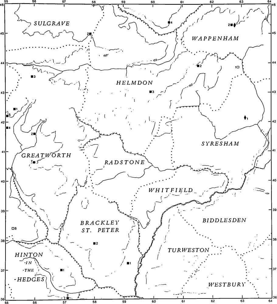
Fig. 5 Prehistoric and Roman sites and finds (for key see fig. 1)
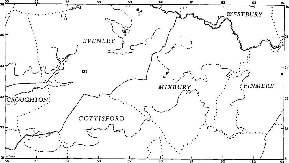
Fig. 6 Prehistoric and Roman sites and finds (for key see fig. 1)
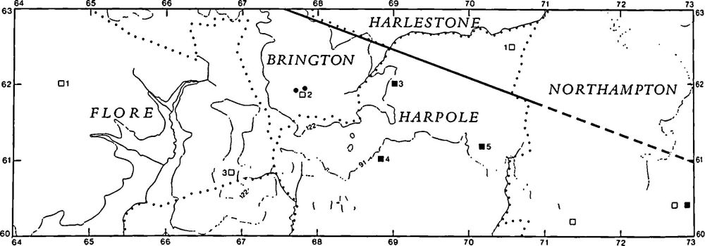
Fig. 7 Prehistoric and Roman sites and finds (for key see fig. 1)
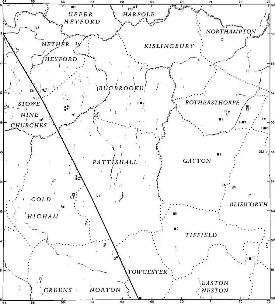
Fig. 8 Prehistoric and Roman sites and finds (for key see fig. 1)
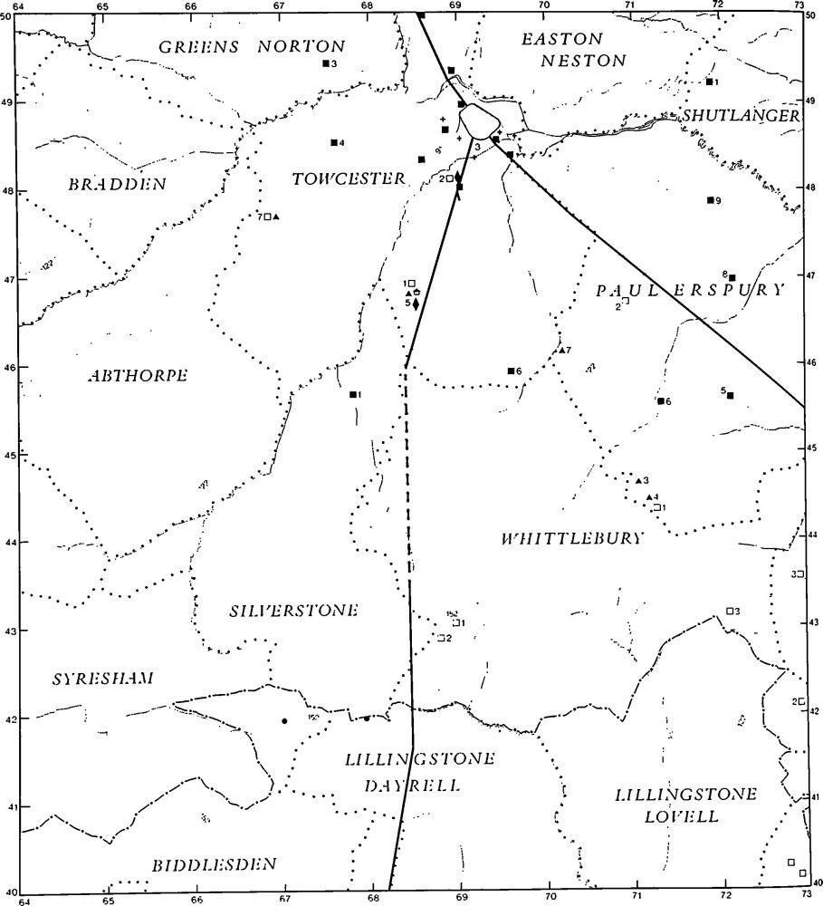
Fig. 9 Prehistoric and Roman sites and finds (for key see fig. 1)
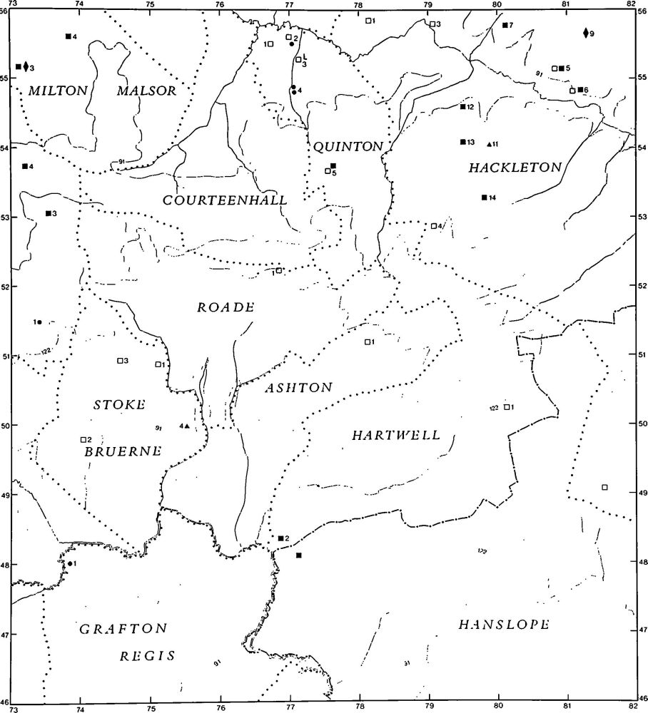
Fig. 10 Prehistoric and Roman sites and finds (for key see fig. 1)
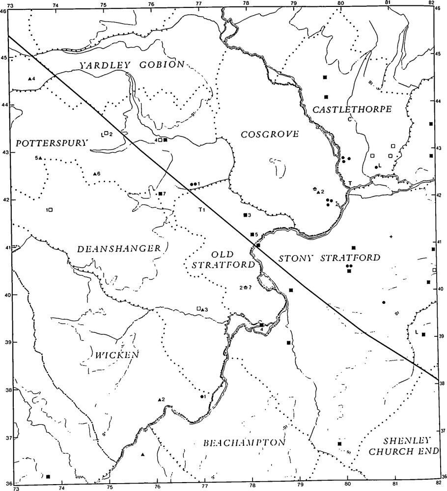
Fig. 11 Prehistoric and Roman sites and finds (for key see fig. 1)
No definite Bronze Age settlements are known, though there is some evidence for one beneath the Roman villa at Cosgrove and for another at King's Sutton (6). As with the Neolithic period, the existence of flint-working sites which appear to be partly of Bronze Age date, and the numerous cropmark sites of enclosures which are at the moment undated, need to be borne in mind in assessing the pattern of Bronze Age settlement.
Flat burials are known from Aynho (1–3) and Milton Malsor (1) and burials within round barrows are listed at King's Sutton (2–4). Several mounds may be barrows, or are barrows reused as windmill mounds in the medieval period (e.g. Blisworth (1), Slapton (3) and Sulgrave (8)), but only excavation can prove their true character. There are very few ring ditches which can be interpreted as ploughed out barrows (e.g. Quinton (2)). Those at Cosgrove and Old Stratford are now known to be former anti-aircraft gun emplacements.
The Iron Age
Only 23 settlements broadly attributable to the Iron Age have been noted in the Inventory, but these include some of considerable interest and importance, for example the hill fort of Rainsborough (Newbottle (1)) and another fort known as Arbury Banks (Chipping Warden (2)). The former has been extensively excavated, but the latter has not been closely studied. The hilltop settlement at Thenford, though it survived into this century, has now been largely destroyed. Finds from the area indicate a long period of occupation, originating before the Iron Age. At least two other settlements (Whittlebury (1) and (2)) remained as earthworks until the 1950s in the former Whittlewood Forest, and one which still survives in Salcey Forest (Hartwell (1)) is an important reminder of what has gone. These settlements have an additional significance in terms of Iron Age occupation in that they lie on land that was waste or forest throughout medieval times. Their existence thus implies a pattern of settlement and land-use very different from that of the historical period. They also suggest a much larger population than has hitherto been presumed.
Other Iron Age settlements are known only from concentrations of pottery found on modern arable land or in quarry faces. Little can be made of the overall distribution and the marked lack of sites in the centre of the area is more likely to be due to lack of fieldwork there than to any real absence of Iron Age occupation. No excavations have been carried out on these sites and thus it is not clear what they represent in terms of settlement type. A few coins, almost all isolated finds, are listed in the Inventory (e.g. Blisworth, Brackley, Farthinghoe and Gayton) but they are too few to form a basis for distributional analysis.
Examples of pit alignments, which are now regarded as being of late Iron Age date, have been found at Aynho (5) and Farthinghoe (9). The former is unrelated to any other archaeological feature but the latter is associated with some undated enclosures. The existence of these and many other cropmarks of undated enclosures and ditches must not be ignored in any discussion of the Iron Age in this area.
Roman Remains
Almost a hundred Roman settlements of various types are recorded from the area under review. This is less than in the three previous Inventories, but still a considerable number and many more than are known for the Iron Age in the same area. This contrast may be the result of the greater durability of Roman material and its ease of recognition rather than of any real difference in the density of settlement in the two periods, though it is noteworthy that at Thenford and Marston St. Lawrence where intensive fieldwork has taken place nineteen Roman settlements are known but only three Iron Age ones. As has been noted in the earlier Inventories, the density of Roman settlement appears to be the result of an intensification of occupation in a landscape already well populated in late Iron Age times. A number of the Roman sites listed yield evidence of Iron Age occupation as well, suggesting continuity at least in the general area and probably of a particular habitation.
The distribution of known Roman sites in the area cannot reflect the true pattern of settlement. As with the Iron Age and earlier material, there is a gap across the centre of south-west Northamptonshire which certainly results from the lack of fieldwork there. To the E. of Watling Street, and on both sides of it immediately S. of Towcester, there is a fairly even spread of settlements and there is a regular scatter in the extreme S.W. of the county. Elsewhere, except in the parishes of Farthinghoe, Thenford, Marston St. Lawrence, Greatworth, Sulgrave and Weston and Weedon, all of which have been subjected to intensive fieldwork, only two Roman sites are recorded. There is certainly no obvious explanation for this distribution in terms of soils, or indeed modern land-use. It must reflect only a lack of archaeological work there. It would be dangerous, for example, to assume that the concentration of sites to the S.E. of Towcester is entirely due to the proximity of the Roman town.
As with some of the Iron Age sites in the S. of the area, it is of interest to note the existence of Roman settlements within or close to what was to become the medieval Whittlewood Forest. These include not only minor agricultural settlements but at least two major villas (Whittlebury (4) and Potterspury (5)). As with Rockingham Forest in the N.E. of the county, the implications are that the woodland either did not exist or was considerably less extensive in the late prehistoric and Roman periods than it later became.
Most of the small rural sites are only known from scatters of pottery, and those that have associated cropmarks (e.g. Helmdon (2)) show the familiar pattern of interlocked and overlapping rectangular enclosures. Of these only the site at Quinton (5) has been excavated to modern standards; a late Iron Age and early Roman farmstead, with at least one circular wooden house, had been replaced in the late 1st century by a rectangular stone building. The small finds at this site are of interest for they indicate not only a varied agricultural economy but a way of life of some sophistication.
A number of important villas are recorded in the Inventory and many of them have been excavated, to various standards, a situation which is in marked contrast to that in other parts of the county. None of the excavations was complete, but together they indicate the variety of structures loosely defined as villas. They range from the simple corridor building at Towcester (7), which seems to have been largely unaltered throughout its life, to the complicated building at Thenford (4) which underwent a process of enlargement, alteration and rebuilding. There is evidence of large, sophisticated villas at Gayton (1) and Towcester (5) where parts of porticos are recorded; buildings arranged round courtyards include those at Whittlebury (4) and Deanshanger (3). To judge from surface finds, there was an extensive villa or a large settlement at Chipping Warden (3), but only the bath block has been excavated. A similar settlement, which must have comprised much more than a single farm, has been recognised at King's Sutton (6) but the exact nature of this type of occupation remains speculative.
The only Roman town in the area was Lactodurum (Towcester (3)) which lay astride Watling Street where the latter crossed the River Tove and a tributary stream. Although numerous finds have been made within the walled area, no major buildings have yet been recognised and the details of the town's history remain unknown. The general outline of the defences has been recovered, as well as some details of their development. It is the extra-mural occupation that is best understood, in part as a result of railway construction and building work in the 19th century as well as of excavation in advance of modern housing development. The latter has resulted in particular in the discovery of an industrial suburb to the S.W. of the town. The position of Easton Neston Park which extends to the edge of Towcester on the E. has resulted in a complete absence of evidence of occupation on this side of the town, and has also prevented the discovery of at least one other Roman road which may be assumed to have run N.E. towards Northampton.
Other important Roman structures include possible temples at Towcester (5) and Cosgrove (2) and, perhaps, pottery kilns at Milton Malsor (3) and Wappenham (2). Among the more interesting chance finds listed in the Inventory are a celebrated glass beaker from Stoke Bruerne and pewter plates from Croughton and Newbottle. By far the most remarkable discovery is the hoard of unusual silver plaques and bronze head-dresses from Old Stratford (2) which may be from an undiscovered temple.
Pagan Saxon Remains
Important Saxon cemeteries are listed in the Inventory as are other isolated burials and finds. An analysis of the material from burials throughout the county is much needed, but this task is not within the Commission's terms of reference.
The major cemeteries do not appear necessarily to relate either to the preceding late Roman occupation pattern or to the medieval one. For example the large cemetery at Marston St. Lawrence (14) lies at some distance not only from the medieval village but also from the great wealth of earlier material found in the parish. The same is true in the adjacent parish of Thenford (9). However the cemetery at Passenham (Old Stratford (6)) lies within the medieval village, and the one at Milton Malsor (6) has produced evidence of Roman occupation. The burials at King's Sutton were remote from the village but on a site apparently occupied from late Neolithic times onwards. The single burial from Stoke Bruerne lay very close to the village.
In contrast to the previous volumes the present area is notable for the lack of early Saxon settlements; only one certain settlement, at Milton Malsor (5), is recorded. This clearly reflects lack of fieldwork in the area as well as the difficulty of recognition of early Saxon pottery. A possible mid Saxon site is listed in Marston St. Lawrence and a late Saxon one at Farthinghoe (15), both at a distance from later settlements.
Medieval and Later Settlement
The earliest record of the pattern of medieval settlement is found in Domesday Book of 1086. It indicates a regular scatter of nucleated villages, from 2 km. to 4 km. apart, over the whole region. Many of these villages lay within a unit of land which has survived to the present time as an ecclesiastical parish. A more complicated pattern is recorded in other parishes where minor settlements isolated from the main village appear always to have had their own land units entirely separate from the land of the main village. These settlements have, in the past, usually been regarded as secondary or daughter hamlets of the primary or mother village but this now seems doubtful. There is no evidence that the minor settlements are later than the major ones and they could be interpreted as elements of a system of late Saxon settlement fitted into a pre-existing arrangement of land units of great antiquity. The best example in the area under review is seen in King's Sutton and Newbottle parishes (Fig. 82).
Also of interest are the parishes of Blakesley, Woodend and Abthorpe. Blakesley and Woodend were once a single ecclesiastical parish but the villages of Blakesley and Woodend each had its own associated land unit and so did the now deserted villages of Kirby (Woodend (1)) and Seawell (Blakesley (2)) and the hamlet of Foxley (Blakesley (3)). At Abthorpe the hamlets of Foscote and Charlock (Abthorpe (3) and (5)) both had clearly defined areas of land associated with them. Elsewhere it is not clear whether settlements now within a single parish ever had separate lands. It is not known whether the hamlet and land of Heathencote in Paulerspury (18) were once separate from the rest of the parish, or whether Crowfield (Syresham (4)) was separate from Syresham. Similarly Astcote, Eastcote and Dalscote (Pattishall (3–5)) may never have had land units separate from that of Pattishall. In all these examples the lack of early documentation makes firm conclusions impossible.
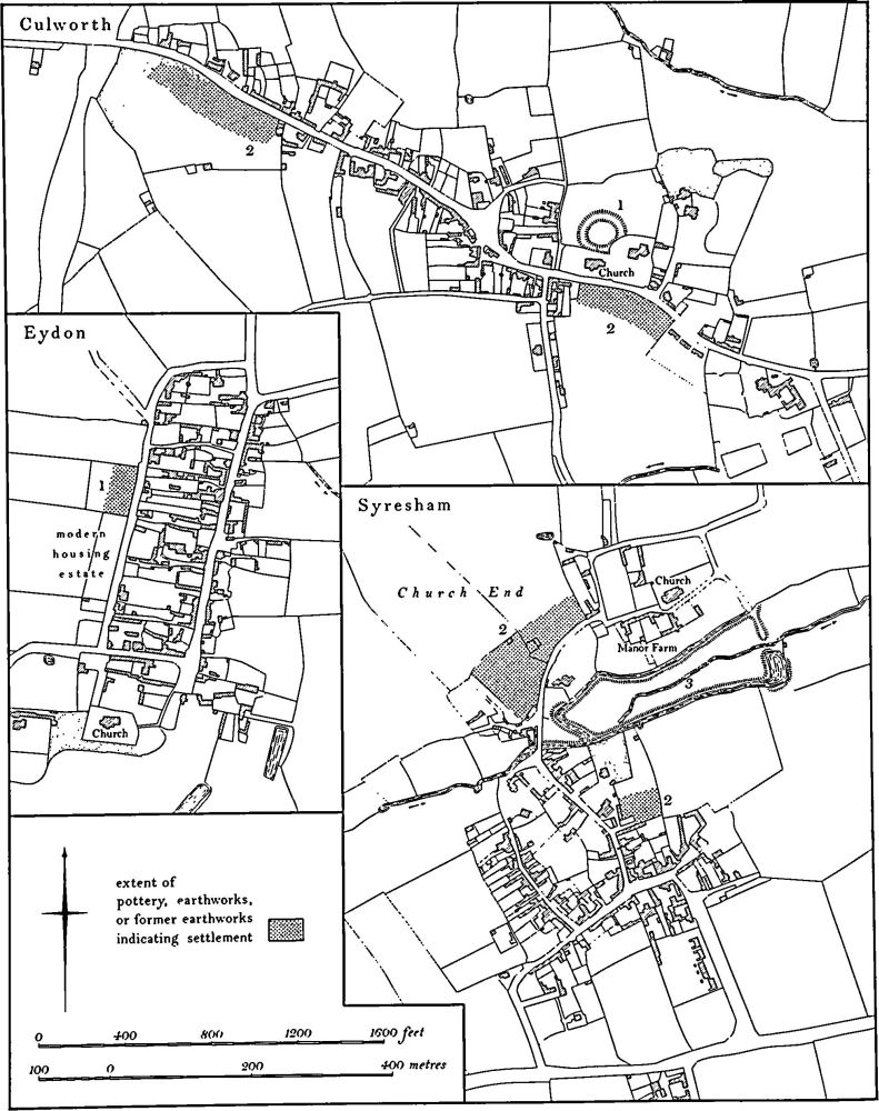
Fig. 12 Culworth, Eydon and Syresham Village plans
Further questions arise from fieldwork evidence. For example, the old parish of Stoke Bruerne contained the present parish of Shutlanger and clearly included the two separate settlements and their lands. However, an undocumented third medieval settlement of unknown name has been identified at Stoke Bruerne (7) and this makes it difficult to reconstruct exactly the pattern of medieval settlement there. Similarly, the deserted village of Furtho (Potterspury (9)) appeared to have been the only settlement in the medieval parish of Furtho until the discovery of a second medieval settlement formerly in Furtho parish (Old Stratford (9)), the name and history of which are apparently totally unrecorded.
The system of multiple settlements and estates within ecclesiastical parishes also poses problems in the interpretation of surviving documents. The population statistics recorded in the various medieval national taxation returns are of limited value for they rarely make clear whether the figures refer to one settlement or to several. Indeed it appears from these taxation returns that the medieval administrators also failed to understand the overall relationships between groups of settlements for it is common to find successive returns which fail to agree on which settlements were to be taxed together.
Topographical studies taking into account any traceable earthworks have continued to throw light on the origins and development of settlements in Northamptonshire. The period of establishment of villages still remains unknown, place-names suggesting pre-Saxon origins are almost entirely absent, although Walton (King's Sutton (10)) may be one example. Several villages appear to have been created or extended by deliberate planning, for example the W. part of Stoke Bruerne (6) is laid out in a neat grid pattern, and at Eydon (1) and Farthinghoe (16) there are plans of equally regular appearance. The single-street village with greens at either end is another recurring type which may have been the result of planning. Of these, it is possible that Wappenham (3) and Yardley Gobion (1) could have developed gradually, but Weston (Weston and Weedon (8)) has additional features which indicate some degree of deliberate arrangement. The first phase of the deserted village of Astwick (Evenley (9)) also appears to be planned. Another recurring village type, already noted in other parts of the county, has buildings only on one side of a single street. It cannot always be shown that these villages had this form from the beginning (e.g. Warkworth (1) and Walton (King's Sutton (10)), but at the ploughed-out deserted village which probably once represented one of the manors of Furtho (Old Stratford (9)) field evidence shows that there were never buildings on both sides of the street. Such asymmetrical layouts presumably indicate planning.
Evidence of polyfocal villages, settlements which have developed into their later form from two or more discrete centres, has also been noted. Moreton Pinkney (1) seems to have been a double village with two parts each centred on a green. Culworth (2) also may have originated as two settlements, with different names at least in 1086. Quinton (7–9) appears once to have had two or possibly three separate centres and Helmdon (4) had two quite distinct parts before later additions were made. Syresham (2) still retains two distinct parts. Perhaps the best example of a village of this type is Paulerspury. There the present large sprawling settlement can be seen to have been made up of at least five centres. In contrast, the two villages of Purston (King's Sutton (11) and Newbottle (4)) lay side by side and apparently used the single main street between them, but each had its own land unit and each lay in a different parish.
Villages once established were subject to many changes throughout the medieval period; some grew larger, others declined or were abandoned and many underwent changes of location. All these processes have been tentatively identified in the area under review, although in most examples lack of firm documentation makes it difficult to establish a chronology. Some villages certainly had planned additions. The best example is Helmdon (4) where a neat rectangular area, bounded by a bank and ditch and containing the church, manor house and other dwellings, appears to have been added to one of the earlier parts of the village. The two parts of Culworth may have been linked together by the creation of a market place, possibly in the 13th century. Upper Boddington (Boddington (3)) also has indications that a rectangular arrangement of streets and lanes was added to a single-street village, and the same process is perhaps visible at Maidford (1). Evenley too appears to be a small, single-street village to which has been added a very large square green. Blakesley (1) is more complicated; not only is there an obvious planned addition, but it is also possible that the present green is an insertion between two older parts. A striking example of alteration is evident at the deserted village of Astwick (Evenley (9)) where the surviving earthworks show clearly that the original rectangular layout of the village was overlaid by a less regular street pattern associated with buildings of late medieval form.
The forest-edge village of Silverstone is another example of a village with several discrete centres. These may originally have been separate units but here secondary growth on the waste is an alternative explanation. All the interpretations of village development given here are tentative. In the final analysis only excavation within and around these villages will elucidate their origins and growth.
The reasons for other changes, movement, decline and desertion, are often obscure. They usually took place over many centuries, through a combination of circumstances and rarely as a sudden response to a single cause. At Edgcote (1) for example, though the village was finally cleared for emparking in the 18th century, it had apparently been declining in size for centuries. Most of the villages that were deliberately removed, whether for sheep-farming in the late medieval period or for landscape parks in the post-medieval period, were always small and very susceptible to the pressures of major land-owners or economic changes. The same applies to those villages which seem to have been reduced to hamlets by the 19th century.
It is difficult to understand decline or desertion when the process took place in the medieval period. The lack of detailed documentation giving population statistics over a continuous period makes it almost impossible to isolate either general or specific conditions or events which caused changes in individual villages, or in the overall pattern of settlement. Few of the national taxation returns are comparable even for the best-documented villages and many villages, especially the smaller places, are almost entirely undocumented. There appears to have been depopulation in many villages between the late 14th century and the early 16th century and this is usually explained as being the result of clearance for sheep. Stuchbury and Halse (Greatworth (10) and (13)), Caswell and Field Burcote (Greens Norton (5) and (6)), Newbottle (3) and the two Purstons (King's Sutton (11) and Newbottle (4)) are examples. However, the earlier history of all these is either unknown or incomplete and the conditions which led to their final abandonment are not fully known.
The post-medieval changes to villages are better understood, as a result of improved documentation. Those cleared for emparking, such as Edgcote (1) and Courteenhall (2), are fairly closely dated. Elsewhere the process of continuous shrinkage or movement can to some extent be established though it is rarely obvious why it took place. At Greens Norton (4) 18th or 19th-century shrinkage or abandonment can be identified and the same is true of Upper Heyford (2), Rothersthorpe (5), Passenham (Old Stratford (7)) and Foscote (Abthorpe (3)). At all these places however, it is clear that early movement or shrinkage, quite undatable without excavation, had already occurred. At Hulcote (Easton Neston (3)) the early 19th-century replanning of the whole village to produce the pretty estate hamlet is of some interest.
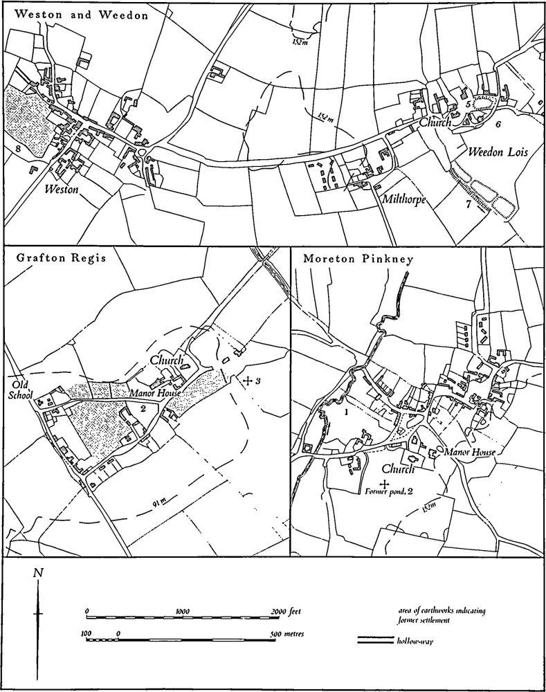
Fig. 13 Grafton Regis, Moreton Pinkney and Weston and Weedon Village plans
Medieval Earthworks
Settlement Remains
Thirty-one deserted hamlets and villages are recorded in the Inventory: Foscote and Charlock (Abthorpe (3) and (5)), Appletree (Aston le Walls (1)), Seawell and Foxley (Blakesley (2) and (3)), Trafford (Chipping Warden (10)), Potcote (Cold Higham (5)), Courteenhall (2), Easton Neston (2), Edgcote (1), Astwick (Evenley (9)), Steane (Farthinghoe (18)), Stuchbury and Halse (Greatworth (10) and (13)), Caswell and Field Burcote (Greens Norton (5) and (6)), Hartwell (3), Bozenham (Hartwell (6)), Falcutt and Astwell (Helmdon (5) and (6)), Walton and Purston (King's Sutton (10) and (11)), Moreton Pinkney (3), Newbottle (3), Purston (Newbottle (4)), Old Stratford (9), Furtho (Potterspury (9)), Lower Radstone (Radstone (2)), Hyde (Roade (2)), Stoke Bruerne (7) and Kirby (Woodend (1)).
Most of the sites have been damaged or altered by later activity, much of it in the present century. Bozenham and the Purston in Newbottle were ploughed over and largely destroyed in antiquity. Astwell was partly obliterated by 17th and 18th-century gardens and emparking and Furtho also had a later garden laid across parts of it. In recent years Caswell, Seawell, Walton, Hartwell and Potcote have been mainly or completely destroyed by industry or agriculture and Hyde by housing estates. Others such as Astwick, Stuchbury and Trafford have been partly damaged by other modern agricultural activities.
Despite this destruction there is still sufficient evidence from existing earthworks, air photographs or early maps and plans for certain features to be identified. Most deserted villages, at least in their final stages, lay either along single streets or around more complicated street systems, all later reduced to hollow-ways. Impressive hollow-ways still remain at Appletree, Astwick, Stuchbury, Halse, Lower Radstone and Kirby and less well-defined ones at Trafford, Foscote, Astwell and Purston. Air photographic evidence shows the same features at Walton and Furtho in Old Stratford. Well-preserved house-sites survive at Astwick, Stuchbury and Kirby. At Astwick clearly defined traces of stone buildings remain up to 0.5 m. high. Less well-defined house-sites in the form of raised or sunken platforms are visible at Foxley, Charlock, Trafford, Steane and Purston in King's Sutton. Villages which were abandoned or cleared at a late date are notable for their lack of good house-sites or indeed closes and paddocks. The best example of this is Courteenhall where after clearance most of the former settlement area appears to have been deliberately flattened; the same process seems to have taken place at Edgcote and Foscote.
By far the most important deserted village in the area in terms of surviving earthworks is Astwick in Evenley where a complete alteration of the village's layout is visible. Another important site is Charlock in Abthorpe where the small hamlet appears to have been laid out within, and at the end of, a pre-existing common-field furlong.
As elsewhere in the county, the remains of shrunken and moved villages are common. Nearly seventy sites are recorded in the Inventory and almost every village has some place where houses formerly stood. Some of the remaining earthworks are well preserved and of considerable interest. These include a hollow-way at Upper Boddington (Boddington (3)), house-sites at Alderton (Grafton Regis (7)) and Passenham (Old Stratford (7)) and abandoned closes at Weston (Weston and Weedon (8)). Modern destruction has been on a large scale. The recent loss of the earthworks at Plumpton (Weston and Weedon (10)) is particularly unfortunate as they indicate that the village had a planned extension to its original nucleus. The continuing process of destruction of earthworks by modern development in many villages is a great loss to scholarship. The remains are often slight and of little apparent interest and so are easily destroyed. They often contain the only clues to the physical history of a village. For example, the remains at Kislingbury (1) are unimpressive, but their excavation could confirm or disprove the theory put forward in the Inventory that they represent the older part of the village and that the settlement was subsequently extended to the E.
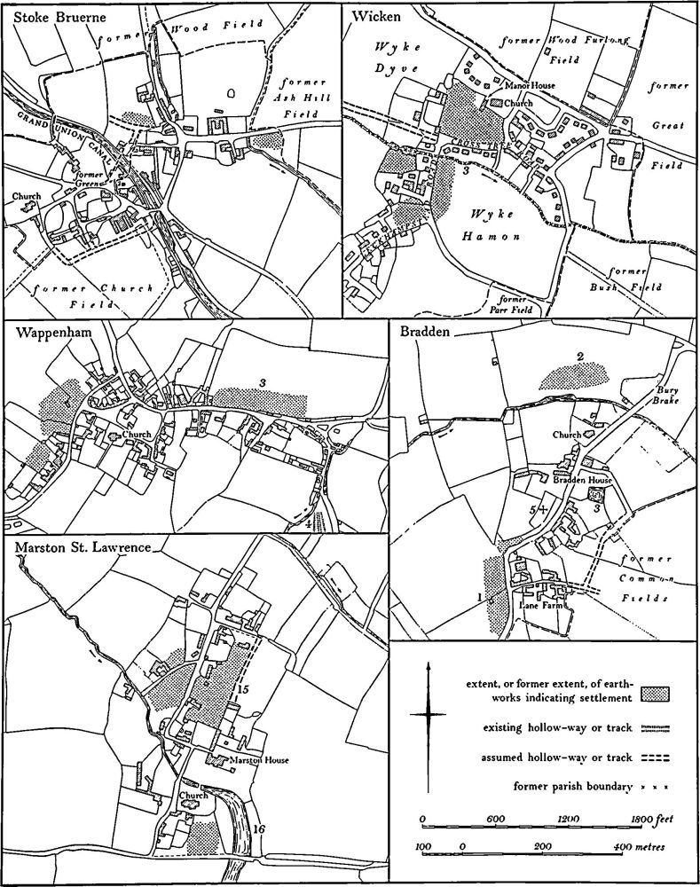
Fig. 14 Bradden, Marston St. Lawrence, Stoke Bruerne, Wappenham and Wicken Village plans
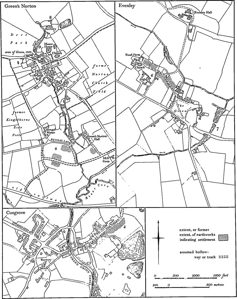
Fig. 15 Cosgrove, Evenley and Greens Norton Village plans
Castles
The remains of a number of large mottes or ringworks have been recorded. The most notable of these are the ringworks at Sulgrave (3), Culworth (1) and Weedon Lois (Weston and Weedon (5)) which appear to have been constructed by the tenant-in-chief, recorded in Domesday Book. However, despite excavations at Sulgrave, the exact sequence of development of the ringworks is not understood. Another ringwork or motte survives at Alderton (Grafton Regis (5)) but the only true motte, that at Towcester (8), has been altered to form part of a garden in the post-medieval period.
Moated Sites
Several earthworks which have at some time been described as moated sites are listed in the Inventory. Two of these are probably 18th or 19th-century landscape features (Cosgrove (3) and Woodend (3)). Of the others those at Caldecote (Towcester (12)), Yardley Gobion (2), Hinton-in-the-Hedges (3), Harpole (7) and Chipping Warden (5) have been totally destroyed either recently or in the past, and those at Easton Neston (6), Milton Malsor (7) and Moor End (Yardley Gobion (3)) have all been partly destroyed, damaged or altered in post-medieval times to such an extent that future work on them would be of limited value. The interesting circular moat at Ashton (2) has a standing building within it. Only those at Helmdon (11), Passenham (Old Stratford (8)), Potterspury (8) and Wicken (5) are relatively undamaged. All the certain medieval moats are comparatively small though some had outer enclosures and fishponds attached to them. Most were constructed around medieval manor houses, e.g. Yardley Gobion, Caldecote, Hinton-in-the-Hedges, Harpole, Milton Malsor and Passenham. The one at Helmdon is likely to have been a park-keeper's lodge, but the other isolated ones, for example at Wicken and Potterspury, are more difficult to explain unless they represent outlying farms established in the parochial wastes or woodlands.
Only one moat, at Quinton (6), has been excavated to modern standards. It appears to have been a manor house site as the remains of a 12th-century stone hall, solar and kitchen range were discovered. The outer paddocks and enclosures have not been investigated.
Manor House Sites
In addition to moated manor houses, the Inventory lists several other sites of large houses. These vary considerably in their history and physical form. The earthworks at Aston le Walls (2) are the remains of paddocks and closes around the extant manor house, but those at Greatworth (9), Thorpe Mandeville (3), Alderton (Grafton Regis (6)) and Warkworth (2) are the sites of post-medieval houses demolished or destroyed at a late date. The first three are associated with the remains of contemporary gardens. Little trace remains on the sites of the medieval manor houses at Thenford (10) and Litchborough (1) as a result of destruction. The earthworks at Helmdon (4), Bradden (2) and Chacombe (3) are well preserved and the last is also associated with a series of medieval fishponds (5). The best earthworks are those at Hulcote (Easton Neston (4)), where the house-site is surrounded by closes, some with ridge-and-furrow within them, and there are fishponds. At Grafton Regis (4) excavations have shown that a small monastic site was remodelled in the late medieval period to become a manorial dwelling which in turn was abandoned in the late 15th century when the whole area was ploughed over and incorporated into the common fields of the parish.
Monastic Sites
The sites of five small monastic houses are known from the area under review. Of these, no trace remains of the Benedictine Priory of Luffield which lay in the S. of Silverstone parish, astride the Buckinghamshire county boundary. Only some fishponds remain at Weedon (Weston and Weedon (7)) and the only earthworks of the Augustinian Priory of Chacombe (2) appear to be part of the precinct boundary and the much modified fishponds. At the site of the Cistercian Priory at Showsley (Easton Neston (8)) again only the fishponds survive, though some coffin slabs were discovered in the 19th century. The excavation of an assumed manor-house site at Grafton Regis (4) revealed an early monastic site about which little is known. The structural remains discovered during excavation are important and unusual.
Deer Parks
Several medieval deer parks have been identified though not all have been located on the ground; the position of the park at Silverstone remains quite unknown and the one at Greatworth (12) is not located with any certainty. The boundaries of the park at Wicken (6) have not been identified and those around Gayton Park (Gayton (8)) are hardly recoverable. On the other hand the well-preserved boundary at Helmdon (12) appears to belong to a deer park which is undocumented. Among the parks with surviving early boundaries are those at Stoke Bruerne (8) and Paulerspury (20). A notable aspect of the medieval deer parks in the area under review is the evidence for their enlargement in the 16th century. Such enlargements, usually as a result of royal instructions, have been recognised at Hartwell (8), Grafton Regis (8) and Yardley Gobion (8). These, though still termed deer parks, may have been the result of Crown policy of the period to encourage the breeding of horses (J. Thirsk, Horses in Early Modern England (1978)). All the medieval deer parks contain areas of ridge-and-furrow though it is not clear whether this pre-dates the establishment of the parks. The 16th-century enlargements also include ridge-and-furrow and some can be proved to have been enclosed from former arable land.
Fishponds
Numerous medieval fishponds are included in the Inventory but other possible ones which have been radically altered in recent times have been omitted. Most of the well-preserved fishponds can be assigned to the various types described in the second Northamptonshire Inventory (Northants. II (1979), lvii–lix) on the basis of their physical characteristics.
Type A. These ponds are formed by the construction of a simple earth dam across a valley. The best example is at Silverstone (2) and there is another at Moreton Pinkney (2).
Type B. Ponds in this category are formed by the construction of a dam, as in type A, but in addition large quantities of spoil have been removed to make them deeper and flat-bottomed. They are characterized by steep artificial scarps along one or both sides where the valley slopes have been cut away. Such ponds exist at Weedon (Weston and Weedon (7)), Thorpe Mandeville (4) and Paulerspury (15).
Type C. These are set on valley sides with dams along the sides of the ponds and the ponds themselves formed by removal of spoil from the hillside. This type is usually placed on a spring line. Some of the ponds at Aston le Walls (3) can be assigned to this category.
Type D. These ponds, constructed on relatively level ground, are entirely surrounded by banks made of spoil from the interior or from the side leats. The large pond at Radstone (3) and those at Stuchbury (Greatworth (11)) and Astwell (Helmdon (7)) are of this type.
Type E. These are simple sunken ponds, usually of small size, and with no real dams or embankments, for example at Culworth (4).
No ponds of Types F and G have been recorded in this area.
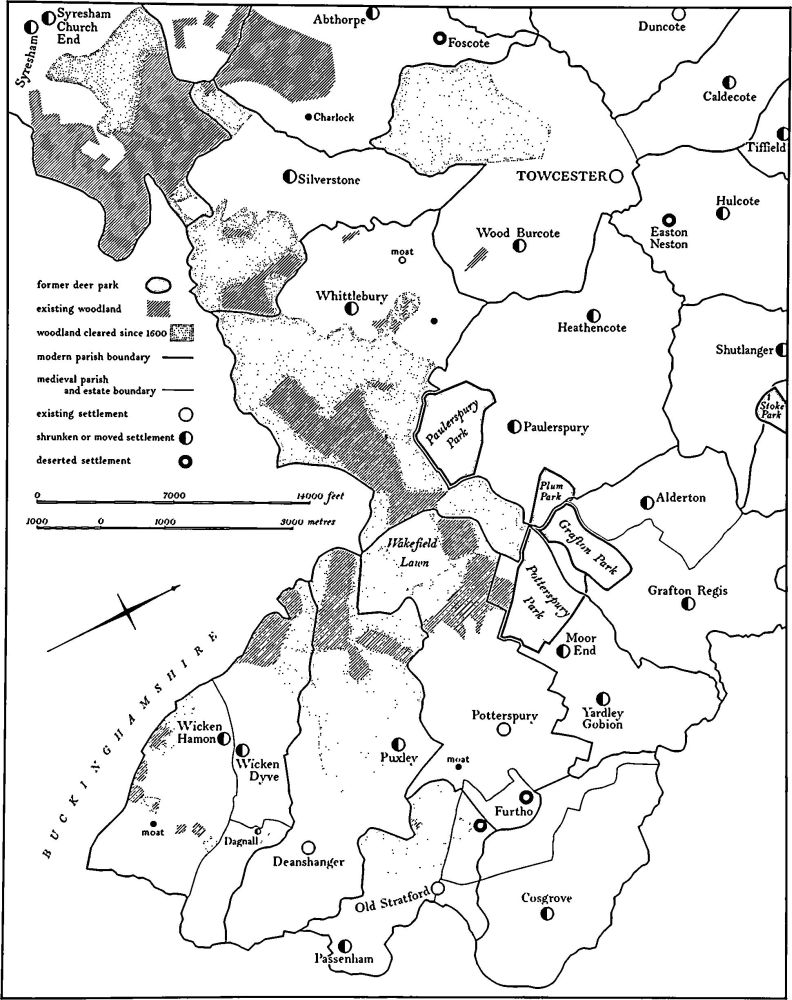
Fig. 16 Whittlewood Forest Medieval settlements and estates
Many fishponds occur in groups of up to four, often set one below the other along a valley. These probably relate to intensive fish-breeding where each pond has a separate function. Such groups of ponds occur at Chacombe (5), Chipping Warden (6), Evenley (7), Greatworth (11) and Weston and Weedon (7). The largest group of fishponds is at Aston le Walls (3) where no less than 20 ponds are identifiable. This site is of interest also because some of the ponds appear to have been constructed across a hollow-way and thus to have prevented its use.
Two features already noted elsewhere in the county have been recorded, islands and ridge-and-furrow within ponds. Islands in fishponds may be low and rectangular or tall and conical as at Aston le Walls (3), or flat-topped and circular as at Radstone (3). The pond at Radstone has recently been restored and the island has regained its medieval appearance. An 'island' of unusual shape in the fishponds at Stuchbury (Greatworth (11)) is inexplicable as it appears to have lain below the water-level of the original ponds. No new functions for these islands have been suggested (RCHM Northants., II (1979), lix).
One fishpond at Paulerspury (16) has ridge-and-furrow within it and it is possible that this is comparable with examples at Dingley and Braybrooke (RCHM Northants., II (1979), Dingley (3), Braybrooke (1)) where the ridge-and-furrow represents medieval ploughing of the bottom of the pond as part of a rotation of fish-breeding and arable cultivation.
The most important fishponds in the area are those at Silverstone (2). The smaller ones are probably breeding ponds, the largest the main fishery. The latter was doubtless the most extensive area of artificial water in the county in medieval times. As they were in royal ownership these ponds are extremely well documented and a number of interesting details of their management has emerged. It also appears that the earlier parish boundary between Silverstone and Abthorpe was moved N. outside the pond, presumably to ensure that the pond lay within one parish for ease of administration.
Several post-medieval ponds are recorded. The most extensive, at Thorpe Mandeville (7), are probably of 18th-century date and may have been constructed for fishing, boating and wild-fowling as well as to enhance the landscape. They contain features which could relate to any of these activities.
Watermills
Of the numerous watermills that once existed in the area only those of special interest are recorded in the Inventory. These include the dam of a very large mill pond at Upper Boddington (Boddington (4)) and the complex series of leats and ponds of the mill at Astwell (Helmdon (10)).
Windmills
As with watermills, the number of documented windmills in the area is considerable and the recording of the mounds which often remain after the demolition of mills has been selective. Mounds which are definitely the sites of mills but which may be misinterpreted in the future as possible barrows, for example those at Old Stratford (10), Radstone (4) and Thenford (12), have been included, as have mounds where there is considerable doubt as to whether they are the sites of mills or barrows, for example Sulgrave (8) and Thorpe Mandeville (9). Windmill mounds of special interest are also listed including a mound at Chipping Warden (7) which lies over earlier ridge-and-furrow that in turn overlies the ramparts of the Iron Age fort there.
Cultivation Remains
Ridge-and-furrow in Open Fields
Large areas of south-west Northamptonshire bear traces of ridge-and-furrow. Indeed more survives here than elsewhere in the county and in certain parishes, notably Moreton Pinkney and Weston and Weedon, the pattern of ridge-and-furrow is almost completely recoverable. In medieval times part at least of every economic land-unit associated with a settlement seems to have been cultivated. Thus in Abthorpe parish each of the three settlements, Abthorpe, Foscote and Charlock, had its own field system. In some parishes almost the entire area seems to have been in strip cultivation at some time (e.g. Moreton Pinkney (4)) but elsewhere there were large expanses which were always woodland or waste, or that were cultivated by other means. This is particularly true of parishes such as Syresham, Whittlebury and Silverstone which lay on the edges of Whittlewood Forest, or Hartwell which lay close to Salcey Forest.
In some areas the lack of ridge-and-furrow is due to modern cultivation, on light soils which never produced well-developed ridges. The higher areas of Oolite Limestone and Northampton Sand in the parishes of Aynho, Croughton and Thorpe Mandeville have very little ridge-and-furrow on them. In contrast, the only part of Nether Heyford which has no ridge-and-furrow is the Heyford Hills, an outcrop of Northampton Sand in the S.W. of the parish.
There are several dated maps which show the detailed layout of the former common fields. These include maps of Blisworth (1808), Brackley (1840), Bradden (1803) and Weston and Weedon (1593). They confirm the accepted view that the ridges were 'lands' or 'selions', groups of which made up the units of property (individual strips). The strips themselves had no physical demarcation. Other maps show the general area of arable land at the time of enclosure, but examination of the ridge-and-furrow on the ground shows that at various times this cultivation was more widespread than the maps indicate. Most of the medieval deer parks have ridge-and-furrow within their boundaries (e.g. Gayton (9) and Stoke Bruerne (9)) but its date is unknown. At Quinton (11) and Bradden (7) ridge-and-furrow lies on land which is depicted as meadow on maps of 1815 and 1803 respectively.
Enclosure of the common fields was carried out over a long period of time. The fields of a number of deserted villages were enclosed, usually for sheep, in the late 15th and early 16th centuries. These included Potcote (Cold Higham (6)) in 1499, Walton (King's Sutton (13)) in 1487, Purston (King's Sutton (13) and Newbottle (7)) in 1495, and Caswell (Greens Norton (10)) in 1509. There was little enclosure in the latter part of the 16th century and it was not until the first half of the 17th century that further enclosures took place, usually by agreement between major land owners. Among the parishes enclosed then were Furtho (Potterspury (17)) in 1600, Culworth (6) in 1612, Greatworth (14) in 1634 and part of Litchborough (5) in 1647. Very little enclosure is recorded for the late 17th century. The first Parliamentary Act of Enclosure, for Grafton Regis (9), was passed in 1727, and only one other, for Chipping Warden (11) in 1733, became law before the main flood of Parliamentary Enclosures commenced in 1758. Between 1758 and 1800 no less than 26 parishes were formally enclosed; the remaining 17 lost their common fields between 1800 and 1840.
Many minor details of ridge-and-furrow already noted elsewhere in the county have again been recorded. Among the most notable are features related to alterations of the layout of the fields, probably in the post-medieval period. For example the joining up of two, three or even four adjacent ridges into a single ridge has been noted at Aston le Walls (4), Radstone (5), Chacombe (6) and Gayton (9), though the exact reason for this is unknown. A more common procedure is the joining up of adjacent end-on furlongs by ploughing over the headlands, so producing unusually long ridges of double or, in one case (King's Sutton (13)), triple reversed-S curves. This probably results from the change over from ox to horse traction, which allowed longer plough runs. The considerable tenurial changes implied by the relatively simple agricultural alterations to the fields are not apparently documented. The abandonment of parts of ridges, so that a new headland is created on top of the older ridge leaving them and the original headland with an uneven and disturbed appearance, is particularly well marked at Warkworth (3).
The remains of cultivation on steep slopes which have been subject to land-slips have again been noted, all on unstable Upper Lias Clay deposits. Small areas exist at Gayton (9) and Purston (Newbottle (7)); at Farthinghoe (20) part of an area of land-slips was cultivated in ridge-and-furrow, but the rest was apparently too steep, and too disturbed by slumping, for ploughing to be undertaken. The most notable example of ploughing on land-slips is at Edgcote (2) where ridge-and-furrow occurs on the treads of massive terraces formed by the collapse of the hillside, and is also visible over and around stabilized mudflows on the lower slopes.
The most interesting piece of ridge-and-furrow in the area under review is at Kirby (Woodend (4)) where there is evidence, within one field, of over-ploughing of land-slips, shortening of furlongs, and even the formation of ridges over and at right angles to older ridges.
Ridge-and-Furrow in 'old enclosures'
Ridge-and-furrow can often be traced in fields described as 'old enclosures' on 19th-century and earlier maps. This type of ridge-and-furrow sometimes appears to have a direct relationship with other earthworks and indicates changes of land use at some period. The deserted village of Charlock (Abthorpe (5)) seems to have been inserted into the end of an earlier furlong, the curved boundaries of which are still reflected in the form of the settlement. At Paulerspury (10) the opposite process is visible, with ridge-and-furrow riding over and destroying earlier house-sites, and at the deserted village of Kirby (Woodend (1)) almost all the surviving earthworks have been ploughed over at some time after the abandonment of the site. Another example of a change in land-use of this kind is at Grafton Regis where the site of the manor house (4), previously a monastic building, was completely ploughed over and almost obliterated by ridge-and-furrow some time after the area was abandoned in the late 15th century. In this case the land was incorporated into the common fields which existed until enclosure in 1727.
Nineteenth-Century Ridge-and-Furrow
In a number of places, especially around and within the former Whittlewood Forest, there are large rectangular fields which bear traces of broad, exactly straight ridge-and-furrow up to 7 m. wide. This is presumably of 19th-century date and was perhaps formed by steam-ploughing in the latter part of that century. It occurs in the parishes of Syresham, Silverstone and Deanshanger and some of it must date from after 1853 when a Disafforestation Act was passed for Whittlewood and large areas of land were cleared for cultivation.
Post-Medieval Earthworks
Garden Remains
The remains of post-medieval gardens, often elaborate, associated with important houses, have continued to be recognised; eleven have been recorded in the Inventory, all but one of late 16th or 17th-century date. None covers an extensive area except the site at Purston (Newbottle (5)) which appears never to have been completed, though it was planned on a large scale. The gardens at Furtho (Potterspury (9)), Shutlanger (3), Farthinghoe (17) and (19) and Greens Norton (8) have all been damaged by subsequent activity, but the terraces of the 17th-century garden at Astwell (Helmdon (9)) are virtually complete as are those at Thorpe Mandeville (3). The best example is at Alderton (Grafton Regis (6)) where the original layout of terraces, ponds and a mount are all well preserved. The only late garden is the small 18th-century terraced and walled area at Great-worth (9) which belonged to a house destroyed in 1793. An unusual site is the medieval motte at Towcester (8) which has been modified to form part of a post-medieval garden.
Tramways
Two tramways, both associated with the construction of canals, have been recorded. The one at Rothersthorpe (6) has now been destroyed but the one at Blisworth (6), which was built in 1800 to carry goods between Stoke Bruerne and Blisworth during the delayed construction of Blisworth Tunnel, remains virtually complete. It is an unusual and important survival from the early canal era.
Undated Earthworks
Without excavation the purpose and date of a number of earthworks listed in the Inventory must remain speculative. The most important of these is the large fortified enclosure known as The Bury at Rothersthorpe (8). Though apparently in use in the medieval period it may well be prehistoric in origin. The earthwork known as Wallow Bank at Chipping Warden (12) has been the subject of much speculation in the past but no convincing explanation for it has been propounded.
Miscellaneous Earthworks
As in the previous volumes earthworks associated with woodland management in medieval and later times have been omitted from the Inventory. The innumerable banks and ditches which bound and cross the areas of surviving woodland are important but little understood and would repay detailed study. The tramways associated with the ironstone-mining of the late 19th and 20th century in the Blisworth and King's Sutton area have also been omitted and these too warrant investigation before an important aspect of the industrial archaeology of the county can be understood.