Survey of London: Volume 42, Kensington Square To Earl's Court. Originally published by London County Council, London, 1986.
This free content was digitised by double rekeying. All rights reserved.
'Plate 33: Kensington High Street', in Survey of London: Volume 42, Kensington Square To Earl's Court, ed. Hermione Hobhouse (London, 1986), British History Online https://www.british-history.ac.uk/survey-london/vol42/plate-33 [accessed 30 April 2025].
'Plate 33: Kensington High Street', in Survey of London: Volume 42, Kensington Square To Earl's Court. Edited by Hermione Hobhouse (London, 1986), British History Online, accessed April 30, 2025, https://www.british-history.ac.uk/survey-london/vol42/plate-33.
"Plate 33: Kensington High Street". Survey of London: Volume 42, Kensington Square To Earl's Court. Ed. Hermione Hobhouse (London, 1986), British History Online. Web. 30 April 2025. https://www.british-history.ac.uk/survey-london/vol42/plate-33.
In this section
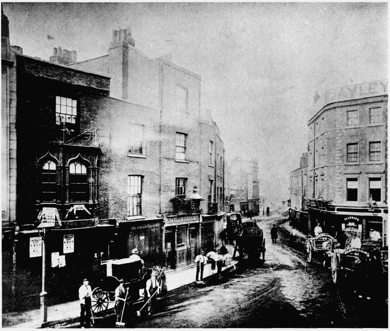
Kensington High Street Area in c. 1865–9. All demolished
a. Looking west along Kensington High Street west of Young Street in c. 1865.
Kensington High Street between Young Street and Derry Street.
Looking west along Kensington High street west of Young Street in c. 1865.
Formar Nos. 40-43 (consec.) to left, the 'Duke of Sussex' (pp. 79-80) in distance at center, North side to right
b. South side of Kensington High Street between Young Street and King Street after clearance in c. 1869, looking north (p. 84).
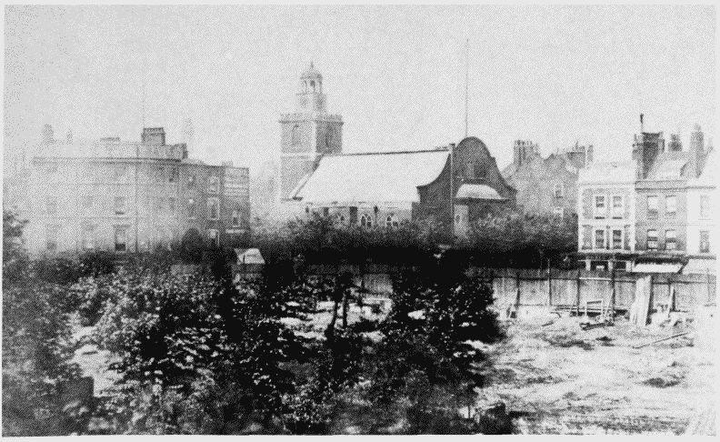
Kensington High Street between Young Street and Derry Street.
South side of kensington High Street between Young Street and King Street after clearance in c. 1869, looking north (p. 84).
St. Mary Abbots Church in centre