Survey of London: Volume 42, Kensington Square To Earl's Court. Originally published by London County Council, London, 1986.
This free content was digitised by double rekeying. All rights reserved.
'Plate 34: Kensington High Street', in Survey of London: Volume 42, Kensington Square To Earl's Court, ed. Hermione Hobhouse (London, 1986), British History Online https://www.british-history.ac.uk/survey-london/vol42/plate-34 [accessed 30 April 2025].
'Plate 34: Kensington High Street', in Survey of London: Volume 42, Kensington Square To Earl's Court. Edited by Hermione Hobhouse (London, 1986), British History Online, accessed April 30, 2025, https://www.british-history.ac.uk/survey-london/vol42/plate-34.
"Plate 34: Kensington High Street". Survey of London: Volume 42, Kensington Square To Earl's Court. Ed. Hermione Hobhouse (London, 1986), British History Online. Web. 30 April 2025. https://www.british-history.ac.uk/survey-london/vol42/plate-34.
In this section
Kensington Improvement Scheme of 1868-71 (pp. 83-5). All demolished
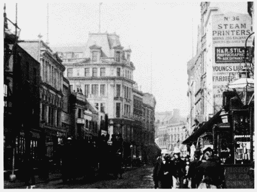
a. (left). Looking west along Kensington High Street in c. 1893.
Kensington High Street
Looking west along Kensington High Street in c. 1893.
43-71 (odd) on left. Nos. 63-65 (with flag) heightened for Barker by Alexander Peebles, architect, 1886-7 (p. 87)
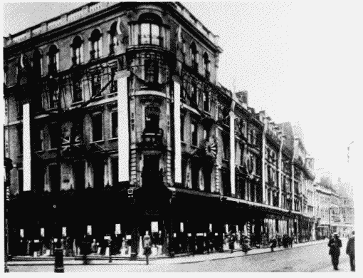
b. (right). Derry and Toms at Nos. pp-121 (odd) Kensington High Street (left to right), decorated for peace decorations in 1919.
Kensington High Street
Derry and Toms at Nos. pp-121 (odd) Kensington High Street (left to right), decorated for peace decorations in 1919.
Nos. 99-101 heightened by Josiah Houle, architect, 1892 (p. 89)
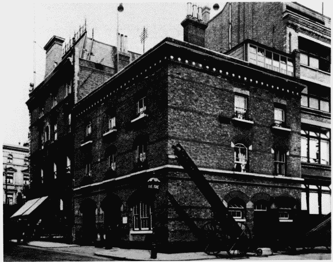
c. (left). Kensington Fire Station at corner of King Street (left) and Ball Street in 1904.
Kensington High Street
Kensington Fire Station at corner of King Street (left) and Ball Street in 1904.
Edward Cresy, architect, 1870-1 (p. 84)
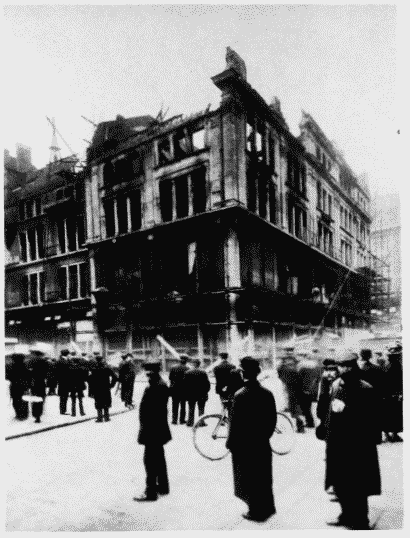
d. (right). Barkers, block at corner of Young Street (right) and Ball Street after fire of 3 November 1912 (p. 88)
Kensington High Street
Barkers, block at corner of Young Street (right) and Ball Street after fire of 3 November 1912 (p. 88)