A Topographical Dictionary of England. Originally published by S Lewis, London, 1848.
This free content was digitised by double rekeying. All rights reserved.
'Gloucester - Godstone', in A Topographical Dictionary of England, ed. Samuel Lewis (London, 1848), British History Online https://www.british-history.ac.uk/topographical-dict/england/pp301-312 [accessed 30 April 2025].
'Gloucester - Godstone', in A Topographical Dictionary of England. Edited by Samuel Lewis (London, 1848), British History Online, accessed April 30, 2025, https://www.british-history.ac.uk/topographical-dict/england/pp301-312.
"Gloucester - Godstone". A Topographical Dictionary of England. Ed. Samuel Lewis (London, 1848), British History Online. Web. 30 April 2025. https://www.british-history.ac.uk/topographical-dict/england/pp301-312.
In this section
Gloucester
GLOUCESTER, a city, an inland port, the head of a union, and a county of itself, locally in the hundred of Dudstone and King's-Barton, E. division of the county of Gloucester, 34 miles (N. N. E.) from Bristol, and 107 (W. N. W.) from London, on the road to South Wales; containing, with the College Precincts, which are extraparochial, 14,152 inhabitants. This was a town of considerable importance prior to the Roman invasion. Its origin is generally ascribed to the Dobuni, a tribe of Britons who settled in this part of the country; and, either from its founder Glowi, a native chief, or, with greater probability, from its eminence, it obtained the appellation of Caer Glou, British words implying, according to the former supposition, "the city of Glowi," or, according to the latter, "the fair city." Richard of Cirencester relates that the British fortress was taken in the year 47 by the Romans, who established a colony here, which he styles Glebon; and which, in the Itinerary of Antoninus, as well as other ancient writings, is denominated Glevum Colonia. The situation of the place on the Ermin-street, which was both a British and a Roman road passing over the Severn, rendered it of importance. The exact site of the Roman station is supposed to have been a tract of land, now in tillage, to the north-east of the present city, called Kingsholme, near which was a palace belonging to the Anglo-Saxon kings of Mercia, in old deeds named Regia Domus: on this spot have been found Roman coins, urns, and sacrificing utensils. Tradition relates that Lucius, the first Christian king of Britain, founded a see at Gloucester, in the second century, and that he was buried in the church of St. Mary de Lode.
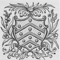
Arms.
After the departure of the Romans, the city is said to have been governed by Eldol, a British chief, who was present at the massacre of the Britons by the Saxons at Stonehenge, and who, according to some writers, escaped from the carnage, and afterwards killed Hengist the Saxon leader, at the battle of Maeshill, in Yorkshire, in 489. Having been captured by the Saxons in 578, Gloucester was by them called Gleau-ceasters, from which, or from Claudii Castra, its present name is derived: it first belonged to the kingdom of Wessex, and then to that of Mercia. About 679, the city was considerably enlarged by Wulphere, King of Mercia, who founded here a priory dedicated to St. Oswald, and subsequently erected the abbey. Edgar, in a charter to the monks of Worcester, dated at Gloucester in 964, styles this a "royal city." It was repeatedly plundered by the Danes, by whom, in the reign of Ethelred II., it was taken, and nearly destroyed by fire: the injury it suffered was, however, soon repaired. Edmund Ironside, having taken up his quarters here after his defeat by Canute at Assandune, challenged that prince to decide their mutual claim to the kingdom by single combat; but the English and Danish nobility, wearied with continual warfare, induced their kings to hold a conference for the partition of the kingdom, which took place in the Isle of Alney, on the south-western side of the city. Edward the Confessor often resided here in regal splendour, as also did William I. (who erected the castle, on the bank of the Severn), William II., and other kings. According to Camden, a mint was established here in the reign of John, on whose death, in 1216, his son Henry III. was crowned in the abbey church, by the Bishop of Winchester, in the presence of the pope's legate. This king, in 1263, having appointed Sir Maci De Besile, a Frenchman, sheriff for Gloucestershire, and constable of Gloucester Castle, the citizens, and the nobility of the county, taking umbrage at the promotion of a foreigner, chose for their governor Sir William de Tracy, who, proceeding to hold a county court, was arrested by De Besile, and imprisoned in the castle. The discontented nobles then besieged and captured that fortress, which they held for some time; but at length surrendered it to Prince Edward, afterwards Edward I., who in 1279 held a parliament here, in which various laws were enacted, called "the Statutes of Gloucester." Another parliament was held by Richard II., in 1378; others by Henry IV., in 1403 and 1407; and finally a parliament was summoned here by Henry V. in 1420, which, at the expiration of 14 days, was adjourned to Westminster.
When hostilities began between Charles I. and the parliament, the citizens declared in favour of the latter; and having procured cannon, and repaired and strengthened their fortifications, with the assistance of a few regular troops under the government of Colonel Massie, they resolved to defend themselves against all opposition. In the middle of Feb, 1642, Lord Herbert, son of the Marquess of Worcester, besieged the city at the head of 2000 Welsh royalists; and after remaining before it five weeks, surrendered himself and his followers, on the approach of an army under Sir William Waller to relieve the place. On the 10th of August, 1643, the king, with a large and well-appointed body of forces, laid siege to Gloucester; but his reiterated attacks were repulsed by the garrison with the utmost vigour and resolution; and after a siege of 26 days, and the loss of 1000 men, he was induced to retreat on the advance of the Earl of Essex, who had marched from London to relieve the city. Previously to this siege, there were eleven parish churches in Gloucester, six of which were destroyed, together with the suburbs of the city, by order of the governor, to obstruct the approach of the enemy. The conduct of the citizens was not forgotten at the Restoration of Charles II., by whose order their walls were rased, and their fortifications destroyed, in 1662: that monarch also deprived them of their charter, but subsequently granted a new one. In 1687, James II. visited Gloucester, in one of his progresses through the kingdom, and lodged at the deanery, where many resorted to him to be touched for the king's evil. George III., the queen, and the princesses, visited Gloucester on their route from Cheltenham, in 1788; in 1807, George IV., then Prince of Wales, dined with the corporation, and received the freedom of the city. On the 19th of October, 1830, Her present Majesty, Queen Victoria, accompanied by her illustrious mother, visited the place, when an address was presented to her by the mayor and corporation.
Gloucester
Gloucester is pleasantly situated in a fertile vale, on the eastern bank of the river Severn, and consists principally of four spacious streets, built on rising ground, and diverging at right angles from the centre of the town, which is the highest spot, towards the cardinal points. They were originally terminated by the East, North, South, and West gates, from which they respectively took their names; and at the intersection was an elegant cross, surrounded by four churches, of which only one is remaining. The West gate, on the western bank of the river, was standing till the erection of the new bridge, many years previously to which all the other gates had been removed. This bridge is a handsome structure of stone, consisting of one arch, 87 feet in the span, with a plain parapet and cornice; the approaches on both sides are defended by iron palisades, and from it a causeway, half a mile in length, extends across the Isle of Alney to Over, where is a noble bridge of one arch, in the construction of which the segments of a circle and an ellipsis have been combined. The streets are paved, and lighted with gas, by a company incorporated in 1820, and in 1834 two acts were obtained for better lighting the city and suburbs; the houses are in general handsome and well built, and the inhabitants amply supplied with water. A beautiful statue of Queen Anne has been lately erected on the College green. Triennial musical festivals of the united choirs of Gloucester, Worcester, and Hereford, are celebrated here, at which oratorios and selections of sacred music are performed in the cathedral, and miscellaneous concerts and balls are held in the spacious room at the shire-hall; the receipts arising from these performances, which embody the principal musical talent in the kingdom, are, after deducting the expenses, appropriated to the benefit of the widows and orphans of the necessitous clergy of the diocese. The theatre, in Westgate-street, is occasionally opened; and there are races annually in a meadow on the bank of the Severn. The environs abound with pleasant walks; and the salubrity of the air, and agreeableness of the situation, render Gloucester desirable as a place of residence. The approaches are ornamented with ranges of modern houses; the entrance from Cheltenham displays many mansions in detached situations, suited for families of opulence and distinction. Commercial rooms have been erected, in connexion with a permanent subscription library; and a literary and scientific association has been formed with much success. To the east of the city a mineral spring, resembling that at Cheltenham, was discovered in 1814, round which an extensive tract of land has been tastefully laid out in pleasure-grounds; a pump-room has been erected, with other buildings for the accommodation of visiters, and near it have been built some handsome villas. In 1823 a church dedicated to the Holy Trinity was erected, in the Grecian style, from a design by Mr. Rickman. The whole forms an elegant appendage to the city, under the designation of the Spa.
As an inland port, Gloucester attained some eminence at an early period. The quay is mentioned as existing in the reign of Edward IV., and in the 22nd of Elizabeth the customs were granted by letters-patent; in the following year the custom-house was erected, and also a wharf, or quay, for unloading vessels, called the King's quay. The limits of the port are, practically, from the source of the Severn, in Montgomeryshire, to Chapel rock, at Beachley. To avoid the dangerous and uncertain navigation of the Severn at Gloucester, a ship canal was projected and commenced in 1793; and it is since the opening of this canal, on the 26th of April, 1827, that Gloucester has become a port of any consequence. It now ranks as a third-class port; and some idea may be formed of its trade, from the fact, that in the year the canal was opened the customs' revenue amounted to £28,550, and in a recent year to £156,641: the number of vessels of above 50 tons' burthen, registered as belonging to the port, is 74, and their aggregate tonnage 5732. Its foreign and coasting trade is very extensive: the imports consist chiefly of grain, timber, wine and spirits, and Mediterranean produce; the exports, of bark, coal, iron, and salt. The canal is a work of great magnitude, having cost nearly £500,000; it is 16¼ miles in length, from 70 to 90 feet wide, 18 feet deep, and level from one extremity to the other, so that vessels of 600 tons' register can pass along it. There is a commodious ship and barge dock at Gloucester, around which are extensive warehouses and wharfs; also a graving-dock for the repair of vessels. In addition to the traffic carried on by means of the canal, many vessels are solely employed upon the Severn, in the trade in coal and iron from Shropshire and Staffordshire; and, considering the geographical advantages of the city as connected with the manufacturing and other districts of the kingdom, there is little doubt that the port will rise to much greater eminence; a notion strengthened by the rapid progress making in railway communication. The Bristol and Birmingham railway passes by the town; the station here is 37½ miles from Bristol, and 53 from Birmingham. An act was passed in 1846 for a railway from Gloucester to the Forest of Dean, the length of the line being 15½ miles, with branches of 2¼ miles.
Gloucester is said to have been a place of considerable trade before the time of the Conquest; and, besides the mint, there was a merchants' guild, established in the reign of John, who granted the burgesses exemption from toll, and other privileges and immunities. Forges for the smelting of ore appear to have subsisted here so early as the 12th century, and Long Smith-street derived its name from the number of artisans by whom it was inhabited. Cap or felt making, the refining of sugar, and the manufacture of glass, which formerly flourished, have been long discontinued. The principal branches of manufacture carried on at present are those of iron and pins: the latter, which was introduced in 1625 by John Tilsby, may be considered as the staple of the place; the former, especially since the establishment of a foundry by Mr. Montague in 1802, has greatly improved, and the castings lately produced are distinguished by a degree of excellence almost unrivalled. A bellfoundry was carried on for nearly a century and a half, by the family of Mr. Rudhall, the original proprietor, in the course of which period not less than 5000 church bells of various sizes were cast, not only for Great Britain and Ireland, but for the East and West Indies, and North and South America; but this manufacture is now discontinued. The trade of wool-stapling, which afforded employment to many persons, has been in a great measure superseded by the dressing of hemp and flax; and an establishment for the manufacture of shawls, in imitation of those of France, has also been discontinued for several years. There is a brush manufactory on an extensive scale, from which most of the surrounding counties are supplied; the proprietors have received three patents for improvements in articles used in the clothing business. The market-days are Wednesday and Saturday, and there is a market for live-stock on the first Monday in every month: they were formerly held in the open streets, but two large and commodious market-houses have been erected; one in East-gate-street, for the sale of corn, meat, poultry, and vegetables; and the other in Southgate-street, for fish, butter, &c. The cattle-market is held in a spacious area, judiciously appropriated to the purpose, in the Lower Northgate-street. The fairs are on April 5th, July 5th, Sept. 28th and 29th (for cheese), and Nov. 28th.
The municipal constitution has varied considerably at different periods: in 1022, the chief magistrate is said to have borne the title of præfect, and in the reign of Henry II. that of provost; under John the place was constituted a borough, and governed by two bailiffs. Henry III. granted a charter of incorporation under bailiffs or provosts, of whom there was a 'succession till the first of Richard III., who bestowed a new charter, appointing a mayor and other officers, and ordaining that the hundreds of Dudstone and King's-Barton should be called the county of the town of Gloucester. Henry VII. ratified all former privileges; and Henry VIII., on establishing the bishopric of Gloucester, in 1541, directed that the town should thenceforth be considered as a city. Edward VI., Elizabeth, James I., and Charles I., confirmed preceding grants; but the charter which extended and established the liberties and franchises of the city, and under the authority of which the corporation acted until the passing of the recent Municipal act, was granted April 18th, 1672, in consideration of a payment to the king of £679. 4. 6. The corporation now consists of a mayor, six aldermen, and 18 councillors; a sheriff is appointed by the council, and a recorder by the crown. The city is divided into three wards; the municipal boundaries have been enlarged, and are now co-extensive with those for parliamentary purposes. The mayor and recorder for the time being are justices of the peace, and the total number of magistrates is five. The income of the corporation averages about £4000 per annum. The freedom is inherited by all the sons of freemen on attaining the age of 21, and acquired by servitude to a resident freeman. The city first exercised the elective franchise in the 23rd of Edward I., since which time it has returned two members to parliament: the right of election was once vested in the freemen, in number about 2000; but by the act of the 2nd of William IV., cap. 45, the former non-resident electors, except within seven miles, were disfranchised, and the privilege was extended to the £10 householders of an enlarged district, containing 460 acres: the sheriff is returning officer. There were anciently 12 companies, but the butchers' company is the only one remaining.
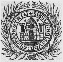
Corporation Seal.
The recorder holds quarterly courts of session, and courts of gaol delivery, for the county of the city, with power to take cognizance of all offences except treason and misprision of treason; and there is a petty-session every Monday, Wednesday, and Friday, for determining affairs of police. The assizes, and quarter-sessions for the county, are also held in the city, which is in the Oxford circuit, and is the place of election for the eastern division of Gloucestershire. The powers of the county debt-court of Gloucester, established in 1847, extend over the registration-districts of Gloucester and Wheatenhurst, and part of the district of Westbury. The municipal affairs are transacted in a building called the Tolsey, which stands at the angle formed by Westgate and Southgate streets, on the site of a church dedicated to All Saints; it was erected in pursuance of an act of parliament passed in the 23rd of George II. The city gaol, situated at the bottom of Southgate-street, and erected in 1782, was a few years since enlarged and improved, with the addition of a chapel: adjoining it a lock-up house has been built. The assizes were formerly held in an old edifice called the Booth Hall, but in 1814 a new and magnificent shire-hall, in the Grecian style, was erected, of Bath and Leckhampton stone, from a design by R. Smirke, Esq.; in the front is a portico of four Ionic columns, 35 feet high, forming the principal entrance. The county gaol stands upon the bank of the Severn, on the site of the ancient castle, the keep of which had been long used as a place of confinement previously to its entire removal to make way for the present massive and colossal edifice, built on the plan recommended by the celebrated Howard, and finished in 1791, at an expense of nearly £30,000.
Gloucester is said to have been a See when Britain was under the dominion of the Romans; and Eldad is mentioned as having presided over the diocese in 490. The first bishopric was probably suppressed when the country was conquered by the Anglo-Saxons; and the whole county of Gloucester, which formed part of the kingdom of Mercia, was, on the full introduction of Christianity, included in the diocese of Lichfield. In 679 it was annexed to the newly-established bishopric of Worcester, to which it belonged till the Reformation, when Henry VIII., by letters-patent dated Sept. 3rd, 1541, confirmed by act of parliament, erected the shire of Gloucester into a see, to which he also annexed so much of the county of the city of Bristol as had formerly belonged to the diocese of Worcester. The new bishopric was suppressed by Queen Mary, but re-established on the accession of Elizabeth. By the late ecclesiastical arrangements, under the act of the 6th and 7th of William IV., cap. 77, the dioceses of Gloucester and Bristol have been united into one bishopric, consisting of the former diocese of Gloucester, of the city and deanery of Bristol, of the deaneries of Cricklade and Malmesbury, in the county of Wilts, and formerly in the diocese of Salisbury, and of the parish of Bedminster, which was in the diocese of Bath and Wells. The bishop is elected by the dean and chapter of Bristol and the dean and chapter of Gloucester, alternately. The establishment of Gloucester consists of a dean, archdeacon, chancellor, five (to be reduced to four) canons, four honorary canons, four (to be three) minor canons, and other officers. The dean and chapter possess the patronage of the minor canonries. On the foundation of the bishopric the abbey church of St. Peter was constituted the cathedral. This edifice owed its origin to Wulphere, the first Christian king of Mercia, who, about 680, commenced the erection of a nunnery, which was completed by his brother and successor, Ethelred. The nunnery, being destroyed by the Danes, was re-founded by Bernulf, King of Mercia, in 821, for the reception of secular priests. Canute, the Dane, in 1022 ejected these priests, and introduced Benedictine monks, who, after some opposition, kept possession of the monastery, which was governed by a line of 32 abbots belonging to that order, the last of whom was William Malvern, otherwise Parker, who wrote a history of the abbey, and died in retirement after the Dissolution. The monastery and its endowments were surrendered to the king's commissioners in January, 1540, by the prior, Gabriel Morton, when the revenue was estimated at £1946. 5. 9. Of the monastic buildings the remains are the church, chapter-house, and cloisters, which escaped demolition in consequence of their being appropriated to the purposes of the episcopal establishment.
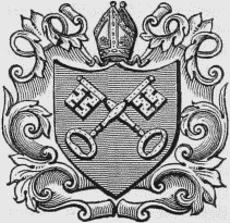
Arms of the Bishopric.
The cathedral is one of the most magnificent ecclesiastical structures in England, combining specimens of Norman, with early and later English, architecture: it consists of a nave, choir, aisles, transepts. Lady chapel, and grand central tower, besides other parts of less importance. The oldest portions are the nave, the chantry chapels around the choir, and the crypt, or undercroft, which are supposed to have belonged to the abbey church founded by Aldred, Bishop of Worcester, a few years prior to the Norman Conquest. The roof of the nave, built by Abbot Henry Foliot, was finished in 1248. The south aisle was begun by Abbot Thokey, in 1310, and the south transept was added in 1330; about which time, also, was commenced the erection of the north transept and the choir, which last was finished in 1457. Between 1351 and 1390 the cloisters, which are the most elegant and perfect of the kind in England, were constructed; the west front and south porch were added in 1421, and the edifice was completed by the erection of the Lady chapel and the central tower, which were begun in 1457, under the direction of Abbot Sebroke, who, dying that year, committed the execution of the work to Robert Tulley, one of the monks, who afterwards became Bishop of St. David's: the chapel was finished in 1498, and the tower in 1518. Notwithstanding the variety of style in its architecture, the exterior presents a noble and impressive appearance: the tower, in particular, though of colossal dimensions, has, from the taste and delicacy of its ornaments, a light and airy effect, which adds greatly to the beauty of the whole. On entering the cathedral through the porch, on the left hand, is the consistory court; and opposite the entrance, across the nave, is a gate of light open iron-work, presenting in pleasing perspective a view of the exquisite tracery of the roof of the great cloister: the western extremity is adorned with a once finely painted window. The nave is separated from the aisles by massive round pillars, from which spring semicircular arches; and the roof displays tracery which is most ornamented towards the west end. A classically correct and appropriate screen, separating the nave from the choir, was erected in 1820 at the expense of Dr. Griffith, prebendary. There are many tombs deserving notice; among which may be mentioned the tomb erected by Abbot Parker, in memory of Osric, King of Northumbria, one of the founders of the monastery, who died about the year 729, with his effigy in freestone, in the north aisle, near the entrance to the Lady chapel; an altartomb in a chapel in the same aisle, removed from the centre of the choir, where were laid the remains of Robert, Duke of Normandy, son of William the Conqueror, with his figure carved in oak recumbent on it, under a wire lattice; not far from the high altar, the monument of Edward II., who was murdered at Berkeley Castle, with a recumbent figure in alabaster, supposed, from the elegance of the sculpture, to be of Italian workmanship, with a more modern but still beautiful canopy of tabernacle work; the monument of Alderman Blackleach and his wife, with their statues in white marble; that of Mrs. Morley, with a group of statuary by Flaxman; and those of Judge Powell; Sir George Onesiphorus Paul, Bart.; Dr. Edward Jenner, who first brought the practice of vaccination into general use; Charles Brandon Trye, an eminent surgeon; and the Rev. Richard Raikes. The chapter-house of the monastery, situated on the north side of the cathedral, with an entrance from the cloisters, is now appropriated to the college library.
The city, prior to the passing of the Municipal Corporations' act, comprised the parishes of St. Aldate, containing 786 inhabitants; St. John the Baptist, 3380; St. Mary de Crypt, 1012; St. Mary de Grace, 298; St. Nicholas, 2775; St. Owen, 714; and the Holy Trinity, 591; with part of the parishes of St. Catherine, 1445; St. Mary de Lode, 1840; and St. Michael, 1029; to which are now added part of the hamlets of Barton St. Michael and Barton St. Mary, the hamlet of Littleworth, and part of the South hamlet. The living of St. Aldate's is a perpetual curacy; net income, £154; patron, the Bishop. St. Catherine's is a perpetual curacy; net income, £34; patrons and appropriators, the Dean and Chapter of Bristol: the tithes were commuted for land and for corn-rents in 1796. The church was destroyed during the siege in 1643. The living of St. John the Baptist's is a discharged rectory, valued in the king's books at £14. 1. 1½., and in the patronage of the Crown, with a net income of £150: the church, with the exception of the ancient tower and spire, was rebuilt in 1734. The living of St. Mary's de Crypt is a discharged rectory, with the livings of All Saints' and St. Owen's consolidated, valued at £14. 7. 11., and in the patronage of the Crown; net income, £120. The church is a spacious cruciform structure, principally in the later English style, with some remains of the Norman, early English, and decorated styles, and having a handsome tower rising from the intersection: the edifice, after a perfect restoration, was reopened with much ceremony in Nov. 1845. St. Owen's church was destroyed during the siege of the city. The living of St. Mary's de Lode is a discharged vicarage, to which that of the Holy Trinity is annexed, together valued in the king's books at £19. 13. 4.; net income, £284; patrons and impropriators, the Dean and Chapter: the tithes were commuted for land and corn-rents in 1796. The body of the church has been rebuilt, in the later English style; but the chancel and tower of the old edifice remain: the latter formerly supported a lofty spire, which was demolished by a storm. In the north wall is an ancient tomb with a recumbent effigy, said to have been erected to the memory of Lucius, first Christian king of Britain, who is erroneously supposed to have been buried in the church. In St. Mary's square, now added to the churchyard, a monument was erected, in 1826, to the memory of Bishop Hooper, who in the reign of Mary suffered martyrdom on the spot. Trinity church was taken down in 1698, since which period its beautiful tower has shared the same fate. The living of St. Michael's is a discharged rectory, with the perpetual curacy of St. Mary's de Grace consolidated, valued in the king's books at £8. 16. 10., and in the gift of the Crown, with a net income of £231: the tithes were commuted for land and corn-rents in 1796. The church, with the exception of its ancient tower, has undergone so much alteration as to have defaced nearly all traces of its original character. St. Mary's church was taken down, by order of the corporation, in 1653. The living of St. Nicholas' is a perpetual curacy, with that of St. Bartholomew's annexed, in the patronage of Charity Trustees belonging to the hospital of St. Bartholomew; net income, £116. The church is an ancient structure in the early English style, with later additions and insertions: the tower, which is handsome, appears to have declined from the perpendicular by the sinking of the foundation; it is surmounted by a spire, the upper part of which has been removed for greater security. The living of ChristChurch is a perpetual curacy; net income, £135; patrons, certain Trustees. Additional churches have been erected within the last few years, of which one, in the extra-parochial district of High Orchard, was built and endowed by the Rev. Samuel Lysons, in whose family the patronage is vested; it is dedicated to St. Luke. The other churches or chapels are, St. James's, the living of which has a net income of £150; St. Mark's, which was consecrated in 1847, and contains 550 sittings, and to which a district is attached, formed out of the parishes of St. Catherine, St. John the Baptist, and St. Mary de Lode; St. Matthew's, Twigworth; and the annexed chapels of St. Mary Magdalen and St. Margaret. The livings of St. James', St. Mark's, and St. Matthew's, are in the gift of the Bishop; the two other chapels are presented to by Trustees. There are places of worship for Baptists, Friends, the Countess of Huntingdon's Connexion, Independents, Wesleyans, and Unitarians, a Roman Catholic chapel, and a synagogue.
The College School, founded by Henry VIII., is held in an apartment adjoining the cathedral. The school of St. Mary's de Crypt was founded and endowed in the 31st of Henry VIII., as a free grammar school, by John Cooke or Coke, alderman of Gloucester, and his wife: the schoolroom adjoins the parochial church from which it is named. Eight scholarships, of about £50 per annum each, were founded by George Townsend, Esq., in 1683, in Pembroke College, Oxford, for boys from the "chief school for the time being" of Gloucester, and from the schools of Cheltenham, Chipping-Campden, and Northleach, the scholars being entitled to presentation to the livings of Colnbrook and Uxbridge. From the time of the foundation, the exhibitioner from Gloucester has invariably been sent from Crypt school. In Eastgate-street is the Blue-coat Hospital, founded on a plan somewhat similar to that of Christ's Hospital, London, by Sir Thomas Rich, Bart., a native of Gloucester, who, by will dated in 1666, left £6000, to purchase lands for the maintenance and education of 20 boys. St. Bartholomew's Hospital, on the north side of Westgate-street, is an almshouse for 59 decayed men and women, who receive weekly pensions, which, with the salaries of a chaplain, a physician, and a surgeon, are paid from the endowment, amounting to about £1000 per annum. Queen Elizabeth granted letters-patent for the establishment of this hospital, to the mayor and burgesses, through the interest of Richard Pates, recorder of the city: its revenue originally belonged to a priory founded in the reign of Henry II. The hospital was rebuilt in 1786, in the early English style. St. Mary Magdalene's or King James's hospital, in the London road, was founded by one of the priors of Llanthony, for ten men and nine women. Not far from it is St. Margaret's hospital, originally a house for lepers, in which eight men are now supported. In the parish of St. Mary de Crypt is an almshouse for six persons, founded by Sir Thomas Bell, who died in 1566. The workhouse, or house of industry, situated in Bare Land, was founded and liberally endowed by Timothy Nourse, Esq., in 1703. The poor-law union of Gloucester comprises 37 parishes or places, and contains a population of 26,838. The Gloucester infirmary, or County hospital for the indigent sick, situated in Southgate-street, was built in 1755; the County lunatic asylum, about half a mile from the city, on the London road, is a handsome building, erected at an expense of £44,000. A Magdalen asylum was established in 1821.
Among other traces of the residence of the Romans, numerous inscribed stones, coins, &c., have at different periods been found in the city and its vicinity, chiefly at or near Kingsholme. One of the most remarkable of the relics was a statera, or Roman steelyard, supposed to have been the first ever discovered in Great Britain. The walls of Gloucester have been entirely destroyed; and of the remains of civil monuments of the middle ages, scarcely any thing exists except the Conduit, a beautiful piece of architecture in the later English style, which formerly stood in Southgate-street, but has been removed to the grounds of a private gentleman in Barton-street. Of the priory of St. Oswald, and the convents of Franciscans, Dominicans, and Carmelites, anciently subsisting here, there are no relics deserving notice. Among the distinguished natives of Gloucester, and persons connected with the city, may be noticed, Osbern of Gloucester, a learned writer, and Benedict, author of the Life of St. Dubricius, who were both monks here in the reign of Stephen; Robert of Gloucester, author of a curious chronicle in rhyme, who lived in the middle of the 13th century; John Rastell and John Corbett, historical writers; John Taylor, "the water poet," born in 1580; Dr. Miles Smith, Bishop of Hereford, one of the translators of the Bible; George Whitefield, founder of the Calvinistic Methodists; Dr. John Moore, Archbishop of Canterbury, educated at Crypt grammar school; Dr. White, the celebrated orientalist, and Dr. Phillpotts, Bishop of Exeter, both educated at the College school; and Robert Raikes, Esq., who, from his unwearied exertions in promoting the increase of Sunday schools, obtained the reputation of having been their founder, though, as is contended by many, they owe their origin to the Rev. Thomas Stock, formerly rector of the parish of St. John the Baptist, in the city.
Gloucestershire
GLOUCESTERSHIRE, a maritime county, bounded on the north and north-east by the counties of Worcester and Warwick, on the east by the county of Oxford, on the south-east by part of Berks and Wilts, on the south and south-west by the county of Somerset and the Bristol Channel, and on the west and north-west by the counties of Monmouth and Hereford, It extends from 51° 25' to 52° 11' (N. Lat.), and from 1° 38' to 2° 42' (W. Lon.); and includes 1258 square miles, or 805,120 statute acres, The county contains 81,016 houses inhabited, 5790 uninhabited, and 787 in course of erection; and the population amounts to 431,383, of whom 205,543 are males, and 225,840 females. At the time of the second invasion of Britain by the Romans, under Claudius, in the year 66, this part of the country was inhabited by the Dobuni, who had been so much harassed and oppressed by their ambitious neighbours, the Cattieuchlani, that they freely submitted to the Romans; and Cogidunus, their prince, is described by Tacitus as having persevered with great fidelity in his allegiance, and as having, on that account, continued in the possession of his own dominions unmolested, with some other states annexed to them. In the first division of Britain by the Romans, this territory was included in Britannia Prima; in the subdivision by Constantine, it formed part of Flavia Cæsariensis. Under the Saxon heptarchy the county was comprised within the great central kingdom of Mercia; and, bordering on the mountainous country which served as the principal retreat of the Britons, it was one of the last that were permanently annexed to that sovereignty.
Gloucestershire was originally in the diocese of Lichfield, and afterwards in that of Worcester, but was made a distinct bishopric, in the province of Canterbury, in 1541, and is now included in that of Gloucester and Bristol. It contains the archdeaconry of Gloucester and part of that of Bristol, with the deaneries of Campden, Cirencester, Dursley, Fairford, Gloucester, Hawkesbury, Stonehouse, Stow, Winchcomb, and the Forest; the number of parishes is 315. The shire is divided into various hundreds, and contains the city of Gloucester, and, locally, part of that of Bristol; the borough and market towns of Cirencester, Tewkesbury, Stroud, and Cheltenham, the two last having been enfranchised by the act of the 2nd of William IV.; and the markettowns of Berkeley, Campden, Coleford, Dursley, Fairford, Minchin-Hampton, Lechlade, Marshfield, MitchelDean, Newnham, Newent, Northleach, Painswick, Sodbury, Stow-on-the-Wold, Tetbury, Thornbury, Wickwar, Winchcomb, and Wotton-under-Edge. It sends four members to parliament, for which it is divided into two electoral portions, called the Eastern and Western divisions; two representatives are returned for the city of Gloucester, and two for each of the boroughs, except Cheltenham, which sends only one. The county is included in the Oxford circuit: the assizes and quartersessions are held at Gloucester, where stand the shirehall and the common gaol or sheriff's prison; the houses of correction are at Horsley, Northleach, Lawford's Gate, and Little Dean.
The natural division of the county is into the Cotswold, the Vale, and the Forest districts, each being distinguished by striking peculiarities. The Cotswold district comprises the whole tract of hilly country from Chipping-Campden to Bath, and is often divided into the Upper and Lower Cotswolds. The Vale district comprehends the whole lowlands from Stratford-uponAvon to Bristol, and is usually divided into the Vales of Evesham, Gloucester, and Berkeley, but more naturally into the Vales of the Severn and the Avon, these rivers forming natural boundaries: the former Vale includes all the low country between Tewkesbury and Bristol, and the latter the lowlands between the Upper Cotswolds and the Avon, from Tewkesbury to Stratford, wherever the river is a boundary to the county. The Forest district contains the parishes on the west side of the Severn up to Gloucester, and afterwards on the west side of the river Leden, up to the spot where it enters the county from Herefordshire. In point of picturesque beauty, the banks of the Wye, and the environs of Bristol, Stroud, and Dursley, rank highest. The general character of the soil of the Cotswolds is a shallow calcareous loam, provincially called stone brash, under which is a stratum of rubble, or mould, the whole resting on calcareous sandstone, varying in some of its qualities, but known by the general name of freestone when found in large masses and deep beds. The soil in the Vale district is various: in the northern part of the county it is a fine black loam mixed with small pebbles, and remarkably fertile; southward it changes to a strong rich clay. Throughout a considerable part of the Forest district the soil inclines to sand, being in the northern part little more than a decomposition of the red sandstone, which is imbedded in large masses to a great depth, and often rises to the surface. On the Cotswolds it is the practice to sow after one ploughing, experience having proved that more frequent ploughing weakens the staple of the light soils there. Beans are the chief produce of the clay soils of the Vale, and a crop on which the farmer much depends. Rye is cultivated in that part of the Forest district which includes Newent, Pauntley, Oxenhall, Dymock, and Bromsberrow, here called the Ryelands. About 300,000 acres of land within the county are under tillage. The richest natural meadows and pastures are on the banks of the Severn and other rivers which run through the Vale; and the natural grass-lands of the other parts of it, beyond the reach of the floods, are generally fertile, though not equal to the former. The dairy is the chief object of the Vale farmers, and the cattle kept are those best adapted for that purpose. The orchards of the Vale and Forest districts form a very important part of the produce; but on the Cotswolds, except partially on the slopes, fruit plantations are not made. About 10,000 acres still remain waste, a small portion of which is in sheep downs on the Cotswolds. On the Cotswolds the beech and the ash are the principal trees; the former seems to be native, and probably at a remote period covered most of this portion of the county. Few tracts of woodland remain in the Vale, but in the Forest of Dean is still a large quantity of valuable timber.
Iron-ore exists in abundance in the Forest of Dean, but only a small quantity is procured, the greater part of that used in the furnaces being Lancashire ore, which, notwithstanding the expense of carriage, is more profitable for smelting, on account of its superior richness. In the lower part of the Vale, veins of Lead are found in nearly all the limestone rocks; but the produce is insufficient to repay the expense of working them. Coal of a sulphureous quality abounds in almost every part of the Forest and its vicinity; and the lower part of the Vale equally abounds with coal, which is less sulphureous: the pits in this latter district supply the vast consumption of the Bristol manufactories, and in some degree that of Bath. Gloucester and its neighbourhood are supplied with coal from Shropshire and Staffordshire, of much superior quality to any produced in this county. The Forest of Dean, Longhope, and adjoining places, furnish Limestone for building and for purposes of agriculture. Freestone of excellent quality for building is raised from the Cotswold quarries; and pavingstones, varying in quality and colour, are dug in the quarries at Frampton-Cotterell, Winterbourne, IronActon, Mangotsfield, and Stapleton. The latter are likewise found in the Forest of Dean, as are also grits for grindstones, of various degrees of fineness, and one species of uncommon hardness and durability, esteemed the best in England for cider-mills: stone tiles are chiefly obtained in different parts of the Cotswolds. In Aust Cliff, in the parish of Henbury, is a fine bed of Gypsum, or alabaster. The principal Manufactures are those of woollen broad-cloth, chiefly superfine and made of Spanish wool; and fine narrow goods, of the stripe and fancy kind, both to a great extent. At Tewkesbury, framework knitting is the principal source of employment; and the manufacture of pins is carried on at Gloucester. There are several paper-mills. The manufacture of felt hats for the London and Bristol trade is chiefly carried on at Frampton-Cotterell, Oldland, Winterbourne, and other villages in the neighbourhood of Bristol; the spinning of flax, during winter, affords employment to the female population of the upper part of the Vale of Evesham. In the Forest district are very ancient and extensive works both for the smelting of iron-ore and the manufacture of wrought iron. The chief articles of export, besides those from the woollencloth and pin manufactories (from the latter of which a great quantity is sent to America), are cheese, bacon, cider, perry, and all kinds of grain. Fat oxen, sheep, and pigs, are sent to the London market, as is also a considerable quantity of salmon.
The principal rivers are the Severn, the Wye, the Upper Avon, the Lower Avon, and the Isis or Thames. The Severn is navigable the whole of its course through the county; below Thornbury it soon takes the name of the Bristol Channel, and forms a grand estuary not less than ten miles broad, which continues expanding until it mingles with the Atlantic Ocean. The tide in this river, well known for its boisterous and impetuous roar, comes up to Gloucester with forcible rapidity, and the stream is turned by it as high as Tewkesbury. The salmon, which has ever been reckoned the boast of the Severn, and in former times was caught in great abundance, is now comparatively scarce. The Wye bounds the county on the west, and is navigable in all that part of its course. The Upper Avon unites with the Severn at Tewkesbury, and is navigable to Stratford, in Warwickshire; the Lower Avon enters the county near Bath, where it becomes navigable, and, having received the waters of the Lower Frome at Bristol, falls into the estuary of the Severn at Kingsroad. The Isis, or Thames, is generally reputed to rise at a spring called ThamesHead, in the parish of Cotes, in this county: it shortly leaves for Wiltshire; but at Kempsford, having become navigable, it forms the boundary between that county and Gloucestershire, and so continues as far as Lechlade, where it enters Oxfordshire. The smaller rivers are the Chelt, the Leden, the Upper Frome, the Ewelme, the Middle Avon, and the Windrush, all which, except the last, are tributary to the Severn.
The Stroudwater canal, constructed about the year 1775, commences at Walbridge, in the parish of Stroud, and after a course of upwards of seven miles, opens into the Severn at Framilode. The advantages of this canal to the interests of the cloth manufacture were increased by the junction of the Thames and Severn, effected by a continuation of the above line of canal from Walbridge to Lechlade, a distance of upwards of 28 miles, opened in 1789. The Gloucester and Berkeley Ship-canal was designed to form a shorter and safer passage for vessels of larger burthen between Gloucester and the wider parts of the Severn; the basin at Gloucester was begun in 1793. The Hereford and Gloucester canal, begun in 1792, enters this county from Herefordshire at its north-western extremity: a tunnel, 2170 yards in length, commences at Dymock and ends at Oxenhall, whence the canal descends the valley of the Leden, crosses that river by an aqueduct, and joins the western channel of the Severn at Gloucester. The Bristol and Birmingham railway runs through the county for an extent of about 50 miles, passing in a N. N. E. direction by Chipping-Sodbury, Wickwar, Berkeley, Stonehouse, Gloucester, Cheltenham, and Tewkesbury, into Worcestershire. Another line, belonging to the Great Western company, runs from Stonehouse, by Stroud, Minchin-Hampton, and Cirencester, into Wilts. The Bullo-Pill, or Forest of Dean tramway, proceeds from the river Severn, near Newnham, to the summit of the hill above Churchway-Engine, a distance of about 7½ miles, and has three short branches from the main line to different coal-mines in the Forest: timber, coal, iron-ore, and other minerals are conveyed along it for shipment on the Severn. The Severn and Wye railway, formerly the Lydney and Ledbrook, commences at the Severn at Lydney, and pursues a course of 26 miles to the Wye at Ruardean, including several branches to the collieries; it was constructed for the conveyance of minerals and timber from the Forest of Dean.
Many tumuli, or barrows, are scattered over the county, but it is uncertain whether any or which of them are British. The circumstance of the Romans having experienced little opposition from the Dobuni is a probable reason why so few Roman stations or fortresses can be traced in the country inhabited by that British tribe. Ancient encampments are conspicuous on almost every eminence, but their origin is doubtful: the principal are at Little Sodbury, Minchin-Hampton, Painswick, Twining, Haresfield, Tytherington, Elberton, Uley, Hatherop, Northleach, Oldbury, Cromhall, Beachley, Willersey, and Staunton; and from the last place, at different intervals, along the edge of the Cotswold range to Bath, Henbury, and Clifton. Remains of Roman buildings, such as tessellated pavements, &c., have been discovered at Gloucester, Cirencester, Woodchester, Rodmarton, Colesborne, and Chedworth, particularly at the two first places. Roman coins have been found in various places, especially at Sapperton; but the majority are of the Lower Empire. Of the four great public or military Roman roads in Britain, three pass through Gloucestershire; namely, the Fosse-way, which enters it from the north at Lemington, and, passing by Northleach and Cirencester, quits it about five miles beyond the latter town: the Ikeneld-way, entering from Oxfordshire at Eastleach, and falling into the Fosse-way near Cirencester; and the Ermin-street, supposed to have led from Caerleon in Monmouthshire, through Gloucester, to Cirencester and Cricklade, in its course to Southampton. Of ancient Castles, only that of Berkeley, erected in the early part of the 12th century, is entire: the most imposing remains are those of Sudely Castle, which was rebuilt about the year 1450, and of Thornbury Castle, built about 1511; there are also minor relics of that of St. Briavell's, built not long after the Conquest, and of the castle of Beverstone, erected prior to that era. Before the Reformation there were, according to Tanner, 47 monasteries, hospitals, and colleges: the most considerable remains are those of St. Peter's Abbey at Gloucester, and of the abbeys of Tewkesbury, Cirencester, Hailes, and Kingswood. Fossils are found in great variety and abundance in almost every quarry opened on the Cotswolds. In the Vale, the beds of blue clay-stone contain numerous cornua ammonis, conchæ rugosæ, &c. Fretherne Cliff, the western shore of the Severn (near Awre), Pyrton Passage, and Westbury Cliff afford similar fields of investigation for the naturalist, as do various other parts of the county, though to a less extent. The Springs which rise through beds of blue clay, are often strongly saline, as at Prestbury, Cleeve, Cheltenham, Sandhurst, Hardwick, Eastington, Gloucester, &c.
Glusburn
GLUSBURN, a township, in the parish of Kildwick, union of Skipton, E. division of the wapentake of Staincliffe and Ewcross, W. riding of York, 4½ miles (S.) from Skipton; containing 1052 inhabitants. The township is situated on the road from Bradford to Colne, and comprises by computation 1513 acres. The population is partly employed in the hand-loom weaving of figured stuffs; and a very productive lead-mine is in operation. There are two places of worship for Wesleyans.
Gluvias, St. (St. Mary Magdalene)
GLUVIAS, ST. (St. Mary Magdalene), a parish, in the union of Falmouth, hundred of Kerrier, W. division of Cornwall; containing 4484 inhabitants, of whom 3337 are in the town of Penryn. The parish is situated on the coast of the English Channel, and from the higher grounds commands some pleasing views. At the village of Ponsnooth is a woollen-factory; and the manufacture of gunpowder and the trade of tanning are carried on to a great extent within the parish, in which also magnetic iron is found. The living is a vicarage, with that of Budock united, valued in the king's books at £21. 6. 10½.; patron, the Bishop of Exeter. The great tithes of St. Gluvias have been commuted for £262, and the small for £339; there is a vicarial glebe of 15 acres. The church is a venerable structure, with a tower of more ancient date, and beautifully enveloped with foliage overhanging the lake, on the border of which it is situated; it contains several handsome monuments. At Cosawes was formerly a chapel, supposed to have been a chantry chapel connected with Glaseney College, in the parish of Budock. There is a place of worship for Wesleyans.
Glympton (St. Mary)
GLYMPTON (St. Mary), a parish, in the union of Woodstock, hundred of Wootton, county of Oxford, 4 miles (N. by W.) from Woodstock; containing 119 inhabitants. The parish derives its name from the small river Glyme, which has its source in the hills near Chipping-Norton. It comprises 1231a. 2r., whereof 899 acres are arable, 138 meadow and pasture, and 115 woodland. The living is a rectory, valued in the king's books at £6. 16. 0½., and in the patronage of Mrs. Elizabeth Way: the tithes have been commuted for £250. 1. 6., and the glebe comprises 51 acres. The church is a small edifice, in the later English style.
Glynde
GLYNDE, a parish, in the union of West Firle, hundred of Ringmer, rape of Pevensey, E. division of Sussex, 3¼ miles (E. S. E.) from Lewes; containing 270 inhabitants. This parish, which is situated on the old road from Lewes to Eastbourne, comprises about 1370 acres; the surface is varied, and from the summit of Mount Caburn, the highest point of elevation, is a beautiful view of the Weald. Glynde Place is a handsome mansion, in the ancient English style of domestic architecture, situated in a tastefully-disposed demesne; and in the vicinity is Glyndbourn, another pleasing residence. The village is at the foot of Mount Caburn; a branch of the Ouse is navigable for barges within a small distance of it, and here is a station of the Brighton, Lewes, and Hastings railway. The living is a discharged vicarage, valued in the king's books at £5. 1. 3.; patrons and appropriators, the Dean and Canons of Windsor: the great tithes have been commuted for £140, and the vicarial for £120; the glebe comprises 10 acres, with a house. The church is a very neat edifice with a campanile turret, erected in 1763, at the expense of Dr. Trevor, Bishop of Durham, who is buried here; the chancel is embellished with scriptural subjects in stained glass. About 16 children are educated for the interest of £100, bequeathed by Mary Trevor; and the dividends on £2000 Bank stock, left by Miss Hay, are distributed among the aged poor. Mount Caburn is a circular earthwork strongly intrenched, and to the west of it are the remains of a large square encampment; in the ravines of the downs, also, are numerous vestiges of antiquity. William Hay, the writer, was born at Glyndbourn, and was buried in the church in 1755.
Gnosall (St. Lawrence)
GNOSALL (St. Lawrence), a parish, in the union of Newport, W. division of the hundred of Cuttlestone, S. division of the county of Stafford, 6½ miles (W. S. W.) from Stafford; containing 2424 inhabitants. The parish is about seven miles in length, and comprises 10,027 acres, of which 106 are waste or common. The soil is various, but the uplands have commonly a strong loam; there are several valleys with rivulets, and the meadows on their banks are generally very productive. Fairs for cattle, &c., are held on May 7th and September 23rd. The living is a perpetual curacy; net income, £114; patron, the Bishop of Lichfield: the tithes have been commuted for £1540, and the incumbent has a glebe of 45 acres. The church is a large edifice in the form of a cross, with a tower rising from the centre; the building was repaired in 1820, and enlarged in 1826 by the erection of galleries. It was given by King Stephen to the church of Lichfield; but afterwards became a royal free chapel, and had an establishment of secular canons: in the reign of Henry VIII., the Bishop of Lichfield and Coventry was titular dean, but with no profits attached to the office, and there were four prebendaries, namely, of Chiltrenhall, Baverley-Hall, Mordhall, and Suckerhall; the first valued at £14. 6. 8., and the others at £11 each, per annum. At the hamlet of Moreton is a chapel, forming a separate incumbency. Edward Cartwright, in 1653, endowed a school, of which the income is £23; and another is endowed with £5 per annum.
Goadby
GOADBY, a chapelry, in the parish and union of Billesdon, hundred of Gartree, S. division of the county of Leicester, 8 miles (N. by E.) from MarketHarborough; containing 122 inhabitants. It lies to the south of the Uppingham and Leicester road, and comprises an area of 944a. 3r. of land, mostly in pasturage; the soil is a red marl, and the surface hilly. The manor belongs to Joseph Sebley, Esq., but the principal part of the soil to Lord Berners, Sir Arthur Grey Hazlerigg, Bart., and John Dunmore, Esq.: Mrs. Elizabeth Dunmore has a neat residence here. The chapel, which is subordinate to the living of Billesdon, is a small edifice of ancient date, without a tower. The township appears to have been formerly called Goltebi, and sometimes Gundeby.
Goadby-Marwood (St. Denis)
GOADBY-MARWOOD (St. Denis), a parish, in the union of Melton-Mowbray, hundred of Framland, N. division of the county of Leicester, 5 miles (N. by E.) from Melton-Mowbray; containing 202 inhabitants. It comprises 1669a. 1r. 10p.; the surface, though generally flat, rises towards the south into a ridge of considerable elevation. The greater portion of the land is a good red soil, and the remainder a strong clay; there are pits of excellent marl, and some quarries of brown stone which is used for building. The living is a rectory, valued in the king's books at £16; patron and incumbent, the Rev. Edward Manners, who is also lord of the manor, and whose seat, Goadby Hall, is in the parish: the tithes have been commuted for £420. 7. 6., and the glebe comprises 34 acres. The church, which is partly in the decorated English style, contains, among several interesting monuments, a flat stone with an inscription in Latin to the memory of the celebrated antiquary, the Rev. Francis Peck, rector, who died in 1743, and was buried here. The sum of £24, arising from land given to the poor, is annually distributed among them. Many vases and Roman coins have been discovered at various times in the park; and in a field called the Dane Field from its having been the scene of a battle with the Danes, and in the neighbourhood, human bones are frequently found in great profusion, sometimes within ten inches of the surface.
Goadland, or Goathland
GOADLAND, or Goathland, a chapelry, in the parish and lythe of Pickering, union of Whitby, N. riding of York, 13½ miles (N. by E.) from Pickering; containing 381 inhabitants. In the dale of Goadland, within the ancient honour of Pickering Forest, the tenants were bound, by the tenure of their lands, to promote the breed of a large species of hawk that resorted to a cliff called Killing-Nab Scar, and to secure them for the king: these birds continue to haunt the same place, but it is remarkable that there is seldom more than one brood produced in a year. The township comprises by computation 11,030 acres, chiefly high moorland hills, and mostly waste: the lower vale, which at the northern end unites with the vale of Esk, is very picturesque; and the two moorland rivulets that meet at the upper end of it form the powerful stream of Goadland beck, abounding in romantic scenery, with occasional waterfalls of no mean beauty. The Whitby and Pickering railway passes near the school-house in the chapelry, and at a small distance attains its summit level, which is 520 feet above the Whitby terminus. The living is a perpetual curacy, in the patronage of the Dean of York, with a net income of £58; impropriator, G. Herbert, Esq. The chapel, a very ancient foundation, was rebuilt in 1821; the old font, supposed to be of Saxon origin, was lately discovered by Dr. Hibbert Wear in a farmyard, and is now set up in the church of St. Matthew at Grosmont. Here was a cell annexed to Whitby Abbey, and a farmhouse which is thought to occupy its site, goes by the name of Abbot House. Some British and Roman antiquities may be traced in the chapelry.
Goat
GOAT, a hamlet, in the township of Papcastle, parish of Bridekirk, union of Cockermouth, Allerdale ward below Derwent, W. division of Cumberland; containing 172 inhabitants. The village is connected with the town of Cockermouth by a handsome stone bridge across the Derwent.
Goathill (St. Peter)
GOATHILL (St. Peter), a parish, in the union of Sherborne, hundred of Horethorne, E. division of Somerset, 2¼ miles (E.) from Sherborne; containing 37 inhabitants, and comprising 232 acres. There are some quarries of stone for rough building. The living is a discharged rectory, valued in the king's books at £3. 11. 10½., and in the gift of Earl Digby: the tithes have been commuted for £60, and the glebe comprises 28 acres. The church is an ancient structure in the Norman style.
Goathurst (St. Edward)
GOATHURST (St. Edward), a parish, in the union of Bridgwater, hundred of Andersfield, W. division of Somerset, 3½ miles (S. W. by W.) from Bridgwater; containing 341 inhabitants. The parish is situated on the verge of the Quantock hills, about 7 miles from the Bristol Channel, and comprises 1437a. 2r. 21p., of which 571 acres are arable, 372 meadow, 321 pasture, and 87 woodland; the soil is gravelly. The surface is pleasingly undulated, the prevailing timber chiefly oak and elm, and the scenery in many parts picturesque. Halswell House, the seat of Charles Kemeys Tynte, Esq., is a handsome mansion, forming, with its park and richlyplanted demesnes, a prominent feature in the landscape. The living is a rectory, valued in the king's books at £9. 10. 7½.; net income, £378; patron, Mr. Tynte. The church, a small structure, contains a monument to the memory of Sir N. Haswell, who sat as knight of the shire in five successive parliaments. The ancient mansion of the Bolton branch of the Powlett family, who held estates here, is still remaining, and is ornamented in several places with the family arms.
Godalming (St. Peter and St. Paul)
GODALMING (St. Peter and St. Paul), an incorporated market - town and parish, in the union of Guildford, First division of the hundred of Godalming, W. division of Surrey, 4 miles (S. S. W.) from Guildford, and 34 (S. W.) from London; containing 4328 inhabitants, of whom 2183 are in the town. This place is supposed by Aubrey to have been called Goda's Alming, from Goda, Countess of Mercia, to whom it belonged, and from the circumstance of her having bestowed it in alms upon a neighbouring monastery; but with greater probability, perhaps, Manning derives the name from its Saxon possessor, Godhelm, and from its situation at the extremity of an ing or meadow; which latter supposition is in some degree strengthened by the designation Godelminge, applied to it in several ancient documents. The lordship was given by King Alfred to his nephew Ethelbald, upon whose rebellion against Edward the Elder it was confiscated to the crown; and was bestowed by Henry II. upon the see of Salisbury, from which, with the exception of the advowson of the living, it reverted to the crown in the reign of Elizabeth.
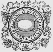
Corporation Seal.
The town is pleasantly situated on the road to Portsmouth, by Guildford, and in a richly-wooded vale on the banks of the river Wey, over which a handsome bridge was erected in 1782, at the expense of the county, on the site of a former one belonging to the lord of the manor. It consists principally of one spacious street, from which several smaller streets diverge, and is paved, and lighted with gas; the houses are in general small, but there are many respectable residences of modern erection, and the inhabitants are amply supplied with excellent water. The chief articles of manufacture are fleecy hosiery, worsted and cotton stockings, shirts, and drawers, silk, paper, and tanned and oiled leather; and a considerable trade is carried on in corn, timber, bark, and hoops, of which great quantities are sent to London. The river Wey, at an expense of £8000, subscribed in shares, was in 1780 made navigable to the town, where is a spacious wharf. Acts were passed in 1846, for a railway from Godalming to Guildford, and another from Epsom, by Godalming, to Portsmouth. The market is on Wednesday, for corn, and on Saturday, also for poultry and vegetables; the fairs are on Feb. 13th and July 10th, at the former of which many hoops are sold. The inhabitants received a charter of incorporation, in 1575, from Queen Elizabeth; it was confirmed by Charles II., and the government was vested in a warden, eight assistants, and a bailiff. By the act of the 5th and 6th of William IV. cap. 76, the corporation now consists of a mayor, four aldermen, and twelve councillors; the mayor and ex-mayor are justices of the peace, but the county magistrates have a concurrent jurisdiction. Courts leet and baron are held in October, at the former of which constables, tything-men, and other officers, are appointed. The powers of the county debt-court of Godalming, established in 1847, extend over the parish of Godalming, and the greater part of the registration-district of Hambledon. The town-hall was erected in 1814.
The living is a vicarage, endowed with a portion of the rectorial tithes, valued in the king's books at £23. 17. 11., and in the patronage of the Bishop of Winchester. The tithes have been commuted for £1700, whereof £600 are payable to the vicar; there are two acres of glebe. The church, an ancient cruciform structure in the early English style, with a central tower surmounted by a spire, was greatly enlarged and improved in 1840 at an expense of £3800, raised by subscription, under the auspices of the Rev. John G. Bull, the vicar, aided by grants of £500 and £400 from the Incorporated and Diocesan Societies. The nave was extended towards the west, the galleries over the north and south aisles were enlarged, and galleries erected in the north and south transepts; by which the number of sittings was increased to 1880, whereof 1150 are free. A district church was built at Ferncomb in 1846, and dedicated to St. John the Apostle and Evangelist; the cost of erection was £2600, including £1000 endowment. There are places of worship for General Baptists, the Society of Friends, Independents, and Wesleyans. The buildings formerly used as a workhouse have been purchased by the vicar, and fitted up for national schools on an extensive scale, at an expense of £900, of which £750 were defrayed by subscription and grants from the National and Diocesan Societies. Almshouses for ten men were founded in 1618, by Richard Wyat, who bequeathed £500 for the erection, and lands producing, with subsequent benefactions, more than £150 per annum for their endowment; and part of an estate yielding nearly £140 per annum, left by Henry Smith for the relief of the poor, is appropriated to the clothing and apprenticing of children. In Bridge-street is an old house, said to have been a hunting-box of Henry VII. Within the boundary of the borough is Westbrook, formerly the seat of Gen. Oglethorpe, who is supposed to have had the Pretender concealed in it for some time in 1745. The Rev. Owen Manning, F.R.S., author of the History and Antiquities of Surrey, and 37 years vicar of the parish, was buried here.
Goddington (Holy Trinity)
GODDINGTON (Holy Trinity), a parish, in the union of Bicester, hundred of Ploughley, county of Oxford, 5½ miles (N. E.) from Bicester; containing 117 inhabitants. The living is a rectory, valued in the king's books at £7. 18. 9.; net income, £334; patrons, the President and Fellows of Corpus Christi College, Oxford. The tithes were commuted for land, under an act of inclosure, in the year 1816. The church was erected in 1792.
Godley
GODLEY, a township, in the parish of Mottramin-Longdendale, union of Ashton-under-Lyne, hundred of Macclesfield, N. division of the county of Chester, 8 miles (E. by S.) from Manchester; containing 1399 inhabitants. Godley is a corruption of Godelegh, the name of the possessors of the place in the reign of John: the manor was afterwards held by the Baguleys, who purchased of the Godleys in 1319, and by the Massey and Newton families successively. The township comprises 604 acres, the soil of which is clay: the manufacture of cotton is carried on, as is also that of hats. This place, and part of Newton, likewise in the parish, were formed into a church district, in 1847, under the provisions of the 6th and 7th Victoria, cap. 37: the living is in the gift of the Crown and the Bishop of Chester, alternately.
Godmanchester (St. Mary)
GODMANCHESTER (St. Mary), an incorporated market-town and parish, in the hundred of Toseland, union and county of Huntingdon, ¾ of a mile (S. E. by S.) from Huntingdon; containing 2152 inhabitants. This ancient town is situated on the bank of the Ouse, over which is a bridge leading to Huntingdon. It is probably of British origin, and occupies the site of the Roman station Durolipons; subsequently, in the time of Alfred, it was a Danish encampment (Gormancastria), and derived its name from Gormon or Guthrum, a Danish chief, to whom the kingdom of the East Angles, which was separated from the kingdom of Mercia by the river Ouse, was assigned by Alfred. The manor was first granted in fee-farm to the "Men of Gumcester" by King John, for £120 a year, and, the grant being in perpetuity, is still held by the same tenure and rent. The charter of John was confirmed and enlarged by succeeding monarchs, and in 1605 a new one was granted by James I., incorporating the inhabitants by the title of the "Bailiffs, Assistants, and Commonalty of the Borough of Gumcester, alias Godmanchester," and vesting the control in two bailiffs and 12 assistants, with a recorder, high steward, and town-clerk. By the act of the 5th and 6th of William IV., cap. 76, the borough is now governed by a mayor, 4 aldermen, and 12 councillors, the mayor and late mayor being justices of the peace concurrently with the county magistrates. The inhabitant householders of £10 qualification are entitled to vote in the election of members of parliament for the borough of Huntingdon. A court of pleas, for the recovery of debts under 40s., is held every three weeks; and a court leet half yearly. A fair, chiefly for horses, is held by charter on EasterTuesday, and is well attended. The living is a vicarage, valued in the king's books at £17. 0. 5.; income, about £400; patrons and appropriators, the Dean and Chapter of Westminster. The church is a noble edifice, in the later English style. A free school was founded by charter of Elizabeth in 1561, and endowed with land now producing a rental of £300, by Richard Robins, in 1576; but the only fund at present belonging to it is £20 per annum, from Emmanuel College, Cambridge. Several charities are supported, and the benefactions for apprenticing children amount to a considerable sum.
Seal.
Godmanstone (Holy Trinity)
GODMANSTONE (Holy Trinity), a parish, in the union of Cerne, hundred of Cerne, Totcombe, and Modbury, Cerne division of Dorset, 5 miles (N. N. W.) from Dorchester; containing 153 inhabitants. The living is a rectory, valued in the king's books at £13. 6. 8., and in the gift of the family of Goodenough: the tithes have been commuted for £240, and the glebe comprises 24½ acres. In 1836 an inclosure act was passed.
Godmersham (St. Lawrence)
GODMERSHAM (St. Lawrence), a parish, in the union of East Ashford, hundred of Felborough, lathe of Shepway, E. division of Kent, 6¼ miles (N. E. by N.) from Ashford; containing 450 inhabitants. The parish comprises 3078a. 28p., of which 953 acres are arable, 927 pasture, 937 woodland, and about 230 down; the soil is chiefly chalk, alternated with loam and gravel. The surface is hilly, and the lower grounds are watered by the river Stour; the well-wooded grounds of Godmersham Park form an interesting feature in the landscape. The living is a vicarage, with that of Challock annexed, valued in the king's books at £9. 3. 9.; patron, the Archbishop of Canterbury; appropriators, the Dean and Chapter: the great tithes have been commuted for £330, and the vicarial for £195. The church, which contains eight stalls, was appropriated to the monks of Canterbury, and had a chantry. The prior resided in a house near it, which still retains somewhat of its ancient appearance; he had liberty of free warren, and obtained the privilege of a weekly market, which has been long disused.
Godney
GODNEY, a chapelry, in the parish of Meare, union of Wells, hundred of Glaston-Twelve-Hides, E. division of Somerset, 2½ miles (N. N. W.) from Glastonbury; containing 280 inhabitants. The living is a perpetual curacy; net income, £55; patrons and impropriators, the Heirs of Peter Davis, Esq. The chapel, dedicated to the Holy Trinity, stands upon the site of a more ancient edifice; it was restored in 1737, by Peter Davis, Esq., Recorder of Wells, and was rebuilt in 1838.
Godolphin
GODOLPHIN, a church district, in the parish of Breage, union of Helston, hundred of Kerrier, W. division of Cornwall, 3½ miles (N. W. by W.) from Helston. This place, anciently called Godolcan, has been long celebrated for its tin-mines. It gave name to the family of Godolphin, who were its lords in the time of William the Conqueror, and of whom Sir Francis Godolphin, by his perseverance and success in mining, increased the customs more than £10,000 per annum in the reign of Elizabeth. Sidney, son of Sir William Godolphin, Bart., a distinguished statesman, was in 1689 created Baron Godolphin, of Rialton, which title, having become extinct, was revived in 1832. The place was made a church district in 1846, under the provisions of the act 6th and 7th Victoria, cap. 37: the living is in the gift of the Crown and the Bishop of Exeter, alternately. The district is about three miles in length, and varies from half a mile to a mile in breadth; the surface is hilly, and rises gradually to the summit of Tregonning and Godolphin hills, the former being the loftiest elevation in the western part of Cornwall. There are two tin-mines, the "Wheal Vor" and "Great Work;" the Wheal Vor mine was formerly very rich, but is now rapidly declining, and it is expected will be relinquished in the course of two or three years. The village is situated about a mile north of the turnpikeroad from Helston to Penzance. An old mansion on the Godolphin estate, belonging to the Duke of Leeds, is now occupied by a farmer. A schoolroom is licensed for the celebration of divine worship, until the erection of a church; and there are three or four small places of worship for Wesleyan Methodists. The school was founded in 1827 by the late George Simon Borlase, Esq., for the children of the miners; it is supported by the endowment of the founder, the subscriptions of landowners, and payments from the children.
Godsfield
GODSFIELD, an extra-parochial liberty, in the hundred of Bountisborough, Winchester and N. divisions of the county of Southampton, 3 miles (N. N. E.) from Alresford; containing 2 inhabitants. It comprises 490 acres of land.
Godshill (All Saints)
GODSHILL (All Saints), a parish, in the liberty of East Medina, Isle of Wight division of the county of Southampton, 5½ miles (S. S. E.) from Newport; containing 1435 inhabitants. The village is one of the neatest in the island, and is surrounded with interesting scenery. About a mile to the south-east is Appuldurcombe, the splendid seat of the Earl of Yarborough, situated in an extensive park, encircled by hills of varied beauty, and very near the site of a priory founded in the reign of Henry III., as a cell to the abbey of Montsburgh, in Normandy. It is an elegant structure of freestone, with four fronts of the Corinthian order, containing many superb apartments, begun by Sir Robert Worsley, and completed by his descendant, Sir Richard; in the hall are some beautiful Ionic columns of porphyry, and a good collection of ancient sculptures and paintings. The hill at the entrance to the park is richly clothed with wood, and embellished with an artificial ruin called Cook's Castle; and on the summit of the principal eminence within the grounds is an obelisk of Cornish granite, nearly 70 feet high, to the memory of Sir Robert Worsley. The living is a discharged vicarage, annexed, with the chapelry of Whitwell, to the rectory of Niton, and valued in the king's books at £37. 17. 6. The church, an ancient cruciform structure, contains some handsome and interesting monuments to the families of Leigh and Worsley. There is a place of worship for Wesleyans. A free school, now held in a building erected by Lord Yarborough in 1804, was founded in 1593 by Philip Andrews and others, who endowed it with an annuity of £5, afterwards augmented by the Worsley family. There is also a school conducted on the national system, which has an endowment of £10 per annum.
Godshill
GODSHILL, a tything, in the parish, poor-law union and hundred of Fordingbridge, Ringwood and S. divisions of the county of Southampton; containing 109 inhabitants.
Godshill-Wood
GODSHILL-WOOD, an extra-parochial liberty, in the union and hundred of Fordingbridge, Ringwood and S. divisions of the county of Southampton, 2 miles (E. by N.) from Fordingbridge; containing, with New-Grounds and Ashley-Lodge, 265 inhabitants.
Godstone (St. Nicholas)
GODSTONE (St. Nicholas), a parish, and the head of a union, in the First division of the hundred of Tandridge, E. division of Surrey, 19 miles (S.) from London; containing 1896 inhabitants. The parish is situated on the road from Croydon to East Grinstead, and comprises by computation 6380 acres. The soil is various, comprising chalk, sandy loam, and a stiffish clay; the surface is elevated, consisting, for the greater part, of a ridge extending from the chain of the Surrey hills. On the Chalk Hill, so called from its substratum, is a quarry of very durable stone, which is raised for building; and from another portion of the ridge, called Tilbuster Hill, is obtained gravel of excellent quality for the roads. The village of Godstone-Green is of considerable extent, and a large brewery is carried on there. The Godstone station of the South-Eastern railway is six miles from the Reigate station, and 27 from the London terminus. A weekly market, and an annual fair of three days' continuance were granted by Henry III. to John St. John; the latter only now exists as a pleasure-fair, and takes place on July 22nd and 23rd. The petty-sessions for the division are held here monthly. The living is a vicarage, styled, in the time of Henry VIII., Walkensted alias Godstone; patron and incumbent, the Venerable Archdeacon Hoare; impropriators, the Earl of Liverpool and Sir W. R. Clayton, Bart.: the tithes have been commuted for £540 payable to the vicar, and £412 to the impropriators; the vicar has a glebe of 11 acres. The church is a neat structure combining various styles, and in the middle of the south aisle has a low tower surmounted by a spire; it was enlarged in 1824. In a small chapel on the north side of the chancel, is a marble altar-tomb, on which are beautiful effigies of Sir John and Lady Evelyn; also another of white marble, to the memory of Jacob Evelyn. James Evelyn, Esq., of Fellbridge House, erected a chapel in 1787, and endowed it with £30 per annum; and in the populous district of Blindley Heath a neat church was erected by subscription in 1842, at a cost of £1800: it is in the early English style, is dedicated to St. John the Evangelist, and the living is a perpetual curacy, in the gift of the Vicar, with a net income of £100. David Maynard in 1709 gave £200, producing £10 per annum, for instructing children; and James Evelyn, in 1783, endowed a school at Fellbridge. The poor law union of Godstone comprises 14 parishes, with a population of 11,459. Here is a mineral spring, now little used. At Leigh Place, where is a hill with an intrenchment on its summit, were formerly extensive powder-mills.