A Topographical Dictionary of England. Originally published by S Lewis, London, 1848.
This free content was digitised by double rekeying. All rights reserved.
'Hartlip - Harwich', in A Topographical Dictionary of England, ed. Samuel Lewis (London, 1848), British History Online https://www.british-history.ac.uk/topographical-dict/england/pp427-431 [accessed 30 April 2025].
'Hartlip - Harwich', in A Topographical Dictionary of England. Edited by Samuel Lewis (London, 1848), British History Online, accessed April 30, 2025, https://www.british-history.ac.uk/topographical-dict/england/pp427-431.
"Hartlip - Harwich". A Topographical Dictionary of England. Ed. Samuel Lewis (London, 1848), British History Online. Web. 30 April 2025. https://www.british-history.ac.uk/topographical-dict/england/pp427-431.
In this section
Hartlip (St. Michael)
HARTLIP (St. Michael), a parish, in the union and hundred of Milton, Upper division of the lathe of Scray, E. division of Kent, 4¾ miles (W.) from Sittingbourne; containing 341 inhabitants. The parish comprises 1412a. 2r. 3p., of which 135 acres are in wood: the soil is in some parts chalky, and in others sandy; the produce consists chiefly of wheat, oats, barley, and beans. A pleasure-fair is held on the 27th of July. The living is a vicarage, valued in the king's books at £9. 10. 10., and has a net income of £182; the Dean and Chapter of Rochester are patrons and appropriators. The church is in the decorated style; the north-east chancel has been lately rebuilt, and a handsome font placed in it. Here is a small place of worship for dissenters; and a national school is supported partly by subscription, and partly by an endowment of land given by Mary Gibbon in 1678, and now producing about £32 per annum. In Lower Danefield, about a mile from the church, are the remains of a large subterranean building, the rooms and passages of which are rudely constructed, and contain a great quantity of Roman tiles.
Hartoft
HARTOFT, a township, in the parish of Middleton, union and lythe of Pickering, N. riding of York; containing 168 inhabitants. It is a narrow dale, comprising 4740 acres, mostly moors.
Harton
HARTON, a township, in the chapelry and union of South Shields, parish of Jarrow, E. division of Chester ward, N. division of the county of Durham, 2 miles (S. E.) from South Shields; containing 265 inhabitants. This place, anciently Heortedun, was included in Aldwin's donation to the monastery of Jarrow, and, with the other lands of that establishment, became the property of the convent of Durham; it was granted to the cathedral after the Dissolution, and is now held under the Dean and Chapter. The township is bounded on the east by the North Sea, and comprises 1390a. 1r. 37p., of which 884 acres are arable, 445 meadow and pasture, and the remainder roads and waste; the soil is chiefly clay, and coal is found in abundance. On the sea-shore, near Marston Rock, is a verdant island called the Velvet Bed, which is a favourite resort of visiters from Tynemouth and the neighbouring places; and near it is a remarkable cavern, named the Fairies' Kettle. A church was erected in 1836, at an expense of £650, raised by subscription; it is a neat structure in the early English style, with a square embattled tower crowned by pinnacles, and contains 280 sittings, of which 138 are free: the living is a curacy, in the patronage of the Incumbent of South Shields. The tithes have been commuted for £5 payable to impropriators, and £249 to the curate of the chapel of Trinity, South Shields.
Harton
HARTON, a hamlet, in the parish of Upminster, union of Romford, hundred of Chafford, S. division of Essex; containing 60 inhabitants.
Harton
HARTON, a township, in the parish of Bossal, wapentake of Bulmer, union and N. riding of York, 10 miles (N. E.) from York; containing 186 inhabitants. It comprises by computation 1620 acres; the village is east of the road from York to Malton, and about a mile south-west of the village of Barton. The tithes have been commuted for £87. 8. payable to the vicar, and £317. 6. to the Dean and Chapter of Durham.
Hartpury (St. Mary)
HARTPURY (St. Mary), a parish, in the union of Newent, Lower division of the hundred of Dudstone and King's-Barton, E. division of the county of Gloucester, 4 miles (N. W. by N.) from Gloucester; containing 877 inhabitants. This parish, which is on the road from Gloucester to Ledbury, is bounded on the west by the small river Leden, and the Severn passes at the distance of about a mile to the east. It comprises about 3430 acres, whereof 1640 are arable, 1683 pasture, and 107 wood, the prevailing timber being elm. The surface is undulated, the scenery in some parts picturesque, and the soil in general a strong clay; the meadows in the vicinity of the Leden are very fertile, but subject to frequent inundations, which occasionally destroy whole crops of hay. The living is a vicarage, valued in the king's books at £16. 6. 5½.; net income, £196; patron and appropriator, the Bishop of Gloucester and Bristol. The church is in the decorated style, of which the east window is a fine specimen; increased accommodation has been provided by the addition of 80 free sittings. There is a Roman Catholic chapel.
Hartsfoot-Lane
HARTSFOOT-LANE, a hamlet, in the parishes of Hilton and Melcombe-Horsey, union of Blandford, hundred of Whiteway, Blandford division of the county of Dorset; containing 237 inhabitants.
Harts-Grounds, or Gibbet-Hills
HARTS-GROUNDS, or Gibbet-Hills, an extraparochial district, locally in the parish of Gosberton, union of Spalding, wapentake of Kirton, parts of Holland, county of Lincoln; containing 58 inhabitants, and comprising 541 acres.
Hartshead
HARTSHEAD, a division, in the parish and union of Ashton-under-Lyne, hundred of Salford, S. division of the county of Lancaster, 9 miles (E. N. E.) from Manchester; containing, with part of the town of Stalybridge, 12,731 inhabitants. This division is the largest in the parish, of which it comprises the whole of the eastern side, the centre being about two miles from Stalybridge. The name is said to have arisen from a covert or shed for deer of the hart species. The north-east portion contains several elevations, whereof Hartshead Pike is the highest. On this point was formerly a conical fabric of stone, erected in 1758, with a vane at its apex cut into the form of a hart's head; it served as a landmark for mariners, but in 1794 was split from top to bottom, and soon afterwards became a ruin. This is a considerable manufacturing district, in which are numerous cotton-mills. Among those in the vicinity of Mossley, are the Bottoms and Scout mills, established in 1805, and subsequently enlarged to their present extent, the property of Mr. G. Mayall and Mr. J. Mayall, who reside near their respective works. Heyrod Hall was at an early period the mansion of a family of the same name, of whom John del Heyrod was the possessor in 1422. Mosdelee was formerly held by the Bardsleys, and has been long the estate of the Halls. Ross-bottom was possessed by Robertus de Rossbotham in the fifteenth century, by the rent of a rose. Scout Mill, on the bank of the Tame, was in 1794 a private lunatic asylum. Among the villages or hamlets within the district are, Mossley; Hurst-Brook, in which are some cotton-mills; Higher Hurst, remarkable for its large cotton-mills; Hurst-Nook; Hurst-Cross; Hazlehurst; Smallshaw; Lusley; and Ridge-Hill Lane.—See Hurst, Mossley, and Stalybridge.
Hartshead, with Clifton
HARTSHEAD, with Clifton, a chapelry, in the parish of Dewsbury, union of Halifax, wapentake of Morley, W. riding of York, 5½ miles (N. E. by N.) from Huddersfield; containing 2675 inhabitants, of whom 896 are in Hartshead. This chapelry is intersected by the river Calder, and comprises by computation 2900 acres, of which 150 are wood and plantations, and of the remainder, two-thirds pasture, and about onethird arable. The scenery is bold and romantic. Stone of good quality for building is quarried, and there are some coal-mines; card-making for machinery, and wiredrawing, are carried on, and facilities of conveyance are afforded by the Calder and Hebble canal, and the Leeds and Manchester railway, which pass through the chapelry, as do the roads between Leeds and Elland, and Halifax and Wakefield. The village, which is small, is on a commanding eminence. The living is a perpetual curacy, in the patronage of the Incumbent of Dewsbury, with a net income of £202; impropriator, Sir George Armytage, Bart. The chapel is an ancient structure in the Norman style, with a square tower, and contains some interesting specimens, among which are two fine arches, in a perfect state; there is a handsome monument to the Armytage family. In 1839 an act was obtained for inclosing the waste lands.
Hartshill
HARTSHILL, a hamlet, in the parish of Mancetter, Atherstone division of the hundred of Hemlingford, N. division of the county of Warwick, 3 miles (N. W. by W.) from Nuneaton; containing 1061 inhabitants. This place is intersected by the Coventry canal; the river Anker, celebrated by Drayton in his Polyolbion; and the roads from Atherstone and Coleshill to Nuneaton. It comprises 1463 acres, of which about 140 are fine spring woods. The soil is fertile, the air salubrious, and the hamlet commands a beautiful prospect over a richly cultivated tract of country, embracing the Peak hills in Derbyshire, and the high ground near Weedon, in Northamptonshire; not less than forty-five churches being visible. The chief proprietors are, Richard Jee, Esq., Charles Okeover, Esq., and Mr. Alkin. The manufacture of ribbons employs about 400 persons; but the principal part of the male inhabitants is occupied in agriculture, and in mines of manganese (now nearly exhausted) and stone-quarries. The manganese is beautifully crystallized and of superior quality, and the rocks of quartz are thought to afford some of the best materials in the kingdom for roads; ironstone and greenstone are abundant, and copper and sulphur, and various mineral substances interesting to the geologist, have been discovered. A church, dedicated to the Holy Trinity, was erected in 1844, at a cost of £2200, raised by subscription aided by a grant of £300 from the Incorporated Society, and one of £400 from the Diocesan Society; the stone was supplied gratuitously by Mr. Jee: the edifice is in the Norman style, and admirably situated for effect, and for the convenience of the population. There are places of worship for the Society of Friends, Independents, and Methodists; and a free school endowed with land producing about £60 per annum. At the utmost point of a ridge in the hamlet, commanding a fine view of Atherstone, are the ruins of a Norman castle, built by Hugh de Hardreshull about the year 1125, and the site of which is in a very perfect state. Connected with their station of Manduessedum at Mancetter, the Romans had their Campus Martius at this place, and their Castra Æstiva, or summer camp, which is still perfect, in the adjoining hamlet of Oldbury. This was the residence of the accomplished daughters of Sir Anthony Cook, one of the tutors of Edward VI.: Mildred became the wife of the great Lord Burleigh; Anne, of Sir Nicholas Bacon, lord keeper; Elizabeth, of Sir John Russell, son and heir of Francis, fourth earl of Bedford; and Katherine, of Sir Henry Killigrew. Drayton was born here in 1563; and not at Atherstone, as stated by Sir William Dugdale.
Hartshorne (St. Peter)
HARTSHORNE (St. Peter), a parish, in the union of Ashby-de-la-Zouch, hundred of Repton and Gresley, S. division of the county of Derby, 6 miles (E. by S.) from Burton-upon-Trent; containing in 1841, 1389 inhabitants. This manor, called in Domesday book Heorteshorne, then belonged to the family of Ferrers. The priory at Repton afterwards had lands, and a moiety of a park here. The Irelands held the manor in 1504; Sir William Compton died seised of it in 1528, and it was subsequently possessed by the Cantrells, and by the Cants, an heiress of whom brought it to John Murcot, Esq., about the close of the last century. The parish is on the Leicester and Derby road, and comprises 2700 acres, in about equal portions of arable and pasture, with some woodland: the surface is hilly and undulated; the soil various, including almost every kind except marl; and the scenery picturesque. There is a quarry, from which the stone was obtained for the erection of the church and rectory-house; and at Woodville, until lately called Wooden-Box, a hamlet part of which is in the parish, are extensive earthenware manufactories, and brick-yards. The living is a rectory, valued in the king's books at £3. 2. 1.; net income, £540; patrons, the Earl of Chesterfield, and W. Blake, Esq., the latter of whom has the next presentation. The tithes were commuted for land in 1765; the glebe altogether comprises 388 acres. The church is a neat edifice in the early English style, the body of which was rebuilt in 1835, at a cost of £1400: it contains a very handsome monument to Humphrey Dethick, Esq., by whom was endowed a school for boys. A girls' school is supported by subscription. The Wesleyans have a place of worship.
Hartside, with Fawdon.—See Fawdon.
HARTSIDE, with Fawdon.—See Fawdon.
Hartsop, with Patterdale.—See Patterdale.
HARTSOP, with Patterdale.—See Patterdale.
Hartwell (St. Mary)
HARTWELL (St. Mary), a parish, in the union and hundred of Aylesbury, county of Buckingham, 2 miles (W. S. W.) from Aylesbury; containing, with part of the hamlet of Sedrup, 138 inhabitants. This was the residence of Louis XVIII., and his court, during the stay of that monarch in England, prior to his restoration to the French throne: he gave £100 for the use of the poor. The living is a rectory, with that of Little Hampden annexed, valued in the king's books at £14. 5. 5.; net income, £226; patrons, the Astronomical Society. The tithes were commuted for land and money payments in 1776. The church was erected by the late Sir William Lee, Bart., in imitation of the early English style, with two octagonal towers, and a roof highly decorated with tracery.
Hartwell (St. John the Baptist)
HARTWELL (St. John the Baptist), a parish, in the union of Potters-Pury, hundred of Cleley, S. division of the county of Northampton, 7¼ miles (S. by E.) from Northampton; containing 553 inhabitants. The parish is situated on the border of Buckinghamshire, which is on the south; and on the east is bounded by the extra-parochial district of Salcey-Forest. It comprises 1305¾ acres, and the London and Birmingham railway skirts it. The living is a perpetual curacy; net income, £70; patron, W. Castleman, Esq.: there is a parsonage-house. A new church was built in a central situation in 1846. The Wesleyans have a place of worship; and a school is chiefly supported by the Duke of Grafton.
Hartwith, with Winsley
HARTWITH, with Winsley, a chapelry, in the parish of Kirkby-Malzeard, union of Pateley-Bridge, Lower division of the wapentake of Claro, W. riding of York, 5 miles (S. E.) from Pateley-Bridge; containing 1138 inhabitants. The chapelry includes the hamlets of Summer-Bridge, Braisty-Wood, and New Laiths; and comprises by measurement 5184 acres, of which 3984 are arable and meadow, 500 woodland, and 700 moor. The surface is elevated, and the soil a heavy marl with rocky intermixtures. The village is situated on the northern acclivity of the vale of the Nidd, and contains several scattered houses, some flour-mills, and an extensive thread-mill; the surrounding scenery is boldly romantic, and at Brimham are masses of vast rocks spread in the wildest profusion over a tract of nearly 40 acres, the ancient resort of the Druids. The living is a perpetual curacy; net income, £103; patrons, the Rev. John Swire, and Richard Henry Roundell, Esq. The chapel, a neat structure in the later English style, was built in 1830, at a cost of £400, raised partly by subscription and partly by a grant from the Incorporated Society of £230. There is a place of worship for Wesleyans; and a free school is endowed with an estate assigned by Robert Haxby.
Harty, Isle of (St. Thomas the Apostle)
HARTY, ISLE of (St. Thomas the Apostle), a parish, in the union of Sheppy, hundred of Faversham, Upper division of the lathe of Scray, E. division of Kent, 11 miles (S. E. by E.) from Queenborough; containing 117 inhabitants. The isle comprises 2628 acres, of which 500 are arable, producing large quantities of wheat, oats, &c., and the rest chiefly rich pasture land, whereon numerous flocks of sheep are fed; the soil is principally a stiff clay. Some parts of the parish are elevated, and command extensive views of the picturesque scenery between Chatham Hill and Herne Bay. The East Swale is navigable on the south side of the parish, which is bounded on the west by Cable creek, and on the east by Muswell creek. The living is a perpetual curacy, with the vicarage of Leysdown, and valued in the king's books at £20. 6. 0½.; patrons, the Archbishop of Canterbury, and W. A. Mann, Esq., the former of whom has three presentations, and the latter one. The church is a small edifice, with a pointed turret.
Harvington (St. James)
HARVINGTON (St. James), a parish, in the union of Evesham, Middle division of the hundred of Oswaldslow, Pershore and E. divisions of the county of Worcester, 4 miles (N. by E.) from Evesham; containing 347 inhabitants. The parish is situated on the borders of Warwickshire, and on the road between Evesham and Alcester. It comprises by measurement 1278 acres, of which 315 are pasture, 15 woodland, and the remainder arable; the soil is a gravelly loam, with, in some parts, a subsoil of red marl. About half a mile distant from the village is a wharf on the river Avon. Sandstone is quarried for building. The living is a rectory, valued in the king's books at £15. 6. 8.; net income, £296; patrons, the Dean and Chapter of Worcester. The tithes were commuted for land and money payments in 1786; the land comprises 222 acres. The church, an ancient edifice in the early English style, stands on the west side of the village, and has been lately thoroughly repaired.
Harwell (St. Matthew)
HARWELL (St. Matthew), a parish, in the union of Wantage, hundred of Moreton, county of Berks, 7 miles (S. S. W.) from Abingdon; containing 857 inhabitants. The manor, which is now the property of the Chetwode family, belonged in the 13th century to Richard, Earl of Cornwall, King of the Romans. The parish is on the road from Wantage to Wallingford, and comprises 2482a. 2r. 39p., of which 2103 acres are arable, 203 meadow, and the remainder homesteads and roads; the lands were inclosed in 1802. The living is a vicarage, valued in the king's books at £12. 4. 2.; patron and impropriator, Sir J. Chetwode, Bart. The great tithes have been commuted for £670, and the vicarial for £170; a rent-charge of £117. 10. 8. is paid to the rector of Brightwell, and the glebe contains 82 acres. In the church is a handsome monument to Christopher Smith, lord mayor of London, who was a native of the parish. In 1644, Robert Loder bequeathed land now producing £50 per annum, for instruction; and in 1772, the Rev. M. Eaton left £32 a year for apprenticing children; besides which there are several bequests for the benefit of the poor generally.
Harwell
HARWELL, a hamlet, in the parish of Everton, union of East Retford, North Clay division of the wapentake of Bassetlaw, N. division of the county of Nottingham; containing 169 inhabitants. It is situated within half a mile of the village of Everton.
Harwich
HARWICH, a sea-port, borough, and market-town, having separate jurisdiction, locally in the hundred of Tendring, union of Tendring, N. division of Essex, 42 miles (N. E. by E.) from Chelmsford, and 72 (N. E. by E.) from London; containing 3829 inhabitants. The name of this place, which is expressive of circumstances connected with its early history, is by Camden derived from the Saxon Harewic, signifying a station or harbour for soldiers; and by the same authority it is supposed that, during the time of the Romans, the counts of the Saxon shore had a stronghold here, in which a force was stationed to repel the Saxons and the Danes, who at that time made frequent incursions. This opinion is in some degree confirmed by the remains of a Roman camp and tumulus in the vicinity of the town, near which coins and fragments of tessellated pavements have been found at various times; and by the discovery of teeth and bones of large animals in the southern cliff, which are by some antiquaries thought to be the remains of elephants brought into England by the Emperor Claudius. After the departure of the Romans, Harwich, with the district adjoining, was wrested from the Britons by Erchenwine, or Erchwine, a Saxon chief, who held it under Octa, grandson of Hengist. In 885, a considerable battle was fought near this port, between the fleet of Alfred and sixteen Danish ships, which terminated in the entire defeat and capture of the latter.
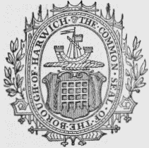
Seal and Arms.
In 1326, Prince Edward and his mother Queen Isabel, landed here from Hainault, with a force of 2750 soldiers, and being joined by several of the nobility, and headed by Thomas de Brotherton, Duke of Norfolk, then lord of the manor and resident in the town, proceeded to Bristol, to make war against the king. In 1338, the same prince, now Edward III., embarked at the port with a fleet of 500 sail, manned with archers and slingers, on his first expedition against France; and in the year following, the French, in retaliation, made an unsuccessful attempt with eleven galleys to set fire to the town. In 1340, the French navy, consisting of 400 ships, having been stationed near Sluys, in Flanders, to intercept the king's passage to France, Edward assembled here his naval forces, and, sailing on Midsummereve, and forming with the northern squadron under the command of Lord Morley, encountered the enemy, destroyed one-half of their ships, and killed or captured nearly 30,000 of their men. Henry VIII. visited Harwich in 1543; and in 1553 preparations were made here for the reception of Philip, King of Spain, on his arrival to celebrate his nuptials with Mary, Queen of England. Queen Elizabeth was sumptuously entertained in 1561 by the corporation, who escorted her as far as the windmill on her return. In some of the naval engagements between the English and the Dutch, in the reign of Charles II., the contending parties approached so near to the town as to render their operations visible to the spectators on the cliffs. When Harwich was fortified against the Dutch in 1666, Charles II., having proceeded from Newmarket to Landguard fort, sailed hither in his yacht, accompanied by the Dukes of York, Monmouth, Richmond, and Buckingham, and, with others of his suite, attended divine service at the parish church; in the evening the royal party embarked for Aldborough, whence they proceeded by land to Ipswich. William III., George I., and George II., visited Harwich on their respective tours to the continent; and the Princess of Mecklenburgh-Strelitz landed at the port on her arrival in England to celebrate her nuptials with King George III. In 1808, the Countess de Lille, consort of Louis XVIII., the Duke and Duchess of Angoulême, the Count and Countess de Damas, and others of the nobility of France, seeking an asylum in this country, during the sway of Napoleon Buonaparte, arrived here in the Euryalus frigate, commanded by the Hon. Captain Dundas. On the 16th of August, 1821, the remains of Queen Caroline, consort of George IV., were brought to the place, whence they were conveyed by the Glasgow frigate to be interred at Brunswick.
Harwich
HARWICH is situated on a peninsular projection at the north-eastern extremity of the Essex coast, bounded on the east by the North Sea, and on the west and north by the estuaries of the Stour and the Orwell, which, uniting previously to their influx into the sea, form a spacious and secure harbour, nearly three miles in breadth. The town is in general well built, and consists principally of three streets: an act of parliament was obtained in 1819, for watching, paving, and lighting it, and for supplying the inhabitants with water. An assembly and a reading room were lately erected in West-street, and a theatre was opened in 1813. The foundations of a castle and fortifications, by which the town was defended, might be seen previously to the encroachment of the sea, at an extraordinary tide in 1784; but of its ancient walls and gates, with the exception of a very small portion serving to indicate their former strength, the memorial is preserved only in the record of tolls, levied in the reign of Edward III. for their repair. Harwich is much resorted to during the season for bathing; and hot and cold baths, arranged with every accommodation, are supplied from a large reservoir of sea water: there are also bathing-machines near the jetty.
The harbour is protected on the east by the isthmus on which the town is built, verging towards the north, and on the west by a similar projection of the coast towards the south. The entrance is defended by Landguard fort, erected on the eastern promontory of the opposite coast; by a large martello tower; and by a number of shoals near the fort, which so much contract the passage as to admit only of one large vessel at a time, rendering the harbour difficult of access, except to expert navigators. Though of unequal depth, the harbour and the bay together form a capacious roadstead for the largest ships of war, 100 of which were assembled here during the war with Holland, in the reign of Charles II., exclusively of their attendant vessels, and 300 or 400 sail of vessels carrying coal. To facilitate the entrance into the harbour by night, two lighthouses were erected, under letters-patent of Charles II.: in the eastern part of the town, where they are situated, is a convenient stone quay, and near it a delightful promenade called the Esplanade. By means of these lights, vessels are guided off a sand-bank named the "Andrews," forming a bar across the entrance to the harbour from Landguard fort into the Rolling grounds, from which the passage leading into good anchorage is safe. The custom-house establishment consists of a collector, comptroller, and other officers. The trade of the port principally arises from the quantities of stone obtained here, from which cement is manufactured; about 100 small vessels and boats being employed in and near the harbour in dredging for stone for making it. The North Sea fishery, though it has materially declined, still affords employment to a considerable number of vessels; and a constant traffic is carried on, by means of steamers and wherries, with Ipswich and Manningtree. The number of vessels of above 50 tons' burthen is 61, and their aggregate tonnage 5497. Ship-building is carried on to a good extent, the dockyard here being provided with launches, storehouses, and other requisites; several third-rate and other vessels have been built, and a patent-slip has been constructed, on which ships of very large burthen may be hauled up for repair with great facility. The manufacture of copperas from stones that are found in abundance on the shore, was carried on in the seventeenth century, about which time an attempt was made to obtain potash from various sea-weeds. The market-days are Tuesday and Friday; the fairs, principally for toys, are on May 1st, and October 18th, each for three days.
The borough was first incorporated by charter of Edward II., which was renewed, with additional privileges, by James I., through the interest of Sir Edward Coke, and confirmed by Charles II. By the act of the 5th and 6th of William IV., cap. 76, the corporation now consists of a mayor, 4 aldermen, and 12 councillors; the mayor and late mayor are justices of the peace, and the total number of magistrates is 12. Harwich first sent members to parliament in the 17th of Edward III., but discontinued till the 12th of James I., since which time it has made regular returns. The right of election was formerly vested in the mayor, aldermen, and capital burgesses, 32 in number; but, by the act of the 2nd and 3rd of William IV., cap. 45, it was extended to the £10 householders of the borough, the limits of which contain 1461 acres. The mayor is returning officer. The mayor and eleven of the corporation, until the passing of the Municipal act, which abolished admiralty jurisdictions, possessed conjointly the powers of the court of admiralty, with all its privileges and profits, without accounting to the exchequer; and at the admiralty sessions the mayor was usually preceded by a person bearing a silver oar. A court of record used to be held under the charter of Charles II., every Tuesday, for the recovery of debts not exceeding £100; but from the expensiveness of the proceedings, it has fallen into disuse. The powers of the county debt-court of Harwich, established in 1847, extend over part of the registrationdistrict of Tendring. There are petty-sessions weekly. A new guildhall was erected a few years since, of which the lower part is used as a prison for the borough, chiefly for the confinement of prisoners previously to their committal to the county gaol, and the upper is appropriated to the holding of the courts, and to the transaction of public business. In the old guildhall, a small brick building, were several buckets bearing the arms and names of members of the corporation, among which were those of Sir Edward Coke, attorney-general in the time of James I.; Christopher Monk, Duke of Albemarle; Colonel Sir Charles Lyttleton, governor of Landguard fort in the reign of Charles II.; Sir Harbottle Grimstone, master of the rolls in the same reign; the Duke of Schomberg; Lord Bolingbroke; and Edward, Earl of Oxford.
Harwich comprises the parishes of All Saints Dovor-Court, containing 813, and St. Nicholas, 3016 inhabitants. The living of Dovor-Court is a vicarage, with the perpetual curacy of St. Nicholas' annexed, valued in the king's books at £5. 0. 10., and in the patronage of the Crown; net income, £221; impropriator, N. G. Garland, Esq. The church contains several ancient monuments, and was celebrated for a rood held in high veneration, for the destruction of which three men from Dedham, who had stolen it from the church and burnt it, were hanged in 1532. The church of St. Nicholas, rebuilt in 1820, at an expense of £18,000, is a handsome edifice in the later English style, with a lofty embattled tower: in the chancel are three finely-painted windows, presented by John Hopkins, Esq., and containing severally the arms of that gentleman, those of the town, and of Dr. Howley, then Bishop of London; among the monuments is a well-sculptured bust of Sir William Clarke, secretary-at-war to Charles I. and II. There are places of worship for Baptists, Independents, and Wesleyans. A fine spring of water, which was much esteemed for its medicinal properties, and possessed a petrifying quality, is noticed in the Philosophical Transactions for the year 1669. Quantities of amber, and, according to some, ambergris, are occasionally met with on the shore; and in the vicinity of Landguard fort, transparent pebbles are found, which were formerly set in rings by the inhabitants.