A History of the County of Middlesex: Volume 12, Chelsea. Originally published by Victoria County History, London, 2004.
This free content was digitised by double rekeying. All rights reserved.
'Hundredal maps', in A History of the County of Middlesex: Volume 12, Chelsea, ed. Patricia E C Croot (London, 2004), British History Online https://www.british-history.ac.uk/vch/middx/vol12/xviii [accessed 30 April 2025].
'Hundredal maps', in A History of the County of Middlesex: Volume 12, Chelsea. Edited by Patricia E C Croot (London, 2004), British History Online, accessed April 30, 2025, https://www.british-history.ac.uk/vch/middx/vol12/xviii.
"Hundredal maps". A History of the County of Middlesex: Volume 12, Chelsea. Ed. Patricia E C Croot (London, 2004), British History Online. Web. 30 April 2025. https://www.british-history.ac.uk/vch/middx/vol12/xviii.
Hundredal maps
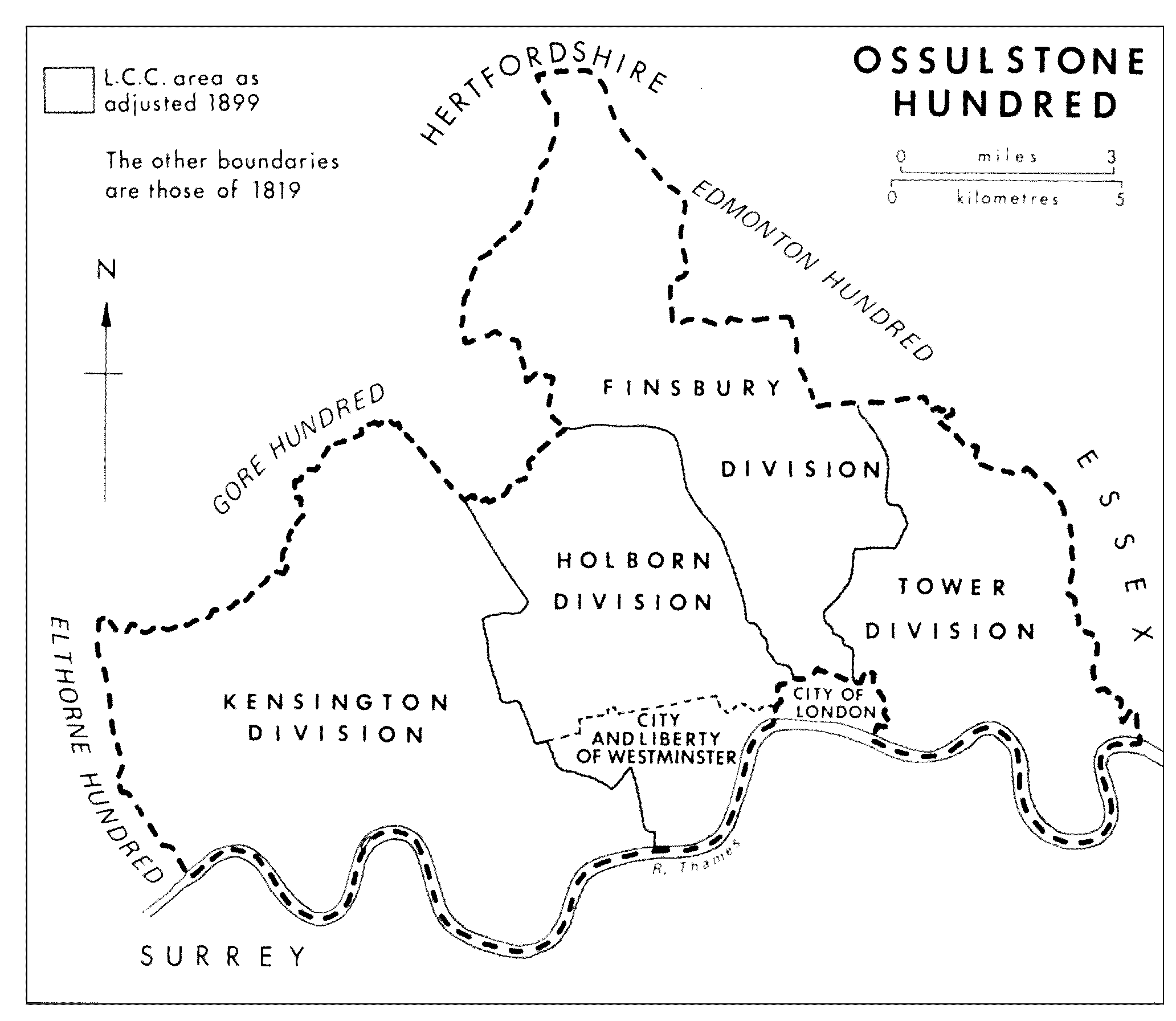
OSSULSTONE HUNDRED
Hundredal Maps.
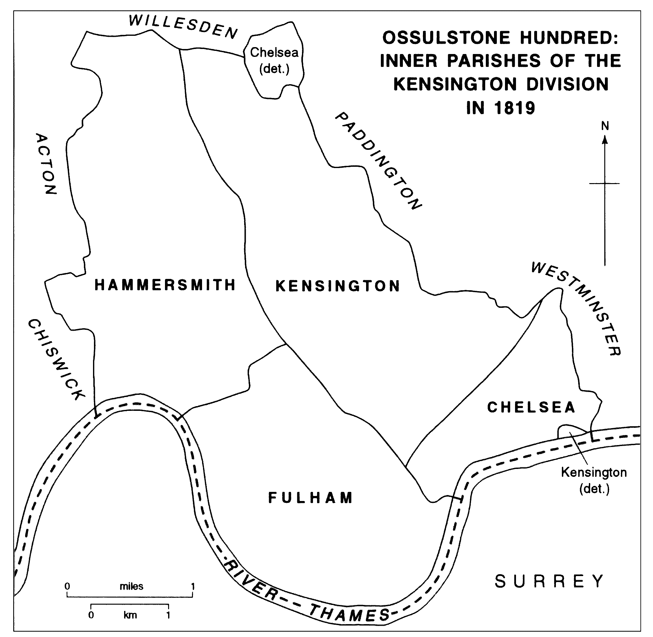
OSSULSTONE HUNDRED: INNER PARISHES OF THE KENSINGTON DIVISION IN 1819