A History of the County of Wiltshire: Volume 14, Malmesbury Hundred. Originally published by Victoria County History, London, 1991.
This free content was digitised by double rekeying. All rights reserved.
A P Baggs, Jane Freeman, Janet H Stevenson, 'Parishes: Dauntsey', in A History of the County of Wiltshire: Volume 14, Malmesbury Hundred, ed. D A Crowley (London, 1991), British History Online https://www.british-history.ac.uk/vch/wilts/vol14/pp65-75 [accessed 30 April 2025].
A P Baggs, Jane Freeman, Janet H Stevenson, 'Parishes: Dauntsey', in A History of the County of Wiltshire: Volume 14, Malmesbury Hundred. Edited by D A Crowley (London, 1991), British History Online, accessed April 30, 2025, https://www.british-history.ac.uk/vch/wilts/vol14/pp65-75.
A P Baggs, Jane Freeman, Janet H Stevenson. "Parishes: Dauntsey". A History of the County of Wiltshire: Volume 14, Malmesbury Hundred. Ed. D A Crowley (London, 1991), British History Online. Web. 30 April 2025. https://www.british-history.ac.uk/vch/wilts/vol14/pp65-75.
In this section
DAUNTSEY

Dauntsey 1773
Dauntsey is a parish of scattered hamlets and farmsteads in the valley of the Bristol Avon, southeast of Malmesbury, north-east of Chippenham, and west of Wootton Bassett. (fn. 1) The parish makes a rectangle 4 km. by 3 km., with a south-eastern extension. A detached part to the east, 42 a., was transferred to Brinkworth parish in 1884, and another small area was transferred to Brinkworth between 1891 and 1901. Thereafter Dauntsey parish measured 1,318 ha. (3,258 a.). (fn. 2)
The parish developed from an estate called Dauntsey granted to Malmesbury abbey in 850. The boundaries of that estate, recorded in the late 12th century or the early 13th but probably surveyed earlier, coincided with those of all but the northern part of the modern parish. (fn. 3) The lands of Idover and Smithcot in the north were held with Dauntsey manor from the 12th century and the 13th respectively, (fn. 4) and, possibly at those dates, were added to the parish. The south-eastern extension brought into what was otherwise a lowland parish the scarp of the Corallian ridge which crosses north-east Wiltshire, and the detached portion, which is recorded as such only in the 19th century, may have been woodland assigned to the men of Dauntsey when other woodland in the parish was imparked in or before the 16th century. (fn. 5)
The Avon and its tributary Brinkworth brook mark the parish's western and northern boundaries with, respectively, Great Somerford and Brinkworth. Near the church, which is on its east bank, the main stream of the Avon, straightened probably in the 18th century either as a mill stream or for ornament, runs within the parish. West of it the boundary was marked by a smaller stream, perhaps following the original course of the Avon, until 1809 when it was defined on a straight course further west. (fn. 6) The name Dauntsey, in which an element possibly refers to an island or well watered land, is perhaps derived from the low island formed by the two courses of the river. (fn. 7) The south-eastern boundary, with Lyneham, runs along the edge of the Corallian ridge, there called the Banks. Between the Avon and the upland, part of the boundary near the river is straight and part follows a road; the straight part, with Christian Malford, continues a line which divides pairs of parishes further west and was possibly drawn when common land was inclosed. The long eastern boundary with Brinkworth is marked by a road in the south and is irregular in the north.
Dauntsey brook, also a tributary of the Avon, crosses the southern part of the parish. Oxford Clay outcrops throughout the parish, including the south-eastern extension, and is covered by alluvium and other river terrace deposits near the Avon, Brinkworth brook, and Dauntsey brook. (fn. 8) Nearly all the parish is flat; it is crossed by the 61 m. contour and is lowest near the Avon. The land reaches over 122 m. on the Banks.
The clay soils of the parish have long provided pasture, with meadow land beside the Avon and other streams. There has always been more grassland than arable in the parish. (fn. 9) In the 1 ith century Dauntsey, like neighbouring parishes, included large areas of woodland. (fn. 10) A park in the south-east, first recorded in the 16th century, (fn. 11) was described in the mid 17th as having admirable oaks. (fn. 12) By the late 18th century it had become farmland (fn. 13) and most of the woodland in the parish had been cleared. (fn. 14) Between 1846 and 1885 c. 300 a. in the north-west around Dauntsey House became parkland and a lake was made west of the house and the main stream of the Avon. (fn. 15) Small areas of woodland were planted in the north in the 20th century. (fn. 16)
In the late 18th century, as presumably earlier, a road on an intricate north-east and south-west course through the parish, linking Brinkworth and Christian Malford, was crossed by others running north-west and south-east between Little Somerford and Tockenham and between Great Somerford and Lyneham. Another road to Lyneham left the Christian Malford road at Dauntsey Gate, later Swallett Gate, south-east of which it was the parish boundary. (fn. 17) South-east and south-west of Swallett Gate the roads were turnpiked in 1758 as part of the Swindon—Chippenham road. Although the trust was allowed to lapse, another was created in 1791. (fn. 18) The south-eastern part of the road was diverted to the east to avoid Bradenstoke village and to cross the escarpment on a lower gradient, presumably c. 1791; it was on its new course in 1815. (fn. 19) The older route remained in use as a minor road. The Swindon—Chippenham road through the parish was disturnpiked in 1879. The Little Somerford road west of its junction with the Brinkworth road and the Brinkworth road between that junction and Swallett Gate were turnpiked in 1809 with others leading east and south-east from Malmesbury. They were disturnpiked in 1876. (fn. 20) The south-east part of the Great Somerford to Lyneham road was called Sodom in 1884 and later Sodom Lane. In the later 20th century the northwest part of the road was called Church Lane, and the Tockenham road was called Olivemead Lane. (fn. 21) In the late 18th century lanes led to Grittenham in Brinkworth from Olivemead Lane and Sodom Lane. (fn. 22) From the mid 20th the east end of Sodom Lane, part of Olivemead Lane, and the lane from Olivemead Lane to Grittenham were used as farm roads. (fn. 23) An avenue running southeast from the gateway of Dauntsey House to Swallett Gate, partly along Church Lane, was planted in the mid 19th century. (fn. 24) In the later 20th it was called Mile Drive and was used as a public bridleway. Part of the London and south Wales motorway runs north-east and south-west across the parish and was opened in 1971. (fn. 25)
The Wilts. & Berks, canal was built east—west across the southern part of the parish and was opened c. 1801. A wharf was built near the parish's south-western boundary soon afterwards. The canal was closed in 1914; (fn. 26) by 1986 it had been drained but its course through the parish remained visible. The G.W.R. London—Bristol line which, in Dauntsey parish, ran parallel to and 200 m. north of the canal was opened in 1841. (fn. 27) Dauntsey station, near the parish boundary in Christian Malford, was opened for passenger traffic in 1868 and for goods traffic soon afterwards. (fn. 28) A branch line from the station to Malmesbury through the southwest part of the parish was open between 1877 and 1933. (fn. 29) Dauntsey station was closed in 1965. (fn. 30)
Taxation assessments of the 14th century and the 16th show Dauntsey to have been one of the wealthiest parishes of Malmesbury hundred. (fn. 31) In 1377 there were 111 poll-tax payers, a little above average for a rural parish of the hundred. (fn. 32) The population was 357 in 1801 but had fallen to 305 by 1811. Thereafter numbers rose until 1851, when the population was 623. In the late 19th century and the early 20th they fell; 357 people lived in the parish in 1921. Between 1951 and 1961 the population grew, presumably as a result of additional housing built in the 1950s. (fn. 33) In 1981 it was 456. (fn. 34)
Settlement in the parish has long been in scattered hamlets and farmsteads, several of which lie beside the Brinkworth to Christian Malford road. Few surviving buildings are older than the 18th century, and most of the older houses and farmsteads are of local brick.
The oldest settlement is presumably that where Church Lane crosses the Avon comprising the church, Dauntsey House, which is of 14th-century origin, (fn. 35) the former rectory house, and a house of the later 20th century. In the late 18th century the hamlet bore the name Dauntsey. (fn. 36) Glebe Farm, 200 m. south-east of the church, is on a site in use in the early 19th century; (fn. 37) a new farmhouse was built in the 1960s. Idover House, a little further east, was built between 1773 and 1820 (fn. 38) and much extended in the early 20th century. (fn. 39)
The name Dauntsey was sometimes used in the 20th century of the settlement more usually called Dauntsey Green in the late 19th century and the 20th. About 1770 it consisted of two hamlets, Dauntsey Green, around the staggered junction of the road from Brinkworth to Christian Malford with the road from Little Somerford to Tockenham, and Dauntsey Common. At Dauntsey Green there were then two or three farmsteads or cottages. Little Smithcot Farm, at the northern junction of the two roads, was apparently built soon afterwards. The buildings of Dauntsey Common were around a square formed by the roads from Brinkworth to Christian Malford and from Great Somerford to Lyneham. (fn. 40) The east side of the square became part of Sodom Lane and the road across the south side was later called Greenman's Lane. (fn. 41) The c. 12 buildings in 1773 included a school and almshouse and, presumably, small farmsteads and cottages: most were on the north and south sides of the square. (fn. 42) Of those which survive, Evergreen Farm at the south-east corner dates from the early 18th century and Great Dairy Farm on the south side from that or an earlier date. In the 19th century building increased along the northern side and spread north to Dauntsey Green, forming a village street later known as the Green. (fn. 43) The new buildings included a new school and almshouse (fn. 44) and four pairs of estate cottages. Great Middle Green Farm, on the street, and White House Farm, east of the street on Olivemead Lane, both survive from the mid 18th century or earlier. Other estate cottages, a nonconformist chapel, and a house were built beside Greenman's Lane in the 19th century. In 1932 four pairs of council houses were built east of the school, (fn. 45) and houses and bungalows were built on both sides of the Green in the later 20th century. When the motorway was built between and roughly parallel to the Green and Greenman's Lane, the course of the road from Brinkworth to Christian Malford was moved slightly east and a bridge was built to carry it over the motorway. Sodom Lane was blocked, and that part of it north of the motorway was renamed Old Sodom Lane. Greenman's Lane was closed and a new road, called Sodom Lane, was made north of it linking the Lyneham and Brinkworth roads. The name Greenman's Lane was retained for the group of buildings which stood at the western end of the closed lane. (fn. 46)
Buildings, probably including several farmsteads, were scattered beside the Christian Malford road south of Greenman's Lane in the late 18th century. Good Monday's Farm, west of the road, is a brick house of early 18th-century origin, and a timber-framed cottage east of the road is of similar date. At the road's junction with the southern road to Lyneham, Dauntsey Gate was a small settlement in 1773. (fn. 47) It had been renamed Swallett Gate by the late 19th century when part of the hamlet was in Christian Malford parish. Several additional houses were built beside the Christian Malford road and in Dauntsey parish in the 19th century. (fn. 48) In 1938 two pairs of council houses, called St. John's, were built east of the road, (fn. 49) and in the 1950s an estate of 22 council houses, called St. James's, was built west of it. St. John's Farm, east of the junction with the Lyneham road, was rebuilt in 1976 (fn. 50) on a site which was in use in the late 18th century. (fn. 51)
By 1820 the Peterborough Arms had been built a little south of the bridge which carried the Swindon—Chippenham road over the canal. (fn. 52) In the later 19th century, probably after the opening of Dauntsey station, houses and farm and industrial buildings were erected nearby; about half lay in Christian Malford parish. The hamlet was known as Dauntsey Lock presumably from the opening of the canal and certainly from 1884. (fn. 53)
A group of small farmsteads built south-east of Dauntsey Common in the late 18th century or the early 19th (fn. 54) was called Sodom in 1884. (fn. 55) Bungalows, houses, and, at the south end of the hamlet, a new farmstead were added in the late 20th century.
Outside the hamlets there were six or seven farmsteads in the parish in the later 18th century. (fn. 56) Most occupied sites which had possibly long been in use. Great Smithcot Farm may have been part of a larger settlement, perhaps nucleated around a chapel recorded at Smithcot in 1327 and 1474. In 1086 the estate called Smithcot included almost half the cultivated land of the later parish, (fn. 57) and the III poll-tax payers in 1377 included 21 of Smithcot. (fn. 58) Great Smithcot farmhouse consists of two parts, both of red brick with stone quoins. The older, probably of the later 17th century, is of two low storeys and attics. It has a symmetrical east entrance front of five bays and a short west service wing. The main doorway has been moved north by one bay. All the windows of the east front have moulded stone mullions. The south-west corner of the older building adjoins a taller twostoreyed block with a symmetrical west entrance front of five bays. The doorway has a broken segmental pediment and the windows have stone heads with decorative keystones. Moulded oak frames are visible where windows on the gables have been blocked, but the windows of the main front have sashes of the later 18th century. Within, the staircase, fireplaces, and three panelled rooms are of the early 18th century.
The 21 poll-tax payers recorded as of Smithcot in 1377 may have included occupants of other farmsteads in the northern part of the parish, among them those on the land called Idover. There were probably never more than one or two farmsteads on the Idover lands; in 1986 Idover Demesne Farm and Home Idover Farm survived as buildings of 18th-century or earlier origin. The site of Park Farm, on the escarpment in the southeast, may first have been used for a farmstead in the mid 16th century. (fn. 59) Crew's Farm in the northeast is of 18th-century or earlier origin, and Union Farm beside Church Lane and Waite Hill Farm on the escarpment may have been rebuilt in the late 18th or early 19th century: all three were standing in 1773. (fn. 60) Olivemead Farm near the eastern boundary was built in the mid 19th century; (fn. 61) extensive farm buildings were added in the later 20th.
Manors and other Estates.
In 850 King Ethelwulf granted to Malmesbury abbey 10 mansiones in Dauntsey. (fn. 62) The lands became DAUNTSEYmanor, of which the abbey remained overlord until the Dissolution. (fn. 63)
In 1066 Alward held Dauntsey of Malmesbury abbey, apparently by lease. By 1086 the abbey had granted it as a knight's fee to Robert. (fn. 64) It apparently passed to Miles of Dauntsey, who was succeeded in turn by his son Miles and Miles's son Miles; (fn. 65) one of that name held the manor in the late 12th century. (fn. 66) In 1242–3 it was held by the youngest Miles's son Roger Dauntsey. It passed to Roger's brother Gilbert, (fn. 67) on whom it was settled for life in 1257 with remainder for life to a third brother Richard. (fn. 68) By 1275 it had passed to Richard's heir, (fn. 69) presumably his son Richard (fl. 1292). (fn. 70) Sir Richard Dauntsey, possibly the younger Richard's son, held the manor in 1331 (fn. 71) and was succeeded after 1349 (fn. 72) by his grandson Sir John Dauntsey (d. 1391). The manor passed in turn to Sir John's son Sir John (fn. 73) (d. 1405) and to that Sir John's son Sir Walter (fn. 74) (d. 1420). Sir Walter was succeeded by his sister Joan, wife of Sir John Stradling (fn. 75) (d. 1433), (fn. 76) later wife of John Dewale. From Joan (d. 1457) the manor passed in turn to her son Edmund Stradling (fn. 77) (d. 1461), Edmund's son John (fn. 78) (d. 1471), and John's posthumous son Edward (fn. 79) (d. 1487). Edward was succeeded by his sister Anne, wife of Sir John Danvers (fn. 80) (d. 1514). (fn. 81) From Anne (d. 1539) the manor passed to her grandson Silvester Danvers (fn. 82) (d. 1551) and to his son Sir John. (fn. 83) On Sir John's death in 1594 it was retained for her life by his relict Elizabeth, (fn. 84) who married Sir Edward Carey and died in 1630. (fn. 85) It passed in turn to her sons Henry Danvers, earl of Danby (d. 1644), (fn. 86) and Sir John Danvers, a regicide. Sir John (d. 1655) was succeeded by his son John, a minor. (fn. 87)
Dauntsey manor was among estates formerly Sir John Danvers's which were confiscated after the Restoration. In 1662 it was granted to James, duke of York, (fn. 88) and in 1685 he, as James II, settled it on Mary his queen. (fn. 89) The manor was resumed by the Crown in 1690, (fn. 90) and in 1691 was granted to Charles Mordaunt, earl of Monmouth, (fn. 91) who in 1697 became earl of Peterborough. Charles (d. 1735) was succeeded by his grandson Charles Mordaunt, earl of Peterborough and of Monmouth (d. 1779), and by the younger Charles's son Charles, earl of Peterborough and of Monmouth (d. 1814), (fn. 92) who devised his estates to his niece Jane Bisset, later wife of the Ven. Maurice Fenwick. Jane (d. 1866) (fn. 93) had by 1840 conveyed Dauntsey manor to her son Mordaunt Fenwick, (fn. 94) who sold it in 1853 to C. W. Miles. In 1877 C. W. Miles and E. P. W. Miles sold it to Sir Henry Meux, Bt. (fn. 95) (d. 1883). Sir Henry was succeeded by his son Sir Henry (d. 1900) whose relict Valerie (d. 1910) (fn. 96) devised the manor to Ferdinand MarshamTownshend. (fn. 97) He sold the estate, which then comprised c. 3,000 a. in Dauntsey parish, in lots in 1913 and 1914. (fn. 98)
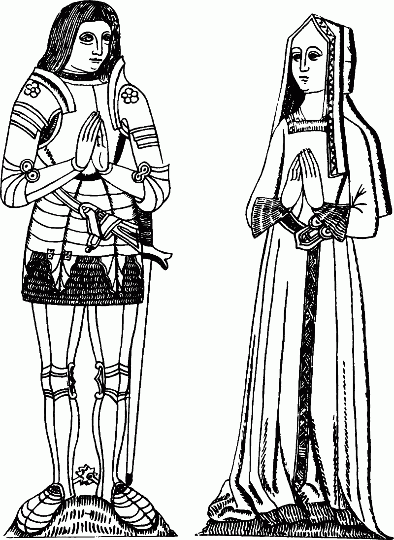
Brass of Sir John Danvers and his wife Anne
Dauntsey House (fn. 99) was probably built for members of the Dauntsey family (fn. 100) and a tradition survives that their successors the Stradlings lived in it. (fn. 101) In 1344 a licence was granted to Roger Dauntsey for an oratory in Dauntsey manor. (fn. 102) The house was lived in by members of the Danvers family, although not always by lords of the manor, in the 16th century and the early 17th, (fn. 103) by Charles, earl of Peterborough and of Monmouth (d. 1814), (fn. 104) and by Sir Henry Meux (d. 1900) and his relict Valerie. (fn. 105) The oldest part of the house is an earlier 14th-century hall range running north and south, with a raised base cruck roof of three bays on rubble walls. In the early 17th century, and probably earlier, there was a chimney stack against the west wall and a stone-walled cross wing at the southern end. The plan of hall and cross wing was retained in the mid and later 18th century when the house was enlarged and faced with ashlar. The house was extended westwards, possibly by a distance equal to the length of an earlier west porch. The hall, into which a first floor had by then been inserted, was redecorated and the interior of the cross wing was reconstructed to provide a large drawing room. Early in the 19th century a stair hall, with a kitchen wing east of it, was built north of the hall, perhaps on the site of the medieval service rooms. More service rooms were built to the north, possibly in the late 19th century; a library built above them was removed in the mid 20th. (fn. 106) The house is approached through an arched gateway of late 18th-century style. North-east of the house is an extensive brick stable court, and west of it is a terrace, below which the Avon flows in a straight course probably made in the 18th century. The 19th-century lake is west of the house, most of the park to the north and east.
Dauntsey House and 365 a. were bought in 1913 by E. R. S. Richardson, (fn. 107) and sold in 1918 by G. S. Guiness to E. H. Brassey (d. 1946). The estate passed to Brassey's son Sir Hugh, who sold it in 1948 to Marigold Denison, countess of Londesborough. It was bought in 1952 by Peter Sturgis, who sold some of the land and bought other holdings in the parish. On his death in 1985 the estate passed to Mr. Julian Sturgis, who in 1987 held Dauntsey House and c. 300 a. in Dauntsey. (fn. 108)
Union farm, 160 a., was bought in 1913 by Ann Spooner. (fn. 109) After her death it was bought in 1919 by Wiltshire county council. (fn. 110) Great Middle Green farm, 179 a., was bought by W. J. Matthews in 1913. (fn. 111) It later belonged to E. F. Potter, (fn. 112) to John Downes, (fn. 113) and to G. F. Ashman who in 1931 sold it to the county council. The council also bought 88 a. of Crew's farm in 1914, and in 1986 it owned c. 370 a. in Dauntsey parish. (fn. 114)
A further c. 12 farms, the largest of which was c. 180 a., were sold in 1913–14: (fn. 115) since then they have generally descended separately although from 1942 to 1970 the London Brick Co. owned St. John's farm, Great Dairy farm, Scots Smith farm, and part of Good Monday's farm. (fn. 116) In the 1980s there were again c. 10 separately owned farms. (fn. 117)
SMITHCOT was held by Sawin in 1066, by Humphrey Lisle in 1086. (fn. 118) Overlordship of Smithcot manor presumably passed to Humphrey's daughter Adelize, wife of Reynold de Dunstanville, (fn. 119) and became part of the Dunstanvilles' barony of Castle Combe; Giles de Badlesmere, Lord Badlesmere (d. 1338), held the overlordship as part of that barony, and at the partition of his estates after his death it was allotted to his sister Maud and her husband John de Vere, earl of Oxford. (fn. 120) John (d. 1360) was succeeded by his son Thomas, earl of Oxford, (fn. 121) who was overlord of Smithcot at his death in 1371. (fn. 122) In 1412 Millicent, wife of Sir John Fastolf, and heir of the portion of the Badlesmere estates which included Castle Combe barony, was said to be overlord, and Smithcot was still part of the barony in 1573. (fn. 123)
In 1086 Elbert held Smithcot of Humphrey Lisle. (fn. 124) In 1242–3 the manor was held by Roger Dauntsey. (fn. 125) Thereafter it passed with Dauntsey manor to Anne (d. 1539), relict of Sir John Danvers; in 1536 she conveyed the reversion of Smithcot manor to her son William Danvers, on condition that her grandson Silvester Danvers might acquire it by exchange when he came of age in 1540. (fn. 126) Silvester held the manor at his death in 1551 (fn. 127) and thereafter it again passed with Dauntsey manor. Great Smithcot farm, 195 a. in 1913, (fn. 128) belonged in 1927 to G. A. Potter (fn. 129) (d. 1941). He was succeeded by his son Mr. R. J. Potter, who with his sons Mr. M. J. Potter and Mr. J. R. Potter owned the farm in 1986. (fn. 130) Little Smithcot farm, 183 a. in 1913, (fn. 131) belonged to W. J. Rose in 1924 (fn. 132) and to Mr. Derek Rose in 1986. (fn. 133)
IDOVER was held in 1166 and 1242–3 of the honor of Wallingford (Berks., later Oxon.). In 1242–3 Miles Niernut was mesne lord. Miles Dauntsey, lord of Dauntsey manor, held Idover in 1166; (fn. 134) thereafter its lands passed with that manor. Idover was mentioned as a separate estate in the early 14th century, (fn. 135) but was afterwards absorbed by Dauntsey manor.
A rent of 3s. from Dauntsey was given to Amesbury priory in a charter confirmed in 1179. (fn. 136) No later reference to the rent has been found.
Economic History.
In 1086 Robert's Dauntsey estate included land for 6 ploughteams. On the demesne were 2 teams and 2 servi; 10 villani, 11 coscets, and 3 cottars had 4 teams. Smithcot included a higher proportion of demesne. Although there was land for only 4 teams, there were 3 teams and 2 servi on the demesne, which was assessed at 2½ hides, and 3 villani, 4 bordars, and 1 coscet shared 2 teams. There were 12 a. of meadow and woodland ½ league square at Dauntsey, and 20 a. of meadow and woodland 4 furlongs long and 1 furlong broad at Smithcot. (fn. 137)
In the Middle Ages open fields and common pastures were presumably shared by the lords and tenants of the Dauntsey, Smithcot, and Idover estates. In the 13th century or earlier, however, much meadow land beside Brinkworth brook and the Avon was exclusive to Dauntsey manor. (fn. 138) Almost certainly a high proportion of the parish was pasture in the Middle Ages. In the mid 16th century only c. 550 a. were arable; the names of West and Hill fields are recorded. There were 800 a. or more of several pasture including the park in the parish's south-east corner and the pastures called Great Idover and Little Idover beside Brinkworth brook and the Avon. The remainder of the parish, about half of it, was common pasture. (fn. 139) The pastures were presumably used then, as later, for dairying and for fattening cattle. (fn. 140)
All the farms in the parish in the mid 16th century consisted of demesne or customary land of Dauntsey and Smithcot manors or of the rector's glebe, and presumably all included rights to feed animals on the common pastures. The demesne lands of the two manors were not then distinguished. The combined demesne included c. 500 a. with rights of common pasture c. 1550. In hand there were 280 a., of which 60 a. were arable in the open fields and the remainder lay in closes. Another 200 a. or more of inclosed demesne pasture were leased in five portions. (fn. 141)
Copyholds of the two manors were still distinct c. 1550. A total of 800 a., 370 a. in the open fields and 430 a. in closes of meadow and pasture, was held by 43 copyholders of Dauntsey manor. Most holdings were of fewer than 20 a.; the largest was of 65 a. Only 25 copyholders had arable. The four copyholders of Smithcot manor held a total of 140 a., mostly arable. (fn. 142)
The open fields were inclosed apparently in the mid 17th century. (fn. 143) Inclosure of common pastures may have been in progress during the 17th century and the early 18th; most of what remained of Dauntsey common was inclosed in the 1760s. (fn. 144) In 1773 vestiges of the common survived as wide verges to the lanes in the centre of the parish. (fn. 145) In 1846 there were 46 a. of common; (fn. 146) the verges remained but were apparently not grazed in 1986. By the mid 18th century much arable had been converted to pasture. A visitor c. 1740 reported that the whole parish was used for grazing, (fn. 147) and in 1846 only 130 a. were arable. (fn. 148) Cattle fattened at Dauntsey had a high reputation in the mid 17th century, (fn. 149) and in the early 18th Dauntsey cheese was said to rival that from Cheddar (Som.). (fn. 150)
In the late 18th century there were between 20 and 25 farms in the parish. Most were worked from farmsteads at Dauntsey Green, beside Church Lane, and scattered in the north and east parts of the parish. (fn. 151) In 1846 there were 18 farms, of which three, all derived from demesne lands, were of more than 250 a. Park farm comprised 350 a., Great Idover farm and Little Idover farm 270 a. each. Most other farms measured between 100 a. and 200 a. (fn. 152)
The farms had changed little in size or number by the early 20th century. (fn. 153) From the 1920s, however, farms belonging to Wiltshire county council were broken up into small holdings. By 1941 the lands of Crew's, Great Middle Green, and Union farms had been divided into seven holdings, each of c. 50 a. (fn. 154) In 1987 there were five holdings, each of between 50 a. and 100 a. (fn. 155)
Most farms retained dairy herds in the late 19th century and the 20th, and from the 1870s beef cattle were reared. Between 1870 and 1940 there were usually between 800 and 950 cattle in the parish, of which over half were for milk. Numbers rose thereafter; over 1,800 cattle were kept in 1966. Sheep were also kept until c. 1950; the size of the adult flock fluctuated between 100 and 350. The area of arable in the parish declined from 343 a. in 1866 to 33 a. in 1936. More land was ploughed in the 1940s, and in 1966 there were again over 300 a. of arable. (fn. 156) In 1986 St. John's and Good Monday's farms were partly and Dauntsey House farm was chiefly arable, growing cereal and fodder crops. (fn. 157)
A mill at Dauntsey and another at Smithcot were recorded in 1086. (fn. 158) A mill in the parish in 1487 and c. 1550 (fn. 159) was presumably Smith's Mill, on the Avon north-west of Dauntsey House, which had been demolished by 1773. (fn. 160)
In 1831, of 99 families in the parish, only 9 derived their income principally from a trade or craft. (fn. 161) From the early 19th century coal was brought to the parish by canal and unloaded at Dauntsey wharf. (fn. 162) In the late 19th century and early 20th there were usually two or three coal merchants. (fn. 163) Probably from the opening of the station for goods traffic c. 1870 (fn. 164) and certainly after the closure of the canal in 1914 (fn. 165) coal was brought to Dauntsey by train.
Clay for bricks may have been dug from a field east of the church in or before the late 17th century. (fn. 166) In the 1880s there were brickworks north and south of the railway line east of Dauntsey station. Those north of the line were disused in 1899 as were those south of it in 1922. (fn. 167)
A milk depot had been built north of Dauntsey station by 1884. (fn. 168) In 1896–7 the Dauntsey Dairy Co. became part of Wilts. United Dairies, which supplied liquid milk to London. (fn. 169) The depot was closed probably in or soon after 1965 when the station was closed; in 1986 its site was used by several small businesses. (fn. 170)
Local Government.
Dauntsey and Smithcot were assessed separately for taxation from the 14th century to the 16th (fn. 171) and may have been separate tithings, but the two were not distinguished after the 16th century.
Records of spring and autumn courts of Dauntsey manor, at which customary tenants were admitted, survive for 1646–8. (fn. 172)
In 1727–8 the overseers of the poor in Dauntsey parish spent £18 and gave monthly relief to five people. Those regularly relieved each received between 4s. and 12s. a month and occasional payments for rents. Other payments were for medical and funeral expenses; for a funeral in 1730 the overseers spent 10s. on the coffin, 3s. on ringing the bell, and 11s. 1½d. on ale, bread, cheese, tobacco, and pipes. By 1747–8 total expenditure had risen to £85 and the number regularly relieved to 10. (fn. 173) The custom of providing refreshments at funerals had lapsed by the 1760s, and the purchase of clothing and coal then accounted for a greater proportion of expenditure than before. In 1767–8 the overseers spent £226 and gave regular relief to 22 people. (fn. 174) The cost of poor relief continued to rise until the early 19th century; £398 was spent and 40 adults received regular relief in 1802–3. Rates in Dauntsey were, however, then lower than in most parishes of Malmesbury hundred. (fn. 175) From 1812 until the late 1820s both the cost of relief and, presumably, the number of the poor fell, with some fluctuations. (fn. 176) In the early 1820s poor relief paid to some labourers was replaced by leases of a few acres each at low rents from the farmers of Dauntsey. (fn. 177) In 1828 only £196 was spent on poor relief, by 1832 the sum had risen to £347, (fn. 178) and between 1833 and 1835 average annual expenditure on the poor was £257. Dauntsey became part of Malmesbury poor-law union in 1835 (fn. 179) and of North Wiltshire district in 1974. (fn. 180)
Church.
The church at Dauntsey was claimed by Malmesbury abbey c. 1177. Since the abbey had already granted its Dauntsey estate in fee by 1086 and since the demesne of Dauntsey manor was later tithe free, it is possible that Dauntsey church was built before the Conquest and belonged to the abbey, and that the lord of the manor intruded the clerk against whom the abbey claimed the church c. 1177. (fn. 181) Then or later, certainly before 1263, the abbey gave up its claim to the church: the benefice became a rectory in the gift of the lord of the manor. (fn. 182) In 1961 the living was united with Brinkworth rectory. (fn. 183)
Richard Dauntsey was patron in 1304, (fn. 184) and lords of Dauntsey manor, or their trustees or executors, presented at most vacancies until the early 19th century. (fn. 185) Rectors were presented by the king in 1405 and 1407, (fn. 186) for what reason is not known, and in 1465 William Lygon and his wife Elizabeth, formerly wife of Edmund Stradling, presented by a grant from Edmund's trustees. (fn. 187) In 1611 the king was patron by lapse, as was the bishop of Salisbury in 1757. Presentations were made by Robert Welborne in 1712 and by Henry St. John, Viscount Bolingbroke, in 1713, each by a grant of a turn. (fn. 188) After 1831 the advowson was apparently sold by trustees of Charles, earl of Peterborough and of Monmouth (d. 1814). In 1859 it was held by W. E. Elwell, (fn. 189) rector of Dauntsey 1859–75; after his death in 1880 (fn. 190) it passed to his relict (d. by 1903). (fn. 191) In 1912 William, Eleanor, and Muriel Elwell conveyed it to Arthur Law, (fn. 192) rector of Dauntsey 1875–1915. (fn. 193) Law (d. 1923) devised the advowson to A. R. Law, rector of Dauntsey 1915–24, and E. C. Elwell. (fn. 194) They conveyed it in 1925 to the bishop of Bristol. (fn. 195) The bishop was patron of the united benefice from 1961. (fn. 196)
Dauntsey rectory was one of the richer livings in Malmesbury deanery in 1291, when it was assessed at £13 6s. (fn. 197) Its assessment was unchanged in 1535; if the figure was correct, its value was then about the average for the deanery. (fn. 198) Between 1829 and 1831 the rector received c. £350 yearly, an income close to the average for a Wiltshire living. (fn. 199)
In the late 17th century, as presumably earlier, tithes from the whole parish except the demesne of Dauntsey manor were due to the rector. (fn. 200) In 1846 1,197 a. were tithe free. The rectorial tithes were then valued at £400 and commuted. (fn. 201) By the late 13th century the rectors had also become entitled to tithes from land owned by members of the Dauntsey family in Wilsford in Swanborough hundred: those tithes were valued at £2 13s. 4d. in 1291. (fn. 202) They arose from 103 a. in Wilsford, from 114 a. after inclosure in 1808. (fn. 203) In 1843 they were valued at £52 and commuted. (fn. 204)
The rector had 40 a. of glebe in 1671 (fn. 205) and 45 a. in 1887. (fn. 206) From 1698 to 1783 or longer the rector was also entitled to hay cut from a meadow in Great Somerford. (fn. 207) Most of the glebe was sold in 1919. (fn. 208) A rectory house standing in 1698 was probably that described in 1783 as ancient. (fn. 209) A new house of red brick, with its principal, northern front in Tudor style faced in ashlar, was built between 1829 and 1833 from designs by W. Strong. In 1869 it was extended and a new stable court and a high boundary wall were built. The house was sold c. 1957. (fn. 210)
A chapel at Smithcot in 1327 (fn. 211) was called St. Anne's in 1347 and later. Between 1347 and 1387 lords of Smithcot manor presented chaplains. In 1390 and 1442 the bishop of Salisbury was patron by lapse. (fn. 212) No chaplain is recorded after 1442 and no reference to the chapel after 1474. (fn. 213) A chapel of Dauntsey church at 'West End' was referred to in 1763. (fn. 214) No such chapel or location is known, and the reference was possibly to the schoolroom later used for prayers. (fn. 215)
In 1304 Peter of Coleshill, rector of Dauntsey, was licensed to study at Oxford for three years and a curate was appointed to serve the parish. (fn. 216) In 1477 the rector, John Jones, received a dispensation to hold another benefice with Dauntsey in plurality. (fn. 217) Robert Davenant, rector 1663–74, was also a canon of Salisbury and had been sequestrated from West Kington rectory by 1654. (fn. 218) Joseph Trapp, a high church pamphleteer and the first professor of poetry at Oxford, held Dauntsey rectory from 1714 to 1722. (fn. 219) In 1783 a service was held at Dauntsey on Sundays alternately in the morning and the evening. Prayers were said twice daily in the school at Dauntsey Green and some additional weekday services were held in the church. Communion was celebrated at Christmas, Easter, and Whitsun. (fn. 220) On Census Sunday in 1851 the congregation at morning service numbered 146. (fn. 221)
The church of ST. JAMES, so called in 1763, (fn. 222) is mostly of rubble, in places rendered, with ashlar dressings. It has a chancel with a north chapel, an aisled nave with north and south porches, and a west tower. The nave was apparently built or rebuilt in the 12th century, and the aisles were apparently added in the 14th: the arcades, the porches, and the east window of the south aisle appear to be 14th-century. The 12th-century north and south doorways were reset in the walls of the aisles. The chancel, which is not divided from the nave, was enlarged and refenestrated in the 15th century and the early 16th. In the period 1630–2 the church was 'repaired and enlarged' for Henry, earl of Danby (d. 1644), (fn. 223) apparently in a debased 14th-century style. The chapel may have been built for Danby, whose tomb chest is in it, but is dated 1656: (fn. 224) its east window is in a style similar to that of the east window of the south aisle. The north and south windows of the aisles, which have cusped ogee lights with blank spandrels within a square frame, resemble the chapel's north windows: it is likely that the aisles are 14th-century and that they were refenestrated for Danby, but possible that they were built anew or rebuilt in the early or mid 17th century. The tower, in a plain Gothic style, was also built 1630–2. (fn. 225) Many 17th-century fittings survive, including the rood screen which incorporates some later 14th-century tracery, most of the pews in the nave, and, in the chancel, stalls which incorporate 15th-century bench ends. The church was restored in 1879, (fn. 226) in 1906 when the roofs of the nave and aisles were renewed, (fn. 227) and in 1932. (fn. 228) The tympanum of a rood screen of c. 1500, found in the mid 19th century, (fn. 229) remains in the church. Tomb chests commemorate Sir John Danvers (d. 1514), Anne Danvers (d. 1539), and Henry, earl of Danby; a tablet in the floor of the chancel commemorates Charles, earl of Peterborough and of Monmouth (d. 1814).
A chalice given in 1420 (fn. 230) was perhaps that of 12 oz. retained by the parish in 1553 when 2 oz. of plate were taken for the king. (fn. 231) The parish had two chalices and two patens in 1783. (fn. 232) They were replaced, probably in 1823, by a chalice and a paten (fn. 233) which were still held, with another chalice and paten, by the parish in 1986. (fn. 234)
Three bells hung in the church in 1553. Of five bells there in 1783 two were of 1632, probably by Nathaniel Boulter, and one was of 1673. The other two were replaced or recast in 1848 by C. & G. Mears. One of the 1848 bells was recast in 1926 by Mears & Stainbank. (fn. 235) The three 17th-century bells and those of 1848 and 1926 hung in the church in 1986. (fn. 236)
There are registers of baptisms, marriages, and burials from 1653. (fn. 237)
Nonconformity.
In the late 17th century and early 18th several Quaker families lived in the parish. (fn. 238)
In 1783 there were said to be several Methodists. (fn. 239) A house was certified in 1827 for meetings of Wesleyan Methodists, and others in 1828 and 1839 for Primitive Methodists. (fn. 240)
Houses were certified for Independents in 1798, 1816, and 1817; (fn. 241) the meetings were addressed sometimes by Independent and sometimes by Baptist preachers. (fn. 242) An Independent chapel at Dauntsev Common, built in 1824 or 1825, was attended by 22 people on the morning of Census Sunday in 1851 and by 34 in the afternoon. (fn. 243) In 1863 a Strict Baptist church was founded. Thereafter the Baptists used the chapel, which was rebuilt as the Providence chapel, a small brick building, in 1875. It was closed in the 1960s (fn. 244) but was again in use in 1986. (fn. 245)
Education.
By will proved 1645 Henry, earl of Danby, gave land in Dauntsey for a school and almshouse. The almshouse was to occupy the ground floor of the building, the schoolroom and accommodation for the schoolmaster the first floor. Lord Danby also gave land in Market Lavington to maintain the building and to pay the schoolmaster £16 a year. The master was to conform to the established church and to teach boys to read, write, and cipher, and girls to read. The building may have been standing in 1667, when disputes over the endowment were resolved by an agreement that a total of £50 a year should be paid to the school and almshouse. (fn. 246) Both were open in 1673. (fn. 247)
In 1818 Earl Danby's school had c. 40 pupils; (fn. 248) in 1833 numbers varied between 20 and 50 according to the demand for labour. (fn. 249) The building, timber-framed and with a bellcot, was in 1858 in poor repair and unsuitable for use as a school; (fn. 250) it was replaced between 1864 and 1866 by another on a neighbouring site. The new brick building comprised a teacher's house of two storeys from which single-storeyed wings extended east and west; the west wing was occupied by the school. (fn. 251) In the late 19th century the school usually had 60–70 pupils and two teachers. (fn. 252) Average attendance had fallen from 60 in 1909–10 to 39 by 1918–19 but was higher in the 1920s and 1930s. (fn. 253) In 1986 the school had 27 pupils on roll. (fn. 254)
The school received little or no income from Lord Danby's endowment from 1865 until 1905, when the Charity Commissioners ordered that part of the endowment should again be used for education. (fn. 255) A Scheme of 1981 required the income, then between £25 and £50, to be spent on benefits for the school not normally provided by the local education authority. (fn. 256)
A school in the parish, attended in 1833 by 40 girls, (fn. 257) was open in 1846. (fn. 258) It or another school was in 1858 attended by 20–30 children. (fn. 259) The school was open in 1865 but closed soon afterwards. (fn. 260)
Charities for the Poor.
There was an almshouse with five or more residents in Dauntsey in 1420. (fn. 261)
By will proved 1645 Henry, earl of Danby, gave a site in Dauntsey and income, £50 a year from 1667, for a school and almshouse. The almshouse was to have six inmates, aged 50 or more, unable to support themselves, and preferably natives or residents of Dauntsey. Each was to receive £5 4s. a year and, if it could be afforded, clothing. The almshouse, like the school, was possibly open in 1667 and certainly was in 1673. (fn. 262) The almshouse occupied the east wing of the new building erected 1864–6. In 1905 there were eight residents, including two married couples; (fn. 263) in 1986 there were six residents. (fn. 264) From 1865 until 1905 most, if not all, of the income from the endowment was paid to the almshouse; (fn. 265) in 1905 the income was £62. Thereafter part of it was again paid to the school. (fn. 266)
Before 1837 Lady Catherine Bisset gave £833 to buy coal for the poor of Dauntsey parish. The income, c. £25 a year, and its use remained the same in the late 19th century and the early 20th. (fn. 267) In the 1960s the income was between £25 and £50 a year. (fn. 268)