A History of the County of Somerset: Volume 5. Originally published by Victoria County History, London, 1985.
This free content was digitised by double rekeying. All rights reserved.
A P Baggs, R J E Bush, M C Siraut, 'Parishes: Kilton', in A History of the County of Somerset: Volume 5, ed. R W Dunning (London, 1985), British History Online https://www.british-history.ac.uk/vch/som/vol5/pp88-96 [accessed 30 April 2025].
A P Baggs, R J E Bush, M C Siraut, 'Parishes: Kilton', in A History of the County of Somerset: Volume 5. Edited by R W Dunning (London, 1985), British History Online, accessed April 30, 2025, https://www.british-history.ac.uk/vch/som/vol5/pp88-96.
A P Baggs, R J E Bush, M C Siraut. "Parishes: Kilton". A History of the County of Somerset: Volume 5. Ed. R W Dunning (London, 1985), British History Online. Web. 30 April 2025. https://www.british-history.ac.uk/vch/som/vol5/pp88-96.
In this section
KILTON
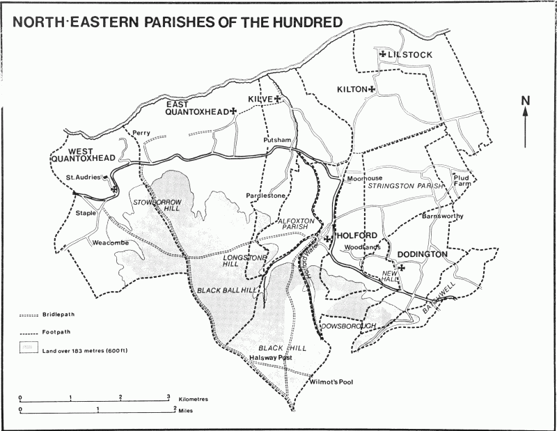
The ancient parish of Kilton took the first element of its name from Kilve Hill. (fn. 1) The main part of the parish lay between Kilve and Lilstock, and was roughly L-shaped, its northern boundary marked by cliffs and a rocky foreshore c. 1 km. in length. From the south-western corner of the L a narrow strip ran south for c. 3 km., first up the gentle incline towards Holford village, and then up the Quantock scarp to common land on Woodlands Hill. Southeast of the main part of the parish, and divided from it by a narrow finger of Stringston parish, was a rectangular area known as Heathfield. (fn. 2) The parish, said to cover 1,691 a. in 1881, was altered for civil purposes in 1886 when the narrow southern strip was transferred to Holford and the detached area to Stringston. The remainder was joined with Lilstock to form an area of 1,689 a. (fn. 3) In 1933 Kilton-cumLilstock and Stringston were united to form the civil parish of Stringston. (fn. 4)
The boundary between Kilton and Lilstock had a regularity suggesting planned division, but was occasionally subject to disputes. (fn. 5) The southern boundary of the main part of the parish followed a former roadway linking Burton in Stogursey with the coast road through Kilve to Dunster. The western boundary with Kilve skirted Kilve Hill and was marked near Kilton Park wood by the bank and ditch of the medieval park, known as Deerleap. The southern strip was largely bounded on the west by a route along the coast from Nether Stowey, and was cut by a further east-west route known as Portway Lane, (fn. 6) which runs from Stogursey to Holford and thence over the Quantocks. The southern tip of the parish, on Woodlands Hill, included Shervage wood, a name perhaps suggesting its position on the boundary. (fn. 7) The regularity of the detached part of the parish at Heathfield was the result of arbitrary division in 1664. (fn. 8)
The main part of the parish lay on undulating ground, mostly on the Lower Lias, the village in the centre south and west of a stream, the church and former green (fn. 9) on rising ground to the north-east. Between the village and the coast the land falls to under 15 m. and then rises to the cliffs. Moorhouse farm and Woodlands occupy much of the narrow southern strip on valley gravel and Keuper Marl rising to over 122 m. Woodlands Hill, reaching to c. 224 m., is on the Hangman Grits of the northern Quantocks. (fn. 10) Around Moorhouse and Woodlands quarrying for stone and chalk left traces in field names, and a marl pit became a carp pond; (fn. 11) in 1495 a limekiln stood in the detached area at Heathfield. (fn. 12)
Kilton village lies on a road which runs from Lilstock and the shore to Holford and the Quantocks. Lanes fan outwards from it to the fields and to the coast road between Stogursey and Dunster. The village itself bears clear signs of shrinkage both at its eastern end, where the church and green stand in virtual isolation, and at its western end where the remains of house platforms were traceable in 1977. There was a farm at Woodlands by 1346 (fn. 13) and one at Moorhouse by 1378. (fn. 14) Plud Farm in the detached part of the parish also has medieval origins, and in the 16th century it was known as the Constable's House and was linked with Nether Stowey castle. (fn. 15) There is some evidence of a house, if not a more extensive settlement, at Shervage in 1402, (fn. 16) of a house at 'West Whittington' in 1589, (fn. 17) and of an isolated cottage at 'Wymellhead' in 1640. (fn. 18)
Open fields lay around Kilton village in the late Middle Ages, but strips were usually located by their furlongs rather than by the fields in which they lay. (fn. 19) Kilton Field and Sessons survived to the late 16th century, (fn. 20) and East and West fields were mentioned in the early 17th. (fn. 21) The two small areas of uninclosed arable that survived on the coast in the mid 19th century, (fn. 22) known since the late 17th century as East and West fields, (fn. 23) may have been created as part of a scheme for consolidation of holdings nearer the village. (fn. 24)
A park, later known as Kilton Park, was formed in the north-west corner of the parish by 1279, (fn. 25) but by the end of the 14th century it was divided into closes and part was ploughed. (fn. 26) It was sold as a single farm in 1710. (fn. 27) An arable field called Corn park in 1379 may have been part of the same park. (fn. 28) Cookeparke or Coxparke, south of Woodlands, may have been a medieval assart from Shervage wood. (fn. 29) Fields called Stone park, south of Moorhouse Farm, were probably so called when the grassland was improved in the 19th century. (fn. 30) Ancient woodland in Kilton Park and at Shervage survived in 1977. (fn. 31) The former measured c. 60 a. in the 17th century and c. 30 a. in the 20th. (fn. 32) Shervage covered c. 30 a. in the 17th century and in 1977 comprised oak standards. (fn. 33)
By the end of the 16th century most of the main farmhouses in the parish were of two storeys, but Woodlands Farm in 1588 had a hall, parlour, kitchen, and shop on the ground floor and only two chambers above. Outbuildings at Woodlands comprised a barn, shippon, milk house, buttery, apple house, wain house, and 'shelf' house. (fn. 34) Part of the late medieval hall remains, but it was probably ceiled by the early 17th century, and an overmantel on the first floor has decorated plasterwork bearing the symbols of the Five Wounds. A parallel north range was later added, and early in the 18th century a five-bayed block at the eastern end of both ranges, with a central staircase rising to the attic floor.
There was a licensed victualler in the parish in 1689 and an inn in 1726. (fn. 35)
John Sheppard, a tanner, created trouble in the parish, accusing several inhabitants in 1645 of having royalist sympathies although they had declared themselves for parliament. He was in turn accused in 1647 of dishonest and disorderly behaviour. (fn. 36)
There were 102 taxpayers in 1667. (fn. 37) About 1791 there were 120 inhabitants and 22 houses. (fn. 38) By 1801 the number had fallen to 114, but thereafter the total rose almost every decade until 1851 when it was 181. Thereafter the number fell to 141 in 1881, 100 in 1891, and to 85 in 1901. (fn. 39)
MANOR AND OTHER ESTATES.
King Alfred gave his estate at Kilton to his son Edward the Elder under his will dated 873 X 888. (fn. 40) Alward and Leuric held two manors 'in parage' T.R.E., but by 1086, as a single estate, KILTON had passed to William de Mohun (I) and descended with the barony of Dunster. (fn. 41) It was named as part of the barony in 1555. (fn. 42)
The estate passed in succession from William de Mohun (I), who died after 1090, to John Mohun (II), who died in 1279. (fn. 43) Kilton formed part of the dower of John's widow Eleanor, (fn. 44) later the wife of William Martin, Lord Martin (d. c. 1324), who remained in possession until after 1303. (fn. 45) John de Mohun (III) had succeeded his mother at Kilton by 1327, and died in 1330. (fn. 46) John de Mohun (V), his grandson, succeeded as a minor. (fn. 47) Settlements made in 1346 and 1369 gave John's wife Joan the disposal of the Mohun estates. (fn. 48) John died in 1375. (fn. 49) Between 1374 and 1376 Joan sold the reversion of Kilton and the other estates to Elizabeth Luttrell, but retained possion until her death in 1404. (fn. 50) John de Mohun's three daughters, however, seem to have laid claim to their father's estate: in 1402 the manor court at Kilton (fn. 51) was held in the name of the eldest daughter Elizabeth, widow of William, earl of Salisbury, of Edward, earl of Rutland and later duke of York, husband of the second daughter, Philippe, and 'others', presumably the heirs of Maud (d. 1400), the third daughter, formerly wife of Richard, Lord Strange of Knockin. (fn. 52)
Sir Hugh Luttrell, who succeeded his mother Elizabeth in 1395, took possession of the estates on Joan Mohun's death in 1404, and successfully established his claim against the Mohun heirs in 1405–6. (fn. 53) He remained in possession until his death in 1428. (fn. 54) He was succeeded by his son John, who died in 1430, leaving Kilton as the dower of his widow Margaret, daughter of John, Lord Audley. (fn. 55) She survived until 1438 and then Kilton reverted to her son James, a minor until 1447. (fn. 56) He died after the battle of St. Alban's in 1461, when his estates were confiscated. (fn. 57)
In 1463 Kilton and other Luttrell property was granted to Sir William Herbert, Lord Herbert (cr. earl of Pembroke 1468), but on his death in 1469 his former Luttrell lands reverted to the Crown. (fn. 58) In 1472 Kilton and other properties passed to trustees for the benefit of Sir James Luttrell's widow, Elizabeth, (fn. 59) who seems to have retained them until 1485, when she exchanged Kilton and Minehead with Hugh, son and heir of Sir James. (fn. 60) In 1508 Sir Hugh Luttrell (d. 1521) settled Kilton on his second wife Walthean. (fn. 61) Her stepson, Sir Andrew Luttrell, was holding courts by 1533, and in 1537 was succeeded by his son Sir John (d. 1551). (fn. 62)
Sir John left as his heirs three daughters, all under age. His widow Mary held courts at Kilton in 1552, (fn. 63) but in 1554 she let half the manor to her husband's brother, Thomas Luttrell, who was called farmer of the manor. (fn. 64) Between 1560 and 1565 Thomas acquired the interests in Kilton of his nieces, and held courts in his own right between 1563 and 1566, and presumably until his death in 1571. (fn. 65) His widow Margaret and her second husband John Strode held the manor in right of the infant heir, George Luttrell, Thomas's son, until he came of age in 1581. (fn. 66) Margaret continued to have an interest until her death in 1588, but from 1584 courts were held by Mary, widow of Sir John Luttrell (d. 1551) who had later married James Godolphin. (fn. 67)
George Luttrell (d. 1629) settled Kilton on his eldest son Thomas in 1621. (fn. 68) Thomas died in 1644 and his widow Jane, joint holder of the manor, in 1668. George Luttrell, their son, was succeeded in 1655 by his brother Francis. Francis left three sons in 1666: Thomas died while still a minor in 1670; Francis died in 1690, leaving a son Tregonwell, who died under age and childless in 1703; and Col. Alexander Luttrell. Alexander was succeeded in 1711 by his son, also Alexander, then a minor. The son died in 1737 and left an only child, Margaret. She married her cousin Henry Fownes, who assumed the additional name Luttrell. Margaret died in 1766. (fn. 69)
Henry Fownes Luttrell died in 1780 and was followed by his second son John Fownes (d. 1816) and by John's son, also John Fownes Luttrell. John died unmarried in 1857 and was succeeded by his brother Henry, also unmarried, who died in 1867. The heir was George, son of Francis Luttrell, brother of the two bachelors, who died in 1910. He was followed by his son Alexander (d. 1944), by Alexander's son Geoffrey (d. 1957), and by Geoffrey's son Lt.-Col. Geoffrey Walter Fownes Luttrell, lord of the manor in 1977 and lord-lieutenant of Somerset from 1978. (fn. 70)
The manor house at Kilton, standing near a tiled barn, stable, and oxhouse, included a hall and a great chamber in the late 14th century, but was not mentioned after 1381. (fn. 71) The manorial dovecot, established by 1329, survived until destroyed c. 1438. (fn. 72)
A building at Moorhouse, first recorded c. 1405, was described in 1455 as a capital messuage. (fn. 73) Two thirds of the estate was held by 1556 on a lease for 60 years and by 1590 was occupied by Edward and Philippe Stradling. (fn. 74) Thomas Symcocks (d. 1619), a London lawyer, left the lease to his wife Alice, but by 1656 the farm was in the lord's hand. (fn. 75) The farm was leased to the Palmers of Fairfield, Stogursey, from the early 18th century until 1763, (fn. 76) and was sold to Sir Peregrine Fuller-Palmer-Acland as a unit of 126 a., in 1870. (fn. 77) Moorhouse Farm is an early 16th-century house with a central hall, having a cross passage and kitchen at one end and at the other two smaller rooms in a short cross wing.
In 1235 a hide of land at Heathfield was sold by Ellis de Benington to Philip de Columbers (III). (fn. 78) Known thereafter as Heathfield Columbers, Little Heathfield, or Honibere Heathfield, (fn. 79) it was in the 17th century regarded as part of Honibere Lilstock manor within the parish of Kilton. (fn. 80) Heathfield descended through the Columbers and Tuchet families, and was held of the honor of Dunster until 1591. (fn. 81) By 1588 part of it came into the hands of Nicholas Luttrell (d. 1592) (fn. 82) and was thereafter merged with Honibere Lilstock. Another part was held in 1579 of Nether Stowey manor, and included the Constable's House. It was then owned by George Tuchet, Lord Audley, and was sold by his son, Sir Mervyn Tuchet, to John Prior the younger in 1615. John died in 1680 and the estate, including the house called variously Constable's House or Plud, passed to his elder son Robert, and on Robert's death to his grandson John, son of his second son, also John. John Prior of Kilton sold the estate, described as Plud and Constable's House, a second house, and 34 a. of land to Thomas Palmer of Fairfield in 1731. (fn. 83) Thomas died in 1734 leaving his estates to his wife Elizabeth (d. 1737). (fn. 84) She left them to Thomas's brother Peregrine (d. 1762), from whom they passed to Arthur Acland (d. 1771), Elizabeth's nephew. (fn. 85) Arthur was followed by his son John (cr. Bt. 1818), who assumed the additional name Palmer in 1818. John's son Sir Peregrine Palmer-Acland (d. 1871) succeeded in 1831 and assumed the additional name Fuller in 1834. (fn. 86) Sir Peregrine's only daughter Isabel, wife of Sir Alexander Fuller-Acland-Hood (d. 1892), survived until 1903. Her eldest son Alexander (cr. Baron St. Audries 1911) died in 1917, and was followed by his son Alexander Peregrine, the 2nd baron, who died in 1971 leaving as his heir his niece Elizabeth, later wife of Sir Michael D. I. Gass, K.C.M.G. (fn. 87)
Plud Farm is a late medieval house, having originally a central hall with a cross passage and kitchen to the east. To the west the ground floor room has a panelled and decorated plaster ceiling dated 1622 and with the initials 'I.P.' for John Prior. The room above it has a decorated plaster ceiling and an overmantel depicting the sacrifice of Isaac, with the initials 'I.P.' and 'A.P.' and the date 1641.
William de Mohun (I) had granted the tithes of Kilton to Bath Priory by 1100, and by 1161 the monks had acquired tithes and land. (fn. 88) The ordination of a vicarage in 1283 gave the priory as appropriators of the rectory the great tithes of the whole parish except 'Lawndelond' and Heathfield. (fn. 89) The rectory was valued at 50s. in 1428, (fn. 90) and was farmed by John Luttrell for £4 in 1429–30. (fn. 91) The clear value was 56s. 4d. in 1535. (fn. 92)
The Luttrells were probably farmers of the rectory until 1539. At the Dissolution John Luttrell, second son of Sir Hugh, held the Kilton tithes as part of his lease of the site and estate of Dunster Priory. (fn. 93) John died in 1558 leaving his lease to his widow. (fn. 94) Thomas Luttrell was farmer of the rectory between 1561 and 1564, but the reversion was granted in 1563 to William Morgan and John Morris. (fn. 95) The descent of the estate has not been traced for a century, but by 1676 it seems to have been owned by Alexander Prior. (fn. 96) He was owner or occupier of land in Kilton until 1691 or later, but by 1711 his estate had passed to Col. Alexander Luttrell (d. 1711). (fn. 97) The rectory was devised by William Harrison (d. 1723) of Edmonton (Mdx.) to his three sisters, of whom Sarah brought it to her husband Thomas Hollier of East Greenwich (Kent). On Thomas's death in 1753 the rectory passed to his only daughter Elizabeth (d. 1788), wife of John Peryear of Lewisham (Kent), and then to her daughter Anna Margaretta, wife of William Griffiths of Camberwell (Surr.). Griffiths and his wife sold the rectory to John Acland in 1814. (fn. 98) Sir Peregrine Fuller-Palmer-Acland was awarded a tithe rent charge of £73 in 1842. (fn. 99)
An estate at Woodlands, which may be traced to the holding of a knight Ralph in 1086 (fn. 100) and may be the land of Hugh of Kilve in 1346, (fn. 101) was a freehold occupied by John Dodington by 1656. (fn. 102) It descended like Dodington manor, and by the end of the 18th century the marquess of Buckingham occupied both Lower and Higher Woodlands. (fn. 103) The Woodlands estate was sold by the duke of Buckingham to Sir Peregrine Fuller-Palmer-Acland in 1838. (fn. 104) Most of the land remained part of the Fairfield estate in 1977. (fn. 105)
A 'modern brick mansion', later Woodlands House, was built to the east of Woodlands Farm on the southern edge of the Woodlands estate by 1792, and was originally a building of four bays by three. (fn. 106) It was let to a Bristol surgeon with nearly 100 a. of land in 1810, (fn. 107) and was thereafter occupied by a succession of tenants until it was sold in 1947 to H. C. Daniel. (fn. 108)
ECONOMIC HISTORY.
In 1086 Kilton gelded for 10½ hides, and there was land for 10 ploughs. There were 4 ploughteams on the demesne of 7½ hides and ½ virgate, and 5 teams on the tenants' land of 2 hides less ½ virgate. The estate of the knight Ralph, said to be included in the main manor, was assessed at 1 hide, with 1 team for 3 virgates and 1 ferling on the demesne and 1 team on the 3 ferlings of the tenants. There were 60 a. of meadow, 60 a. of pasture, and 100 a. of wood on the main holding; 5 a. of meadow and 1 virgate of pasture belonged to Ralph's estate. Stock comprised 4 beasts, 10 swine, and 130 sheep on the main holding, and 4 beasts, 2 swine, 22 sheep, and 5 she-goats on Ralph's estate. (fn. 109)
By 1279 one free tenant, 25 villeins, and 3 cottars were contributing rents totalling well over £6, including customary payments of a rent called domescot (18d.) and a total of 700 eggs at Easter (8d.). Manual works were valued at £2 15s. 7½d. By 1330 the tenants comprised 6 freeholders, 18 nativi, and 6 coterelli, all paying cash rents and all performing services. Rents totalled £7 6s. and works were valued at £5 2s. 5¼d. The demesne farm in 1279 had 342 a. of arable, 34 a. of meadow, and 10 a. of pasture, the arable varying in value from 6d. an acre to just over 1d., with 242 a. of the best quality. By 1330 only 240 a. of arable were recorded, together with 31 a. of meadow, and unspecified areas of pasture. Grazing on Quantock had possibly replaced the low-quality arable of fifty years earlier. Herbage in the park mentioned in 1279 may have been represented by pasturage of 80 a. of woodland in 1330. (fn. 110)
There was little change in the size of the demesne farm until the end of the 14th century. During the period 1377–81 the arable crop was almost entirely wheat, grown in a three-year cycle, with very small areas of beans and peas and, in one year, barley. Stock comprised a herd of some 50 pigs and 25 cattle, of which 17 were draught animals, in the first year only. The farm staff comprised 2 ploughmen, 2 drovers, and a swineherd. Manorial rents in the same four years rose from £8 12s. to £8 15s., including 'lardersilver' at Martinmas and Peter's Pence, to which were added small sums for the farm of demesne and bond land. A flock of 120 sheep introduced in 1380 indicates a change in the use of demesne pasture, and the increase in rents to £22 between 1381 and 1403 and to nearly £27 in 1406 is evidence that the demesne arable was probably let, and that cash was taking the place of labour in the economy. In 1377–8 the manorial tenants owed between them 891 works, of which more than a third were commuted for cash rents and others diverted for specific tasks other than hay and harvest works, such as fencing arable and pasture grounds, driving cattle, or repairing buildings. Cash was already being paid for haymaking and ploughing. There were 86 a. of wheat grown in that year. By 1403 the demesne arable was entirely let, one tenant holding as much as 54 a. Thereafter the only income from the demesne was from pasturage, underwood, and timber in the park. (fn. 111)
Changes in manorial income in the 15th century were solely the result of small variations in cash for the farm of the dovecot, timber sales, occasional levies of chevage, and perquisites of court. For most of the century the rental was over £28 and by the early 16th century the average net income was over £31. There was a notable contrast between the emergence of substantial tenant farms, often including former demesne, and the persistence of peasant status. A farm of 60 a. in 1447 was divided equally between neif and bord land; a holding called Holford Place and others at Woodlands commanded substantial fines. (fn. 112) By 1523 Moorhouse farm measured 100 a., another farm covered 97 a., there were two of over 80 a. and five more over 50 a. (fn. 113) One family, the Gouninghams, occupied c. 180 a. of land and held the rights over half the seaweed (or ore) gathered on the beach. An occupier of over 50 a. was Thomas Tailor alias Gregory, described as a neif. Chevage and marriage fines were regularly levied up to 1461–2 and six families were noted as neifs in 1448, with details of the place of residence of those outside the manor. Manumissions were granted in 1448 and 1497; reports of illegal residence elsewhere were made until 1498. (fn. 114)
The pattern of substantial farms continued in the late 16th and the 17th century, with an increasing acreage of wheat. From 1566, for example, John Chester held 110 a., of which 12 a. were meadow and the rest wheatlands, John Gouningham from 1547 held 83 a. of which all but 15 a. were wheatlands, and John Thorne from 1520 had 78 a. of which 75 a. were wheatlands. Another John Thorne, however, from 1565 had 113 a., of which 7 a. were meadow, 50 a. were wheat, and the rest ryelands (fn. 115) on a farm which evidently stretched to the top of the Quantocks where rye was being grown in 1504–5, (fn. 116) and where common was ploughed by 1606 for the cultivation of both rye and oats. (fn. 117) At least two farms, however, had dairies. (fn. 118)
By 1656 there were 23 copyholders for single lives, their farms ranging from 7 a. to c. 80 a., 7 small leaseholders, and 7 freeholders including Peregrine Palmer and John Dodington, holding respectively at Honibere Heathfield and Woodlands. Leaseholders were required to do suit of court, and enjoyed turfcutting rights on the Quantocks. (fn. 119) By 1705 there were 30 holdings, two of just over 100 a. and four of c. 80 a.; nine were still copyholds on a single life, thirteen were leases for three lives, and four were in process of transfer from copyhold to leasehold. The common on Quantock was then used for pasturage, with rights to cut heath, furze, and turf. By the mid 18th century some further consolidation had taken place. All tenants were on leases for three lives, and one farm reached 160 a. (fn. 120) Improving clauses were introduced in leases at the same time, with such stipulations as the sowing of grass in barley. (fn. 121)
More radical rearrangement of the main Luttrell estate took place from 1796 onwards as the ancient tenements mostly centred on Kilton village were absorbed and let at rack rents, creating units to match the distinct holdings at Moorhouse and Woodlands. Thus Kilton farm of 534 a. was formed in 1815 out of at least twelve smaller units. (fn. 122) Moorhouse, already some 85 a. by the mid 17th century, was increased to c. 100 a. by 1680, and for c. 60 years in the 18th century was held on lease by the Palmers of Fairfield. (fn. 123) In 1842 it measured 84 a. (fn. 124) Two farms at Woodlands were let together by 1802 and became Woodlands farm in 1810. (fn. 125)
By the mid 19th century the pattern had changed little, though the Aclands increased their holdings by purchases from the duke of Buckingham and the Luttrells. They held Plud farm from 1731, (fn. 126) by 1767 occupied some 158 a. in the same general area nearest Fairfield, though not all in Kilton parish, (fn. 127) and added more in 1787. (fn. 128) By 1842 Sir Peregrine Acland held 380 a. in the parish, compared with the 847 a. of John Fownes Luttrell, 150 a. of John Govett, and 122 a. (the former Kilton Park) of Chester Jenkins. (fn. 129) By 1851 Kilton farm measured 592 a. and gave employment to 25 labourers, more than half the working population of the village. (fn. 130)
There was a significant change in land use. In 1842 there were 670 a. of arable, a considerable reduction from the amount in the 16th century, and the arable had been further reduced by 1905 when there were 428 a. in Kilton and Lilstock together. There was a corresponding increase in grassland, which in 1842 still included 110 a. of common on the Quantocks and totalled 725 a. By 1905 the total for the two parishes was 1,177 a. (fn. 131) The balance in 1977 was strongly in favour of grass.
Woodland in the parish was managed by the late 14th century by the manor court. Underwood and thorn were regularly sold in the 15th century, and less often oak standards and stumps. (fn. 132) Wood at Shervage had been burnt for ash by 1504, (fn. 133) and Kilton wood was evidently replanted after ditching and fencing in 1596–7. (fn. 134) Customary tenants of the manor in the early 17th century could cut spar rods, faggots, and underwood except oak, ash, or crab apple, and could root up apple to plant in their orchards and take enough timber for repairs. Elm on their own holdings could be cut and sold. (fn. 135) Shervage was coppiced every 20 years by the mid 17th century. (fn. 136) In 1816–17 it comprised 46 oaks fit to be cut and 290 not then ready. (fn. 137)
From the early 16th century seaweed or ore from the foreshore was burnt for manuring. Four men were licensed to burn it from 1520 for a substantial rent, but from 1523 a quarter share was let with each of four of the tenant farms. (fn. 138) A lease of 1700 included half the seaweed along the coast and a fishpond, the silt from which was evidently used as manure. (fn. 139) Glatting or hunting conger was a common practice on the shore until the early years of the 20th century. (fn. 140)
Field names suggest that there was a windmill in the parish by 1516, and the name Windmill mead survived until 1753. (fn. 141)
LOCAL GOVERNMENT.
Extracts and drafts of court rolls for the manor, which included small properties in Kilve and Stringston, (fn. 142) survive for 99 separate years between 1379 and 1680, including the periods 1399–1403, 1446–60, 1485–90, 1493–1504, 1590–99, and 1675–80. (fn. 143) There are presentments for the period 1739–79 and for 1782. (fn. 144) Courts leet seem normally to have been held twice a year at Hockday and Michaelmas, and courts were held at other times for entries and surrenders. After 1747 courts were held only once a year, in the autumn. In 1782 the court was held at Kilton in the afternoon, following a dinner. During the 14th and 15th centuries the courts administered the sale of wood and underwood. By the 18th century presentment of houses out of repair was the main concern of the court.
By 1377 the tenant who served as reeve was excused 54 works. (fn. 145) The office was taken in turn by 1775. (fn. 146) The tithingman was chosen each year at the Michaelmas court and the hayward at the Hockday court in the 15th century. The hayward by 1467 received half the profits from attachments. (fn. 147)
Two churchwardens were holding office according to their tenements by 1678, but by the 1840s there was only one warden. Two were again appointed from 1860. (fn. 148) In 1699 briefs were paid 'by consent of the major part of the parish', (fn. 149) but by 1843 the vestry had only three members. (fn. 150) Six members signed minutes in 1862. (fn. 151)
The former church house had become a poorhouse by 1656, (fn. 152) and was let to the overseers throughout the 18th century. (fn. 153) The parish was part of the Williton poor-law union from 1836, the Williton rural district from 1894, and the West Somerset district from 1974. (fn. 154)
CHURCH.
Between 1090 and 1100 William de Mohun (I) gave the tithes of Kilton to the monastery of Bath. (fn. 155) A confirmation of the gift between 1138 and 1161 referred to the lands and tithes there. (fn. 156) There may have been an incumbent rector in the early 13th century, for Robert, prior of Bath 1198– 1223, granted the messuage in Kilton where the priest's house used to be to John the parson for his life. (fn. 157) A vicar had been appointed by 1276, (fn. 158) and a vicarage was ordained in 1283. (fn. 159) The convent of Bath was patron until the Dissolution, (fn. 160) when the advowson passed to the Crown. In 1863 Henry Labouchere, Baron Taunton (d. 1869), bought the advowson from the Lord Chancellor, and in 1865 exchanged it for that of Over Stowey with the bishop of Bath and Wells. The bishop remained sole patron when Kilton was united with Lilstock in 1881, but became joint patron with Lord St. Audries after the union with Kilve in 1947. (fn. 161) When the benefice of Quantoxhead was formed in 1978 the bishop became patron jointly with Lady Gass and Lt.-Col. G. W. F. Luttrell. (fn. 162)
The vicarage was valued at £4 3s. 4d. in 1291 and at £7 6s. 9d. net in 1535. (fn. 163) The reputed value c. 1668 was £60, (fn. 164) and in 1831 was £189. (fn. 165) The living was augmented with £100 in 1859, (fn. 166) and the gross value after union with Lilstock was £238. (fn. 167)
Under the ordination of 1283 the vicar received the corn tithes of 'Lawnelond' and Heathfield and all the small tithes. (fn. 168) The tithes were worth £6 4s. 6d. in 1535. (fn. 169) By the 17th century the vicar still enjoyed the small tithes, apparently payable as Easter dues and as oblations in wool, lambs, pigs, apples, and hops. Tithes of corn land and meadows came from the higher or southern part of the parish, including Heathfield. (fn. 170) In 1842 the vicar was awarded a tithe rent charge of £167 1s. 8d. in lieu of all tithes in the southern half of the parish. (fn. 171)
The vicar was assigned 63 a. of arable in the common fields and 2 a. of meadow for his horse in 1283. (fn. 172) The glebe was worth 33s. 4d. in 1341 and 33s. 8d. in 1535. (fn. 173) By 1571 the area was said to be just over 55 a. (fn. 174) and was reckoned at just over 49 a. in 1842. (fn. 175) There was no glebe in 1977. (fn. 176)
A house, perhaps that granted to John the parson by 1223, (fn. 177) was assigned to the vicar in 1283. (fn. 178) By 1626 the house comprised an entry, hall, kitchen, and buttery, with three rooms over, and farm buildings. (fn. 179) In 1815 the house was said to be unfit because it was old, mean, and neglected. (fn. 180) It was evidently rebuilt before 1831, when it was described as fit, and it was extended in 1859. (fn. 181) It was sold in 1960. (fn. 182) The house is of two storeys in local roughcast blue lias, and is irregular in plan. (fn. 183) It may incorporate part of the 17th-century building.
Lights and images were removed from the church in Edward VI's reign, and were not immediately replaced in 1554, and neglect of sermons was several times reported. (fn. 184) Annual church ales continued at least until 1636, the year when the royal arms were painted on the church wall and the communion table was railed. (fn. 185) Communion was celebrated in the 1630s five times a year with double services at Michaelmas and Christmas. By the 1670s there were usually only four celebrations, including one on Palm Sunday, though the vicar, Thomas Conway, was resident. (fn. 186) At his death in 1683 he possessed goods worth £165 including a pair of virginals. (fn. 187) In 1776 there were said to be 14 communicants. (fn. 188) Nonresidence, in part due to neglect of the vicarage house in the 18th century, continued until c. 1859. (fn. 189) William Wollen, vicar from 1815, was already incumbent of Bridgwater and Chilton Trinity and combined all three until his death in 1844. (fn. 190) A curate living at Nether Stowey took two services a Sunday by 1827 (fn. 191) but in 1840 there was no curate and only a single service. (fn. 192) In 1851 the incumbent of Dodington served as curate, and the general congregation averaged 30–50 with 15 from the Sunday school. (fn. 193) From 1856 until union with Kilve in 1947 there were only two vicars, Samuel Shedden, 1856–91, and his son S. H. Shedden, 1891–1947. (fn. 194)
There was a church house by 1594. (fn. 195) In 1635–6 its loft was apparently converted to an upper chamber, possibly after the discontinuance of church ales earlier in the year. (fn. 196) By 1656 it was used as a poorhouse. (fn. 197) It was still standing, on the edge of the churchyard, in 1843. (fn. 198)
The church of ST. NICHOLAS was so dedicated in 1533. (fn. 199) It stands on rising ground at the edge of the village, and comprises a chancel with north vestry, nave with south porch, and west tower. The lower parts of the tower and the chancel arch are of the 14th century and the plan of the nave and chancel is of that date or earlier. All the windows appear to have been renewed in the 15th or early 16th century. (fn. 200) It was extensively restored and partially rebuilt by John Norton between 1861 and 1864. (fn. 201) He added the top stage of the tower and replaced some of the chancel windows with lancets. (fn. 202) Box pews in chancel and nave were removed, but medieval fragments, incorporated in a later three-decker pulpit, were retained. The ornate late-medieval font retains traces of colour. (fn. 203) A barrel organ made in 1845 was purchased from Bishop's Hull in 1862. (fn. 204) After restoration it was placed in West Quantoxhead church in 1981. (fn. 205)
The four bells include the treble of c. 1350 from the Bristol foundry. (fn. 206) There is a cup and cover by 'I.P.' dated 1572–3. (fn. 207) The registers date from 1683 and are complete. (fn. 208)
NONCONFORMITY.
None known.
EDUCATION.
A day and a Sunday school were started in 1829 and by 1835 8 children attended during the week and 16 on Sundays. The schools were supported by the vicar of Kilton and a clerical neighbour. (fn. 209) By 1847 8 boys and 8 girls attended both during the week and on Sundays, and 2 girls attended on Sundays only, when the schools were said to be supported by subscriptions. (fn. 210) About 1860 a cottage in a terrace in the village was adapted as a school by the lord of the manor. (fn. 211) After improvements it was reconstituted as Kilton-cum-Lilstock National school in 1892, (fn. 212) supported by a voluntary rate, and in 1903 had 30 children on the books. (fn. 213) By 1920 numbers had fallen rapidly, and the school was closed in 1921. (fn. 214) In 1977 it was a private house. (fn. 215)
CHARITIES FOR THE POOR.
James Houndrell of Kilton (d. 1673) gave £20 which was to be lent in four portions. Interest of 16s. was still paid in 1787, (fn. 216) but one portion was evidently lost soon afterwards. In 1826 it was intended to place the principal under the management of the vicar and churchwardens, but the holders of the three remaining portions distributed the interest themselves in the 1830s. (fn. 217) By 1870 the representatives of only one of the three holders were in a position to repay the principal, and the charity was thus considered to be lost. (fn. 218)