Survey of London: Volume 39, the Grosvenor Estate in Mayfair, Part 1 (General History). Originally published by London County Council, London, 1977.
This free content was digitised by double rekeying. All rights reserved.
'Plate 3: Extract from the Ordnance Survey map surveyed in 1869–70, scale 1, 2500', in Survey of London: Volume 39, the Grosvenor Estate in Mayfair, Part 1 (General History), (London, 1977) pp. . British History Online https://www.british-history.ac.uk/survey-london/vol39/pt1/plate-3 [accessed 26 April 2024]
Extract from the Ordnance Survey map surveyed in 1869–70
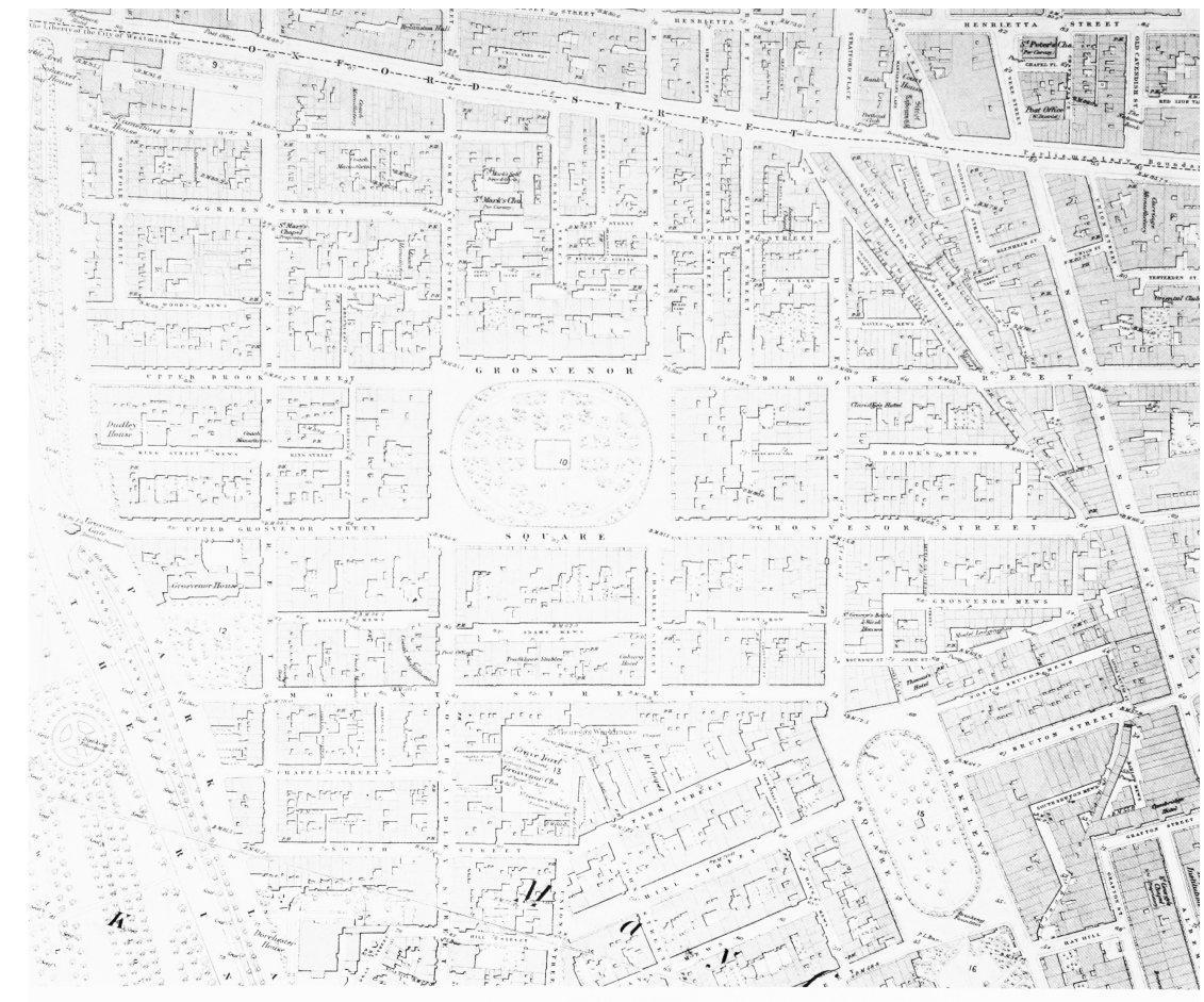
Extract from the Ordnance Survey map surveyed in 1869–70, scale 1: 2500
Extract from the Ordnance Survey map surveyed in 1869–70